Nimishillen Creek
| Nimishillen Creek | |
|---|---|
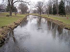 West Branch Nimishillen Creek in a city park in Canton in 2006 | |
| Origin | 40°48′24″N 81°21′14″W / 40.80667°N 81.35389°W,[1] Canton, Ohio, confluence of East and Middle Branches[2] |
| Mouth | Sandy Creek in Tuscarawas County, Ohio[2] |
| Basin countries | United States |
| Length | 24.5 mi (39.4 km)[3] |
| Mouth elevation | 938 ft (286 m) [1] |
| Basin area | 187 mi² (484 km²) [4] |
Nimishillen Creek is a tributary of Sandy Creek, 24.5 miles (39.4 km) long, in northeastern Ohio in the United States. Via Sandy Creek and the Tuscarawas, Muskingum and Ohio Rivers, it is part of the watershed of the Mississippi River, draining an area of 187 square miles (484 km²), including the city of Canton.[2]
Nimishillen Creek flows on both glaciated (in the north) and unglaciated (in the south) portions of the Allegheny Plateau,[5] in Stark and Tuscarawas Counties.[2] It is formed in Canton by the confluence of the East Branch Nimishillen Creek[6] and the Middle Branch Nimishillen Creek.[7] The East Branch is 10.4 miles (16.7 km) long and flows through Louisville; the Middle Branch is 16.6 miles (26.6 km) long.[3][5] Shortly downstream of this confluence, the stream collects the West Branch Nimishillen Creek,[8] which is nine miles (14.5 km) long[3] and flows through North Canton and Canton.[2][5] From Canton, Nimishillen Creek flows generally southwardly, past East Sparta, into northern Tuscarawas County, where it flows into Sandy Creek from the north.
Variant names
According to the Geographic Names Information System, Nimishillen Creek has also been known historically as:[1]
- Memenshehelas Creek
- Nanashehelas Creek
- Nemenshehela Creek
- Nemenshehelas Creek
- Nenenchelus Creek
- Nimishillen Run
- Nine Shilling Creek
See also
References
- ↑ 1.0 1.1 1.2 "Geographic Names Information System entry for Nimishillen Creek". Retrieved 2007-01-13.
- ↑ 2.0 2.1 2.2 2.3 2.4 DeLorme (1991). Ohio Atlas & Gazetteer. Yarmouth, Maine: DeLorme. ISBN 0-89933-233-1.
- ↑ 3.0 3.1 3.2 Eric Akin, Upper Tuscarawas River Watershed Coordinator (2006-06-21). "Nimishillen Creek Watershed - State Action Plan". pp. p.25. Retrieved 2007-01-13.
- ↑ Ohio Department of Natural Resources. "Major Ohio Watersheds". A Guide to Ohio Streams. pp. p. 11. Archived from the original on 2006-12-09. Retrieved 2007-01-13.
- ↑ 5.0 5.1 5.2 Eric Akin, Upper Tuscarawas River Watershed Coordinator (2006-06-21). "Nimishillen Creek Watershed - State Action Plan". pp. p.14. Retrieved 2007-01-13.
- ↑ "Geographic Names Information System entry for East Branch Nimishillen Creek". Retrieved 2007-01-13.
- ↑ "Geographic Names Information System entry for Middle Branch Nimishillen Creek". Retrieved 2007-01-13.
- ↑ "Geographic Names Information System entry for West Branch Nimishillen Creek". Retrieved 2007-01-13.