Nikaj-Mërtur

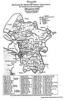
Nikaj-Mërtur is a small historical region in the Tropojë District, Albania as well as one of the North Albanian tribes.[1] It lays south-east of the Albanian Alps, bordering Dukagjin highlands. It is a southern extension of the Djakovica highland.[2] Nikaj is considered having derived from Krasniqi tribe, while Mërtur is closely related to the Berisha.[3] In 2014, the region was proclaimed as the Nikaj-Mertur Regional Nature Park.[4]
Geography
The Alps' mountain peaks surrounding the area are: Maja e Hekurave, "Grykat e Hapta" (English: Open gorges), Maja e Kakisë, Maja e Ndërmanjës. "Qafa e Kolcit" connects the area to the Krasniqi tribe of the Gjakova highlands, while "Qafa e Ndërmajës" connect it to the Shala tribe and "Qafa e Agrit" (1300m) connects it to the Dukagjin region. It has Alpine climate with a robust winter season, plenty of snowfall and relatively cool summer. Average year-long temperature is 11.5 C, and snow reaches 2570 mm/year. Oak, beech, and pine are predominant in the flora. The climate and terrain favor livestock. There is a great potential for mountain tourism.
Administrative division
Administratively, the region falls under Lekbibaj municipality, beside the Rajë village which belongs to the Fierzë municipality. On the east it borders Bujan municipality, Theth in the north, Shalë and Shosh in the west, Fierzë, Pukë and Fierzë, Tropojë in the south. The area lays within circa 200 km2.
Geology
The geological composition of the terrain consists of limestone, dolomite, and schist.
Hydrology
Nikaj-Mërtur is a valley traspased by two rives that bear the clans names: "Lumi i Nikajve" (English: Nikaj river) and "Lumi i Mërturit" (English: Mërtur river). Nikaj river starts in Ndërmanjë valley as "Lumi i Zi" (English: Black river), passes through Kapit, Gjonpepaj, and Lekbibaj villages and joins Mërtur river south-west of Curraj i Poshtëm village. Mërturi river itself starts in Curraj i Epërm village, passes along "Mali i Theposur " (English: Sharp mountain) between the villages Shëngjergj and Curraj i Poshtëm, and after joining Nikaj river continue through Raje and Tetaj villages, with Drin river as a final destination.[5] Both rivers are relatively short.
Ethnography
The region is inhabited by Nikaj and Mërtur clans. Marturi was first recorded as a toponym in 1629.[3] Kapit is another smaller clan which lays throughout the geographical space of Nikaj.
Nikaj-Mërtur region contains the following settlements: Lekbibaj, Gjonpepaj, Peraj, Curraj i Poshtëm, Curraj i Epërm, Qeresh, Kuq, Tetaj, Bëtoshë (Btoshë), Shëngjergj, Salcë, Palçë, Kotec, Brisë, Mulaj, Kapit, Varg (Vark), Shofrran, Paplekaj, Bushat, Mserr, Markaj, and Rajë. The first seven belong to Nikaj clan. Blood feuds and Kanun rules are present in the area.[6]
The population belong mainly to the Catholic rite, with a Muslim minority.
The area presents an interesting toponymy, being pure and totally uninfluenced influenced by the Slavic elements, i.e. "Shtegu i Dashit", "Rrasa e Currajve", "Shpella e Lumit", "Qafa e Rrethit", "Qafa e Derzave", "Shpella e Kakverrit", "Rruku i Nikajve", "Kodra Plakë", "Gurrat e Lumit të Zi", "Qafa e Murrizit", "Qafa e T'thermes", "Fusha e Shukut", "Kodra e Palçit", "Guri Murg", "Korja e Mërtuit", "Qafa e Kolcit", "Qafa e Agrit" etc.
See also
- List of Albanian tribes
Further reading
- Nikaj-Mërturi: vështrim historik, Dodë Progni, Zef Doda, "Shtjefni" 2003, ISBN 9789992782644
External links
References
- ↑ Andromaqi Gjergji (Academy of Sciences of Albania, Institute of Folkloric Culture) (2004). Albanian Costumes Through the Centuries: Origin, Types, Evolution. Mësonjëtorja. p. 152. ISBN 9789994361441.
- ↑ Universiteti Shtetëror i Tiranës. Instituti i Historisë e Gjuhësisë. Sektori i Etnografisë.; Instituti i Historisë (Akademia e Shkencave e RPSH). Sektori i Etnografisë (1984). Etnografia shqiptare. 13-14. Akademia e Shkencave e RPSH, Instituti i Historisë, Sektori i Etnografisë. p. 290. OCLC 2260870.
- ↑ 3.0 3.1 Robert Elsie (2010), Historical Dictionary of Albania, Historical Dictionaries of Europe 75 (2 ed.), Scarecrow Press, p. 299, ISBN 978-0810861886,
The Merturi region is situated north and south of the Drin River in the Districts of Puka and Tropoja, basically the area to the west of the town of Fierza. It borders on the traditional tribal regions of Shoshi to the west, Nikaj to the north and northwest, Krasniqi to the east and Berisha, with whom it is closely related...
The name was recorded in 1629 as Marturi. - ↑ http://www.shqiptarja.com/fotogaleri/index.php?id=14353&IDCategoria=4
- ↑ Dayrell Oakley-Hill, David Smiley (2002). An Englishman in Albania: memoirs of a British officer 1929-1955. Centre for Albanian Studies. p. 62. ISBN 9781903616208.
- ↑ Islam Qerimi, Vjollca Salihu (7.12.2011). Social Organization and Self-Government of Albanians According to the Costumary Law. GRIN Verlag. pp. 5, 8, 19. ISBN 9783640947867.
...The code was applied and it is still applied in these regions: Lezha mountains, Mirditë, Shala, Shoshë and Nikaj, Mertur, also in Dukagjin areain the west part of the Republic of Kosovo. This code was summarized and codified in the end of XIX...
Check date values in:|date=(help)
| ||||||||||||||||