Nigali
For a historical district on the Georgian-Turkish border, see Nigali valley.
| Nigali निगली | |
|---|---|
| Village development committee | |
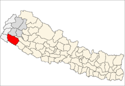
 Nigali Location in Nepal | |
| Coordinates: 28°58′N 80°44′E / 28.97°N 80.73°ECoordinates: 28°58′N 80°44′E / 28.97°N 80.73°E | |
| Country |
|
| Zone | Seti Zone |
| District | Kailali District |
| Population (1991) | |
| • Total | 4,480 |
| Time zone | Nepal Time (UTC+5:45) |
Nigali is a village development committee in Kailali District in the Seti Zone of western Nepal. At the time of the 1991 Nepal census it had a population of 4480 living in 669 individual households.[1]
References
- ↑ "Nepal Census 2001", Nepal's Village Development Committees (Digital Himalaya), retrieved 15 November 2009.