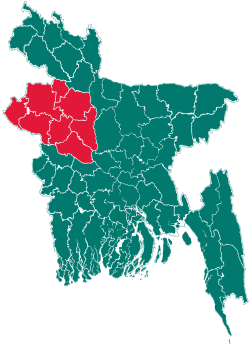
Niamatpur Upazila
| Niamatpur নিয়ামতপুর | |
|---|---|
| Upazila | |
 Niamatpur Location in Bangladesh | |
| Coordinates: 24°51.5′N 88°34′E / 24.8583°N 88.567°ECoordinates: 24°51.5′N 88°34′E / 24.8583°N 88.567°E | |
| Country |
|
| Division | Rajshahi Division |
| District | Naogaon District |
| Area | |
| • Total | 449.1 km2 (173.4 sq mi) |
| Population (1991) | |
| • Total | 193,197 |
| • Density | 430/km2 (1,100/sq mi) |
| Time zone | BST (UTC+6) |
| Website | Official Map of Niamatpur |
Niamatpur (Bengali: নিয়ামতপুর) is an Upazila of Naogaon District in the Division of Rajshahi, Bangladesh.
Geography
Niamatpur is located at 24°51′30″N 88°34′00″E / 24.8583°N 88.5667°E . It has 35299 units of house hold and total area 449.1 km².Here most of the people are muslim(sunni).There also have Hindu, Christian and other. The main source of income is agriculture and business.
Demographics
As of the 1991 Bangladesh census, Niamatpur has a population of 193197. Males constitute 50.37% of the population, and females 49.63%. This Upazila's eighteen up population is 98284. Niamatpur has an average literacy rate of 25.8% (7+ years), and the national average of 32.4% literate.[1]
Administrative
Niamatpur has 8 Unions/Wards,<Towhodur></Rahman> 201 Mauzas/Mahallas, and 197 villages.[2]
See also
References
- ↑ "Population Census Wing, BBS.". Archived from the original on 2005-03-27. Retrieved November 10, 2006.
- ↑ Md. Montajur Rahman (2012). "Niamatpur Upazila". In Sirajul Islam and Ahmed A. Jamal. Banglapedia: National Encyclopedia of Bangladesh (Second ed.). Asiatic Society of Bangladesh.
| |||||||||||||||||||||||||||||||||||||||||
