Nezperce, Idaho
| Nezperce, Idaho | |
|---|---|
| City | |
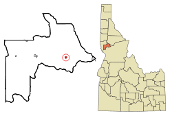 Location in Lewis County and the state of Idaho | |
| Coordinates: 46°14′4″N 116°14′23″W / 46.23444°N 116.23972°WCoordinates: 46°14′4″N 116°14′23″W / 46.23444°N 116.23972°W | |
| Country | United States |
| State | Idaho |
| County | Lewis |
| Government | |
| • Mayor | Steve Bateman |
| Area[1] | |
| • Total | 0.40 sq mi (1.04 km2) |
| • Land | 0.40 sq mi (1.04 km2) |
| • Water | 0 sq mi (0 km2) |
| Elevation | 3,215 ft (980 m) |
| Population (2010)[2] | |
| • Total | 466 |
| • Estimate (2012[3]) | 472 |
| • Density | 1,165.0/sq mi (449.8/km2) |
| Time zone | Pacific (PST) (UTC-8) |
| • Summer (DST) | PDT (UTC-7) |
| ZIP code | 83543 |
| Area code(s) | 208 |
| FIPS code | 16-57250 |
| GNIS feature ID | 0396958 |
| Website | cityofnezperce.com |
Nezperce is a city in and the county seat of Lewis County, Idaho, United States.[4] The population was 466 at the 2010 census, down from 523 in 2000. Nezperce is named for the local Nez Perce tribe of Native Americans. ("Nezperce" derives from a corruption of French words nez percé, literally "pierced nose.")
Geography
Nezperce is located at 46°14′4″N 116°14′23″W / 46.23444°N 116.23972°W ,[5] on the Camas Prairie at an elevation of 3,215 feet (980 m) above sea level.[6]
According to the United States Census Bureau, the city has a total area of 0.40 square miles (1.04 km2), all of it land.[1]
Demographics
Nezperce has a municipal airport, primarily used by cropdusters and light aircraft. The asphalt runway is 2,450 feet long, 30 feet wide, unlighted and has numerous obstructions. See airport/facility directory for more information.
| Historical population | |||
|---|---|---|---|
| Census | Pop. | %± | |
| 1900 | 300 | — | |
| 1910 | 599 | 99.7% | |
| 1920 | 677 | 13.0% | |
| 1930 | 444 | −34.4% | |
| 1940 | 590 | 32.9% | |
| 1950 | 543 | −8.0% | |
| 1960 | 667 | 22.8% | |
| 1970 | 555 | −16.8% | |
| 1980 | 517 | −6.8% | |
| 1990 | 453 | −12.4% | |
| 2000 | 523 | 15.5% | |
| 2010 | 466 | −10.9% | |
| source:[7][8] | |||
2010 census
As of the census[2] of 2010, there were 466 people, 191 households, and 130 families residing in the city. The population density was 1,165.0 inhabitants per square mile (449.8/km2). There were 213 housing units at an average density of 532.5 per square mile (205.6/km2). The racial makeup of the city was 95.1% White, 4.1% Native American, 0.2% Asian, and 0.6% from two or more races. Hispanic or Latino of any race were 0.6% of the population.
There were 191 households of which 26.2% had children under the age of 18 living with them, 59.2% were married couples living together, 6.3% had a female householder with no husband present, 2.6% had a male householder with no wife present, and 31.9% were non-families. 28.3% of all households were made up of individuals and 16.7% had someone living alone who was 65 years of age or older. The average household size was 2.36 and the average family size was 2.84.
The median age in the city was 48.2 years. 21.2% of residents were under the age of 18; 7.5% were between the ages of 18 and 24; 16.5% were from 25 to 44; 31.8% were from 45 to 64; and 23% were 65 years of age or older. The gender makeup of the city was 50.4% male and 49.6% female.
2000 census
As of the census[9] of 2000, there were 523 people, 197 households, and 150 families residing in the city. The population density was 1,283.7 people per square mile (492.5/km²). There were 225 housing units at an average density of 552.3 per square mile (211.9/km²). The racial makeup of the city was 91.20% White, 1.34% African American, 1.91% Native American, 1.34% Asian, 0.76% from other races, and 3.44% from two or more races. Hispanic or Latino of any race were 0.76% of the population.
There were 197 households out of which 33.5% had children under the age of 18 living with them, 67.5% were married couples living together, and 23.4% were non-families. 22.3% of all households were made up of individuals and 12.7% had someone living alone who was 65 years of age or older. The average household size was 2.61 and the average family size was 3.05.
In the city the population was spread out with 29.8% under the age of 18, 4.2% from 18 to 24, 20.8% from 25 to 44, 24.7% from 45 to 64, and 20.5% who were 65 years of age or older. The median age was 42 years. For every 100 females there were 107.5 males. For every 100 females age 18 and over, there were 99.5 males.
The median income for a household in the city was $36,094, and the median income for a family was $40,000. Males had a median income of $30,625 versus $21,094 for females. The per capita income for the city was $15,450. About 5.7% of families and 7.4% of the population were below the poverty line, including 11.1% of those under age 18 and 3.3% of those age 65 or over.
Climate
| Climate data for Nezperce, Idaho (1971–2000) | |||||||||||||
|---|---|---|---|---|---|---|---|---|---|---|---|---|---|
| Month | Jan | Feb | Mar | Apr | May | Jun | Jul | Aug | Sep | Oct | Nov | Dec | Year |
| Record high °F (°C) | 61 (16) |
67 (19) |
76 (24) |
87 (31) |
90 (32) |
94 (34) |
103 (39) |
104 (40) |
97 (36) |
85 (29) |
71 (22) |
59 (15) |
104 (40) |
| Average high °F (°C) | 34.9 (1.6) |
41.0 (5) |
47.7 (8.7) |
55.4 (13) |
63.1 (17.3) |
70.4 (21.3) |
79.5 (26.4) |
80.7 (27.1) |
71.0 (21.7) |
58.0 (14.4) |
42.2 (5.7) |
34.8 (1.6) |
56.6 (13.7) |
| Average low °F (°C) | 21.7 (−5.7) |
25.1 (−3.8) |
29.2 (−1.6) |
33.6 (0.9) |
39.4 (4.1) |
44.7 (7.1) |
48.6 (9.2) |
48.6 (9.2) |
41.8 (5.4) |
34.5 (1.4) |
27.9 (−2.3) |
22.1 (−5.5) |
34.8 (1.6) |
| Record low °F (°C) | −20 (−29) |
−19 (−28) |
−10 (−23) |
17 (−8) |
21 (−6) |
29 (−2) |
31 (−1) |
25 (−4) |
18 (−8) |
0 (−18) |
−12 (−24) |
−33 (−36) |
−33 (−36) |
| Average precipitation inches (mm) | 1.51 (38.4) |
1.33 (33.8) |
1.85 (47) |
2.19 (55.6) |
3.01 (76.5) |
1.99 (50.5) |
1.26 (32) |
1.11 (28.2) |
1.31 (33.3) |
1.48 (37.6) |
1.94 (49.3) |
1.43 (36.3) |
20.41 (518.5) |
References
- ↑ 1.0 1.1 "US Gazetteer files 2010". United States Census Bureau. Retrieved 2012-12-18.
- ↑ 2.0 2.1 "American FactFinder". United States Census Bureau. Retrieved 2012-12-18.
- ↑ "Population Estimates". United States Census Bureau. Retrieved 2013-06-03.
- ↑ "Find a County". National Association of Counties. Retrieved 2011-06-07.
- ↑ "US Gazetteer files: 2010, 2000, and 1990". United States Census Bureau. 2011-02-12. Retrieved 2011-04-23.
- ↑ U.S. Geological Survey Geographic Names Information System: Nezperce, Idaho
- ↑ Moffatt, Riley. Population History of Western U.S. Cities & Towns, 1850-1990. Lanham: Scarecrow, 1996, 96.
- ↑ "Subcounty population estimates: Idaho 2000-2007" (CSV). United States Census Bureau, Population Division. 2009-03-18. Retrieved 2009-05-06.
- ↑ "American FactFinder". United States Census Bureau. Retrieved 2008-01-31.
External links
- Official website - City of Nezperce
- Nezperce Community Library
- AirNav.com - Nezperce Municipal Airport
- Nezperce Hotel - established 1915
- jeffzenner.com - photos - Nezperce and Camas Prairie
| |||||||||||||||||||||