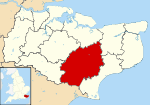
Newenden
| Newenden | |
 Newenden |
|
| Area | 4.23 km2 (1.63 sq mi) |
|---|---|
| Population | 223 (Civil Parish)[1] |
| – density | 53/km2 (140/sq mi) |
| OS grid reference | TQ835275 |
| Civil parish | Newenden |
| District | Ashford |
| Shire county | Kent |
| Region | South East |
| Country | England |
| Sovereign state | United Kingdom |
| Post town | CRANBROOK |
| Postcode district | TN18 |
| Dialling code | 01797 |
| Police | Kent |
| Fire | Kent |
| Ambulance | South East Coast |
| EU Parliament | South East England |
| UK Parliament | Ashford |
Coordinates: 51°01′03″N 0°37′02″E / 51.0174°N 0.6172°E
Newenden is a small village and civil parish in area and population in the Ashford District of Kent, England.
Geography
The village is clustered together along the south slope and at the foot of the end of a tall escarpment by the River Rother, four miles (6.4 km) south-east of Tenterden. The humpback bridge of 1736 has recently been repaired. As the land at the very edge of the parish and lowest points is marshy, the narrow hill escarpment itself is known locally as Frogs Hill.
History
Lossenham Friary was established northeast of the village in around 1242 but it was burnt down in 1275 and no remains are visible.
Amenities
The ancient parish church is dedicated to Saint Peter; it was restored in 1859. A large pub is marked in maps next to the river.
References
External links
| Wikimedia Commons has media related to Newenden. |
 |
Iden Green | Rolvenden | Small Hythe |  |
| Sandhurst | |
Wittersham | ||
| ||||
| | ||||
| Ewhurst Green | Northiam | Playden |
