Newcastle West
| Newcastle West an Caisleán Nua Thiar | |
|---|---|
| Town | |
|
The Square | |
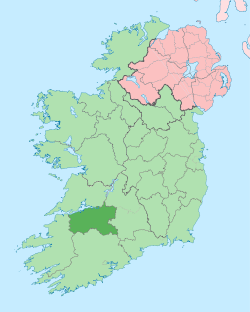
 Newcastle West Location in Ireland | |
| Coordinates: 52°27′04″N 9°03′18″W / 52.451°N 9.055°WCoordinates: 52°27′04″N 9°03′18″W / 52.451°N 9.055°W | |
| Country | Ireland |
| Province | Munster |
| County | County Limerick |
| Limerick County Council LEA | Newcastle |
| Dáil Éireann Constituency | Limerick |
| EU Parliament | Dublin |
| Population (2006)[1] | |
| • Town | 5,098 |
| • Urban | 3,922 |
| • Environs | 1,176 |
| Irish Grid Reference | R282336 |

Newcastle West (Irish: an Caisleán Nua Thiar) or simply Newcastle (an Caisleán Nua, formerly anglicized Castlenoe) is a town in west County Limerick, Ireland. It is the largest town in the county, excluding Limerick city, and sits on the River Arra which flows into the River Deel. Newcastle West is in the middle of a great bowl-shaped valley in West Limerick, known one time as the valley of the Wild Boar, apparently due to the abundance of this animal here when the area was thickly wooded. The crest of the town carries the image of a wild boar. Newcastle West is on the N21 road from Limerick to Tralee, between Rathkeale and Abbeyfeale.
History
Foundation and development
Newcastle West grew up around a castle, the ruins of which are located off the town square. The large castle ruins are well maintained.
Newcastle West used to be called Castle-Roe, after a castle built there by the Knights Templar in 1184. The town then came to be known as Newcastle, West Limerick, but over time the 'west' became part of Newcastle and the town was known by the current name Newcastle West.
According to Begley,[2] the parish was called Newcastle and Ardagh in 1704. Newcastle was joined with Monagea from 1722 until 1764 when it became a separate parish. Lewis stated that parts of Monagea and Killeedy were in the parish of Newcastle West.
Two notable mentions included in the history of the diocese of Limerick were the first Monsignor in the diocese, Richard Baptist O'Brien in 1881, and Denis Hallinan who was P.P. here and later became Bishop.
Sir William Courtenay, the local landlord, held 10,500 acres (42 km2) of land in Newcastle West in the late 16th century. He was a staunch Catholic, and suffered persecution for his beliefs. His son George may have practiced his faith in secret. Their home was reputed to have had a room in which priests were hidden. William Courtenay was denounced in the House of Commons as a papist recusant in 1624.
During the reign of Elizabeth I, three battles were fought near here. Tradition has it that the locals killed many of the Knights Templar. The town was sacked in 1302 and destroyed in 1315. Two of the Earls of Desmond died here. Garrett (better known as Gearóid Iarla) in 1399, and James, the 8th earl, in 1462.
Markets were held on Tuesday, Thursday, and Saturday. Large numbers used to attend Thursday's hiring fairs for farm workers. Fairs were held on April 1, May 3, July 12, August 20, October 1, and December 10.
The motto that goes with the town coat of arms is "As Dúchas Dóchas", which may be translated as 'Our Hope springs from our Traditions'. The town now has a population of around 11,000. The urban area has passed well beyond the old town boundaries which are due for redefinition.
Notable people
- William Nash, recipient of the Victoria Cross
- Philomena Lee, subject of "The Lost Child of Philomena Lee" by Martin Sixsmith.
- Max Arthur Macauliffe
- Michael Hartnett
- The poet Michael Hartnett (Irish: Mícheál Ó hAirtnéide) (18 September 1941 – 13 October 1999) is perhaps Newcastle West's most famous son. He is an Irish poet who wrote in both English and Irish. Born into a working-class background, Hartnett excelled in school, his first poem published while still a teenager.[3] He is now considered one of the most significant outsider voices in late 20th century Irish writing and has been called "Munster's de facto poet laureate"[4] Each April a literary and arts festival (Eigse Michael Hartnett) takes place within the town.[5] At the 2011 Eigse Michael Hartnett festival a life sized statue of Michael Hartnett by sculptor Rory Breslin was unveiled in the town square.[6]
Business and commerce
The West Limerick and Newcastle West area has traditionally had a strong Dairy and Agricultural contribution to the local economy. Huge changes have occurred during the last 20 – 30 years seeing the expanding of the town as a services centre for West Limerick, also bringing an increase in population. Many people who work in Limerick City live in Newcastle West and its environs and commute the 42 kilometres (26 mi) daily. However, Newcastle West itself is now a large centre of employment with a strong business and entrepreneurial culture. Large to medium employers include Pallas Foods, Rettig Myson, Ballygowan Spring Water and Filtertek. There are dozens of Businesses employing 10-50 including PSE Power Systems, Brian A Flynn, Brian Scully Services and Nolan Products. Hundreds are employed in the retail stores including local and international multiples. In recent times, there has been national success stories in e-business from local companies like HuntOffice.ie[7] and IrishTourism.com,[8] who are growing information technology skills and employment in the emerging knowledge economy of the town.

Transport
The town was connected to the railway network until 1975, as part of the "North Kerry" line, from Limerick city to Tralee, via Rathkeale and Listowel. In 1999, the station house was restored. Newcastle West railway station opened on 1 January 1857, closed for passenger traffic on 4 February 1963, closed for goods traffic on 2 December 1974 and finally closed altogether on 3 November 1975.[9]
Today, Newcastle West is situated on the Irish National primary road - N21, where it is joined by the R520, R521 and R522 regional roads. Newcastlewest is forty minutes drive from Limerick City and an hour from Killarney. It is within 1 hours drive of Shannon, and Kerry International Airports, and 2 hours from Cork Airport.
Places of interest
Buildings, bridges, parcs
- The Square - One of the finest Town Squares in Munster.
- Desmond Banqueting Hall and Castle - Newcastle West's landmark feature dominates the southern of end of the Main Town Square. The banqueting hall of the Desmond Castle, seat of the Earl of Desmond, parts of which date from the 13th century, is the most notable historical feature of the town. The Current Castle dates from the 15th century and has been recently partly restored and is open to the public, for guided tours May to September. Local folklore always insisted that the castle at one time had been a seat of the Knights Templar. This has been more than likely verified lately while during cleaning of the Old Stone during renovations found the Seals and Crests of the Knights Templar over on old door Threshold of " The Halla Mor", which are in the same grounds. Either way, there has been castles of both timber and stone on this ground since the 13th century and the guided tour is a must for locals and visitors. The area in front of the banqueting hall was the site of The Protestant Church, built in 1777.
- Castle Demesne - Over 0.4 square kilometres (99 acres) of parkland with numerous forms of flora and fauna as well as playing areas and sports fields.
- Slí na Sláinte - Walking trails which includes the Square and the Demesne.
- Great Southern Trail - A walking trail developed along the disused railway line. It offers an interesting scenic walk between Newcastle West and Ardagh or Newcastle West and the Old Mill.
- Churchtown Graveyard and Grotto - The Old Church Ruins in Churchtown (Catholic) date back hundreds of years.
- Old IRA Monument - situated opposite the church this monument commemorates 17 volunteers who were killed during the war of independence and Civil War 1916 - 1922. The monument was unveiled by President Sean T.O'Kelly in 1955.
- Church of the Immaculate Conception (Catholic) - built in 1828 by Father Thomas Coll P.P. The local Landlord, the Earl of Devon gave the site with the parishioners providing voluntary labour in the building work.
- Iron Footbridge - crossing over the river Arra the bridge is located opposite the church and was erected by Edward Curling, the Landlord's agent in Newcastle West from 1848 - 1874.
- Famine Graveyard - located at the rear of St. Ita's Hospital. Many hundreds of people who died in the work house during the famine are buried there in unmarked graves. The cemetery is marked by a plain old cross and modern, limestone gates sculptured by Cliodna Cussen, showing scenes from the famine and commissioned by the Famine Cemetery Committee.
- St. Bridget's Well - located in Shanagarry on the Killarney Road.
- Carnegie Library - located in the Market Yard this impressive building was built by the Carnegie Trust and founded by the Scottish / philanthropist Andrew Carnegie. The building housed a secondary school for many years. It is now a busy commercial centre.
- Bridge of Tears - located at the south of the town at the junction of the Dromcollogher Road, there is a stone bridge which takes its name from being a famous last farewell point. Known locally as the Bridge of Sorrows or Tears, during the time of the famine, Emigrants from all over West Limerick said their last goodbyes before walking or taking a carriage to Cork and the boat to North America or further.
- Barnagh Gap - About 7 kilometres west of the town is the scenic view point at Barnagh Gap, which provides a panoramic east facing view over County Limerick, West Tipperary/ Galtee Mountains and north County Cork. On a clear day North tipperary and Clare are also visible.
Great Southern Trail Ireland
The Great Southern Trail is a 53-mile (85 km) stretch of countryside in West Limerick/North Kerry. It is the route taken by the former Limerick - Tralee railway line, which opened in 1867/1880 and closed in 1975/1977. The Great Southern Trail Action Group are a non-profit group working to develop the Limerick to Tralee section as a rail trail so that everyone can explore this beautiful region in a safe, leisurely way by foot or bicycle. This Group is based around the Newcastle West area.
2008 summer flood
On August 1, 2008, up to 20 homes were badly affected by overnight flash flooding in Newcastle West, in an incident described as a 'freak' occurrence. A number of people had to be rescued from their houses after the River Arra burst it banks following heavy rain. There were few injuries, however an elderly woman was taken to hospital after she was airlifted from her home suffering from hypothermia. 3,000 homes in Newcastle West temporarily lost power. The Killarney Road (N21) was temporarily closed as was the R522 to Dromcolliher and the Bruff line.[10]
Surrounding area
Ardagh, Dromcollogher, Broadford, Carrigkerry, Monagea, Kilmeedy, Castlemahon, Feenagh, Ballingarry, Knockaderry, Feohanagh, Strand, Killeedy, Ashford and Raheenagh are all villages within 10 miles of Newcastle West.
See also
- List of towns and villages in Ireland
- Market Houses in Ireland
- Newcastlewest Stage & Musical Society (aka Newcastlewest Musical Society) - Founded 2009
External links
| Wikimedia Commons has media related to Newcastle West. |
References
- ↑ "Census 2006 – Volume 1 – Population Classified by Area" (PDF). Central Statistics Office Census 2006 Reports. Central Statistics Office Ireland. April 2007. Retrieved 2011-06-19.
- ↑ ?
- ↑ Lawlor, James. “Are these my people?’ A Study of Contemporary Working-Class Irish Poetry M.A Diss. Queen’s University Belfast. 2010. Print.
- ↑ Nolan, Val (July 2009). "The Shoulders for a Raggy Coat". Poetry Ireland Newsletter.
- ↑ http://www.michael-hartnett.com/
- ↑ http://www.eigsemichaelhartnett.ie/
- ↑ Who are HuntOffice.ie at HuntOffice.ie Website
- ↑ IrishTourism.com
- ↑ "Newcastle West station". Railscot - Irish Railways. Retrieved 2007-11-19.
- ↑ Boil notice issued after Limerick floods
| ||||||||||||||||||||||||||
| ||||||||||||||||||||||||||||||||||||||||||||||||||||