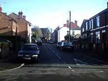
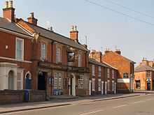
New Zealand, Derby

The New Zealand suburb/area of Derby is situated about 1 mile from Derby City Centre. The suburb is surrounded by the Mackworth Estate, Rowditch, Friargate and The West End. New Zealand incorporates an area called the Morley Estate.
There is the New Zealand Area centre (Lonny Wilsoncroft centre) on Campion Street/Stepping Lane.
The boundary of New Zealand is: Uttoxeter Old Road to Ashbourne Road/Friargate then Ashbourne Road to Markeaton Island/A38 then Markeaton Island/A38 to A38/Kingsway then A38/Kingsway to Brackensdale Bridge/Lyttleton Street then Lyttleton Street to Cheviot Street then Cheviot Street to Slack Lane and finally Slack Lane to Uttoxeter Old Road.
Education/Schools
The area has one primary school Ashgate school whose main vehicular entrance is on Frederick Street but can also be accessed on foot from Ashourne Road and also one nursery Ashgate nursery, which is located on the corner of Stepping Lane and Ashbourne Road and Fowler Street and Stepping Lane.
Public Houses

There are several licensed premises:
- The Travellers Rest, Ashbourne Road
- The Waggon and Horses, Ashbourne Road
- Mr Grundys, Ashbourne Road
- The Crescent, Campion Street/Wild Street
- The New Zealand Arms, Peel Street/Langley Street
Former pubs and clubs are:
- The Cobden Arms: corner of Stanley Street and Cobden Street
- The Morley Club: Just off Cobden Street (between Stanley Street and Slack Lane)
- The Earl Grey: corner of Uttoxeter Old Road and Upper South Street (street now gone)
- The Blue Bell: corner of Uttoxeter Old Road and Upper South Street (street now gone)
- The Brickmakers Arms: corner of Ashbourne Road and Fowler Street
- The Bay Horse Inn: Uttoxeter Old Road
- Swan and Salmon: corner of Ashbourne Road and Chadnos Pole Street
- Gallant Hussar: corner of Ashbourne Road and Noel Street
- The 102 (One Hundred and Two Social Club): corner of Uttoxeter Old Road and Ashbourne Road[1]
Streets
The following is an alphabetical list of streets in New Zealand for 2010:
- Kingsway (A38), Arnold Street, Ashbourne Court, Ashbourne Road (A52), Ashley Street, Bass Street, Bright Street, Brigmore Walk, Brough Street, Campion Street, Cecil Street, Cheviot Street, Cobden Street, Cooper Street, Cross Street, Etwall Street, Findern Street, Fowler Street, Frederick Street, Handford Court, Handford Street, Hawke Street, Heyworth Street, Howe Street, Jackdaw Close, Jay Court, Kingsway Park Close, Langley Street, Leake Street, Lloyd Street, Lyttleton Street, Mackenzie Street, Manchester Street, Morley Street, Napier Street, New Zealand Square, Peach Street, Peel Street, Plimsoll Street, Uttoxeter Old Road, Radbourne Street, Raglan Avenue, Raleigh Street, Richardson Street, Saint Christophers Court, Saint Katherines Court, Selwyn Street, Seymour Close, Slater Avenue, Stables Street, Stanley Street, Stepping Close, Stepping Lane, Surrey Street, Sutton Close, Thurcroft Close, Wallace Street, Westleigh Avenue, Wild Street, Windmill Hill Lane
Morley Estate
The Morley Estate is part of the New Zealand area and the following are the streets that are part of it: Ashley Street, Bright Street, Cheviot Street, Hawke Street, Lyttleton Street, Mackenzie Street, Morley Street, Napier Street, New Zealand Square, Plimsoll Street, Raglan Avenue, Raleigh Street, Selwyn Street, Seymour Close, Wallace Street
Former streets
- Shelton Terrace off Slack Lane and almost opposite Peach Street. This street was cleared in 1974.
- Upper South Street in between Uttoxeter Old Road and Fowler Street. Today Rebecca House is on it, a footpath with a green hill and situated next to the traffic lights next to South Street and Uttoxeter Old Road. Originally a continuation of South Street that took you to Fowler Street. The street was cleared in 1972.
- Rose Place demolished around 1963 but was situated in the car park of the Travellers Rest on Ashbourne Road. Several cottages that were located here and its exact location was on Windmill Hill Lane and the bottom of Bass Street.
Streets that have had name changes
- The present day Cross Street used to be called Brewery Street after the brewery near to it.
- The section of Stepping Lane that runs from Fowler Street to Uttoxeter Old Road used to be known as Cross Fowler Street until the 1860s.
Places of Worship
- Derby Christadelphians - Bass Street
- Saint Barnabas Church of England Church - Bass Street/Radbourne Street[2]
- The Church of Jesus Christ of Latter Day Saints - Radbourne Street
Recreation Grounds - Public Parks
- Handford Street
- Cheviot Street - Entrance opposite junction of Cheviot Street and Mackenzie Street also opposite junction of Hawke Street and Cheviot Street.
Notable residents
- Frank Conroy - Born in Derby on 14 October 1890 at 33 Heyworth Street - died Paramus, New Jersey, USA on 24 February 1964, aged 73. Went on to become a Hollywood actor.
- Patricia Greene (MBE) - actress. As a child she lived in Campion Street and went to Ashgate Infants School on Ashbourne Road. Today she still appears in BBC Radio 'The Archers' as Jill Archer and has appeared in it since 1957.
- Richard Keene - photographer. Founding member of the Derby Photographic Society in 1884 and the Photographic Convention of the United Kingdom in 1886. In 1891 was living in 100 Radbourne Street.
- Lord Tunnicliffe - (Dennis Tunnicliffe) - (Labour Peer) Born and Raised on Cheviot Street (Morley Estate) until aged 18. Brought up to Peerage as Baron Tunnicliffe, of Bracknell in the Royal County of Berkshire 2004
References and notes
- ↑ The 102 club was exactly where Ashbourne Court is now, but Club relocated to the corner of Friargate and Vernon Street.
- ↑ "St.Barnabas Church Derby". Retrieved 19 May 2014.
Coordinates: 52°55′23″N 1°30′07″W / 52.923°N 1.502°W
| ||||||