New York State Route 191
| ||||
|---|---|---|---|---|
|
Map of northern Clinton County with NY 191 highlighted in red | ||||
| Route information | ||||
| Maintained by Clinton County | ||||
| Length: | 6.24 mi[1] (10.04 km) | |||
| Existed: | 1930[2] – present | |||
| Major junctions | ||||
| West end: |
| |||
|
| ||||
| East end: |
| |||
| Location | ||||
| Counties: | Clinton | |||
| Highway system | ||||
| ||||


New York State Route 191 (NY 191) is a 6.24-mile (10.04 km) long state highway located north of Adirondack Park The route is maintained and co-designated by the Clinton County highway department as County Route 23 (CR 23) and heads from an intersection with NY 22 in the hamlet of Sciota within the town of Chazy to a junction with U.S. Route 9 (US 9) in the hamlet of Chazy. The route meets Interstate 87 (I-87, also known as the Adirondack Northway) west of Chazy hamlet.
NY 191 was assigned as part of the 1930 renumbering of state highways in New York. The route initially extended from the community of Altona to a ferry landing on Lake Champlain in Chazy Landing, where it connected to Vermont Route F-2. The ferry ceased to operate in 1937, but NY 191 remained unchanged until 1980 when ownership and maintenance of NY 191 was transferred from the state to Clinton County. NY 191 was truncated to its current length following the maintenance swap.
Route description
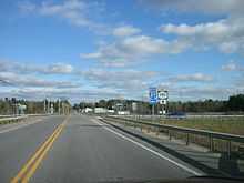
NY 191 begins at an intersection with NY 22 and Miner Farm Road (CR 23) in the Clinton County hamlet of Sciota, located within the town of Chazy. The route heads to the northeast as a two-lane county-maintained, state-numbered highway, overlapping with CR 23 and taking on the Miner Farm Road name. East of Sciota, the highway traverses lightly developed areas, serving several residences separated by patches of woodlands. The route eventually begins to turn to the southeast, connecting with Angelville Road (unsigned CR 20) in the process. A long stretch of dense forests follows the turn, with little to no development along the highway.[3]
After 2 miles (3.2 km), the road bends back to the east, leaving the woodlands behind as it passes south of the Miner Institute. The research complex leads to another stretch of isolated homes along NY 191, centered around the route's interchange with the Adirondack Northway (I-87). Not far from the junction, NY 191 enters the hamlet of Chazy, a small community located on the Little Chazy River. The route bypasses most of Chazy, skirting the northern edge of the hamlet as it heads northeast to a junction with US 9. NY 191 ends here while CR 23 follows the state-maintained US 9 south into downtown Chazy.[3]
History
Modern NY 191 is one part of a mostly continuous east–west highway between the hamlets of Altona and Chazy Landing. On September 23, 1908, the state assumed maintenance of the part east of the hamlet of Chazy following the completion of a $38,925 project (equivalent to $1,021,709 in 2015) to improve a total of 4.60 miles (7.40 km) of roads in Clinton County. The section west of the hamlet of Sciota cost $75,711 (equivalent to $1.19 million in 2015) to rebuild to state highway standards, and it became a state highway on December 12, 1918.[4][5] From Sciota to Chazy, the road was locally maintained[6] until the late 1920s.[7][8]
In the 1930 renumbering of state highways in New York, hundreds of state-maintained highways without a posted route number were given a signed designation for the first time.[9] The Altona–Chazy Landing state highway was designated as NY 191. At its east end, the route connected to Vermont Route F-2 on Isle La Motte by way of a ferry across part of Lake Champlain.[2] The ferry was discontinued in 1937;[10] however, the endpoints of NY 191 remained unchanged.[11][12] On April 1, 1980, ownership and maintenance of all of NY 191 was transferred from the state of New York to Clinton County as part of a highway maintenance swap between the two levels of government.[13] The entirety of the highway was designated as CR 23 by Clinton County[14] and NY 191 was truncated to consist only of the portion of the route between Sciota and Chazy.[15]
Major intersections
The entire route is in Chazy, Clinton County.
| mi[1] | km | Destinations | Notes | ||
|---|---|---|---|---|---|
| 0.00 | 0.00 | Hamlet of Sciota | |||
| 5.23 | 8.42 | Exit 41 (I-87) | |||
| 6.24 | 10.04 | Hamlet of Chazy | |||
| 1.000 mi = 1.609 km; 1.000 km = 0.621 mi | |||||
See also
References
- ↑ 1.0 1.1 "2008 Traffic Volume Report for New York State" (PDF). New York State Department of Transportation. June 16, 2009. p. 182. Retrieved February 1, 2010.
- ↑ 2.0 2.1 Road Map of New York (Map). Cartography by General Drafting. Standard Oil Company of New York. 1930.
- ↑ 3.0 3.1 Yahoo!; Navteq (April 10, 2013). "overview map of NY 191" (Map). Yahoo! Maps. Yahoo!. Retrieved April 10, 2013.
- ↑ State of New York Commission of Highways (1922). Tables Giving Detailed Information and Present Status of All State, County and Federal Aid Highways. Albany, NY: J. B. Lyon Company. pp. 26, 76, 163. Retrieved April 10, 2013.
- ↑ Consumer Price Index (estimate) 1800–2014. Federal Reserve Bank of Minneapolis. Retrieved February 27, 2014.
- ↑ Official Map Showing State Highways and other important roads (Map). Cartography by Rand McNally and Company. State of New York Department of Public Works. 1926.
- ↑ Road Map of New York in Soconyland (Map). Cartography by General Drafting. Standard Oil Company of New York. 1927.
- ↑ New York in Soconyland (Map). Cartography by General Drafting. Standard Oil Company of New York. 1929.
- ↑ Dickinson, Leon A. (January 12, 1930). "New Signs for State Highways". The New York Times. p. 136.
- ↑ Fairchild, Francie (Summer 2009). "Chazy Public Library" (PDF). Trailblazer (Plattsburgh, NY: Clinton–Essex–Franklin Library System) 11 (3): 3. Retrieved June 9, 2010.
- ↑ New York Road Map for 1938 (Map). Cartography by General Drafting. Esso. 1938.
- ↑ New York (Map). Cartography by General Drafting. Esso. 1940.
- ↑ New York State Legislature. "New York State Highway Law § 341". Retrieved June 17, 2009.
- ↑ Champlain Digital Raster Quadrangle (Map). 1:24,000. New York State Department of Transportation. 1979. Retrieved June 17, 2009.
- ↑ I Love New York Tourism Map (Map). Cartography by Rand McNally and Company. State of New York. 1981.
External links
| Wikimedia Commons has media related to New York State Route 191. |
- New York State Route 191 at New York Routes • New York State Highway Termini