New Waltham
| New Waltham | |
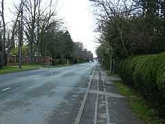 Humberston Avenue looking towards New Waltham |
|
 New Waltham |
|
| Population | 4,557 (2001) |
|---|---|
| OS grid reference | TA286049 |
| – London | 140 mi (230 km) S |
| District | North East Lincolnshire |
| Shire county | Lincolnshire |
| Region | East Midlands |
| Country | England |
| Sovereign state | United Kingdom |
| Postcode district | DN36 |
| Police | Lincolnshire |
| Fire | Lincolnshire |
| Ambulance | East Midlands |
| EU Parliament | East Midlands |
| UK Parliament | Cleethorpes |
|
|
Coordinates: 53°31′31″N 0°03′40″W / 53.525175°N 0.061009°W
New Waltham is a village and civil parish in North East Lincolnshire, England. It is situated just south of Grimsby and Cleethorpes, close to the A16 (Louth Road), and between the villages of Waltham and Humberston.
Previously part of Waltham parish, the parish of New Waltham was created in 1961. Village population at the 2001 census was 4,557.[1]
The main road is Station Road (or the B1219 Humberston Avenue), named after the former station on the East Lincolnshire railway from Grimsby to Louth which ran through the village. The B1219 and A16 meet at Toll Bar Roundabout. The boundary of North East Lincolnshire and East Lindsey is at the southern part of the village, near Enfield Primary School, and the Lincolnshire village of Holton le Clay is less than 1 mile (1.6 km) to the south.
The village has three schools: Enfield Primary School, New Waltham Primary School and the secondary school, Tollbar Academy, which is the largest in the region and between the village and Waltham.
Government
North East Lincolnshire Council has two council wards within New Waltham.
Humberston and New Waltham Ward:
- Cllr John Colebrook (C)
- Cllr John S Fenty (C)
- Cllr Steve Norton (C)
Wolds Ward:
- Cllr Melanie Dickerson (C)
- Cllr Peter M Mills (C)
KEY: (C) = Conservative Party (I) = Independent (L) = Labour Party (LD) = Liberal Democrat Party
References
External links
 Media related to New Waltham at Wikimedia Commons
- Enfield Primary School
| ||||||||||||||||||||||
| ||||||||||