New London, North Carolina
| New London, North Carolina | |
|---|---|
| Town | |
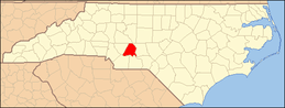
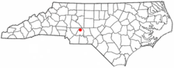 Location of New London, North Carolina | |
| Coordinates: 35°26′41″N 80°13′7″W / 35.44472°N 80.21861°WCoordinates: 35°26′41″N 80°13′7″W / 35.44472°N 80.21861°W | |
| Country | United States |
| State | North Carolina |
| County | Stanly |
| Area | |
| • Total | 0.6 sq mi (1.6 km2) |
| • Land | 0.6 sq mi (1.6 km2) |
| • Water | 0.0 sq mi (0.0 km2) |
| Elevation | 732 ft (223 m) |
| Population (2010) | |
| • Total | 600 |
| • Density | 530.7/sq mi (204.9/km2) |
| Time zone | Eastern (EST) (UTC-5) |
| • Summer (DST) | EDT (UTC-4) |
| ZIP code | 28127 |
| Area code(s) | 704 |
| FIPS code | 37-46820[1] |
| GNIS feature ID | 1013929[2] |
New London is a town in Stanly County, North Carolina, United States. The population was 600 at the 2010 census.
Government
The mayor of New London is W. Calvin Gaddy as of January 2007.
Geography
New London is located at 35°26′41″N 80°13′7″W / 35.44472°N 80.21861°W (35.444859, -80.218723).[3]
According to the United States Census Bureau, the town has a total area of 0.6 square miles (1.6 km2), all of it land. New London is located at the crossroads of US Route 52, NC 8, and NC 740.
Demographics
As of the census[1] of 2000, there were 326 people, 131 households, and 94 families residing in the town. The population density was 530.7 people per square mile (206.3/km²). There were 144 housing units at an average density of 234.4 per square mile (91.1/km²). The racial makeup of the town was 90.80% White, 5.83% African American, 0.61% Native American, 0.92% Asian, 0.61% from other races, and 1.23% from two or more races. Hispanic or Latino of any race were 0.61% of the population.
There were 131 households out of which 34.4% had children under the age of 18 living with them, 53.4% were married couples living together, 12.2% had a female householder with no husband present, and 28.2% were non-families. 25.2% of all households were made up of individuals and 8.4% had someone living alone who was 65 years of age or older. The average household size was 2.49 and the average family size was 2.90.
In the town the population was spread out with 26.7% under the age of 18, 8.0% from 18 to 24, 29.4% from 25 to 44, 24.2% from 45 to 64, and 11.7% who were 65 years of age or older. The median age was 36 years. For every 100 females there were 96.4 males. For every 100 females age 18 and over, there were 82.4 males.
The median income for a household in the town was $42,188, and the median income for a family was $51,429. Males had a median income of $31,806 versus $25,000 for females. The per capita income for the town was $18,520. About 5.2% of families and 6.5% of the population were below the poverty line, including 1.1% of those under age 18 and 29.4% of those age 65 or over.
References
- ↑ 1.0 1.1 "American FactFinder". United States Census Bureau. Retrieved 2008-01-31.
- ↑ "US Board on Geographic Names". United States Geological Survey. 2007-10-25. Retrieved 2008-01-31.
- ↑ "US Gazetteer files: 2010, 2000, and 1990". United States Census Bureau. 2011-02-12. Retrieved 2011-04-23.
| |||||||||||||||||||||||||||||