New Hampshire Route 33
| ||||
|---|---|---|---|---|
|
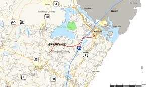
Map of Rockingham County in southeastern New Hampshire with NH 33 highlighted in red | ||||
| Route information | ||||
| Maintained by NHDOT | ||||
| Length: | 9.090 mi[1] (14.629 km) | |||
| Major junctions | ||||
| West end: |
| |||
|
| ||||
| East end: |
| |||
| Location | ||||
| Counties: | Rockingham | |||
| Highway system | ||||
| ||||

New Hampshire Route 33 (NH 33) is an 9.090-mile-long (14.629 km) east–west highway in the Seacoast Region of the U.S. state of New Hampshire. It is the main road connecting Stratham with Portsmouth. The eastern terminus of NH 33 is in Portsmouth at U.S. Route 1. The western terminus is in Stratham at NH 108.
The road skirts the south side of Portsmouth International Airport at Pease.
Route description
NH 33 begins at an intersection with NH 108 in Stratham. The route then travels northeast. It passes by a cemetery and a park, then curves to the east before leaving Stratham. After an intersection with NH 151, the highway bends to the northeast and enters Portsmouth. It then intersects Interstate 95 at a diamond interchange and warps to the east. NH 33 then crosses a railroad track before terminating at an intersection with US 1.[2]
History

The entirety of NH 33 was once the easternmost section of NH 101 before it was re-routed along former NH 51 from NH 108 in Stratham to Hampton Beach.
Junction list
The entire route is in Rockingham County. [1][3]
| Location[1][3] | mi[1][3] | km | Destinations | Notes | |
|---|---|---|---|---|---|
| Stratham | 0.000 | 0.000 | Western terminus | ||
| Greenland | 5.261 | 8.467 | Northern terminus of NH 151 | ||
| Portsmouth | 6.744– 7.340 | 10.853– 11.813 | Exit 3 on I-95 | ||
| 9.090 | 14.629 | Eastern terminus | |||
| 1.000 mi = 1.609 km; 1.000 km = 0.621 mi | |||||
References
- ↑ 1.0 1.1 1.2 1.3 Bureau of Planning & Community Assistance (February 20, 2015). "NH Public Roads". Concord, New Hampshire: New Hampshire Department of Transportation. Retrieved April 7, 2015.
- ↑ Google (April 26, 2013). "New Hampshire Route 33" (Map). Google Maps. Google. Retrieved April 26, 2013.
- ↑ 3.0 3.1 3.2 Bureau of Planning & Community Assistance (April 3, 2015). "Nodal Reference 2015, State of New Hampshire". New Hampshire Department of Transportation. Retrieved April 7, 2015.