New Hampshire Route 107
| ||||
|---|---|---|---|---|
|
Map of eastern New Hampshire with NH 107 highlighted in red | ||||
| Route information | ||||
| Maintained by NHDOT | ||||
| Length: | 69.108 mi[1] (111.219 km) | |||
| Major junctions | ||||
| South end: |
| |||
| North end: |
| |||
| Location | ||||
| Counties: | Rockingham, Merrimack, Belknap | |||
| Highway system | ||||
| ||||


New Hampshire Route 107 (abbreviated NH 107) is a 69.108-mile-long (111.219 km) north–south state highway in New Hampshire. It connects Laconia in the Lakes Region with Seabrook on the Atlantic coast.
The southern terminus of NH 107 is at U.S. Route 1 in Seabrook, at the entrance to Seabrook Station Nuclear Power Plant. The northern terminus is at U.S. Route 3 in Laconia.
NH 107 between U.S. Route 3 and Leavitt Road in Laconia is part of the Timberman 70.3 Triathlon bicycle course.[2]
Route description
NH 107 traverses the following towns from roughly southeast to northwest:
- Seabrook[3]
- Kensington[4]
- East Kingston[5]
- Kingston[6]
- Fremont[7]
- Raymond[8]
- Deerfield[9]
- Epsom[10]
- Northwood[11]
- Pittsfield[12]
- Barnstead[13]
- Gilmanton[14]
- Belmont[15]
- Laconia[16]
History
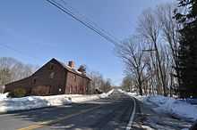
From Laconia to Barnstead, Route 107 is part of the Old Province Road, the first "farm to market" road in New Hampshire. Province Road was planned in 1763 to divert crops from being shipped down the Connecticut River from the Haverhill area, then called "Little Co-os", and instead have them brought to the Durham area.[17] Province Road began the great era of roadbuilding in New Hampshire, a dream of Governor John Wentworth, which had to wait until the end of the French and Indian Wars.[18]
Major intersections
| County | Location[1][19] | mi[1][19] | km | Destinations | Notes |
|---|---|---|---|---|---|
| Rockingham | Seabrook | 0.000 | 0.000 | Southern terminus of NH 107 | |
| 0.206– 0.616 | 0.332– 0.991 | Exit 1 on I-95 | |||
| Kensington | 3.075 | 4.949 | |||
| East Kingston | 7.335 | 11.805 | Southern end of wrong-way concurrency with NH 108 | ||
| 7.724 | 12.431 | Northern end of wrong-way concurrency with NH 108 | |||
| Kingston | 9.563 | 15.390 | Northern terminus of NH 107A | ||
| 9.620 | 15.482 | Southern end of concurrency with NH 111 / NH 125 | |||
| 10.663 | 17.160 | Northern end of concurrency with NH 111 | |||
| 11.195 | 18.017 | Northern end of concurrency with NH 125 | |||
| Fremont | 13.475 | 21.686 | Southern end of concurrency with NH 111A | ||
| 15.252 | 24.546 | Northern end of concurrency with NH 111A | |||
| Raymond | 18.908 | 30.429 | Eastern terminus of NH 102 | ||
| 19.621– 19.997 | 31.577– 32.182 | Exit 5 on NH 101 | |||
| 20.447 | 32.906 | Southern end of concurrency with NH 27 | |||
| 20.551 | 33.074 | Southern terminus of NH 156 | |||
| 24.367 | 39.215 | Northern end of concurrency with NH 27 | |||
| Deerfield | 28.173 | 45.340 | Southern end of concurrency with NH 43 | ||
| 31.663 | 50.957 | Northern end of concurrency with NH 43 | |||
| Merrimack | Epsom | 37.409 | 60.204 | Southern end of concurrency with US 4 / US 202 / NH 9 | |
| Rockingham | Northwood | 39.462 | 63.508 | Northern end of concurrency with US 4 / US 202 / NH 9 | |
| Merrimack | Pittsfield | 48.166 | 77.516 | ||
| Belknap | Gilmanton | 52.741 | 84.878 | Eastern terminus of NH 129 | |
| 58.127 | 93.546 | ||||
| Laconia | 64.932– 65.020 | 104.498– 104.640 | Partial interchange; exit to US 3 north / NH 11 east and entrance from US 3 south / NH 11 west | ||
| 65.610 | 105.589 | Southern end of concurrency with NH 106 | |||
| 66.155 | 106.466 | Northern end of concurrency with NH 106; southern end of concurrency with NH 11A | |||
| 66.729 | 107.390 | Northern end of concurrency with NH 11A | |||
| 69.108 | 111.219 | Northern terminus | |||
1.000 mi = 1.609 km; 1.000 km = 0.621 mi
| |||||
Suffixed routes
| |
|---|---|
| Location: | South Hampton–Kingston |
| Length: | 6.349 mi[1] (10.218 km) |
New Hampshire Route 107A (abbreviated NH 107A) is a 6.34-mile (10.20 km) long north–south highway in Rockingham County, New Hampshire. The southern terminus of the route is at the Massachusetts state line in South Hampton, where South Hampton Road continues to Amesbury, Massachusetts. The northern terminus is at New Hampshire Route 107 in Kingston.
NH 107A begins at the Massachusetts border in South Hampton as Main Avenue. The road progresses to the northwest, becoming Burnt Swamp Road at the town line. The name remains the same to an intersection with New Hampshire Route 108, where NH 107A becomes Powwow River Road. In Kingston, NH 107A turns to the north a short distance ahead of its northern terminus at NH 107 a few yards east of the junction of NH 107 and New Hampshire Route 125.
References
- ↑ 1.0 1.1 1.2 1.3 Bureau of Planning & Community Assistance (February 20, 2015). "NH Public Roads". Concord, New Hampshire: New Hampshire Department of Transportation. Retrieved April 7, 2015.
- ↑ "Timberman 70.3 Triathlon Course Maps".
- ↑ "NH Economic and Labor Market Information Bureau Community Profile for Seabrook".
- ↑ "Town of Kensington Home Page".
- ↑ "NH Economic and Labor Market Information Bureau Community Profile for East Kingston".
- ↑ "NH Economic and Labor Market Information Bureau Community Profile for Kingston".
- ↑ "NH Economic and Labor Market Information Bureau Community Profile for Fremont".
- ↑ "NH Economic and Labor Market Information Bureau Community Profile for Raymond".
- ↑ "NH Economic and Labor Market Information Bureau Community Profile for Deerfield".
- ↑ "NH Economic and Labor Market Information Bureau Community Profile for Epsom".
- ↑ "Northwood NH map at MapQuest.com".
- ↑ "NH Economic and Labor Market Information Bureau Community Profile for Pittsfield".
- ↑ "NH Economic and Labor Market Information Bureau Community Profile for Barnstead".
- ↑ "NH Economic and Labor Market Information Bureau Community Profile for Gilmanton".
- ↑ U.S. Geological Survey. Concord, NH, 1:100,000-scale quadrangle, 1988
- ↑ "NH Economic and Labor Market Information Bureau Community Profile for Laconia".
- ↑ Workers of the Federal Writers' Project of the Works Progress Administration for the State of New Hampshire. New Hampshire: a guide to the granite state. Boston: Houghton, 1938. 63. Print
- ↑ Garvin, Donna, and James L. Garvin. On the road north of Boston: New Hampshire taverns and turnpikes, 1700-1900. Concord, N.H.: New Hampshire Historical Society, 1988. 46. Print.
- ↑ 19.0 19.1 Bureau of Planning & Community Assistance (April 3, 2015). "Nodal Reference 2015, State of New Hampshire". New Hampshire Department of Transportation. Retrieved April 7, 2015.
- Town of Seabrook, Rockingham County
- Town of Kensington, Rockingham County
- Town of East Kingston, Rockingham County
- Town of Kingston, Rockingham County
- Town of Fremont, Rockingham County
- Town of Raymond, Rockingham County
- Town of Deerfield, Rockingham County
- Town of Epsom, Merrimack County
- Town of Northwood, Rockingham County
- Town of Pittsfield, Merrimack County
- Town of Gilmanton, Belknap County
- City of Laconia, Belknap County
External links
| Wikimedia Commons has media related to New Hampshire Route 107. |