Neville Island Bridge
| Neville Island Bridge | |
|---|---|
 | |
| Coordinates | 40°30′48″N 80°08′05″W / 40.5133°N 80.1347°WCoordinates: 40°30′48″N 80°08′05″W / 40.5133°N 80.1347°W |
| Carries |
6 lanes of |
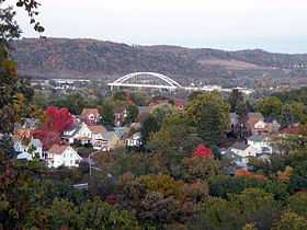
| Crosses | Ohio River and Neville Island, Pennsylvania |
| Locale | Between Glenfield, Pennsylvania, Neville Township, Allegheny County, Pennsylvania and Robinson Township, Allegheny County, Pennsylvania. |
| Characteristics | |
| Design | Steel bowstring arch bridge |
| Longest span | 725 feet |
| Clearance below | 68 feet |
| History | |
| Opened | 1976 |
The Neville Island Bridge is a tied arch bridge which carries Interstate 79 and the Yellow Belt across the Ohio River and over Neville Island, west of Pittsburgh, Pennsylvania.[1]
Construction
Opening in 1976, after five years of construction, the Neville Island Bridge was the last link to finish on the 180 mile long I-79. It is also the second longest single spanning bridge in Allegheny County. The engineers who built it were the Pennsylvania Department of Transportation (PennDot), making it with a 125' arch.[2]
Improvements
During 2010 PennDot completed a $20.8 million improvement of I-76, Neville Island Bridge as well as other intersections.[3]
See also
References
- ↑ "unknown". pghbridges.com. Retrieved 11 November 2012.
- ↑ "I-79, Neville Island Bridge". www.americanbridge.net. Retrieved 11 November 2012.
- ↑ Schmitz, Jon (18 August 2009). "Neville Island Bridge project to bring closures, restrictions". www.post-gazette.com. Retrieved 11 November 2012.
| |||||||||