Nesarabad (Swarupkati) Upazila
| Swarupkathi স্বরূপকাঠি | |
|---|---|
| Upazila | |
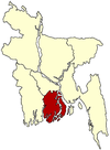
 Swarupkathi Location in Bangladesh | |
| Coordinates: 22°44.8′N 90°6.2′E / 22.7467°N 90.1033°ECoordinates: 22°44.8′N 90°6.2′E / 22.7467°N 90.1033°E | |
| Country |
|
| Division | Barisal Division |
| District | Pirojpur District |
| Area | |
| • Total | 199.14 km2 (76.89 sq mi) |
| Population (1991) | |
| • Total | 202,520 |
| • Density | 1,017/km2 (2,630/sq mi) |
| Time zone | BST (UTC+6) |
| Website | Official Map of the Swarupkathi(Nesarabad) Upazila |
Swarupkathi (Nesarabad) (Bengali: (স্বরূপকাঠি) ) is an Upazila of Pirojpur District in the Division of Barisal, Bangladesh. The name Nesarabad is less familiar than the name Swarupkathi. Swarupkathi is famous for Sarsina Darbar Sharif.
Geography
Swarupkathi (Nesarabad) is located at 22°44′50″N 90°06′13″E / 22.7472°N 90.1036°E. It has 40,792 households and a total area of 199.14 km².
Demographics
According to the 1991 Bangladesh census, Swarupkathi had a population of 202,520. Males constituted 49.54% of the population, and females 50.46%. The population aged 18 or over was 107,488. Swarupkathi had an average literacy rate of 50.8% (7+ years), compared to the national average of 32.4%.[1]
Administration
Swarupkathi has 10 Unions, 82 Mauzas, and 137 villages.
The unions are:
- Baldia
- Shohagdal
- Swarupkathi
- Atgharkuriana
- Jalabari
- Samudoy Kathi
- Daihari
- Sareng Kathi
- Sutiakathi
- Guarekha
See also
References
- ↑ "Population Census Wing, BBS.". Archived from the original on 2005-03-27. Retrieved November 10, 2006.
External links
| |||||||||||||||||||||||||||||||||
.gif)