Nerang National Park
| Nerang National Park Queensland | |
|---|---|
|
IUCN category II (national park) | |
 Nerang National Park | |
| Nearest town or city | Nerang |
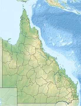
| Coordinates | 27°58′20″S 153°18′12″E / 27.97222°S 153.30333°ECoordinates: 27°58′20″S 153°18′12″E / 27.97222°S 153.30333°E |
| Area | 17 km2 (6.6 sq mi) |
| Managing authorities | Queensland Parks and Wildlife Service |
| Website | Nerang National Park |
| See also | Protected areas of Queensland |
Nerang National Park (commonly referred to as Nerang State Forest) is a national park in Queensland, Australia situated on the Gold Coast. The protected area is located 12 kilometres (7.5 mi) from Surfers Paradise on Nerang’s north-west outskirts.[1]
Nerang National Park is known for its variety of birds, trails, and views. Making it a popular place for mountain bike riders, bushwalkers and bird watchers.[2]
Environment
Nerang National Park is an open forest environment providing a habitat for lot of native and non-native animals. The land of the Nerang National Park is around 100 m above sea level and located 8 kilometres (5.0 mi) from the Pacific Ocean. The Nerang National Park is mostly small-large hills. Both the Coombabah and Saltwater creek run through the Nerang National Park. The soil in the park is mostly clay and limestone though near rivers and in fertile areas the soil is more loamy and aerated.
Recreation
The Nerang National Park is used for all sorts of sports such as horse riding, mountain biking and trail running. The park consist of many fire trails and tracks making it very popular for bike riding, horse riding and walking.[3]
Walking
A network of multi-use recreational trails are shared by cyclists, walkers and horseriders (unless otherwise signed). When using these trails, walkers must give way to horseriders and cyclists must give way to both hosreriders and walkers.
Horseriding
Horses may be ridden on all multi-use recreational trails in Nerang National Park and Nerang State Forest. To protect the environment of the forest horse riders have to follow certain rules such as: Horses are only allowed to cross natural watercourses at designated crossing points on the trail for the protection of watercourses in the area. To minimise damage to vegetation. Do not allow horses to graze on any vegetation while in the area. Tether horses at hitching posts or resting areas only for short periods to minimise soil erosion and compaction. Avoid spreading weeds—ensure horses’ coats, hooves and equipment are free of seeds before park visits.
Mountain-bike riding
Mountain-bike riders have access to all multi-use recreational trails in the national park and State forest, as well as two designated mountain-bike tracks in Nerang National Park. Horseriders and bushwalkers are not permitted on these designated mountain-bike tracks. The two main mountain biking traks are:
Casuarina grove circuit—2.7 km circuit (plus optional 800 m loop) As the name suggests, this circuit leads you through a grove of casuarina trees—the favoured food tree of the vulnerable glossy black-cockatoo. To extend your ride there is the option of diverging to an additional loop which adds another 800 m (8 mins riding time) to your trip.
Three hills track—2 km (one way) Starting from the track entrance on Centre Road, the Three hills track winds through open forest of grey gum and tallowwood, habitat for the regionally vulnerable koala, before joining the Casuarina grove circuit. This track includes steep hilly sections; a moderate level of fitness is recommended.
See also
References
- ↑ "Nerang National Park". Environment and Resource Management. 2010. Retrieved 22 May 2011.
- ↑ Bonzle (2011). "Nerang State Forest". Digital Atlas Pty Limited.
- ↑ "Nerang National Park (DERM)". Environment and Resource Management. 2010. Retrieved 5 December 2011.
External links
| Wikimedia Commons has media related to Nerang National Park. |
| ||||||||||||||||||||||||||||||||||||||||||