Neißeaue
| Neißeaue | ||
|---|---|---|
|
Easternmost point in Germany | ||
| ||
 Neißeaue | ||
Location of Neißeaue within Görlitz district 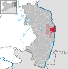
 | ||
| Coordinates: 51°14′50″N 14°58′30″E / 51.24722°N 14.97500°ECoordinates: 51°14′50″N 14°58′30″E / 51.24722°N 14.97500°E | ||
| Country | Germany | |
| State | Saxony | |
| District | Görlitz | |
| Municipal assoc. | Weißer Schöps/Neiße | |
| Government | ||
| • Mayor | Ernst Ewald | |
| Area | ||
| • Total | 47.29 km2 (18.26 sq mi) | |
| Population (2013-12-31)[1] | ||
| • Total | 1,749 | |
| • Density | 37/km2 (96/sq mi) | |
| Time zone | CET/CEST (UTC+1/+2) | |
| Postal codes | 02829 | |
| Dialling codes | 035820 | |
| Vehicle registration | GR | |
| Website | www.neisseaue.de | |


Neißeaue is a municipality in the district Görlitz, Saxony, Germany. The easternmost point in Germany lies within its municipal limits, including Deschka, roughly 7.5 km north-east of Neißeaue's town center, the easternmost settlement in Germany.
From German unification in 1871 until World War II, the title was held by the village of Gingen, in East Prussia.
References
- ↑ "Statistisches Landesamt des Freistaates Sachsen – Bevölkerung des Freistaates Sachsen jeweils am Monatsende ausgewählter Berichtsmonate nach Gemeinden" (PDF). Statistisches Landesamt des Freistaates Sachsen (in German). 6 September 2014.