Nazirpur Upazila
| Kalardoania নাজিরপুর | |
|---|---|
| Upazila | |
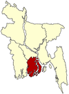
 Kalardoania Location in Bangladesh | |
| Coordinates: 22°44.8′N 89°58.1′E / 22.7467°N 89.9683°ECoordinates: 22°44.8′N 89°58.1′E / 22.7467°N 89.9683°E | |
| Country |
|
| Division | Barisal Division |
| District | Pirojpur District |
| Area | |
| • Total | 233.65 km2 (90.21 sq mi) |
| Population (1991) | |
| • Total | 166,014 |
| • Density | 711/km2 (1,840/sq mi) |
| Time zone | BST (UTC+6) |
| Website | Official Map of the Nazirpur Upazila |
Nazirpur (Bengali: নাজিরপুর ) is an Upazila of Pirojpur District in the Division of Barisal, Bangladesh.
Geography
Nazirpur is located at 22°44′46″N 89°58′04″E / 22.7461°N 89.9678°E . It has 31,862 households and a total area of 233.65 km².
Demographics
According to the 1991 Bangladesh census, Nazirpur had a population of 166014. Males constituted 50.92% of the population, and females 49.08%. The population aged 18 or over was 86,581. Nazirpur had an average literacy rate of 43.4% (7+ years), compared to the national average of 32.4%.[1]
Administration
Nazirpur has 8 Unions/Wards, 69 Mauzas/Mahallas, and 142 villages.
See also
References
- ↑ "Population Census Wing, BBS.". Archived from the original on 2005-03-27. Retrieved November 10, 2006.
| |||||||||||||||||||||||||||||||||