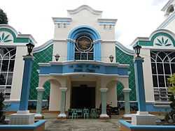
Natividad, Pangasinan
| Natividad | ||
|---|---|---|
| Municipality | ||
 | ||
| ||
 Map of Pangasinan showing the location of Natividad | ||
.svg.png) Natividad Location within the Philippines | ||
| Coordinates: 16°03′N 120°49′E / 16.050°N 120.817°ECoordinates: 16°03′N 120°49′E / 16.050°N 120.817°E | ||
| Country |
| |
| Region | Ilocos (Region I) | |
| Province | Pangasinan | |
| District | 6th district of Pangasinan | |
| Barangays | 18 | |
| Government[1] | ||
| • Mayor | Rodrigo L. Rafael | |
| Area[2] | ||
| • Total | 134.36 km2 (51.88 sq mi) | |
| Population (2010)[3] | ||
| • Total | 22,713 | |
| • Density | 170/km2 (440/sq mi) | |
| Time zone | PST (UTC+8) | |
| ZIP code | 2446 | |
| Dialing code | 75 | |
| Income class | 4th class; rural | |

Natividad is a fourth class municipality in the province of Pangasinan, Philippines. According to the 2010 census, it has a population of 22,713 people.[3]
Barangays
Natividad is politically subdivided into 18 barangays.[2]
- Barangobong
- Batchelor East
- Batchelor West
- Burgos (San Narciso)
- Cacandungan
- Calapugan
- Canarem
- Luna
- Poblacion East
- Poblacion West
- Rizal
- Salud
- San Eugenio
- San Macario Norte
- San Macario Sur
- San Maximo
- San Miguel
- Silag
Demographics
| Population census of Natividad | ||
|---|---|---|
| Year | Pop. | ±% p.a. |
| 1990 | 17,010 | — |
| 1995 | 18,070 | +1.14% |
| 2000 | 19,870 | +2.06% |
| 2007 | 21,560 | +1.13% |
| 2010 | 22,713 | +1.91% |
| Source: National Statistics Office[3][4] | ||
References
- ↑ "Municipalities". Quezon City, Philippines: Department of the Interior and Local Government. Retrieved 26 November 2012.
- ↑ 2.0 2.1 "Province: PANGASINAN". PSGC Interactive. Makati City, Philippines: National Statistical Coordination Board. Retrieved 26 November 2012.
- ↑ 3.0 3.1 3.2 "Total Population by Province, City, Municipality and Barangay: as of May 1, 2010". 2010 Census of Population and Housing. National Statistics Office. Retrieved 26 November 2012.
- ↑ "Province of Pangasinan". Municipality Population Data. LWUA Research Division. Retrieved 5 September 2013.
External links
| Wikimedia Commons has media related to Natividad, Pangasinan. |
- Philippine Standard Geographic Code
- Philippine Census Information
- Local Governance Performance Management System
 |
San Nicolas | | ||
| Tayug | |
Carranglan, Nueva Ecija | ||
| ||||
| | ||||
| San Quintin |
| ||||||||||||||||||||||