National secondary road

A national secondary road (Irish: Bóthar Náisiúnta den Dara Grád) is a category of road in Ireland. These roads form an important part of the national route network, but are secondary to the main arterial routes which are classified as national primary roads. National secondary roads are designated with route numbers higher than those used for primary roads, but with the same "N" prefix. Routes N51 and higher are all national secondary roads.
National secondary roads have a default speed limit of 100 km/h (62.5 mph), as along with national primary routes, they fall into the speed limit category of national roads.
There are 2684 km of national secondary roads in Ireland, making up slightly less than 50% of the entire national route (national primary and national secondary) network.[1] National secondary routes are generally more poorly maintained than primary routes (although their quality can vary widely), but often carry more traffic than regional roads. Almost the entire network of national secondary roads is single carriageway, although there are some short sections of dual carriageway on the Tallaght bypass section of the N81, on the N52 at Dundalk, on the N85 at Ennis, on the N62 at Athlone, on the N69 at Tralee and on the N71 between Cork and Bandon. Typically, national secondary roads are of a similar standard or higher than regional roads although some are of lower quality than the better sections of regional roads. Many of them have been resurfaced with higher quality pavements in recent years with relatively smooth surfaces and good road markings and signposting. However, road widths and alignments are often inadequate, with many narrow and winding sections.
Traditionally national secondary roads generally would not bypass towns on their routes although there now stands an increasing number of exceptions: the N52 bypasses Nenagh, Mullingar and the centre of Dundalk (as a relief road) along with now complete N52 bypass of Tullamore. The N55 (along with the N3) bypasses Cavan, the N56 forms part of the Donegal bypass, the N61 and the N63 bypass Roscommon, the N69 forms part of the Tralee bypass, the N71 bypasses Halfway and Skibbereen, the N74 bypasses Cashel, the N76 bypasses Callan, the N77 forms the northern part of the Kilkenny ring road, the N80 bypasses Carlow and the N85 bypasses Ennis. The former N8 bypass of Mitchelstown was re-classified as the N73 when the Fermoy (Moorepark) to Kilbehenny section of the M8 was completed.
Most national secondary roads were originally Trunk Roads under the old system of road classification in Ireland, although some sections of national secondary routes were formerly Link Roads. A large number of less important Trunk Roads became regional roads when the road classification system changed from 1977 onwards, including some roads, such as the N72 between Killarney and Killorglin, the N86 and the N87, which were originally re-classified as regional roads but later re-classified again as national secondary routes. In 1994, three national secondary roads were reclassified as national primary roads: the N57 between Swinford and Ballina became the N26, the N64 between Oranmore and Claregalway became part of the N18 and the N79 between New Ross and Enniscorthy became the N30. In addition, a section of the N60 between Castlebar and Westport became part of the N5.
Some national secondary roads, though not arterial routes between major cities, connect scenic areas to major population centres. For example, the N59 through County Galway and County Mayo, the N70 road through County Kerry (see Ring of Kerry) and the N71 through West Cork. For this reason, many national secondary roads are well-travelled by tourists.
List of national secondary roads
(XXXX) = Junction with road XXXX, e.g. (N21) = Junction with N21 road
| National Secondary Roads in Ireland (31 December 2007) | ||
|---|---|---|
| Road Name | Description | Length |
| | Drogheda – Slane (N2) – Navan (N3) – Athboy – Delvin (N52 to Mullingar) | 54.367 km (33.782 mi) |
| | (runs around the east of) Dundalk (N1) – Ardee (N2, N33) – Kells (N3) – Delvin (N51) – Mullingar – Tyrrellspass (joins N6) Kilbeggan – Durrow – Tullamore (N80) – Birr (N62) – Borrisokane (N65) – (N7 east of Nenagh) | 199.615 km (124.035 mi) |
| | Dundalk to Castleblayney (a short section of the road becomes the A37 where it runs through County Armagh) | 18.191 km (11.303 mi) |
| | Monaghan (N2) – Clones – Cavan (N3) (a short section of the road becomes the A3 where it runs through County Fermanagh) | 34.513 km (21.445 mi) |
| | (N3 just outside Cavan) – Granard – Edgeworthstown (N4) – (N6 Athlone ringroad) | 79.206 km (49.216 mi) |
| | (N15 just east of Donegal) – (R263 near Killybegs) – Glenties – Dungloe – Gweedore – Dunfanaghy – Letterkenny (N14) | 156.206 km (97.062 mi) |
| | Foxford (N26) – (N5 between Swinford and Castlebar) | 11.273 km (7.005 mi) |
| | (N4 to Sligo) – Ballina (N26) – Bangor Erris – Rosturk – Westport (N5) – Clifden – Oughterard – Moycullen – Galway (N6) | 296.683 km (184.350 mi) |
| | Castlebar – Claremorris (N17) – Ballyhaunis – Castlerea – Ballymoe – Roscommon | 92.282 km (57.341 mi) |
| | Athlone (N6) – Knockcroghery – Roscommon – Tulsk (N5) – Boyle (N4) | 74.752 km (46.449 mi) |
| | N6 near Athlone to M8 at Horse and Jockey) N6 – Ferbane – Cloghan – Birr – Roscrea – Templemore – Thurles – Horse and Jockey (M8) | 93.648 km (58.190 mi) |
| | (N63 Galway city to Longford town) Galway – Claregalway – Lackagh – Turloughmore – Abbeyknockmoy – Moylough – Mountbellew – Newbridge – Ballygar – Mount Talbot – Athleague – Roscommon – Lanesborough-Ballyleague – Longford (N5) | 94.733 km (58.864 mi) |
| | N6 near Loughrea to N52 at Borrisokane; crossing the River Shannon at Portumna | 40.530 km (25.184 mi) |
| | N6 near Loughrea to N18 at Gort | 24.659 km (15.322 mi) |
| | Kilcolgan – Kinvara – Ballyvaughan – Lisdoonvarna – Ennistymon (N85) – Kilkee – Kilrush (N68) – (ferry pier near Killimer) (ferry pier near Tarbert) – Tarbert (N69) | 128.781 km (80.021 mi) |
| | Kilrush to Ennis | 40.865 km (25.392 mi) |
| | Dock Road (Limerick) – Mungret – Clarina – Kildimo – (Askeaton) – Foynes – Tarbert (N67) – Listowel – Tralee (N21, N22, N70, N86) | 101.273 km (62.928 mi) |
| | (Comprises most of the Ring of Kerry) - (N70 Killarney Road at Kenmare) – Sneem – Castlecove – Caherdaniel – Waterville – Cahersiveen – Killorglin – (N72) – Milltown – Castlemaine – (N86) – (N21, N69) Tralee | 142.654 km (88.641 mi) |
| | (N22) Cork (Wilton Road, Bishopstown Road, Bandon Road) – Halfway bypass – Innishannon – Bandon – Ballinascarty – Clonakilty – Rosscarbery – Leap – Skibbereen – (R592 to Ballydehob) – Bantry – Ballylickey – Glengarriff – Kenmare – (N70) – Muckross – Killarney (N22, N72) | 188.089 km (116.873 mi) |
| | Killorglin – Killarney (N22) – Rathmore – Mallow (N20) – Fermoy (N8) – Lismore – Dungarvan (N25) | 166.124 km (103.225 mi) |
| | Mitchelstown (N8) – (N72 east of Mallow) | 28.172 km (17.505 mi) |
| | (N8) Cashel – Golden – Kilfeakle – Tipperary (N24) | 20.131 km (12.509 mi) |
| | Thurles to the N8 near Two-Mile Borris | 8.993 km (5.588 mi) |
| | (N10) Kilkenny Ring Road – Ballymack – Callan bypass – Ninemilehouse – (N24 east of Clonmel) | 43.818 km (27.227 mi) |
| | (N10) Kilkenny Ring Road – (N78) – Ballyragget – (N8) at Durrow | 27.177 km (16.887 mi) |
| | (N77) – Castlecomer – (N80) – Athy – (M9) at Kilcullen | 50.200 km (31.193 mi) |
| | (N6) in Moate – Clara – (N52) in Tullamore – Mountmellick – crosses the (M7) at Portlaoise (connects to M7 via R445) – Stradbally – (N78) Carlow – Ballon – (N81) – Kildavin – Bunclody – (N11) near Enniscorthy | 138.385 km (85.988 mi) |
| | Dublin (Terenure, Tallaght) – (N82) – Baltinglass – Tullow – (N80 just east of Ballon) | 85.476 km (53.112 mi) |
| | Citywest Road (N81 near Tallaght) – (J3 N7 near Clondalkin) | 2.554 km (1.587 mi) |
| | Tuam – Dunmore – Cloonfad – Ballyhaunis – Tooreen – N17 south of Charlestown | 45.219 km (28.098 mi) |
| | Galway – Cloonboo – Headford – Shrule – Kilmaine – Ballinrobe – Castlebar | 73.510 km (45.677 mi) |
| | Ennis (N68) – Ennistymon (N67) | 32.226 km (20.024 mi) |
| | Tralee – Annascaul – Lispole – Dingle | 49.564 km (30.798 mi) |
| | Belturbet (N3) – Ballyconnell – Swanlinbar – (border with Northern Ireland where it becomes the A32) | 28.053 km (17.431 mi) |
| Total | National Secondary route network | 2,683.974 km (1,667.744 mi) |
Defunct routes
 N57 road – Defunct route designation. Swinford – Ballina route prior to its redesignation as the N26 National primary road.
 N64 road – Defunct route designation. Oranmore – Claregalway route prior to its redesignation as the N18 National primary road.
 N79 road – Defunct route designation. Enniscorthy – New Ross route prior to its redesignation as the N30 National primary road.
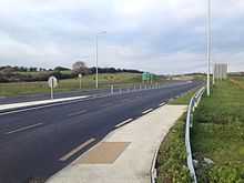
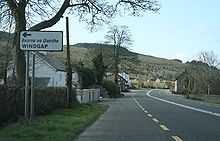
Gallery


See also
- Roads in Ireland
- Motorways in the Republic of Ireland
- National primary road
- Regional road
- Local Roads in Ireland
- Atlantic Corridor
- Dublin Port Tunnel
- Jack Lynch Tunnel
- History of Roads in Ireland
- Trunk Roads in Ireland
- National Roads Authority
- Road signs in the Republic of Ireland
- Road speed limits in the Republic of Ireland
- Vehicle registration plates of Ireland
- Northern Irish Vehicle Registration Plates
- Transport in Ireland
- List of Ireland-related topics
References
- ↑ NRA: National Route Lengths 2007
- S.I. No. 209/1994: Roads Act, 1993 (Declaration of National Roads) Order, 1994
- Roads Act 1993 (Classification of National Roads) Order 2006 – Department of Transport
- - National Roads Authority: National Route Lengths 2007
| ||||||||||||||||||||||||||||||||