| [2] |
Name on the Register[3] |
Image |
Date listed[4] |
Location |
City or town |
Description |
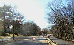
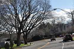
|---|
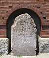
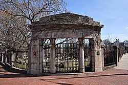
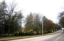
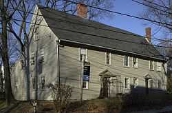
| 1 |
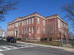
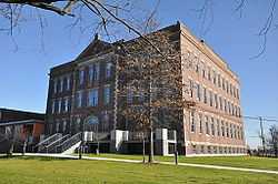
1767 Milestones |
|
01971-04-07-0000April 7, 1971
(#71000084) |
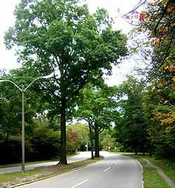
Between Boston and Springfield along Old Post Rd.
42°19′48″N 71°05′29″W / 42.33°N 71.091389°W / 42.33; -71.091389 (1767 Milestones) |
Roxbury, Mission Hill |
Includes markers in Allston-Brighton, and markers in Hampden, Middlesex, and Worcester counties
|
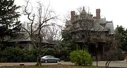
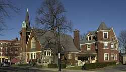
| 2 |
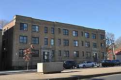
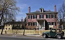
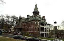
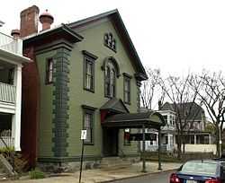
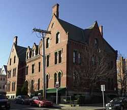
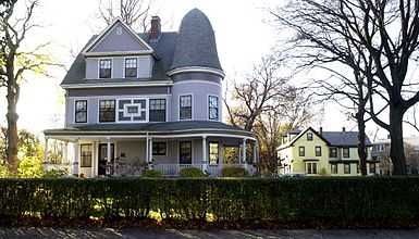
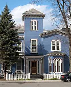
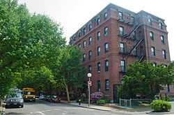
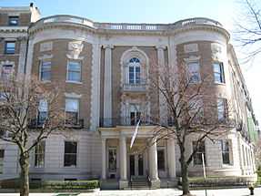
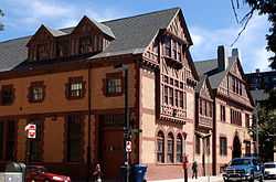
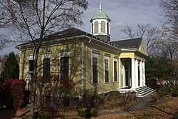
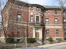
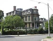
Abbotsford |
|
01987-09-16-0000September 16, 1987
(#87000885) |
300 Walnut Ave.
42°18′58″N 71°05′35″W / 42.316111°N 71.093056°W / 42.316111; -71.093056 (Abbotsford) |
Roxbury |
|
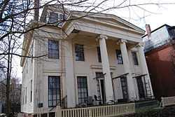
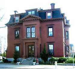
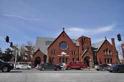
| 3 |
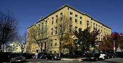
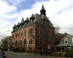
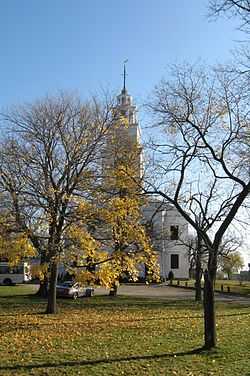
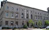
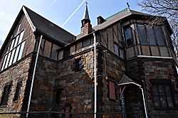
Adams-Nervine Asylum |
|
01982-06-01-0000June 1, 1982
(#82004456) |
990-1020 Centre St.
42°18′13″N 71°07′31″W / 42.303611°N 71.125278°W / 42.303611; -71.125278 (Adams-Nervine Asylum) |
Jamaica Plain |
|
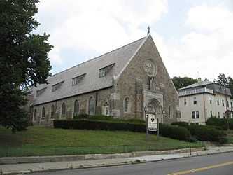
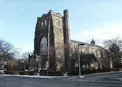
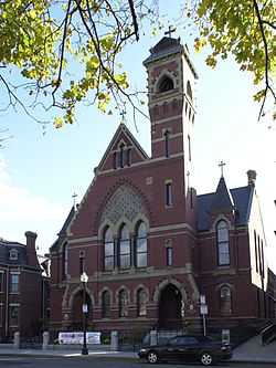
| 4 |
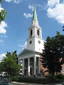
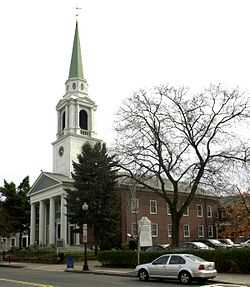
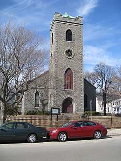
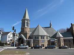
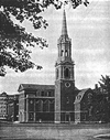
All Saints' Church |
|
01980-06-16-0000June 16, 1980
(#80000678) |
211 Ashmont St.
42°17′09″N 71°03′48″W / 42.285833°N 71.063333°W / 42.285833; -71.063333 (All Saints' Church) |
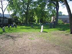
Dorchester |
|
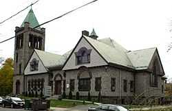
| 5 |
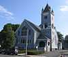
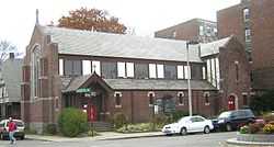
Allston Congregational Church |
|
01997-11-07-0000November 7, 1997
(#97001377) |
31-41 Quint Ave.
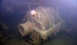
42°21′06″N 71°08′05″W / 42.351667°N 71.134722°W / 42.351667; -71.134722 (Allston Congregational Church) |
Allston |
|
| 6 |
Almont Apartments |
|
02014-09-22-0000September 22, 2014
(#14000698) |
1439-1443 & 1447-1451 Blue Hill Ave.
42°16′29″N 71°05′38″W / 42.2747°N 71.0939°W / 42.2747; -71.0939 (Almont Apartments) |
Mattapan |
|
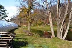
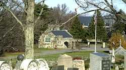
| 7 |
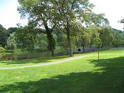
Larz Anderson Park Historic District |
|
01985-10-17-0000October 17, 1985
(#85003245) |
Bounded by Goddard and Avon Sts.
42°18′43″N 71°08′10″W / 42.311944°N 71.136111°W / 42.311944; -71.136111 (Larz Anderson Park Historic District) |
Jamaica Plain |
Extends into Brookline in Norfolk County
|
| 8 |
Arnold Arboretum |
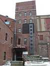
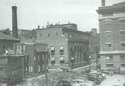
|
01966-10-15-0000October 15, 1966
(#66000127) |
22 Divinity Ave.
42°17′55″N 71°07′30″W / 42.298611°N 71.125°W / 42.298611; -71.125 (Arnold Arboretum) |
Jamaica Plain and Roslindale |
|
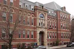
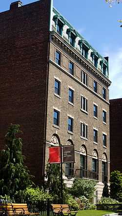
| 9 |
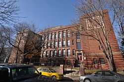
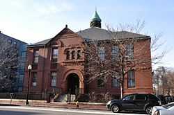
Sarah J. Baker School |
|
01983-07-07-0000July 7, 1983
(#83004285) |
33 Perrin St.
42°19′20″N 71°04′48″W / 42.3222°N 71.08°W / 42.3222; -71.08 (Sarah J. Baker School) |
Roxbury |
|
| 10 |
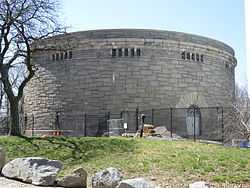
Bellevue Standpipe |
|
01990-01-18-0000January 18, 1990
(#89002251) |
On Bellevue Hill at Washington St. and Roxbury Parkway
42°16′31″N 71°08′40″W / 42.275278°N 71.144444°W / 42.275278; -71.144444 (Bellevue Standpipe) |
West Roxbury |
|
| 11 |
Benedict Fenwick School |
|
02004-02-11-0000February 11, 2004
(#04000023) |
150 Magnolia St.
42°18′49″N 71°04′21″W / 42.313611°N 71.0725°W / 42.313611; -71.0725 (Benedict Fenwick School) |
Dorchester |
|
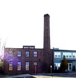
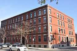
| 12 |
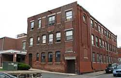
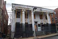
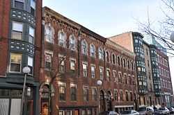
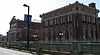
Berger Factory |
|
01980-04-09-0000April 9, 1980
(#80000677) |
37 Williams St.
42°19′58″N 71°04′59″W / 42.332778°N 71.083056°W / 42.332778; -71.083056 (Berger Factory) |
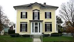
Roxbury |
|
| 13 |
Bigelow School |
|
01985-02-21-0000February 21, 1985
(#85000316) |
350 W. 4th St.
42°21′08″N 71°02′52″W / 42.352222°N 71.047778°W / 42.352222; -71.047778 (Bigelow School) |
South Boston |
|
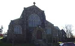
| 14 |
James Blake House |
|
01974-05-01-0000May 1, 1974
(#74002350) |
735 Columbia Rd.
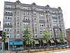
42°19′11″N 71°03′37″W / 42.319722°N 71.060278°W / 42.319722; -71.060278 (James Blake House) |
Dorchester |
|
| 15 |
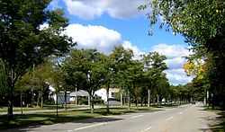
Blue Hills Parkway |
|
02003-06-23-0000June 23, 2003
(#03000574) |
Blue Hills Parkway
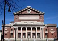
42°15′21″N 71°05′38″W / 42.255833°N 71.093889°W / 42.255833; -71.093889 (Blue Hills Parkway) |
Mattapan |
Extends into Milton in Norfolk County
|
| 16 |
Boston Consumptives Hospital |
|
02002-02-07-0000February 7, 2002
(#01001557) |
249 River St.
42°16′34″N 71°05′01″W / 42.276111°N 71.083611°W / 42.276111; -71.083611 (Boston Consumptives Hospital) |
Dorchester |
|
| 17 |
Boston Harbor Islands Archeological District |
|
01985-12-21-0000December 21, 1985
(#85003323) |
Address Restricted
|
Boston Harbor |
Extends into Quincy in Norfolk County and Hingham in Plymouth County
|
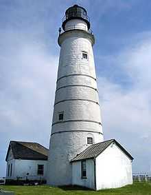
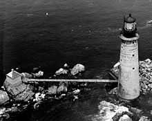
| 18 |
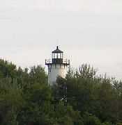
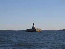
Boston Light |
|
01966-10-15-0000October 15, 1966
(#66000133) |
Little Brewster Island, Boston Harbor
42°19′41″N 70°53′26″W / 42.328056°N 70.890556°W / 42.328056; -70.890556 (Boston Light) |
Boston Harbor |
|
| 19 |
Boston Young Men's Christian Association |
|
01998-08-20-0000August 20, 1998
(#98001082) |
312-320 Huntington Ave.
42°20′26″N 71°05′14″W / 42.340667°N 71.08725°W / 42.340667; -71.08725 (Boston Young Men's Christian Association) |
Fenway-Kenmore |
|
| 20 |
Bowditch School |
|
01990-08-03-0000August 3, 1990
(#90001145) |
80-82 Greene St.
42°18′42″N 71°06′36″W / 42.311667°N 71.11°W / 42.311667; -71.11 (Bowditch School) |
Jamaica Plain |
|
| 21 |
Brandegee Estate |
|
01985-10-17-0000October 17, 1985
(#85003244) |
280 Newton St.
42°18′18″N 71°08′05″W / 42.305°N 71.134722°W / 42.305; -71.134722 (Brandegee Estate) |
West Roxbury |
Extends into Brookline in Norfolk County
|
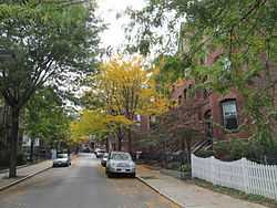
| 22 |
Brighton Center Historic District |
|
02001-02-20-0000February 20, 2001
(#01000088) |
Academy Hill Rd., Chestnut Hill Ave., Dighton, Elko, Henshaw, Leicester, Market, Washington, and Winship Sts.
42°20′57″N 71°09′12″W / 42.349133°N 71.153469°W / 42.349133; -71.153469 (Brighton Center Historic District) |
Brighton |
|
| 23 |
Brighton Evangelical Congregational Church |
|
01997-08-21-0000August 21, 1997
(#97000920) |
404-410 Washington St.
42°20′55″N 71°09′22″W / 42.348611°N 71.156111°W / 42.348611; -71.156111 (Brighton Evangelical Congregational Church) |
Brighton |
|
| 24 |
Brook Farm |
|
01966-10-15-0000October 15, 1966
(#66000141) |
670 Baker St.
42°17′14″N 71°10′43″W / 42.287222°N 71.178611°W / 42.287222; -71.178611 (Brook Farm) |
West Roxbury |
|
| 25 |
Buildings at 825-829 Blue Hill Avenue |
|
02014-09-10-0000September 10, 2014
(#14000561) |
825-829 Blue Hill Ave.
42°17′49″N 71°05′16″W / 42.2969°N 71.0877°W / 42.2969; -71.0877 (Buildings at 825-829 Blue Hill Avenue) |
Dorchester |
|
| 26 |
Calf Pasture Pumping Station Complex |
|
01990-08-02-0000August 2, 1990
(#90001095) |
435 Mount Vernon St.
42°18′48″N 71°02′01″W / 42.313333°N 71.033611°W / 42.313333; -71.033611 (Calf Pasture Pumping Station Complex) |
Dorchester |
|
| 27 |
Cathedral of St. George Historic District |
|
01998-11-25-0000November 25, 1998
(#98001361) |
517-523-525 E. Broadway
42°20′07″N 71°02′37″W / 42.335306°N 71.043556°W / 42.335306; -71.043556 (Cathedral of St. George Historic District) |
South Boston |
|
| 28 |
Charles Street African Methodist Episcopal Church |
|
01983-09-01-0000September 1, 1983
(#83000601) |
551 Warren St.
42°18′45″N 71°05′03″W / 42.3125°N 71.084167°W / 42.3125; -71.084167 (Charles Street African Methodist Episcopal Church) |
Roxbury |
|
| 29 |
Chestnut Hill Reservoir Historic District |
|
01990-01-18-0000January 18, 1990
(#89002271) |
Beacon St. and Commonwealth Ave.
42°19′58″N 71°09′27″W / 42.332778°N 71.1575°W / 42.332778; -71.1575 (Chestnut Hill Reservoir Historic District) |
Brighton |
Extends into Newton.
|
| 30 |
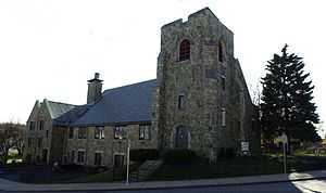
Christ Church |
|
01986-01-30-0000January 30, 1986
(#86000140) |
1220 River St.
42°15′38″N 71°07′48″W / 42.260556°N 71.13°W / 42.260556; -71.13 (Christ Church) |
Hyde Park |
|
| 31 |
Clapp Houses |
|
01974-05-02-0000May 2, 1974
(#74000911) |
199 and 195 Boston St.
42°19′12″N 71°03′25″W / 42.32°N 71.056944°W / 42.32; -71.056944 (Clapp Houses) |
Dorchester |
Home of the Dorchester Historic Society
|
| 32 |
Codman Square District |
|
01983-06-23-0000June 23, 1983
(#83000602) |
Norfolk, Talbot, Epping, Lithgow, Centre, and Moultrie Sts.
42°17′25″N 71°04′16″W / 42.290278°N 71.071111°W / 42.290278; -71.071111 (Codman Square District) |
Dorchester |
|
| 33 |
Collins Building |
|
02005-06-08-0000June 8, 2005
(#05000559) |
213-217 Washington St.
42°18′02″N 71°04′37″W / 42.300556°N 71.076944°W / 42.300556; -71.076944 (Collins Building) |
Dorchester |
|
| 34 |
Congregation Adath Jeshurun |
|
01999-11-12-0000November 12, 1999
(#99001304) |
397 Blue Hill Ave.
42°18′43″N 71°04′53″W / 42.311944°N 71.081389°W / 42.311944; -71.081389 (Congregation Adath Jeshurun) |
Dorchester |
|
| 35 |
Cyclorama Building |
|
01973-04-13-0000April 13, 1973
(#73000318) |
543-547 Tremont St.
42°20′40″N 71°04′19″W / 42.344444°N 71.071944°W / 42.344444; -71.071944 (Cyclorama Building) |
South End |
|
| 36 |
Sarah Davidson Apartment Block |
|
02013-12-18-0000December 18, 2013
(#13000928) |
3 Gaylord St.
42°17′56″N 71°04′23″W / 42.299°N 71.073°W / 42.299; -71.073 (Sarah Davidson Apartment Block) |
Dorchester |
|
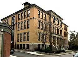
| 37 |
Dearborn School |
|
02000-08-02-0000August 2, 2000
(#00000871) |
25 Ambrose St.
42°19′46″N 71°04′42″W / 42.329444°N 71.078333°W / 42.329444; -71.078333 (Dearborn School) |
Roxbury |
|
| 38 |
Dillaway School |
|
01980-04-09-0000April 9, 1980
(#80001683) |
16-20 Kenilworth St.
42°19′43″N 71°05′14″W / 42.328611°N 71.087222°W / 42.328611; -71.087222 (Dillaway School) |
Roxbury |
|
| 39 |
Dimock Community Health Center Complex |
|
01985-02-21-0000February 21, 1985
(#85000317) |
41 and 55 Dimock St.
42°19′14″N 71°05′51″W / 42.320556°N 71.0975°W / 42.320556; -71.0975 (Dimock Community Health Center Complex) |
Roxbury |
|
| 40 |
District 13 Police Station |
|
01988-02-10-0000February 10, 1988
(#87002549) |
28 Seaverns Ave.
42°18′43″N 71°06′46″W / 42.311944°N 71.112778°W / 42.311944; -71.112778 (District 13 Police Station) |
Jamaica Plain |
|
| 41 |
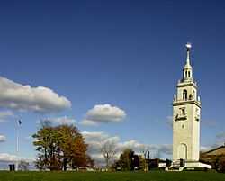
Dorchester Heights National Historic Site |
|
01966-10-15-0000October 15, 1966
(#66000050) |
South Boston
42°19′58″N 71°02′47″W / 42.332778°N 71.046389°W / 42.332778; -71.046389 (Dorchester Heights National Historic Site) |
South Boston |
|
| 42 |
Dorchester Heights Historic District |
|
02001-11-01-0000November 1, 2001
(#01001198) |
Roughly a one block area surrounding Telegraph Hill
42°19′58″N 71°02′48″W / 42.332778°N 71.046667°W / 42.332778; -71.046667 (Dorchester Heights Historic District) |
South Boston |
|
| 43 |
Dorchester North Burying Ground |
|
01974-04-18-0000April 18, 1974
(#74000915) |
Stoughton St. and Columbia Rd.
42°19′00″N 71°03′52″W / 42.316667°N 71.064444°W / 42.316667; -71.064444 (Dorchester North Burying Ground) |
Dorchester |
|
| 44 |
Dorchester Park |
|
02008-02-20-0000February 20, 2008
(#08000089) |
Bounded by Dorchester Ave., Richmond, Adams, and Richview Sts.
42°16′34″N 71°04′01″W / 42.276117°N 71.067014°W / 42.276117; -71.067014 (Dorchester Park) |
Dorchester |
|
| 45 |
Dorchester Pottery Works |
|
01985-02-21-0000February 21, 1985
(#85000318) |
101-105 Victory Rd.
42°17′49″N 71°03′05″W / 42.296944°N 71.051389°W / 42.296944; -71.051389 (Dorchester Pottery Works) |
Dorchester |
|
| 46 |
Dorchester South Burying Ground |
|
02014-06-27-0000June 27, 2014
(#14000365) |
2095 Dorchester Ave.
42°16′43″N 71°04′01″W / 42.2786°N 71.0669°W / 42.2786; -71.0669 (Dorchester South Burying Ground) |
Dorchester |
|
| 47 |
Dorchester Temple Baptist Church |
|
01998-01-16-0000January 16, 1998
(#97001239) |
670 Washington St.
42°17′17″N 71°04′17″W / 42.288056°N 71.071389°W / 42.288056; -71.071389 (Dorchester Temple Baptist Church) |
Dorchester |
|
| 48 |
Dorchester-Milton Lower Mills Industrial District |
|
01980-04-02-0000April 2, 1980
(#80000675) |
Both sides of the Neponset River; also Adams, River, and Medway Sts., Millers Lane, and Eliot and Adams Sts.
42°16′16″N 71°04′08″W / 42.271111°N 71.068889°W / 42.271111; -71.068889 (Dorchester-Milton Lower Mills Industrial District) |
Dorchester |
Extends into Milton in Norfolk County; second set of addresses represents a boundary increase
|
| 49 |
Frederick Douglass Square Historic District |
|
01996-10-03-0000October 3, 1996
(#96001063) |
Roughly bounded by Hammond St., Cobat St., Windsor St., and Westminister St., Lower Roxbury
42°20′09″N 71°05′04″W / 42.335833°N 71.084444°W / 42.335833; -71.084444 (Frederick Douglass Square Historic District) |
Roxbury |
|
| 50 |
Dudley Station Historic District |
|
01985-12-05-0000December 5, 1985
(#85003074) |
Washington, Warren, and Dudley Sts.
42°19′48″N 71°05′04″W / 42.33°N 71.084444°W / 42.33; -71.084444 (Dudley Station Historic District) |
Roxbury |
|
| 51 |
Edna G. shipwreck (eastern rig dragger) |
|
02010-11-22-0000November 22, 2010
(#10000039) |
Stellwagen Bank National Marine Sanctuary
|
Boston vicinity |
Eastern Rig Dragger Fishing Vessel Shipwrecks in the Stellwagen Bank National Marine Sanctuary MPS
|
| 52 |
Egleston Substation |
|
02010-12-27-0000December 27, 2010
(#10001066) |
3025 Washington St.
42°19′01″N 71°05′51″W / 42.316944°N 71.0975°W / 42.316944; -71.0975 (Egleston Substation) |
Jamaica Plain |
|
| 53 |
Eliot Burying Ground |
|
01974-06-25-0000June 25, 1974
(#74000388) |
Eustis and Washington Sts.
42°19′55″N 71°04′55″W / 42.331944°N 71.081944°W / 42.331944; -71.081944 (Eliot Burying Ground) |
Roxbury |
|
| 54 |
Eliot Congregational Church |
|
01994-02-09-0000February 9, 1994
(#93001587) |
56 Dale St., corner 118-120 Walnut St.
42°19′10″N 71°04′55″W / 42.319444°N 71.081944°W / 42.319444; -71.081944 (Eliot Congregational Church) |
Roxbury |
|
| 55 |
Eliot Hall |
|
01988-07-15-0000July 15, 1988
(#88000959) |
7A Eliot St.
42°18′37″N 71°06′59″W / 42.310278°N 71.116389°W / 42.310278; -71.116389 (Eliot Hall) |
Jamaica Plain |
|
| 56 |
Evergreen Cemetery |
|
02009-08-14-0000August 14, 2009
(#09000612) |
2060 Commonwealth Ave.
42°20′20″N 71°09′43″W / 42.338889°N 71.161944°W / 42.338889; -71.161944 (Evergreen Cemetery) |
Brighton |
|
| 57 |
Fairview Cemetery |
|
02009-09-16-0000September 16, 2009
(#09000717) |
45 Fairview Ave.
42°14′45″N 71°08′18″W / 42.245897°N 71.138464°W / 42.245897; -71.138464 (Fairview Cemetery) |
Hyde Park |
|
| 58 |
Fenway Park |
|
02012-03-07-0000March 7, 2012
(#12000069) |
24, & 2-4 Yawkey Wy., 64-76 Brookline Ave., & 70-80 Lansdowne St.
42°20′50″N 71°05′47″W / 42.34709°N 71.09631°W / 42.34709; -71.09631 (Fenway Park) |
Fenway-Kenmore |
Longtime home of Boston Red Sox built in 1912; has been oldest ballpark in use by Major League Baseball since 1999.
|
| 59 |
Fenway Studios |
|
01978-09-13-0000September 13, 1978
(#78000473) |
30 Ipswich St.
42°20′50″N 71°05′28″W / 42.347222°N 71.091111°W / 42.347222; -71.091111 (Fenway Studios) |
Fenway-Kenmore |
|
| 60 |
Fenway-Boylston Street District |
|
01984-09-04-0000September 4, 1984
(#84002875) |
Fenway, Boylston, Westland, and Hemenway Sts.
42°20′43″N 71°05′26″W / 42.345278°N 71.090556°W / 42.345278; -71.090556 (Fenway-Boylston Street District) |
Fenway-Kenmore |
|
| 61 |
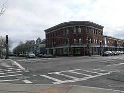
Fields Corner Municipal Building |
|
01981-11-12-0000November 12, 1981
(#81000620) |
1 Arcadia St., 195 Adams St.
42°18′07″N 71°03′38″W / 42.301944°N 71.060556°W / 42.301944; -71.060556 (Fields Corner Municipal Building) |
Dorchester |
|
| 62 |
First Church of Jamaica Plain |
|
01988-07-15-0000July 15, 1988
(#88000955) |
6 Eliot St.
42°18′35″N 71°07′00″W / 42.309722°N 71.116667°W / 42.309722; -71.116667 (First Church of Jamaica Plain) |
Jamaica Plain |
|
| 63 |
First Congregational Church of Hyde Park |
|
01999-11-12-0000November 12, 1999
(#99001308) |
6 Webster St.
42°15′27″N 71°07′15″W / 42.2575°N 71.120833°W / 42.2575; -71.120833 (First Congregational Church of Hyde Park) |
Hyde Park |
|
| 64 |
Forest Hills Cemetery |
|
02004-11-17-0000November 17, 2004
(#04001219) |
95 Forest Hills Ave.
42°17′35″N 71°06′29″W / 42.293056°N 71.108056°W / 42.293056; -71.108056 (Forest Hills Cemetery) |
Roslindale |
|
| 65 |
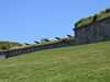
Fort Independence |
|
01970-10-15-0000October 15, 1970
(#70000921) |
Castle Island
42°20′17″N 71°00′42″W / 42.338056°N 71.011667°W / 42.338056; -71.011667 (Fort Independence) |
South Boston |
|
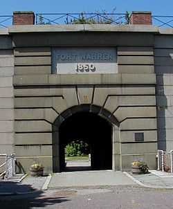
| 66 |
Fort Warren |
|
01970-08-29-0000August 29, 1970
(#70000540) |
Georges Island, Boston Harbor
42°19′11″N 70°55′43″W / 42.319722°N 70.928611°W / 42.319722; -70.928611 (Fort Warren) |
Boston Harbor |
|
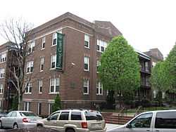
| 67 |
Frances and Isabella Apartments |
|
02002-02-22-0000February 22, 2002
(#02000081) |
430-432 and 434-436 Dudley St.
42°19′27″N 71°04′29″W / 42.324167°N 71.074722°W / 42.324167; -71.074722 (Frances and Isabella Apartments) |
Roxbury |
|
| 68 |
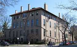
Isabella Stewart Gardner Museum |
|
01983-01-27-0000January 27, 1983
(#83000603) |
280 The Fenway
42°20′17″N 71°05′59″W / 42.338056°N 71.099722°W / 42.338056; -71.099722 (Isabella Stewart Gardner Museum) |
Fenway-Kenmore |
|
| 69 |
William Lloyd Garrison House |
|
01966-10-15-0000October 15, 1966
(#66000653) |
125 Highland St.
42°19′34″N 71°05′38″W / 42.326111°N 71.093889°W / 42.326111; -71.093889 (William Lloyd Garrison House) |
Roxbury |
|
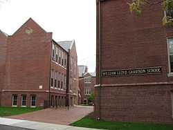
| 70 |
William Lloyd Garrison School |
|
01980-04-16-0000April 16, 1980
(#80000674) |
20 Hutchings St.
42°18′34″N 71°05′22″W / 42.309444°N 71.089444°W / 42.309444; -71.089444 (William Lloyd Garrison School) |
Roxbury |
|
| 71 |
Goldsmith Block |
|
02007-06-05-0000June 5, 2007
(#07000510) |
41 Ruggles St., 746-750 Shawmut Ave.
42°19′56″N 71°05′02″W / 42.332222°N 71.083889°W / 42.332222; -71.083889 (Goldsmith Block) |
Roxbury |
|
| 72 |
Graves Light Station |
|
01987-09-28-0000September 28, 1987
(#87002041) |
Entrance to North Channel, Boston Harbor
42°21′54″N 70°52′11″W / 42.365°N 70.869722°W / 42.365; -70.869722 (Graves Light Station) |
Boston Harbor |
|
| 73 |
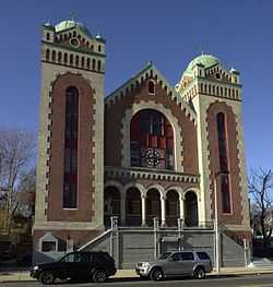
Greek Orthodox Cathedral of New England |
|
01988-06-30-0000June 30, 1988
(#88000957) |
520 Parker St.
42°20′11″N 71°05′39″W / 42.336389°N 71.094167°W / 42.336389; -71.094167 (Greek Orthodox Cathedral of New England) |
Fenway-Kenmore |
|
| 74 |
Greenwood Memorial United Methodist Church |
|
02002-03-08-0000March 8, 2002
(#02000154) |
378A-380 Washington St.
42°17′49″N 71°04′19″W / 42.296944°N 71.071944°W / 42.296944; -71.071944 (Greenwood Memorial United Methodist Church) |
Dorchester |
|
| 75 |
Haffenreffer Brewery |
|
01982-05-02-0000May 2, 1982
(#82004453) |
Germania St.
42°18′52″N 71°06′15″W / 42.314444°N 71.104167°W / 42.314444; -71.104167 (Haffenreffer Brewery) |
Jamaica Plain |
|
| 76 |
Edward Everett Hale House |
|
01979-03-21-0000March 21, 1979
(#73000325) |
12 Morley St.
42°19′44″N 71°05′33″W / 42.328889°N 71.0925°W / 42.328889; -71.0925 (Edward Everett Hale House) |
Roxbury |
|
| 77 |
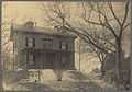
John Harris House and Farm |
|
01985-10-17-0000October 17, 1985
(#85003246) |
284 Newton St.
42°18′16″N 71°08′19″W / 42.304444°N 71.138611°W / 42.304444; -71.138611 (John Harris House and Farm) |
West Roxbury |
Extends into Brookline in Norfolk County
|
| 78 |
Harrison Square Historic District |
|
02002-10-22-0000October 22, 2002
(#02001190) |
Bounded by MBTA Braintree line embankment, Park, Everett, Freeport, Mill, Asland, Blanche Sts., Victory Rd.
42°18′07″N 71°03′13″W / 42.302031°N 71.053531°W / 42.302031; -71.053531 (Harrison Square Historic District) |
Dorchester |
|
| 79 |
Harriswood Crescent |
|
01986-03-13-0000March 13, 1986
(#86000375) |
60-88 Harold St.
42°19′05″N 71°05′47″W / 42.318056°N 71.096389°W / 42.318056; -71.096389 (Harriswood Crescent) |
Roxbury |
|
| 80 |
Harvard Avenue Fire Station |
|
01983-03-31-0000March 31, 1983
(#83000605) |
16 Harvard Ave.
42°21′19″N 71°07′58″W / 42.355278°N 71.132778°W / 42.355278; -71.132778 (Harvard Avenue Fire Station) |
Allston |
|
| 81 |
Harvard Avenue Historic District |
|
02000-04-28-0000April 28, 2000
(#00000415) |
Roughly bounded by Linden St., Commonwealth Ave., Harvard Ave., and Park Vale Ave.
42°21′12″N 71°07′58″W / 42.353333°N 71.132778°W / 42.353333; -71.132778 (Harvard Avenue Historic District) |
Allston |
|
| 82 |
Edward H. Haskell Home for Nurses |
|
02004-02-26-0000February 26, 2004
(#04000085) |
220 Fisther Ave., 63 Parker Hill Ave.
42°19′49″N 71°06′36″W / 42.330278°N 71.11°W / 42.330278; -71.11 (Edward H. Haskell Home for Nurses) |
Mission Hill |
|
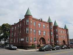
| 83 |
Hibernian Hall |
|
02004-06-02-0000June 2, 2004
(#04000534) |
182-186 Dudley St.
42°19′43″N 71°04′57″W / 42.328611°N 71.0825°W / 42.328611; -71.0825 (Hibernian Hall) |
Roxbury |
|
| 84 |
Highland Spring Brewery Bottling and Storage Buildings |
|
02010-05-28-0000May 28, 2010
(#10000300) |
154-166 Terrace St.
42°19′37″N 71°05′55″W / 42.326944°N 71.098536°W / 42.326944; -71.098536 (Highland Spring Brewery Bottling and Storage Buildings) |
Mission Hill |
|
| 85 |
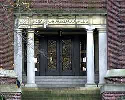
Home for Aged Couples |
|
02005-08-11-0000August 11, 2005
(#05000879) |
409, 419 Walnut Ave. and 2055 Columbus Ave.
42°18′49″N 71°05′43″W / 42.313611°N 71.095278°W / 42.313611; -71.095278 (Home for Aged Couples) |
Jamaica Plain |
|
| 86 |
Home for Destitute Jewish Children |
|
02014-10-08-0000October 8, 2014
(#14000840) |
150-156 American Legion Hwy.
42°17′41″N 71°05′34″W / 42.2948°N 71.0927°W / 42.2948; -71.0927 (Home for Destitute Jewish Children) |
Dorchester |
Now houses a community center and charter school.
|
| 87 |
House at 17 Cranston Street |
|
01987-11-20-0000November 20, 1987
(#87001398) |
17 Cranston St.
42°19′14″N 71°06′35″W / 42.320556°N 71.109722°W / 42.320556; -71.109722 (House at 17 Cranston Street) |
Jamaica Plain |
|
| 88 |
Timothy Hoxie House |
|
01987-11-20-0000November 20, 1987
(#87001399) |
135 Hillside St.
42°19′52″N 71°06′19″W / 42.331111°N 71.105278°W / 42.331111; -71.105278 (Timothy Hoxie House) |
Mission Hill |
|
| 89 |
John Eliot Square District |
|
01973-04-23-0000April 23, 1973
(#73000854) |
John Eliot Sq.
42°19′47″N 71°05′27″W / 42.329722°N 71.090833°W / 42.329722; -71.090833 (John Eliot Square District) |
Roxbury |
|
| 90 |
Joshua Bates School |
|
02008-08-22-0000August 22, 2008
(#08000793) |
731 Harrison Ave.
42°20′15″N 71°04′19″W / 42.337626°N 71.071823°W / 42.337626; -71.071823 (Joshua Bates School) |
South End |
|
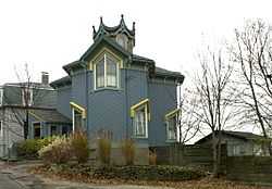
| 91 |
Alvah Kittredge House |
|
01973-05-08-0000May 8, 1973
(#73000855) |
12 Linwood St.
42°19′47″N 71°05′38″W / 42.329722°N 71.093889°W / 42.329722; -71.093889 (Alvah Kittredge House) |
Roxbury |
|
| 92 |
Lawrence Model Lodging Houses |
|
01983-09-22-0000September 22, 1983
(#83000606) |
79, 89, 99 and 109 E. Canton St.
42°20′17″N 71°04′14″W / 42.338056°N 71.070556°W / 42.338056; -71.070556 (Lawrence Model Lodging Houses) |
South End |
|
| 93 |
Long Island Head Light |
|
01987-06-15-0000June 15, 1987
(#87001481) |
Long Island
42°19′49″N 70°57′28″W / 42.330278°N 70.957778°W / 42.330278; -70.957778 (Long Island Head Light) |
Boston Harbor |
|
| 94 |
Harrison Loring House |
|
01983-09-01-0000September 1, 1983
(#83000604) |
789 E. Broadway St.
42°20′07″N 71°02′01″W / 42.335278°N 71.033611°W / 42.335278; -71.033611 (Harrison Loring House) |
South Boston |
|
| 95 |
Loring-Greenough House |
|
01972-04-26-0000April 26, 1972
(#72000544) |
12 South St.
42°18′35″N 71°06′56″W / 42.309722°N 71.115556°W / 42.309722; -71.115556 (Loring-Greenough House) |
Jamaica Plain |
|
| 96 |
Lower Roxbury Historic District |
|
01994-12-09-0000December 9, 1994
(#94001494) |
Roughly the area surrounding Coventry, Cunard, and Walpole Sts.
42°20′11″N 71°05′12″W / 42.336389°N 71.086667°W / 42.336389; -71.086667 (Lower Roxbury Historic District) |
Roxbury |
|
| 97 |
Luna (tugboat) |
Upload image |
01983-10-06-0000October 6, 1983
(#83004099) |
Commonwealth Pier
42°21′04″N 71°02′24″W / 42.3512°N 71.0399°W / 42.3512; -71.0399 (Luna (tugboat)) |
South Boston |
Supposedly on display some Saturdays.[5]
|
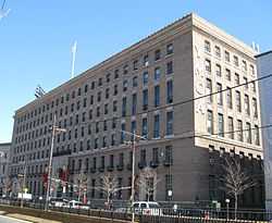
| 98 |
Massachusetts Historical Society Building |
|
01966-10-15-0000October 15, 1966
(#66000770) |
1154 Boylston St.
42°20′47″N 71°05′26″W / 42.346389°N 71.090556°W / 42.346389; -71.090556 (Massachusetts Historical Society Building) |
Fenway-Kenmore |
|
| 99 |
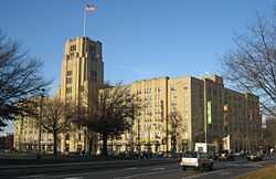
Massachusetts Mental Health Center |
|
01994-01-21-0000January 21, 1994
(#93001489) |
74 Fenwood Rd.
42°20′08″N 71°06′35″W / 42.335556°N 71.109722°W / 42.335556; -71.109722 (Massachusetts Mental Health Center) |
Fenway-Kenmore |
Campus demolished in 2010.
|
| 100 |
Massachusetts School of Art |
|
01989-08-03-0000August 3, 1989
(#89000974) |
364 Brookline Ave.
42°20′20″N 71°06′24″W / 42.338889°N 71.106667°W / 42.338889; -71.106667 (Massachusetts School of Art) |
Fenway-Kenmore |
|
| 101 |
Mission Hill Triangle Historic District |
|
01989-11-06-0000November 6, 1989
(#89001747) |
Roughly bounded by Smith St., Worthington St., Tremont St., and Huntington Ave.
42°20′02″N 71°06′09″W / 42.333889°N 71.1025°W / 42.333889; -71.1025 (Mission Hill Triangle Historic District) |
Mission Hill |
|
| 102 |
Monument Square Historic District |
|
01990-10-11-0000October 11, 1990
(#90001536) |
Roughly bounded by Jamaicaway, Pond, Centre and Eliot Sts.
42°18′34″N 71°06′57″W / 42.309417°N 71.115778°W / 42.309417; -71.115778 (Monument Square Historic District) |
Jamaica Plain |
Not to be confused with Monument Square Historic District (Charlestown, Boston, Massachusetts), where the Bunker Hill Monument is located.
|
| 103 |
Moreland Street Historic District |
|
01984-03-29-0000March 29, 1984
(#84002890) |
Roughly bounded by Kearsarge, Blue Hill Aves., Warren, Waverly, and Winthrop Sts.
42°19′25″N 71°04′48″W / 42.323611°N 71.08°W / 42.323611; -71.08 (Moreland Street Historic District) |
Roxbury |
|
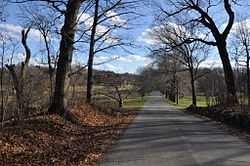
| 104 |
Morton Street, Metropolitan Park System of Greater Boston |
|
02005-01-24-0000January 24, 2005
(#04001572) |
Morton St.
42°17′11″N 71°05′27″W / 42.286389°N 71.090833°W / 42.286389; -71.090833 (Morton Street, Metropolitan Park System of Greater Boston) |
Jamaica Plain |
|
| 105 |
Mount Hope Cemetery |
|
02009-09-24-0000September 24, 2009
(#09000767) |
355 Walk Hill St.
42°17′12″N 71°06′19″W / 42.286572°N 71.105258°W / 42.286572; -71.105258 (Mount Hope Cemetery) |
Roslindale |
|
| 106 |
Mount Pleasant Historic District |
|
01989-02-09-0000February 9, 1989
(#89000004) |
Roughly bounded by Forest St. and Mount Pleasant Ave.
42°19′33″N 71°04′43″W / 42.325833°N 71.078611°W / 42.325833; -71.078611 (Mount Pleasant Historic District) |
Roxbury |
|
| 107 |
Nazing Court Apartments |
|
02004-05-12-0000May 12, 2004
(#04000426) |
224-236 Seaver St. and 1-8 Nazing Court
42°18′13″N 71°05′36″W / 42.303611°N 71.093333°W / 42.303611; -71.093333 (Nazing Court Apartments) |
Roxbury |
|
| 108 |
Neponset Valley Parkway, Metropolitan Park System of Greater Boston |
|
02005-01-24-0000January 24, 2005
(#04001573) |
Neponset Valley Parkway
42°14′14″N 71°07′36″W / 42.237222°N 71.126667°W / 42.237222; -71.126667 (Neponset Valley Parkway, Metropolitan Park System of Greater Boston) |
Hyde Park |
Extends into Milton in Norfolk County
|
| 109 |
New England Conservatory of Music |
|
01980-05-14-0000May 14, 1980
(#80000672) |
290 Huntington Ave.
42°20′26″N 71°05′13″W / 42.340556°N 71.086944°W / 42.340556; -71.086944 (New England Conservatory of Music) |
Fenway-Kenmore |
|
| 110 |
New Riding Club |
|
01987-08-20-0000August 20, 1987
(#87001394) |
52 Hemenway St.
42°20′42″N 71°05′23″W / 42.345°N 71.089722°W / 42.345; -71.089722 (New Riding Club) |
Fenway-Kenmore |
|
| 111 |
Nix's Mate Daybeacon |
|
02004-03-18-0000March 18, 2004
(#04000189) |
Nubble Channel, The Narrows, Boston Harbor
42°19′56″N 70°56′42″W / 42.332222°N 70.945°W / 42.332222; -70.945 (Nix's Mate Daybeacon) |
Boston Harbor |
|
| 112 |
Oak Square School |
|
01980-11-10-0000November 10, 1980
(#80000465) |
35 Nonantum St.
42°20′59″N 71°10′10″W / 42.349722°N 71.169444°W / 42.349722; -71.169444 (Oak Square School) |
Brighton |
|
| 113 |
Old Harbor Reservation Parkways, Metropolitan Park System of Greater Boston |
|
02008-07-24-0000July 24, 2008
(#08000693) |
William J. Day Boulevard, Columbia Rd. between Farragut Rd and Kosciuszko Cir., and Old Colony Ave. between Pacuska Ave.
42°19′46″N 71°02′45″W / 42.329383°N 71.045722°W / 42.329383; -71.045722 (Old Harbor Reservation Parkways, Metropolitan Park System of Greater Boston) |
South Boston |
|
| 114 |
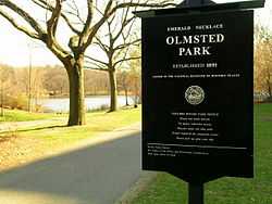
Olmsted Park System |
|
01971-12-08-0000December 8, 1971
(#71000086) |
Encompassing the Back Bay Fens, Muddy River, Olmsted (Leverett Park), Jamaica Park, Arborway, and Franklin Park
42°20′43″N 71°05′45″W / 42.345278°N 71.095833°W / 42.345278; -71.095833 (Olmsted Park System) |
Jamaica Plain and Fenway-Kenmore |
|
| 115 |
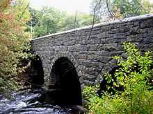
Paul's Bridge |
|
01972-12-11-0000December 11, 1972
(#72000140) |
Neponset Valley Parkway over the Neponset River
42°14′04″N 71°07′24″W / 42.234444°N 71.123333°W / 42.234444; -71.123333 (Paul's Bridge) |
Hyde Park |
Extends into Milton in Norfolk County
|
| 116 |
The Peabody |
|
02001-08-08-0000August 8, 2001
(#01000872) |
195-197 Ashmont St.
42°17′07″N 71°03′53″W / 42.285278°N 71.064722°W / 42.285278; -71.064722 (The Peabody) |
Dorchester |
|
| 117 |
Pierce House |
|
01974-04-26-0000April 26, 1974
(#74000917) |
24 Oakton Ave.
42°17′13″N 71°03′13″W / 42.286944°N 71.053611°W / 42.286944; -71.053611 (Pierce House) |
Dorchester |
|
| 118 |
Pilgrim Congregational Church |
|
02013-12-18-0000December 18, 2013
(#13000929) |
540-544 Columbia Road
42°18′58″N 71°04′01″W / 42.316°N 71.067°W / 42.316; -71.067 (Pilgrim Congregational Church) |
Dorchester |
|
| 119 |
Ellen H. Swallow Richards House |
|
01992-03-31-0000March 31, 1992
(#92001874) |
32 Eliot St.
42°18′57″N 71°07′06″W / 42.315833°N 71.118333°W / 42.315833; -71.118333 (Ellen H. Swallow Richards House) |
Jamaica Plain |
|
| 120 |
The Riviera |
|
01995-12-07-0000December 7, 1995
(#95001450) |
270 Huntington Ave.
42°20′30″N 71°05′11″W / 42.341667°N 71.086389°W / 42.341667; -71.086389 (The Riviera) |
Fenway-Kenmore |
|
| 121 |
Roslindale Baptist Church |
|
01998-11-05-0000November 5, 1998
(#98001330) |
52 Cummins Highway
42°17′07″N 71°07′41″W / 42.285278°N 71.128056°W / 42.285278; -71.128056 (Roslindale Baptist Church) |
Roslindale |
|
| 122 |
Roslindale Congregational Church |
|
01991-07-26-0000July 26, 1991
(#91000925) |
25 Cummins Highway at its junction with Summer Ave.
42°17′42″N 71°07′43″W / 42.295°N 71.128611°W / 42.295; -71.128611 (Roslindale Congregational Church) |
Roslindale |
|
| 123 |
Roslindale Substation |
|
02013-08-27-0000August 27, 2013
(#13000621) |
4228 Washington St.,
42°17′11″N 71°07′41″W / 42.286262°N 71.128063°W / 42.286262; -71.128063 (Roslindale Substation) |
Roslindale |
|
| 124 |
Roxbury High Fort |
|
01973-04-23-0000April 23, 1973
(#73000856) |
Beech Glen St. at Fort Ave.
42°19′16″N 71°05′24″W / 42.321111°N 71.09°W / 42.321111; -71.09 (Roxbury High Fort) |
Roxbury |
|
| 125 |
Roxbury Highlands Historic District |
|
01989-02-22-0000February 22, 1989
(#89000147) |
Roughly bounded by Dudley St., Washington St., and Columbus Ave.
42°19′32″N 71°05′26″W / 42.325556°N 71.090556°W / 42.325556; -71.090556 (Roxbury Highlands Historic District) |
Roxbury |
|
| 126 |
Roxbury Presbyterian Church |
|
01991-03-15-0000March 15, 1991
(#89002125) |
328 Warren St.
42°19′10″N 71°04′55″W / 42.319444°N 71.081944°W / 42.319444; -71.081944 (Roxbury Presbyterian Church) |
Roxbury |
|
| 127 |
Saint Augustine Chapel and Cemetery |
|
01987-09-18-0000September 18, 1987
(#87001495) |
Dorchester St. between W. 6th and Tudor Sts.
42°20′02″N 71°03′00″W / 42.333889°N 71.05°W / 42.333889; -71.05 (Saint Augustine Chapel and Cemetery) |
South Boston |
|
| 128 |
St. Joseph's Roman Catholic Church Complex |
|
01989-12-28-0000December 28, 1989
(#89002169) |
Bounded by Circuit, Regent, Hulbert, and Fenwick Sts.
42°19′26″N 71°05′16″W / 42.323889°N 71.087778°W / 42.323889; -71.087778 (St. Joseph's Roman Catholic Church Complex) |
Roxbury |
|
| 129 |
St. Luke's and St. Margaret's Church |
|
01997-11-12-0000November 12, 1997
(#97001472) |
5-7 St. Luke's Rd.
42°21′07″N 71°07′40″W / 42.351944°N 71.127778°W / 42.351944; -71.127778 (St. Luke's and St. Margaret's Church) |
Allston |
|
| 130 |
St. Mark's Episcopal Church |
|
02014-07-03-0000July 3, 2014
(#12000783) |
73 Columbia Rd.
42°18′16″N 71°04′56″W / 42.3045°N 71.0821°W / 42.3045; -71.0821 (St. Mark's Episcopal Church) |
Dorchester |
|
| 131 |
St. Mary's Episcopal Church |
|
01998-10-30-0000October 30, 1998
(#98001292) |
14-16 Cushing Ave.
42°18′59″N 71°03′54″W / 42.316389°N 71.065°W / 42.316389; -71.065 (St. Mary's Episcopal Church) |
Dorchester |
|
| 132 |
Savin Hill Historic District |
|
02003-05-09-0000May 9, 2003
(#03000385) |
Roughly bounded by Savin Hill Ave., Morrissey Boulevard, Dorchester Bay, and Interstate 93
42°18′33″N 71°03′01″W / 42.309167°N 71.050278°W / 42.309167; -71.050278 (Savin Hill Historic District) |
Dorchester |
|
| 133 |
Sears Roebuck and Company Mail Order Store |
|
01991-01-15-0000January 15, 1991
(#90001992) |
309 Park Dr. and 201 Brookline Ave.
42°20′41″N 71°06′12″W / 42.344722°N 71.103333°W / 42.344722; -71.103333 (Sears Roebuck and Company Mail Order Store) |
Fenway-Kenmore |
A former Sears building now known as Landmark Center
|
| 134 |
Second Church in Boston |
|
02010-06-24-0000June 24, 2010
(#10000391) |
874, 876, 880 Beacon St.
42°20′49″N 71°06′17″W / 42.346944°N 71.104722°W / 42.346944; -71.104722 (Second Church in Boston) |
Fenway–Kenmore |
|
| 135 |
Sherman Apartments Historic District |
|
02012-11-28-0000November 28, 2012
(#12000978) |
544-546 Washington, 4-6, 12-14, 18 Lyndhurst Sts.
42°17′32″N 71°04′17″W / 42.2923°N 71.0715°W / 42.2923; -71.0715 (Sherman Apartments Historic District) |
Dorchester |
|
| 136 |
Shirley-Eustis House |
|
01966-10-15-0000October 15, 1966
(#66000787) |
31-37 Shirley St.
42°19′24″N 71°04′21″W / 42.323333°N 71.0725°W / 42.323333; -71.0725 (Shirley-Eustis House) |
Roxbury |
|
| 137 |
South Boston Boat Clubs Historic District |
|
02005-09-01-0000September 1, 2005
(#05000936) |
1793-1849 William J. Day Boulevard
42°19′56″N 71°01′37″W / 42.332222°N 71.026944°W / 42.332222; -71.026944 (South Boston Boat Clubs Historic District) |
South Boston |
|
| 138 |
South End District |
|
01973-05-08-0000May 8, 1973
(#73000324) |
South Bay area between Huntington and Harrison Aves.; also 200-224 Northampton St.
42°20′23″N 71°04′23″W / 42.339722°N 71.073056°W / 42.339722; -71.073056 (South End District) |
South End |
Second set of addresses represents a boundary increase 02014-12-29-0000December 29, 2014
|
| 139 |
Stony Brook Reservation Parkways, Metropolitan Park System of Great Boston MPS |
|
02006-01-03-0000January 3, 2006
(#05001509) |
Dedham, Enneking, Turtle Pond Parkways, Smith Field, Reservation, W. Border Rds.
42°15′28″N 71°08′32″W / 42.257778°N 71.142222°W / 42.257778; -71.142222 (Stony Brook Reservation Parkways, Metropolitan Park System of Great Boston MPS) |
Hyde Park and West Roxbury |
Extends into Dedham in Norfolk County
|
| 140 |
Students House |
|
01997-09-11-0000September 11, 1997
(#97000970) |
96 The Fenway
42°20′31″N 71°05′33″W / 42.341944°N 71.0925°W / 42.341944; -71.0925 (Students House) |
Fenway-Kenmore |
|
| 141 |
Sumner Hill Historic District |
|
01987-10-22-0000October 22, 1987
(#87001889) |
Roughly bounded by Seaverns Ave., Everett St., Carolina Ave., and Newbern St.
42°18′35″N 71°06′43″W / 42.309722°N 71.111944°W / 42.309722; -71.111944 (Sumner Hill Historic District) |
Jamaica Plain |
|
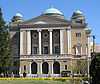
| 142 |
Symphony and Horticultural Halls |
|
01975-05-30-0000May 30, 1975
(#75000301) |
Massachusetts and Huntington Aves.
42°20′33″N 71°05′09″W / 42.3425°N 71.085833°W / 42.3425; -71.085833 (Symphony and Horticultural Halls) |
Fenway-Kenmore |
|
| 143 |
Symphony Hall |
|
01999-01-20-0000January 20, 1999
(#99000633) |
301 Massachusetts Ave.
42°20′33″N 71°05′09″W / 42.3425°N 71.085833°W / 42.3425; -71.085833 (Symphony Hall) |
South End |
|
| 144 |
William Monroe Trotter House |
|
01976-05-11-0000May 11, 1976
(#76002003) |
97 Sawyer Ave.
42°18′47″N 71°03′46″W / 42.313056°N 71.062778°W / 42.313056; -71.062778 (William Monroe Trotter House) |
Dorchester |
|
| 145 |
Truman Parkway-Metropolitan Park System of Greater Boston |
|
02005-01-05-0000January 5, 2005
(#04001430) |
Truman Parkway
42°14′53″N 71°06′59″W / 42.248056°N 71.116389°W / 42.248056; -71.116389 (Truman Parkway-Metropolitan Park System of Greater Boston) |
Hyde Park |
Extends into Milton in Norfolk County
|
| 146 |
Upham's Corner Market |
|
01990-10-11-0000October 11, 1990
(#90001537) |
600 Columbia Rd.
42°19′02″N 71°03′55″W / 42.317222°N 71.065278°W / 42.317222; -71.065278 (Upham's Corner Market) |
Dorchester |
|
| 147 |
US Post Office Garage |
|
01986-06-26-0000June 26, 1986
(#86001378) |
135 A St.
42°20′36″N 71°03′14″W / 42.343333°N 71.053889°W / 42.343333; -71.053889 (US Post Office Garage) |
South Boston |
Destroyed
|
| 148 |
VFW Parkway, Metropolitan Park System of Greater Boston |
|
02005-01-05-0000January 5, 2005
(#04001432) |
VFW Parkway, between Spring and Centre Sts.
42°17′10″N 71°09′31″W / 42.286111°N 71.158611°W / 42.286111; -71.158611 (VFW Parkway, Metropolitan Park System of Greater Boston) |
West Roxbury |
Briefly crosses into Brookline in Norfolk County.
|
| 149 |
Walton and Roslin Halls |
|
02013-12-18-0000December 18, 2013
(#13000930) |
702-708 & 710-726 Washington St., 3-5 Walton St.
42°17′13″N 71°04′16″W / 42.286993°N 71.071009°W / 42.286993; -71.071009 (Walton and Roslin Halls) |
Dorchester |
|
| 150 |
West Roxbury Parkway, Metropolitan Park System of Greater Boston |
|
02006-01-19-0000January 19, 2006
(#05001528) |
West Roxbury Parkway, Bellevue Hill, East Border Rd., and West Border Rd.
42°18′10″N 71°09′11″W / 42.302778°N 71.153056°W / 42.302778; -71.153056 (West Roxbury Parkway, Metropolitan Park System of Greater Boston) |
West Roxbury |
Extends into Brookline in Norfolk County
|
| 151 |
Westerly Burial Ground |
|
01987-11-20-0000November 20, 1987
(#87001401) |
Centre St.
42°16′53″N 71°09′34″W / 42.281389°N 71.159444°W / 42.281389; -71.159444 (Westerly Burial Ground) |
West Roxbury |
|
| 152 |
Woodbourne Historic District |
|
01999-06-04-0000June 4, 1999
(#99000593) |
Roughly bounded by Walk Hill, Goodway, and Wachusett Sts.
42°17′30″N 71°06′58″W / 42.291667°N 71.116111°W / 42.291667; -71.116111 (Woodbourne Historic District) |
Jamaica Plain |
|

.JPG)


_-_exterior_before_restoration.jpg)
.jpg)