| [2] |
Name on the Register[3] |
Image |
Date listed[4] |
Location |
City or town |
Description |
|---|
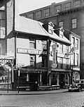
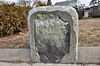
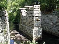
| 1 |
1767 Milestones |
|
01971-04-07-0000April 7, 1971
(#71000084) |
Between Boston and Springfield along Old Post Rd.
42°21′42″N 71°07′48″W / 42.361556°N 71.129998°W / 42.361556; -71.129998 (1767 Milestones) |
Allston |
Includes markers in Roxbury and Mission Hill, and markers in Hampden, Middlesex, and Worcester counties
|
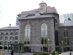
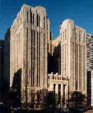
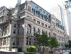
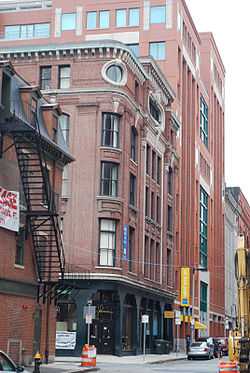
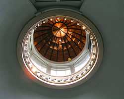
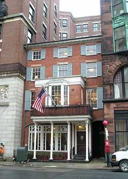
| 2 |
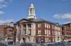
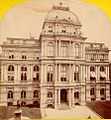
John Adams Courthouse |
|
01974-05-08-0000May 8, 1974
(#74000391) |
Pemberton Sq.
42°21′33″N 71°03′42″W / 42.359167°N 71.061667°W / 42.359167; -71.061667 (John Adams Courthouse) |
Downtown |
Contains the nation's oldest law library, the Social Law Library
|
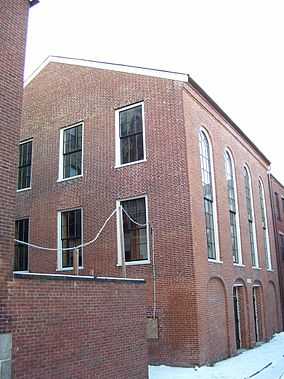
| 3 |
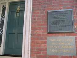
African Meetinghouse |
|
01971-10-07-0000October 7, 1971
(#71000087) |
8 Smith St.
42°21′35″N 71°03′57″W / 42.359722°N 71.065833°W / 42.359722; -71.065833 (African Meetinghouse) |
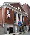
Beacon Hill |
This is the nation's longest standing black church edifice; it also hosts the Museum of African American History, open to the public.
|
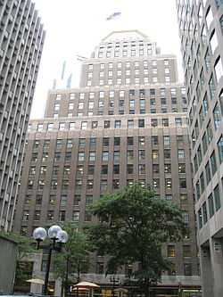
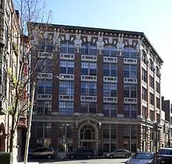
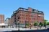
| 4 |
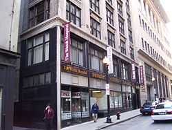
Ames Building |
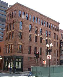
|
01974-04-26-0000April 26, 1974
(#74000382) |
1 Court St.
42°21′32″N 71°03′31″W / 42.358889°N 71.058611°W / 42.358889; -71.058611 (Ames Building) |
Downtown |
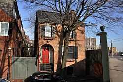
Considered Boston's first skyscraper.
|
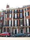
| 5 |
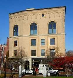
Nathan Appleton Residence |
|
01977-12-22-0000December 22, 1977
(#77001541) |
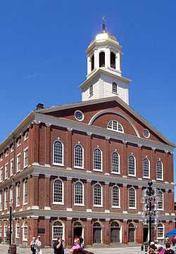
39-40 Beacon St.
42°21′25″N 71°04′01″W / 42.356944°N 71.066944°W / 42.356944; -71.066944 (Nathan Appleton Residence) |
Beacon Hill |
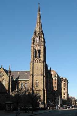
|
| 6 |
Arlington Street Church |
|
01973-05-04-0000May 4, 1973
(#73000313) |
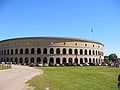
Arlington and Boylston Sts.
42°21′07″N 71°04′16″W / 42.352028°N 71.071139°W / 42.352028; -71.071139 (Arlington Street Church) |
Back Bay |
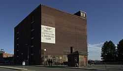
|
| 7 |
Armory of the First Corps of Cadets |
|
01973-05-22-0000May 22, 1973
(#73000314) |
97-105 Arlington St. and 130 Columbus Ave.
42°20′59″N 71°04′14″W / 42.349722°N 71.070556°W / 42.349722; -71.070556 (Armory of the First Corps of Cadets) |
Bay Village |
|
| 8 |
Francis B. Austin House |
|
01988-10-21-0000October 21, 1988
(#87001478) |
58 High St.
42°22′34″N 71°04′37″W / 42.376111°N 71.076944°W / 42.376111; -71.076944 (Francis B. Austin House) |
Charlestown |
|
| 9 |
Frederick Ayer Mansion |
|
02005-04-05-0000April 5, 2005
(#05000459) |
395 Commonwealth Ave.
42°20′57″N 71°05′25″W / 42.349256°N 71.090317°W / 42.349256; -71.090317 (Frederick Ayer Mansion) |
Back Bay |
|
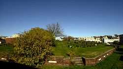
| 10 |
Back Bay Historic District |
|
01973-08-14-0000August 14, 1973
(#73001948) |
Roughly bounded by the Charles River, Arlington, Providence, Boylston, and Newbury Sts., and Charlesgate East
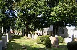
42°21′04″N 71°04′50″W / 42.3512°N 71.0806°W / 42.3512; -71.0806 (Back Bay Historic District) |
Back Bay |
|
| 11 |
Baker Congregational Church |
|
01998-11-19-0000November 19, 1998
(#98001381) |
760 Saratoga St.
42°23′02″N 71°01′04″W / 42.383889°N 71.017778°W / 42.383889; -71.017778 (Baker Congregational Church) |
East Boston |
|
| 12 |
Beach-Knapp District |
|
01980-12-09-0000December 9, 1980
(#80000462) |
Roughly bounded by Harrison Ave., Washington, Kneeland, and Beach Sts.
42°21′04″N 71°03′44″W / 42.351111°N 71.062222°W / 42.351111; -71.062222 (Beach-Knapp District) |
Chinatown |
|
| 13 |
Beacon Hill Historic District |
|
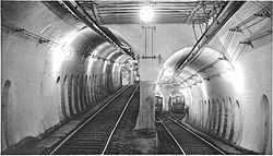
01966-10-15-0000October 15, 1966
(#66000130) |
Bounded by Beacon St., the Charles River Embankment, and Pinckney, Revere, and Hancock Sts.
42°21′33″N 71°04′05″W / 42.359072°N 71.068117°W / 42.359072; -71.068117 (Beacon Hill Historic District) |
Beacon Hill |
|
| 14 |
Bedford Building |
|
01979-08-21-0000August 21, 1979
(#79000368) |
89-103 Bedford St.
42°21′10″N 71°03′32″W / 42.352778°N 71.058889°W / 42.352778; -71.058889 (Bedford Building) |
Downtown |
|
| 15 |
Bennington Street Burying Ground |
|
02002-05-22-0000May 22, 2002
(#02000548) |
Bennington St., between Swift and Harmony Sts.
42°22′50″N 71°01′19″W / 42.380556°N 71.021944°W / 42.380556; -71.021944 (Bennington Street Burying Ground) |
East Boston |
|
| 16 |
Blackstone Block Historic District |
|
01973-05-26-0000May 26, 1973
(#73000315) |
Area bound by Union, Hanover, Blackstone, and North Sts.
42°21′40″N 71°03′25″W / 42.361111°N 71.056944°W / 42.361111; -71.056944 (Blackstone Block Historic District) |
Downtown |
|
| 17 |
Blake and Amory Building |
|
02014-06-02-0000June 2, 2014
(#14000272) |
59 Temple Pl.
42°21′17″N 71°03′41″W / 42.3547°N 71.0615°W / 42.3547; -71.0615 (Blake and Amory Building) |
Downtown |
|
| 18 |
Boston African American National Historic Site |
|
01980-10-10-0000October 10, 1980
(#80004396) |
Joy St.
42°21′36″N 71°03′55″W / 42.359986°N 71.065217°W / 42.359986; -71.065217 (Boston African American National Historic Site) |
Beacon Hill |
|
| 19 |
Boston Athenaeum |
|
01966-10-15-0000October 15, 1966
(#66000132) |
10½ Beacon St.
42°21′28″N 71°03′45″W / 42.357778°N 71.0625°W / 42.357778; -71.0625 (Boston Athenaeum) |
Beacon Hill |
|
| 20 |
Boston Common |
|
01987-02-27-0000February 27, 1987
(#87000760) |
Beacon, Park, Tremont, Boylston, and Charles St.
42°21′16″N 71°03′54″W / 42.354444°N 71.065°W / 42.354444; -71.065 (Boston Common) |
multiple |
|
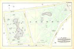
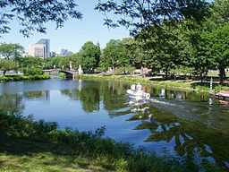
| 21 |
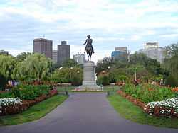
Boston Common and Public Garden |
|
01972-07-12-0000July 12, 1972
(#72000144) |
Beacon, Park, Tremont, Boylston, and Arlington Sts.
42°21′15″N 71°04′12″W / 42.3541°N 71.07°W / 42.3541; -71.07 (Boston Common and Public Garden) |
multiple |
|
| 22 |
Boston Edison Electric Illuminating Company |
|
01980-12-09-0000December 9, 1980
(#80000453) |
25-39 Boylston St.
42°21′08″N 71°03′51″W / 42.352222°N 71.064167°W / 42.352222; -71.064167 (Boston Edison Electric Illuminating Company) |
Chinatown |
|
| 23 |
Boston National Historical Park |
|
01974-10-26-0000October 26, 1974
(#74002222) |
Inner harbor at the mouth of the Charles River
42°22′12″N 71°03′20″W / 42.37°N 71.055556°W / 42.37; -71.055556 (Boston National Historical Park) |
Boston Harbor |
|
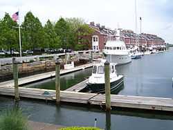
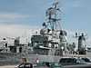
| 24 |
Boston Naval Shipyard |
|
01966-11-15-0000November 15, 1966
(#66000134) |
East of Chelsea St., Charlestown
42°22′30″N 71°03′09″W / 42.375°N 71.0525°W / 42.375; -71.0525 (Boston Naval Shipyard) |
Charlestown |
|
| 25 |
Boston Police Station Number One-Traffic Tunnel Administration Building |
|
02015-03-03-0000March 3, 2015
(#15000048) |
128, 150 North & 130 -140 Richmond St.
42°21′45″N 71°03′17″W / 42.3626°N 71.0547°W / 42.3626; -71.0547 (Boston Police Station Number One-Traffic Tunnel Administration Building) |
North End |
|
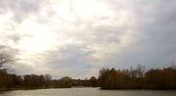
| 25 |
Boston Public Garden |
|
01987-02-27-0000February 27, 1987
(#87000761) |
Beacon, Charles, Boylston, and Arlington Sts.
42°21′15″N 71°04′12″W / 42.3541°N 71.07°W / 42.3541; -71.07 (Boston Public Garden) |
Back Bay |
|
| 26 |
Boston Public Library |
|
01973-05-06-0000May 6, 1973
(#73000317) |
Copley Sq.
42°20′57″N 71°04′43″W / 42.349167°N 71.078611°W / 42.349167; -71.078611 (Boston Public Library) |
Back Bay |
|
| 27 |
Boston Transit Commission Building |
|
02007-08-31-0000August 31, 2007
(#07000861) |
15 Beacon St.
42°21′30″N 71°03′46″W / 42.358333°N 71.062778°W / 42.358333; -71.062778 (Boston Transit Commission Building) |
Beacon Hill |
|
| 28 |
Boston Young Men's Christian Union |
|
01980-12-09-0000December 9, 1980
(#80000451) |
48 Boylston St.
42°21′07″N 71°03′53″W / 42.351944°N 71.064722°W / 42.351944; -71.064722 (Boston Young Men's Christian Union) |
Chinatown |
|
| 29 |
Boylston Building |
|
01980-12-09-0000December 9, 1980
(#80000450) |
2-22 Boylston St.
42°21′07″N 71°03′49″W / 42.351944°N 71.063611°W / 42.351944; -71.063611 (Boylston Building) |
Chinatown |
|
| 30 |
Building at 138-142 Portland Street |
|
01985-09-05-0000September 5, 1985
(#85002015) |
138-142 Portland St.
42°21′51″N 71°03′43″W / 42.364167°N 71.061944°W / 42.364167; -71.061944 (Building at 138-142 Portland Street) |
Downtown |
|
| 31 |
Bulfinch Triangle Historic District |
|
01986-02-27-0000February 27, 1986
(#86000274) |
Roughly bounded by Canal, Market, Merrimac, and Causeway Sts.
42°21′50″N 71°03′41″W / 42.363889°N 71.061389°W / 42.363889; -71.061389 (Bulfinch Triangle Historic District) |
Downtown |
|
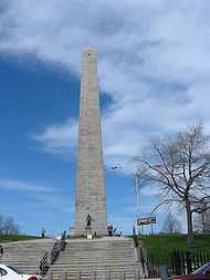
| 32 |
Bunker Hill Monument |
|
01966-10-15-0000October 15, 1966
(#66000138) |
Breed's Hill
42°22′35″N 71°03′41″W / 42.376389°N 71.061389°W / 42.376389; -71.061389 (Bunker Hill Monument) |
Charlestown |
|
| 33 |
Bunker Hill School |
|
01987-10-15-0000October 15, 1987
(#87001771) |
68 Baldwin St.
42°22′56″N 71°04′15″W / 42.382222°N 71.070833°W / 42.382222; -71.070833 (Bunker Hill School) |
Charlestown |
|
| 34 |
Central Congregational Church |
|
02012-10-16-0000October 16, 2012
(#12001012) |
67 Newbury St.
42°21′08″N 71°04′27″W / 42.3521°N 71.0741°W / 42.3521; -71.0741 (Central Congregational Church) |
Back Bay |
This church has the largest intact Tiffany-designed ecclesiastical interior in its original location in America. The congregation is now known as the Church of the Covenant.
|
| 35 |
Charles Playhouse |
|
01980-06-16-0000June 16, 1980
(#80000676) |
74-78 Warenton St.
42°20′58″N 71°03′59″W / 42.349444°N 71.066389°W / 42.349444; -71.066389 (Charles Playhouse) |
Theatre District |
|
| 36 |
Charles River Basin Historic District |
|
01978-12-22-0000December 22, 1978
(#78000436) |
Both banks of the Charles River from Eliot Bridge to Charles River Dam
42°21′46″N 71°06′28″W / 42.362778°N 71.107778°W / 42.362778; -71.107778 (Charles River Basin Historic District) |
Back Bay |
|
| 37 |
Charles River Reservation Parkways |
|
02006-01-18-0000January 18, 2006
(#05001530) |
Soldiers Field, Nonantum, Leo Birmingham, Arsenal, Greenough, N. Beacon, Charles River, Norumbega, Recreation
42°21′42″N 71°09′31″W / 42.361667°N 71.158611°W / 42.361667; -71.158611 (Charles River Reservation Parkways) |
Allston/Brighton |
Extends into Cambridge, Newton, Waltham, and Watertown and Weston in Middlesex County
|
| 38 |
Charles River Reservation (Speedway)-Upper Basin Headquarters |
|
02010-07-19-0000July 19, 2010
(#10000506) |
1420-1440 Soldiers Field Rd.
42°21′41″N 71°08′47″W / 42.361389°N 71.146389°W / 42.361389; -71.146389 (Charles River Reservation (Speedway)-Upper Basin Headquarters) |
Brighton |
|
| 39 |
Charlestown Heights |
|
01998-01-08-0000January 8, 1998
(#97000969) |
Roughly bounded by St. Martin, Bunker Hill, Medford, and Sackville Sts.
42°22′56″N 71°04′05″W / 42.382222°N 71.068056°W / 42.382222; -71.068056 (Charlestown Heights) |
Charlestown |
|
| 40 |
Church Green Buildings Historic District |
|
01999-12-30-0000December 30, 1999
(#99001614) |
101-113 Summer St.
42°21′12″N 71°03′30″W / 42.353333°N 71.058333°W / 42.353333; -71.058333 (Church Green Buildings Historic District) |
Downtown |
|
| 41 |
Codman Building |
|
01983-10-19-0000October 19, 1983
(#83004097) |
55 Kilby St.
42°21′28″N 71°03′23″W / 42.357778°N 71.056389°W / 42.357778; -71.056389 (Codman Building) |
Downtown |
|
| 42 |
Compton Building |
|
02008-12-31-0000December 31, 2008
(#08001284) |
159, 161–175 Devonshire Street, 18–20 Arch Street
42°21′21″N 71°03′27″W / 42.355833°N 71.0575°W / 42.355833; -71.0575 (Compton Building) |
Downtown |
|
| 43 |
Congress Street Fire Station |
|
01987-09-03-0000September 3, 1987
(#87001396) |
344 Congress St.
42°20′58″N 71°02′56″W / 42.349444°N 71.048889°W / 42.349444; -71.048889 (Congress Street Fire Station) |
South Boston |
|
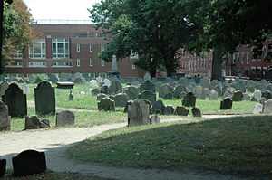
| 44 |
Copp's Hill Burial Ground |
|
01974-04-18-0000April 18, 1974
(#74000385) |
Charter, Snowhill, and Hull Sts.
42°22′02″N 71°03′23″W / 42.367222°N 71.056389°W / 42.367222; -71.056389 (Copp's Hill Burial Ground) |
North End |
|
| 45 |
Copp's Hill Terrace |
|
01990-04-19-0000April 19, 1990
(#90000631) |
Between Commercial and Charter Sts. west of Jackson Place
42°22′04″N 71°03′22″W / 42.367778°N 71.056111°W / 42.367778; -71.056111 (Copp's Hill Terrace) |
North End |
|
| 46 |
Crowninshield House |
|
01972-02-23-0000February 23, 1972
(#72000145) |
164 Marlborough St.
42°21′09″N 71°04′45″W / 42.3525°N 71.079167°W / 42.3525; -71.079167 (Crowninshield House) |
Back Bay |
|
| 47 |
Custom House District |
|
01973-05-11-0000May 11, 1973
(#73000321) |
Between the J.F.K. Expressway and Kirby St. and S. Market and High and Batterymarch Sts.
42°21′28″N 71°03′12″W / 42.357778°N 71.053333°W / 42.357778; -71.053333 (Custom House District) |
Downtown |
|
| 48 |
Dill Building |
|
01980-12-09-0000December 9, 1980
(#80000448) |
11-25 Stuart St.
42°21′04″N 71°03′50″W / 42.351111°N 71.063889°W / 42.351111; -71.063889 (Dill Building) |
Theatre District |
|
| 49 |
Eagle Hill Historic District |
|
01998-02-26-0000February 26, 1998
(#98000149) |
Roughly bounded by Border, Lexington, Trenton, and Falcon Sts.
42°22′51″N 71°02′05″W / 42.380897°N 71.034815°W / 42.380897; -71.034815 (Eagle Hill Historic District) |
East Boston |
|
| 50 |
Old East Boston High School |
|
02006-03-15-0000March 15, 2006
(#06000127) |
127 Marion St.
42°22′41″N 71°02′16″W / 42.378056°N 71.037778°W / 42.378056; -71.037778 (Old East Boston High School) |
East Boston |
|
| 51 |
Engine House No. 34 |
|
01985-10-24-0000October 24, 1985
(#85003375) |
444 Western Ave.
42°21′43″N 71°08′30″W / 42.361944°N 71.141667°W / 42.361944; -71.141667 (Engine House No. 34) |
Brighton |
|
| 52 |
Ether Dome |
|
01966-10-15-0000October 15, 1966
(#66000366) |
Fruit St.
42°21′48″N 71°04′07″W / 42.363333°N 71.068611°W / 42.363333; -71.068611 (Ether Dome) |
West End |
Part of Massachusetts General Hospital, Bulfinch Building
|
| 53 |
Faneuil Hall |
|
01966-10-15-0000October 15, 1966
(#66000368) |
Dock Sq.
42°21′36″N 71°03′24″W / 42.36°N 71.056667°W / 42.36; -71.056667 (Faneuil Hall) |
Downtown |
|
| 54 |
Peter Faneuil School |
|
01994-12-16-0000December 16, 1994
(#94001492) |
60 Joy St.
42°21′37″N 71°03′58″W / 42.360278°N 71.066111°W / 42.360278; -71.066111 (Peter Faneuil School) |
Beacon Hill |
|
| 55 |
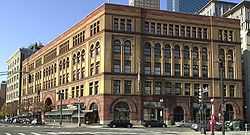
Filene's Department Store |
|
01986-07-24-0000July 24, 1986
(#86001909) |
426 Washington St.
42°21′18″N 71°03′39″W / 42.355°N 71.060833°W / 42.355; -71.060833 (Filene's Department Store) |
Downtown |
Partially demolished by investors in 2008, irrespective of its historical significance. Historic Burnham Building (Beaux-Arts) remains, now part of Millennium Tower development.
|
| 56 |
First Baptist Church |
|
01972-02-23-0000February 23, 1972
(#72000146) |
Commonwealth Ave. and Clarendon St.
42°21′06″N 71°04′36″W / 42.351667°N 71.076667°W / 42.351667; -71.076667 (First Baptist Church) |
Back Bay |
|
| 57 |
Fort Point Channel Historic District |
|
02004-09-10-0000September 10, 2004
(#04000959) |
Necco Court, Thomson Place, and A, Binford, Congress, Farnsworth, Melcher, Midway, Sleeper, Stillings, and Summer Sts.
42°20′59″N 71°03′05″W / 42.349722°N 71.051389°W / 42.349722; -71.051389 (Fort Point Channel Historic District) |
South Boston |
|
| 58 |
Fulton-Commercial Streets District |
|
01973-03-21-0000March 21, 1973
(#73000319) |
Fulton, Commercial, Mercantile, Lewis, and Richmond Sts.; also 81-95 Richmond St.
42°21′43″N 71°03′12″W / 42.361944°N 71.053333°W / 42.361944; -71.053333 (Fulton-Commercial Streets District) |
North End |
81-95 Richmond St. represent a boundary increase
|
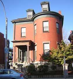
| 59 |
Gibson House |
|
02001-08-07-0000August 7, 2001
(#01001048) |
137 Beacon St.
42°21′17″N 71°04′27″W / 42.354608°N 71.074114°W / 42.354608; -71.074114 (Gibson House) |
Back Bay |
|
| 60 |
Ozias Goodwin House |
|
01988-06-23-0000June 23, 1988
(#88000908) |
7 Jackson Ave.
42°22′03″N 71°03′19″W / 42.3675°N 71.055278°W / 42.3675; -71.055278 (Ozias Goodwin House) |
North End |
|
| 61 |
Gridley Street Historic District |
|
02014-12-03-0000December 3, 2014
(#14000974) |
Bounded by Congress, High, Pearl & Purchase Sts.
42°21′17″N 71°03′15″W / 42.3547°N 71.0541°W / 42.3547; -71.0541 (Gridley Street Historic District) |
Financial District |
|
| 61 |
Chester Harding House |
|
01966-10-15-0000October 15, 1966
(#66000764) |
16 Beacon St.
42°21′28″N 71°03′47″W / 42.357778°N 71.063056°W / 42.357778; -71.063056 (Chester Harding House) |
Beacon Hill |
|
| 62 |
Harvard Stadium |
|
01987-02-27-0000February 27, 1987
(#87000757) |
60 N. Harvard St.
42°22′01″N 71°07′36″W / 42.366864°N 71.126586°W / 42.366864; -71.126586 (Harvard Stadium) |
Allston |
|
| 63 |
Hayden Building |
|
01980-12-09-0000December 9, 1980
(#80000446) |
681-683 Washington St.
42°21′05″N 71°03′50″W / 42.351389°N 71.063889°W / 42.351389; -71.063889 (Hayden Building) |
Downtown |
|
| 64 |
Headquarters House |
|
01966-10-15-0000October 15, 1966
(#66000765) |
55 Beacon St.
42°21′23″N 71°04′08″W / 42.356389°N 71.068889°W / 42.356389; -71.068889 (Headquarters House) |
Beacon Hill |
|
| 65 |
Hoosac Stores 1 & 2-Hoosac Stores 3 |
|
01985-08-14-0000August 14, 1985
(#85002339) |
25 and 115 Water St.
42°22′16″N 71°03′40″W / 42.371111°N 71.061111°W / 42.371111; -71.061111 (Hoosac Stores 1 & 2-Hoosac Stores 3) |
Charlestown |
|
| 66 |
House at 1 Bay Street |
|
01994-02-09-0000February 9, 1994
(#93001573) |
1 Bay St.
42°20′53″N 71°04′07″W / 42.348056°N 71.068611°W / 42.348056; -71.068611 (House at 1 Bay Street) |
Bay Village |
|
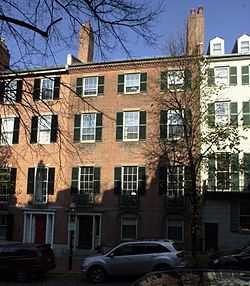
| 67 |
Samuel Gridley and Julia Ward Howe House |
|
01974-09-13-0000September 13, 1974
(#74002044) |
13 Chestnut St.
42°21′27″N 71°04′03″W / 42.3575°N 71.0675°W / 42.3575; -71.0675 (Samuel Gridley and Julia Ward Howe House) |
Beacon Hill |
|
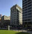
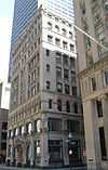
| 68 |
International Trust Company Building |
|
01979-09-10-0000September 10, 1979
(#79000369) |
39-47 Milk St.
42°21′23″N 71°03′29″W / 42.356389°N 71.058056°W / 42.356389; -71.058056 (International Trust Company Building) |
Downtown |
|
| 69 |
King's Chapel |
|
01974-05-02-0000May 2, 1974
(#74002045) |
Tremont and School Sts.
42°21′28″N 71°03′38″W / 42.357778°N 71.060556°W / 42.357778; -71.060556 (King's Chapel) |
Downtown |
|
| 70 |
Leather District |
|
01983-12-21-0000December 21, 1983
(#83004098) |
Roughly bounded by Atlantic Ave., Kneeland, Lincoln, and Essex Sts.
42°21′03″N 71°03′30″W / 42.350833°N 71.058333°W / 42.350833; -71.058333 (Leather District) |
Leather District |
|
| 71 |
Liberty Tree District |
|
01980-12-09-0000December 9, 1980
(#80000460) |
Roughly bounded by Harrison Ave., Washington, Essex and Beach Sts.
42°21′07″N 71°03′47″W / 42.351944°N 71.063056°W / 42.351944; -71.063056 (Liberty Tree District) |
Downtown |
|
| 72 |
Locke-Ober Restaurant |
|
01986-07-24-0000July 24, 1986
(#86001911) |
3-4 Winter Pl.
42°21′20″N 71°03′46″W / 42.355556°N 71.062778°W / 42.355556; -71.062778 (Locke-Ober Restaurant) |
Downtown |
|
| 73 |
Long Wharf and Customhouse Block |
|
01966-11-13-0000November 13, 1966
(#66000768) |
Foot of State St.
42°21′37″N 71°02′59″W / 42.360278°N 71.049722°W / 42.360278; -71.049722 (Long Wharf and Customhouse Block) |
Downtown |
|
| 74 |
Theodore Lyman School |
|
02014-12-02-0000December 2, 2014
(#14000975) |
30 Gove St.
42°22′19″N 71°02′16″W / 42.3720°N 71.0378°W / 42.3720; -71.0378 (Theodore Lyman School) |
East Boston |
|
| 74 |
Mariner's House |
|
01999-11-12-0000November 12, 1999
(#99001302) |
11 North Square
42°21′50″N 71°03′13″W / 42.363889°N 71.053611°W / 42.363889; -71.053611 (Mariner's House) |
North End |
|
| 75 |
Massachusetts General Hospital |
|
01970-12-30-0000December 30, 1970
(#70000682) |
Fruit Street
42°21′48″N 71°04′08″W / 42.363333°N 71.068889°W / 42.363333; -71.068889 (Massachusetts General Hospital) |
West End |
1820s hospital building by Charles Bulfinch
|
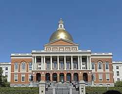
| 76 |
Massachusetts Statehouse |
|
01966-10-15-0000October 15, 1966
(#66000771) |
Beacon Hill
42°21′31″N 71°03′52″W / 42.358611°N 71.064444°W / 42.358611; -71.064444 (Massachusetts Statehouse) |
Beacon Hill |
|
| 77 |
Donald McKay House |
|
01982-06-02-0000June 2, 1982
(#82004450) |
78-80 White St.
42°22′49″N 71°02′14″W / 42.380278°N 71.037222°W / 42.380278; -71.037222 (Donald McKay House) |
East Boston |
|
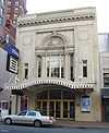
| 78 |
Metropolitan Theatre |
|
01980-12-09-0000December 9, 1980
(#80000445) |
252-272 Tremont St.
42°21′01″N 71°03′56″W / 42.350278°N 71.065556°W / 42.350278; -71.065556 (Metropolitan Theatre) |
Theatre District |
|
| 79 |
Monument Square Historic District |
|
01987-06-02-0000June 2, 1987
(#87001128) |
Monument Square
42°22′35″N 71°03′38″W / 42.3763°N 71.0605°W / 42.3763; -71.0605 (Monument Square Historic District) |
Charlestown |
Not to be confused with the Monument Square Historic District (Jamaica Plain, Boston, Massachusetts).
|
| 80 |
Middlesex Canal Historic and Archaeological District |
|
02009-11-19-0000November 19, 2009
(#09000936) |
Numerous locations along the historic route of the Middlesex Canal
|
Charlestown |
Extends into Middlesex County.[5]
|
| 81 |
Lightship No. 112, NANTUCKET |
|
01989-12-20-0000December 20, 1989
(#89002464) |
Boston Harbor Shipyard and Marina
end of Marginal Street
42°21′40″N 71°02′07″W / 42.361098°N 71.035178°W / 42.361098; -71.035178 (Lightship No. 112, NANTUCKET) |
East Boston |
Largest lightship ever built. Listed in Portland, Maine. Arrived in Boston May 11, 2010
|
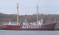
| 82 |
William C. Nell House |
|
01976-05-11-0000May 11, 1976
(#76001979) |
3 Smith Ct.
42°21′28″N 71°03′53″W / 42.357778°N 71.064722°W / 42.357778; -71.064722 (William C. Nell House) |
Beacon Hill |
|
| 83 |
Newspaper Row |
|
01983-07-07-0000July 7, 1983
(#83000607) |
322-328 Washington St., 5-23 Milk St., and 11 Hawley St.
42°21′24″N 71°03′33″W / 42.356667°N 71.059167°W / 42.356667; -71.059167 (Newspaper Row) |
Downtown |
|
| 84 |
North Terminal Garage |
|
01997-09-11-0000September 11, 1997
(#97000971) |
600 Commercial St.
42°22′01″N 71°03′28″W / 42.366944°N 71.057778°W / 42.366944; -71.057778 (North Terminal Garage) |
North End |
|
| 85 |
Ohabei Shalom Cemetery |
|
02008-08-19-0000August 19, 2008
(#08000795) |
147 Wordsworth St.
42°22′59″N 71°00′52″W / 42.382973°N 71.014466°W / 42.382973; -71.014466 (Ohabei Shalom Cemetery) |
East Boston |
|
| 86 |
Old City Hall |
|
01970-12-30-0000December 30, 1970
(#70000687) |
School and Providence Sts.
42°21′29″N 71°03′35″W / 42.358056°N 71.059722°W / 42.358056; -71.059722 (Old City Hall) |
Downtown |
|
| 87 |
Old Corner Bookstore |
|
01973-04-11-0000April 11, 1973
(#73000322) |
Northwestern corner of Washington and School Sts.
42°21′27″N 71°03′32″W / 42.3575°N 71.058889°W / 42.3575; -71.058889 (Old Corner Bookstore) |
Downtown |
|
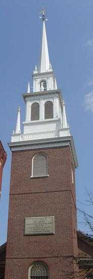
| 88 |
Old North Church |
|
01966-10-15-0000October 15, 1966
(#66000776) |
193 Salem St.
42°21′58″N 71°03′18″W / 42.366111°N 71.055°W / 42.366111; -71.055 (Old North Church) |
North End |
|
| 89 |
Old South Church in Boston |
|
01970-12-30-0000December 30, 1970
(#70000690) |
645 Boylston St.
42°21′01″N 71°04′43″W / 42.350278°N 71.078611°W / 42.350278; -71.078611 (Old South Church in Boston) |
Back Bay |
|
| 90 |
Old South Meetinghouse |
|
01966-10-15-0000October 15, 1966
(#66000778) |
Milk and Washington Sts.
42°21′25″N 71°03′31″W / 42.356944°N 71.058611°W / 42.356944; -71.058611 (Old South Meetinghouse) |
Downtown |
|
| 91 |
Old State House |
|
01966-10-15-0000October 15, 1966
(#66000779) |
Washington and State Sts.
42°21′32″N 71°03′28″W / 42.358889°N 71.057778°W / 42.358889; -71.057778 (Old State House) |
Downtown |
|
| 92 |
Old West Church |
|
01970-12-30-0000December 30, 1970
(#70000691) |
131 Cambridge St.
42°21′41″N 71°03′55″W / 42.361389°N 71.065278°W / 42.361389; -71.065278 (Old West Church) |
West End |
|
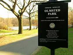
| 93 |
Olmsted Park System |
|
01971-12-08-0000December 8, 1971
(#71000086) |
Encompassing the Back Bay Fens, Muddy River, Olmsted (Leverett Park), Jamaica Park, Arborway, and Franklin Park
42°20′43″N 71°05′45″W / 42.345278°N 71.095833°W / 42.345278; -71.095833 (Olmsted Park System) |
Jamaica Plain and Fenway-Kenmore |
|
| 94 |
(First) Harrison Gray Otis House |
|
01970-12-30-0000December 30, 1970
(#70000539) |
141 Cambridge St.
42°21′41″N 71°03′57″W / 42.361389°N 71.065833°W / 42.361389; -71.065833 ((First) Harrison Gray Otis House) |
West End |
|
| 95 |
(Second) Harrison Gray Otis House |
|
01973-07-27-0000July 27, 1973
(#73001955) |
85 Mt. Vernon St.
42°21′29″N 71°04′05″W / 42.358056°N 71.068056°W / 42.358056; -71.068056 ((Second) Harrison Gray Otis House) |
Beacon Hill |
|
| 96 |
Paine Furniture Building |
|
02002-09-12-0000September 12, 2002
(#02001039) |
75-81 Arlington St.
42°21′04″N 71°04′17″W / 42.351111°N 71.071389°W / 42.351111; -71.071389 (Paine Furniture Building) |
Back Bay |
|
| 97 |
Park Street District |
|
01974-05-01-0000May 1, 1974
(#74000390) |
Tremont, Park, and Beacon Sts.
42°21′26″N 71°03′44″W / 42.357222°N 71.062222°W / 42.357222; -71.062222 (Park Street District) |
Beacon Hill |
|
| 98 |
Francis Parkman House |
|
01966-10-15-0000October 15, 1966
(#66000782) |
50 Chestnut St.
42°21′25″N 71°04′09″W / 42.356944°N 71.069167°W / 42.356944; -71.069167 (Francis Parkman House) |
Beacon Hill |
|
| 99 |
Phipps Street Burying Ground |
|
01974-05-14-0000May 14, 1974
(#74000907) |
Phipps St.
42°22′34″N 71°04′13″W / 42.376111°N 71.070278°W / 42.376111; -71.070278 (Phipps Street Burying Ground) |
Charlestown |
|
| 100 |
Piano Row District |
|
01980-12-09-0000December 9, 1980
(#80000458) |
Boston Common, Park Sq., Boylston Pl. and Tremont St.
42°21′08″N 71°03′55″W / 42.352222°N 71.065278°W / 42.352222; -71.065278 (Piano Row District) |
Downtown |
|
| 101 |
Pierce-Hichborn House |
|
01968-11-24-0000November 24, 1968
(#68000042) |
29 North Sq.
42°21′48″N 71°03′16″W / 42.363333°N 71.054444°W / 42.363333; -71.054444 (Pierce-Hichborn House) |
North End |
|
| 102 |
Publicity Building |
|
02003-08-20-0000August 20, 2003
(#03000781) |
40-44 Bromfield St.
42°21′23″N 71°03′41″W / 42.356389°N 71.061389°W / 42.356389; -71.061389 (Publicity Building) |
Downtown |
|
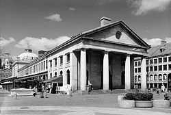
| 103 |
Quincy Market |
|
01966-11-13-0000November 13, 1966
(#66000784) |
S. Market St.
42°21′36″N 71°03′18″W / 42.36°N 71.055°W / 42.36; -71.055 (Quincy Market) |
Downtown |
|
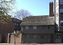
| 104 |
Paul Revere House |
|
01966-10-15-0000October 15, 1966
(#66000785) |
19 North Sq.
42°21′49″N 71°03′16″W / 42.363611°N 71.054444°W / 42.363611; -71.054444 (Paul Revere House) |
North End |
|
| 105 |
Richardson Block |
|
01986-08-09-0000August 9, 1986
(#86001504) |
113-151 Pearl and 109-119 High Sts.
42°21′18″N 71°03′17″W / 42.355°N 71.054722°W / 42.355; -71.054722 (Richardson Block) |
Downtown |
|
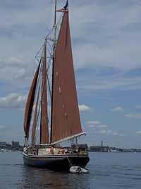
| 105 |
ROSEWAY (schooner) |
|
01997-09-25-0000September 25, 1997
(#97001278) |
Boston Harbor
44°12′38″N 69°03′46″W / 44.210556°N 69.062778°W / 44.210556; -69.062778 (ROSEWAY (schooner)) |
Boston Harbor |
National Historic Landmark
|
| 107 |
Roughan Hall |
|
01982-04-15-0000April 15, 1982
(#82004448) |
15-18 City Sq.
42°22′20″N 71°03′44″W / 42.372222°N 71.062222°W / 42.372222; -71.062222 (Roughan Hall) |
Charlestown |
|
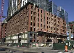
| 108 |
Russia Wharf Buildings |
|
01980-12-02-0000December 2, 1980
(#80000463) |
518-540 Atlantic Ave., 270 Congress St. and 276-290 Congress St.
42°21′12″N 71°03′11″W / 42.353333°N 71.053056°W / 42.353333; -71.053056 (Russia Wharf Buildings) |
Downtown |
|
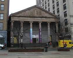
| 109 |
St. Paul's Church |
|
01970-12-30-0000December 30, 1970
(#70000730) |
136 Tremont St.
42°21′21″N 71°03′46″W / 42.355833°N 71.062778°W / 42.355833; -71.062778 (St. Paul's Church) |
Downtown |
|
| 110 |
St. Stephen's Church |
|
01975-04-14-0000April 14, 1975
(#75000300) |
Hanover St. between Clark and Harris Sts.
42°21′56″N 71°03′10″W / 42.365556°N 71.052778°W / 42.365556; -71.052778 (St. Stephen's Church) |
North End |
|
| 111 |
Sears' Crescent and Sears' Block |
|
01986-08-09-0000August 9, 1986
(#86001486) |
38-68 and 70-72 Cornhill
42°21′34″N 71°03′34″W / 42.359444°N 71.059444°W / 42.359444; -71.059444 (Sears' Crescent and Sears' Block) |
Downtown |
|
| 112 |
David Sears House |
|
01970-12-30-0000December 30, 1970
(#70000731) |
42 Beacon St.
42°21′25″N 71°04′03″W / 42.356944°N 71.0675°W / 42.356944; -71.0675 (David Sears House) |
Beacon Hill |
|
| 113 |
Second Brazer Building |
|
01986-07-24-0000July 24, 1986
(#86001913) |
25-29 State St.
42°21′30″N 71°03′28″W / 42.358333°N 71.057778°W / 42.358333; -71.057778 (Second Brazer Building) |
Downtown |
|
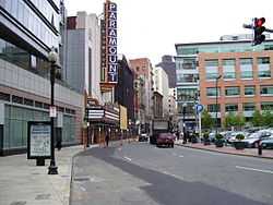
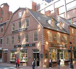
| 114 |
Sam S. Shubert Theatre |
|
01980-12-09-0000December 9, 1980
(#80000444) |
263-265 Tremont St.
42°21′00″N 71°03′58″W / 42.35°N 71.066111°W / 42.35; -71.066111 (Sam S. Shubert Theatre) |
Theatre District |
|
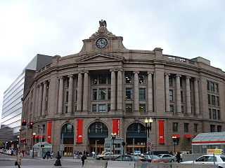
| 115 |
South Station Headhouse |
|
01975-02-13-0000February 13, 1975
(#75000299) |
Atlantic Ave. and Summer St.
42°21′07″N 71°03′21″W / 42.351944°N 71.055833°W / 42.351944; -71.055833 (South Station Headhouse) |
Downtown |
|
| 116 |
R.H. Stearns House |
|
01980-06-16-0000June 16, 1980
(#80000671) |
140 Tremont St.
42°21′20″N 71°03′47″W / 42.355556°N 71.063056°W / 42.355556; -71.063056 (R.H. Stearns House) |
Downtown |
Although the site is named the "R.H. Stearns House", it is the former main building of the R.H. Stearns Department Store company.
|
| 117 |
Suffolk County Jail |
|
01980-04-23-0000April 23, 1980
(#80000670) |
215 Charles St.
42°21′43″N 71°04′13″W / 42.361944°N 71.070278°W / 42.361944; -71.070278 (Suffolk County Jail) |
West End |
|
| 118 |
Charles Sumner House |
|
01973-11-07-0000November 7, 1973
(#73001953) |
20 Hancock St.
42°21′36″N 71°03′56″W / 42.36°N 71.065556°W / 42.36; -71.065556 (Charles Sumner House) |
Beacon Hill |
|
| 119 |
Temple Place Historic District |
|
01988-07-26-0000July 26, 1988
(#88000427) |
11-55, 26-58 Temple Pl.
42°21′18″N 71°03′40″W / 42.355°N 71.061111°W / 42.355; -71.061111 (Temple Place Historic District) |
Downtown |
|
| 120 |
Terminal Storage Warehouse District |
|
02012-03-12-0000March 12, 2012
(#12000099) |
267-281 Medford St., 40 & 50 Terminal St.
42°22′51″N 71°03′42″W / 42.380913°N 71.061741°W / 42.380913; -71.061741 (Terminal Storage Warehouse District) |
Charlestown |
|
| 121 |
Textile District |
|
01990-11-29-0000November 29, 1990
(#90001757) |
Roughly Essex St. from Phillips Sq. to Columbia St. and Chauncy St. from Phillips Sq. to Rowe Pl.
42°20′52″N 71°03′17″W / 42.347778°N 71.054722°W / 42.347778; -71.054722 (Textile District) |
Downtown |
|
| 122 |
Town Hill District |
|
01973-05-11-0000May 11, 1973
(#73000850) |
Bounded roughly by Rutherford Ave. and Main and Warren Sts.
42°22′21″N 71°03′44″W / 42.3725°N 71.062222°W / 42.3725; -71.062222 (Town Hill District) |
Charlestown |
|
| 123 |
Tremont Street Subway |
|
01966-10-15-0000October 15, 1966
(#66000788) |
Beneath Tremont, Boylston, and Washington Sts.
42°21′23″N 71°03′47″W / 42.356389°N 71.063056°W / 42.356389; -71.063056 (Tremont Street Subway) |
Downtown |
|
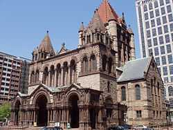
| 124 |
Trinity Church |
|
01970-07-01-0000July 1, 1970
(#70000733) |
Copley Sq.
42°21′07″N 71°04′28″W / 42.351944°N 71.074444°W / 42.351944; -71.074444 (Trinity Church) |
Back Bay |
|
| 125 |
Trinity Neighborhood House |
|
01992-04-14-0000April 14, 1992
(#92000356) |
406 Meridian St.
42°22′49″N 71°02′23″W / 42.380278°N 71.039611°W / 42.380278; -71.039611 (Trinity Neighborhood House) |
East Boston |
|
| 126 |
Trinity Rectory |
|
01972-02-23-0000February 23, 1972
(#72000150) |
Clarendon and Newbury Sts.
42°21′06″N 71°04′34″W / 42.351667°N 71.076111°W / 42.351667; -71.076111 (Trinity Rectory) |
Back Bay |
|
| 127 |
Union Oyster House |
|
02003-05-27-0000May 27, 2003
(#03000645) |
41-43 Union Street
42°21′46″N 71°03′38″W / 42.362778°N 71.060556°W / 42.362778; -71.060556 (Union Oyster House) |
Downtown |
|
| 128 |
Union Wharf |
|
01980-06-22-0000June 22, 1980
(#80000669) |
295-353 Commercial St.
42°21′56″N 71°03′03″W / 42.365556°N 71.050833°W / 42.365556; -71.050833 (Union Wharf) |
North End |
|
| 129 |
United Shoe Machinery Corporation Building |
|
01980-08-19-0000August 19, 1980
(#80000668) |
138-164 Federal St.
42°21′14″N 71°03′23″W / 42.353889°N 71.056389°W / 42.353889; -71.056389 (United Shoe Machinery Corporation Building) |
Downtown |
|
| 130 |
United States Post Office, Courthouse, and Federal Building |
|
02011-04-08-0000April 8, 2011
(#11000160) |
5 Post Office Square
42°21′26″N 71°03′25″W / 42.357222°N 71.056944°W / 42.357222; -71.056944 (United States Post Office, Courthouse, and Federal Building) |
Downtown |
|
| 131 |
USS CASSIN YOUNG (destroyer) |
|
01986-01-14-0000January 14, 1986
(#86000084) |
Charlestown Navy Yard
42°22′17″N 71°03′18″W / 42.371389°N 71.055°W / 42.371389; -71.055 (USS CASSIN YOUNG (destroyer)) |
Charlestown |
|
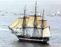
| 132 |
U.S.S. CONSTITUTION |
|
01966-10-15-0000October 15, 1966
(#66000789) |
Boston Naval Shipyard
42°22′21″N 71°03′25″W / 42.3725°N 71.056944°W / 42.3725; -71.056944 (U.S.S. CONSTITUTION) |
Charlestown |
|
| 133 |
Vermont Building |
|
01984-11-13-0000November 13, 1984
(#84000421) |
6-12 Thacher St.
42°21′56″N 71°03′28″W / 42.365556°N 71.057778°W / 42.365556; -71.057778 (Vermont Building) |
North End |
|
| 134 |
Washington Street Theatre District |
|
01979-03-19-0000March 19, 1979
(#79000370) |
511-559 Washington St.
42°21′14″N 71°03′46″W / 42.353889°N 71.062778°W / 42.353889; -71.062778 (Washington Street Theatre District) |
Theatre District |
|
| 135 |
West Street District |
|
01980-12-09-0000December 9, 1980
(#80000455) |
West St.
42°21′18″N 71°03′49″W / 42.355°N 71.063611°W / 42.355; -71.063611 (West Street District) |
Downtown |
|
| 136 |
Wigglesworth Building |
|
01982-10-21-0000October 21, 1982
(#82000486) |
89-83 Franklin St.
42°21′18″N 71°03′29″W / 42.355°N 71.058056°W / 42.355; -71.058056 (Wigglesworth Building) |
Downtown |
|
| 137 |
Wilbur Theatre |
|
01980-12-09-0000December 9, 1980
(#80000443) |
244-250 Tremont St.
42°21′02″N 71°03′56″W / 42.350556°N 71.065556°W / 42.350556; -71.065556 (Wilbur Theatre) |
Theatre District |
|
| 138 |
Winthrop Building |
|
01974-04-18-0000April 18, 1974
(#74000392) |
7 Water St.
42°21′27″N 71°03′29″W / 42.3575°N 71.058056°W / 42.3575; -71.058056 (Winthrop Building) |
Downtown |
|
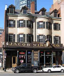
| 139 |
Jacob Wirth Buildings |
|
01980-12-09-0000December 9, 1980
(#80000442) |
31-39 Stuart St.
42°21′04″N 71°03′52″W / 42.351111°N 71.064444°W / 42.351111; -71.064444 (Jacob Wirth Buildings) |
Theatre District |
|
| 140 |
Youth's Companion Building |
|
01974-05-02-0000May 2, 1974
(#74000393) |
209 Columbus Ave.
42°20′54″N 71°04′22″W / 42.348333°N 71.072778°W / 42.348333; -71.072778 (Youth's Companion Building) |
Back Bay |
|
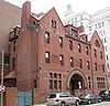
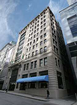
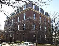
| 141 |
YWCA Boston |
|
02004-03-03-0000March 3, 2004
(#04000119) |
140 Clarendon St.
42°21′01″N 71°04′33″W / 42.350278°N 71.075833°W / 42.350278; -71.075833 (YWCA Boston) |
Back Bay |
Neoclassical building of YWCA Boston. |


.JPG)

.jpg)

.jpg)