| [5] |
Name on the Register |
Image |
Date listed[6] |
Location |
City or town |
Description |
|---|
| 1 |
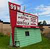
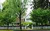
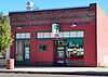
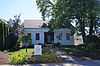
99W Drive-in Theatre |
|
02014-07-11-0000July 11, 2014
(#14000401) |
3110 Portland Road
45°18′17″N 122°56′53″W / 45.304861°N 122.948071°W / 45.304861; -122.948071 (99W Drive-in Theatre) |
Newberg |
|
| 2 |
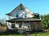
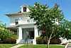
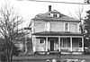
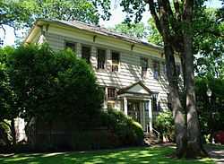
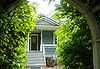
Avery House |
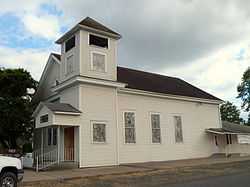
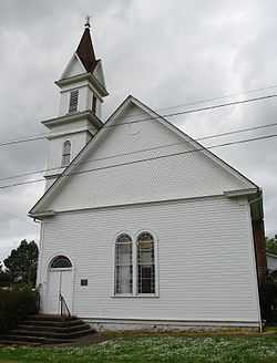
|
01987-03-16-0000March 16, 1987
(#87000329) |
403 Church St.
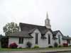
45°13′18″N 123°04′39″W / 45.221667°N 123.0775°W / 45.221667; -123.0775 (Avery House) |
Dayton |
|
| 3 |
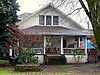
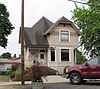
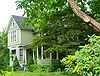
Berry–Sigler Investment Property |
|
01987-08-03-0000August 3, 1987
(#87000368) |
700 Church St.
45°13′07″N 123°04′55″W / 45.218611°N 123.081944°W / 45.218611; -123.081944 (Berry–Sigler Investment Property) |
Dayton |
|
| 4 |
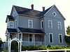
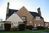
Henry Bertram, Sr. House |
|
01988-02-29-0000February 29, 1988
(#88000080) |
6160 SE Webfoot Rd.
45°12′51″N 123°05′04″W / 45.214167°N 123.084444°W / 45.214167; -123.084444 (Henry Bertram, Sr. House) |
Dayton |
|
| 5 |
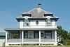
Briedwell School |
|
01988-07-28-0000July 28, 1988
(#88001156) |
11935 SW Bellevue Hwy.
45°06′48″N 123°14′16″W / 45.113215°N 123.237872°W / 45.113215; -123.237872 (Briedwell School) |
Amity |
Built in 1895, this is the most intact and architecturally sophisticated of the few remaining one-room schoolhouses in Yamhill County. It served students in kindergarten through 8th grade until it closed in 1957, and has since been converted into a house. It is the sole remnant of the former railroad town of Briedwell.[7]
|
| 6 |
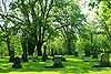
Brookside Cemetery |
|
01987-03-16-0000March 16, 1987
(#87000332) |
South end of 3rd St.
45°13′08″N 123°04′17″W / 45.218889°N 123.071389°W / 45.218889; -123.071389 (Brookside Cemetery) |
Dayton |
|
| 7 |
Buchanan Cellers Mill |
|
02012-01-27-0000January 27, 2012
(#11001065) |
855 NE 5th St.
45°12′42″N 123°11′23″W / 45.211656°N 123.189722°W / 45.211656; -123.189722 (Buchanan Cellers Mill) |
McMinnville |
|
| 8 |
John Marion Bunn House |
|
01979-10-16-0000October 16, 1979
(#79002152) |
285 W 3rd St.
45°20′21″N 123°11′17″W / 45.339167°N 123.188056°W / 45.339167; -123.188056 (John Marion Bunn House) |
Yamhill |
|
| 9 |
Cain House |
|
01987-03-16-0000March 16, 1987
(#87000333) |
208 Alder St.
45°13′13″N 123°04′26″W / 45.220242°N 123.073902°W / 45.220242; -123.073902 (Cain House) |
Dayton |
Has been demolished.[8]
|
| 10 |
Carlton State and Savings Bank |
|
01988-02-11-0000February 11, 1988
(#88000082) |
109 W. Main St.
45°17′40″N 123°10′33″W / 45.294444°N 123.175833°W / 45.294444; -123.175833 (Carlton State and Savings Bank) |
Carlton |
|
| 11 |
Carter–Goodrich House |
|
01987-03-16-0000March 16, 1987
(#87000334) |
521 Church St.
45°13′16″N 123°04′42″W / 45.221111°N 123.078333°W / 45.221111; -123.078333 (Carter–Goodrich House) |
Dayton |
|
| 12 |
Asa F. Cate Farm Ensemble |
|
01990-02-23-0000February 23, 1990
(#90000285) |
16900 NW Baker Creek Rd.
45°13′52″N 123°17′16″W / 45.231111°N 123.287778°W / 45.231111; -123.287778 (Asa F. Cate Farm Ensemble) |
McMinnville |
|
| 13 |
Joseph and Virginia Chambers Farmstead |
|
01992-03-05-0000March 5, 1992
(#92000136) |
30295 N. OR 99W
45°18′47″N 122°55′33″W / 45.313056°N 122.925833°W / 45.313056; -122.925833 (Joseph and Virginia Chambers Farmstead) |
Newberg |
|
| 14 |
Commercial Club – S. C. Stuckey Building |
|
01987-03-16-0000March 16, 1987
(#87000335) |
304 Ferry St.
45°13′14″N 123°04′33″W / 45.220441°N 123.075769°W / 45.220441; -123.075769 (Commercial Club – S. C. Stuckey Building) |
Dayton |
|
| 15 |
Amos Cook House |
|
01974-12-31-0000December 31, 1974
(#74001726) |
NW of Dayton on OR 233
45°14′14″N 123°06′50″W / 45.237222°N 123.113889°W / 45.237222; -123.113889 (Amos Cook House) |
Dayton |
|
| 16 |
Courthouse Square Park |
|
01987-03-16-0000March 16, 1987
(#87000336) |
Bounded by 3rd, 4th, Ferry, and Main Sts.
45°13′15″N 123°04′36″W / 45.220841°N 123.076534°W / 45.220841; -123.076534 (Courthouse Square Park) |
Dayton |
|
| 17 |
Dayton Common School |
|
01987-03-16-0000March 16, 1987
(#87000338) |
504 4th St.
45°13′11″N 123°04′35″W / 45.219646°N 123.076324°W / 45.219646; -123.076324 (Dayton Common School) |
Dayton |
|
| 18 |
Dayton High School |
|
01987-03-16-0000March 16, 1987
(#87000339) |
801 Ferry St.
45°13′00″N 123°04′58″W / 45.216667°N 123.082778°W / 45.216667; -123.082778 (Dayton High School) |
Dayton |
|
| 19 |
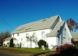
Dayton Methodist Episcopal Church |
|
01987-03-16-0000March 16, 1987
(#87000340) |
302 4th St.
45°13′17″N 123°04′42″W / 45.221377°N 123.078415°W / 45.221377; -123.078415 (Dayton Methodist Episcopal Church) |
Dayton |
|
| 20 |
Diehl–Seitters House |
|
01987-03-16-0000March 16, 1987
(#87000344) |
527 Church St.
45°13′14″N 123°04′50″W / 45.220653°N 123.080517°W / 45.220653; -123.080517 (Diehl–Seitters House) |
Dayton |
Has been demolished.[8]
|
| 21 |
Dundee Woman's Club Hall |
|
01986-06-05-0000June 5, 1986
(#86001241) |
OR 99W
45°16′31″N 123°00′44″W / 45.275278°N 123.012222°W / 45.275278; -123.012222 (Dundee Woman's Club Hall) |
Dundee |
|
| 22 |
Jesse Edwards House |
|
01980-08-25-0000August 25, 1980
(#80003393) |
402 S. College St.
45°17′52″N 122°58′17″W / 45.297778°N 122.971389°W / 45.297778; -122.971389 (Jesse Edwards House) |
Newberg |
|
| 23 |
Evangelical Church of Lafayette |
|
02002-10-31-0000October 31, 2002
(#02001278) |
605 Market St.
45°14′47″N 123°06′40″W / 45.246389°N 123.111111°W / 45.246389; -123.111111 (Evangelical Church of Lafayette) |
Lafayette |
|
| 24 |
Evangelical United Brethren Church |
|
01987-08-03-0000August 3, 1987
(#87000346) |
302 5th St.
45°13′15″N 123°04′41″W / 45.220833°N 123.078056°W / 45.220833; -123.078056 (Evangelical United Brethren Church) |
Dayton |
|
| 25 |
Frank W. Fenton House |
|
01983-09-01-0000September 1, 1983
(#83002180) |
434 N. Evans St.
45°12′41″N 123°11′34″W / 45.211389°N 123.192778°W / 45.211389; -123.192778 (Frank W. Fenton House) |
McMinnville |
|
| 26 |
Fernwood Pioneer Cemetery |
|
01994-08-05-0000August 5, 1994
(#94000809) |
Everest Rd., 0.5 miles (0.80 km) south of the junction with OR 219
45°17′42″N 122°57′33″W / 45.295°N 122.959167°W / 45.295; -122.959167 (Fernwood Pioneer Cemetery) |
Newberg |
|
| 27 |
First Baptist Church |
|
01979-10-16-0000October 16, 1979
(#79002151) |
3rd and Main Sts.
45°13′18″N 123°04′31″W / 45.221667°N 123.075278°W / 45.221667; -123.075278 (First Baptist Church) |
Dayton |
|
| 28 |
Carl Fischer Meats |
|
01987-03-16-0000March 16, 1987
(#87000348) |
400 Ferry St.
45°13′12″N 123°04′36″W / 45.219974°N 123.076681°W / 45.219974; -123.076681 (Carl Fischer Meats) |
Dayton |
|
| 29 |
Alfred P. Fletcher Farmhouse |
|
01980-08-25-0000August 25, 1980
(#80003392) |
1007 3rd St.
45°14′32″N 123°06′26″W / 45.242222°N 123.107222°W / 45.242222; -123.107222 (Alfred P. Fletcher Farmhouse) |
Lafayette |
|
| 30 |
Francis Fletcher House |
|
01975-10-29-0000October 29, 1975
(#75001601) |
W of Dayton off OR 18
45°13′26″N 123°06′25″W / 45.223889°N 123.106944°W / 45.223889; -123.106944 (Francis Fletcher House) |
Dayton |
|
| 31 |
Fletcher–Stretch House |
|
01987-03-16-0000March 16, 1987
(#87000349) |
401 Oak St.
45°13′20″N 123°04′43″W / 45.222222°N 123.078611°W / 45.222222; -123.078611 (Fletcher–Stretch House) |
Dayton |
|
| 32 |
Foster Oil Company |
|
01987-03-16-0000March 16, 1987
(#87000356) |
216 Ferry St.
45°13′15″N 123°04′25″W / 45.220833°N 123.073611°W / 45.220833; -123.073611 (Foster Oil Company) |
Dayton |
|
| 33 |
Free Methodist Church |
|
01987-03-16-0000March 16, 1987
(#87000357) |
411 Oak St.
45°13′20″N 123°04′44″W / 45.222222°N 123.078889°W / 45.222222; -123.078889 (Free Methodist Church) |
Dayton |
|
| 34 |
Gabriel–Filer House |
|
01987-03-16-0000March 16, 1987
(#87000358) |
525 Church St.
45°13′15″N 123°04′44″W / 45.220833°N 123.078889°W / 45.220833; -123.078889 (Gabriel–Filer House) |
Dayton |
|
| 35 |
Gabriel–Will House |
|
01987-03-16-0000March 16, 1987
(#87000359) |
401 3rd St.
45°13′18″N 123°04′28″W / 45.221667°N 123.074444°W / 45.221667; -123.074444 (Gabriel–Will House) |
Dayton |
|
| 36 |
Levi Hagey House |
|
01974-12-19-0000December 19, 1974
(#74001727) |
Off OR 99W
45°17′05″N 123°00′05″W / 45.284722°N 123.001389°W / 45.284722; -123.001389 (Levi Hagey House) |
Dundee |
|
| 37 |
Harrington House |
|
01987-03-16-0000March 16, 1987
(#87000360) |
212 Mill St.
45°13′10″N 123°04′19″W / 45.219444°N 123.071944°W / 45.219444; -123.071944 (Harrington House) |
Dayton |
|
| 38 |
Harris Building |
|
01987-03-16-0000March 16, 1987
(#87000363) |
302 Ferry St.
45°13′14″N 123°04′26″W / 45.220556°N 123.073889°W / 45.220556; -123.073889 (Harris Building) |
Dayton |
|
| 39 |
William Hibbert House |
|
01978-11-30-0000November 30, 1978
(#78002329) |
426 5th St.
45°13′11″N 123°04′37″W / 45.219722°N 123.076944°W / 45.219722; -123.076944 (William Hibbert House) |
Dayton |
|
| 40 |
Hole House |
|
01987-03-16-0000March 16, 1987
(#87000367) |
623 Ferry St.
45°13′04″N 123°04′54″W / 45.217695°N 123.081666°W / 45.217695; -123.081666 (Hole House) |
Dayton |
|
| 41 |
J. C. Penney Building |
|
02007-06-13-0000June 13, 2007
(#07000555) |
516 E. 1st St.
45°18′01″N 122°58′22″W / 45.300278°N 122.972778°W / 45.300278; -122.972778 (J. C. Penney Building) |
Newberg |
|
| 42 |
Jessen–Goodrich House |
|
01987-03-16-0000March 16, 1987
(#87000370) |
324 6th St.
45°13′10″N 123°04′47″W / 45.219444°N 123.079722°W / 45.219444; -123.079722 (Jessen–Goodrich House) |
Dayton |
|
| 43 |
James M. and Paul R. Kelty House |
|
01982-09-23-0000September 23, 1982
(#82003756) |
675 3rd St.
45°14′36″N 123°06′36″W / 45.243333°N 123.11°W / 45.243333; -123.11 (James M. and Paul R. Kelty House) |
Lafayette |
|
| 44 |
Dr. Andrew Kershaw House |
|
01989-03-02-0000March 2, 1989
(#89000122) |
472 E. Main St.
45°04′50″N 123°28′49″W / 45.080556°N 123.480278°W / 45.080556; -123.480278 (Dr. Andrew Kershaw House) |
Willamina |
|
| 45 |
Krietz House |
|
01987-03-16-0000March 16, 1987
(#87000372) |
627 Church St.
45°13′11″N 123°04′53″W / 45.219722°N 123.081389°W / 45.219722; -123.081389 (Krietz House) |
Dayton |
|
| 46 |
Lamson Ranch |
|
02013-07-09-0000July 9, 2013
(#13000483) |
37845 SW Dent Road
45°04′49″N 123°30′18″W / 45.080288°N 123.504987°W / 45.080288; -123.504987 (Lamson Ranch) |
Willamina vicinity |
|
| 47 |
Lee Laughlin House |
|
01979-03-26-0000March 26, 1979
(#79002153) |
100 S. Laurel St.
45°20′29″N 123°11′07″W / 45.341389°N 123.185278°W / 45.341389; -123.185278 (Lee Laughlin House) |
Yamhill |
|
| 48 |
Lewis–Shippy House |
|
01987-03-16-0000March 16, 1987
(#87000373) |
421 6th St.
45°13′09″N 123°04′44″W / 45.219167°N 123.078889°W / 45.219167; -123.078889 (Lewis–Shippy House) |
Dayton |
|
| 49 |
Gottlieb Londershausen House |
|
01987-03-16-0000March 16, 1987
(#87000383) |
402 Main St.
45°13′14″N 123°04′35″W / 45.220556°N 123.076389°W / 45.220556; -123.076389 (Gottlieb Londershausen House) |
Dayton |
|
| 50 |
Paul Londershausen House |
|
01987-03-16-0000March 16, 1987
(#87000384) |
309 Main St.
45°13′17″N 123°04′33″W / 45.221389°N 123.075833°W / 45.221389; -123.075833 (Paul Londershausen House) |
Dayton |
|
| 51 |
Mabee–Mayberry House |
|
01987-08-03-0000August 3, 1987
(#87000385) |
309 7th St.
45°13′07″N 123°04′52″W / 45.218611°N 123.081111°W / 45.218611; -123.081111 (Mabee–Mayberry House) |
Dayton |
|
| 52 |
Joseph Mattey House |
|
01977-02-15-0000February 15, 1977
(#77001118) |
W of Lafayette at jct. of Mattey Lane and Rutherford Rd.
45°14′44″N 123°07′53″W / 45.245556°N 123.131389°W / 45.245556; -123.131389 (Joseph Mattey House) |
Lafayette |
|
| 53 |
McMinnville Downtown Historic District |
|
01987-09-14-0000September 14, 1987
(#87001366) |
Bounded by 5th St., Southern Pacific RR tracks, 2nd, and N. Adams Sts.
45°12′37″N 123°11′36″W / 45.210278°N 123.193333°W / 45.210278; -123.193333 (McMinnville Downtown Historic District) |
McMinnville |
|
| 54 |
McNamar Building |
|
01987-03-16-0000March 16, 1987
(#87000386) |
310–312 Ferry St.
45°13′13″N 123°04′29″W / 45.220278°N 123.074722°W / 45.220278; -123.074722 (McNamar Building) |
Dayton |
|
| 55 |
McNish House |
|
01987-03-16-0000March 16, 1987
(#87000388) |
1005 Ferry St.
45°12′52″N 123°05′16″W / 45.214360°N 123.087773°W / 45.214360; -123.087773 (McNish House) |
Dayton |
|
| 56 |
Mellinger House |
|
01987-03-16-0000March 16, 1987
(#87000389) |
414 5th St.
45°13′12″N 123°04′38″W / 45.22°N 123.077222°W / 45.22; -123.077222 (Mellinger House) |
Dayton |
|
| 57 |
Mellinger–Ponnay House |
|
01987-08-03-0000August 3, 1987
(#87000390) |
102 Tribbett Court
45°13′04″N 123°04′08″W / 45.217778°N 123.068889°W / 45.217778; -123.068889 (Mellinger–Ponnay House) |
Dayton |
|
| 58 |
Methodist Episcopal Parsonage |
|
01987-08-03-0000August 3, 1987
(#87000393) |
202 4th St.
45°13′19″N 123°04′39″W / 45.221944°N 123.0775°W / 45.221944; -123.0775 (Methodist Episcopal Parsonage) |
Dayton |
|
| 59 |
Minthorn Hall |
|
01997-06-13-0000June 13, 1997
(#97000581) |
North St. on the George Fox University Campus
45°18′15″N 122°58′00″W / 45.304167°N 122.966667°W / 45.304167; -122.966667 (Minthorn Hall) |
Newberg |
|
| 60 |
Dr. Henry J. Minthorn House (Herbert Hoover House) |
|
02003-12-19-0000December 19, 2003
(#75001602) |
115 S. River St.
45°17′59″N 122°58′03″W / 45.299722°N 122.9675°W / 45.299722; -122.9675 (Dr. Henry J. Minthorn House (Herbert Hoover House)) |
Newberg |
|
| 61 |
Monahan House |
|
01987-03-16-0000March 16, 1987
(#87000395) |
120 5th St.
45°13′19″N 123°04′46″W / 45.221944°N 123.079444°W / 45.221944; -123.079444 (Monahan House) |
Dayton |
|
| 62 |
Morse House |
|
01987-03-16-0000March 16, 1987
(#87000398) |
409 Oak St.
45°13′13″N 123°04′43″W / 45.220278°N 123.078611°W / 45.220278; -123.078611 (Morse House) |
Dayton |
|
| 63 |
Morse House |
|
01987-03-16-0000March 16, 1987
(#87000396) |
101 5th St.
45°13′22″N 123°04′46″W / 45.222778°N 123.079444°W / 45.222778; -123.079444 (Morse House) |
Dayton |
|
| 64 |
Nichols House |
|
01987-03-16-0000March 16, 1987
(#87000400) |
303 Main St.
45°13′18″N 123°04′32″W / 45.221667°N 123.075556°W / 45.221667; -123.075556 (Nichols House) |
Dayton |
|
| 65 |
Oregon Mutual Merchant Fire Insurance Association Office |
|
01987-03-16-0000March 16, 1987
(#87000402) |
308 Ferry St.
45°13′13″N 123°04′33″W / 45.220340°N 123.075970°W / 45.220340; -123.075970 (Oregon Mutual Merchant Fire Insurance Association Office) |
Dayton |
|
| 66 |
Palmer House |
|
01987-03-16-0000March 16, 1987
(#87000403) |
600 Ferry St.
45°13′05″N 123°04′42″W / 45.218056°N 123.078333°W / 45.218056; -123.078333 (Palmer House) |
Dayton |
|
| 67 |
William Albert and Anna May Bristow Parrish Farmstead |
|
02000-07-17-0000July 17, 2000
(#00000803) |
30280 NE Wilsonville Rd.
45°17′18″N 122°55′32″W / 45.288333°N 122.925556°W / 45.288333; -122.925556 (William Albert and Anna May Bristow Parrish Farmstead) |
Newberg |
|
| 68 |
Paulson–Gregory House |
|
01999-03-18-0000March 18, 1999
(#99000355) |
509 S. College
45°17′48″N 122°58′19″W / 45.296667°N 122.971944°W / 45.296667; -122.971944 (Paulson–Gregory House) |
Newberg |
|
| 69 |
Pioneer Hall, Linfield College |
|
01978-02-23-0000February 23, 1978
(#78002330) |
Linfield College campus
45°12′06″N 123°12′00″W / 45.201667°N 123.2°W / 45.201667; -123.2 (Pioneer Hall, Linfield College) |
McMinnville |
|
| 70 |
Curtis W. Powell House |
|
01987-03-16-0000March 16, 1987
(#87000404) |
524 Ash St.
45°13′20″N 123°04′47″W / 45.222222°N 123.079722°W / 45.222222; -123.079722 (Curtis W. Powell House) |
Dayton |
|
| 71 |
Rippey House |
|
01987-03-16-0000March 16, 1987
(#87000405) |
533 Ash St.
45°13′21″N 123°04′50″W / 45.2225°N 123.080556°W / 45.2225; -123.080556 (Rippey House) |
Dayton |
|
| 72 |
Sigler House |
|
01987-03-16-0000March 16, 1987
(#87000406) |
521 Ferry St.
45°13′09″N 123°04′44″W / 45.219213°N 123.078896°W / 45.219213; -123.078896 (Sigler House) |
Dayton |
|
| 73 |
Andrew Smith House |
|
01976-06-23-0000June 23, 1976
(#76001591) |
306 5th St.
45°13′14″N 123°04′40″W / 45.220556°N 123.077778°W / 45.220556; -123.077778 (Andrew Smith House) |
Dayton |
|
| 74 |
John T. Smith House |
|
01984-11-15-0000November 15, 1984
(#84000493) |
414 N. College St.
45°18′12″N 122°58′16″W / 45.303333°N 122.971111°W / 45.303333; -122.971111 (John T. Smith House) |
Newberg |
|
| 75 |
Charles K. Spaulding House |
|
01994-08-26-0000August 26, 1994
(#94001022) |
717 E. Sheridan St.
45°18′07″N 122°58′14″W / 45.301944°N 122.970556°W / 45.301944; -122.970556 (Charles K. Spaulding House) |
Newberg |
|
| 76 |
Jack Spence House |
|
01986-02-27-0000February 27, 1986
(#86000295) |
536 E. 5th St.
45°12′41″N 123°11′32″W / 45.211389°N 123.192222°W / 45.211389; -123.192222 (Jack Spence House) |
McMinnville |
|
| 77 |
Dr. Stuart House |
|
01987-03-16-0000March 16, 1987
(#87000408) |
103 Ferry St.
45°13′19″N 123°04′19″W / 45.221944°N 123.071944°W / 45.221944; -123.071944 (Dr. Stuart House) |
Dayton |
|
| 78 |
Travelers Home |
|
01982-07-08-0000July 8, 1982
(#82003757) |
147 NE Yamhill St.
45°06′03″N 123°23′35″W / 45.100833°N 123.393056°W / 45.100833; -123.393056 (Travelers Home) |
Sheridan |
|
| 79 |
Union Block |
|
02000-05-05-0000May 5, 2000
(#00000450) |
610–620 E. 1st St.
45°18′00″N 122°58′19″W / 45.3°N 122.971944°W / 45.3; -122.971944 (Union Block) |
Newberg |
|
| 80 |
Yamhill River Lock and Dam |
|
01991-06-21-0000June 21, 1991
(#91000799) |
Across the Yamhill R. at S terminus of Locks Rd.
45°13′50″N 123°06′11″W / 45.230556°N 123.103056°W / 45.230556; -123.103056 (Yamhill River Lock and Dam) |
Dayton |
|
| 81 |
Ewing Young Site |
Upload image |
01989-11-26-0000November 26, 1989
(#89001977) |
Address restricted[9]
|
Newberg |
|

.jpg)
_(yamDA0084).jpg)
_(yamDA0070).jpg)
_(yamDA0025b).jpg)
.jpg)
.jpg)
.jpg)
.jpg)

.jpg)
.jpg)
_(yamDA0073).jpg)
 Media related to National Register of Historic Places in Yamhill County, Oregon at Wikimedia Commons