National Register of Historic Places listings in Wilkes County, North Carolina

This list includes properties and districts listed on the National Register of Historic Places in Wilkes County, North Carolina. Click the "Map of all coordinates" link to the right to view a Google map of all properties and districts with latitude and longitude coordinates in the table below.[1]
- This National Park Service list is complete through NPS recent listings posted May 1, 2015.[2]
| [3] | Name on the Register[4] | Image | Date listed[5] | Location | City or town | Description |
|---|---|---|---|---|---|---|
| 1 | Brown-Cowles House and Cowles Law Office | Upload image | (#82003522) |
200 and 106 E. Main St. 36°08′57″N 81°09′01″W / 36.149167°N 81.150278°W |
Wilkesboro | |
| 2 | Claymont Hill |  |
(#85002369) |
W side of SR 2303 along Ronda-Clingman Rd. 36°12′39″N 80°55′40″W / 36.210847°N 80.927778°W |
Ronda | |
| 3 | Robert Cleveland Log House | Upload image | (#72001003) |
E of Purlear near jct. of SR 1300 and 1317 36°11′54″N 81°18′50″W / 36.198242°N 81.313889°W |
Purlear | Relocated near the Old Wilkes County Jail in downtown Wilkesboro[6] (geocode coordinates are for the original location) |
| 4 | Downtown Main Street Historic District |  |
(#03000392) |
Roughly the 800 and 900 Blks of Main St. 36°09′34″N 81°08′47″W / 36.159444°N 81.146389°W |
North Wilkesboro | |
| 5 | Downtown Wilkesboro Historic District |  |
(#09000290) |
Bounded roughly by Cowles and Corporation Sts., Henderson Dr., and Woodland Blvd. Coordinates missing |
Wilkesboro | |
| 6 | Elkin Creek Mill | Upload image | (#82003521) |
SR 2045 36°16′40″N 80°52′29″W / 36.277778°N 80.874722°W |
West Elkin | |
| 7 | Federal Building |  |
(#82003523) |
201 W. Main St. 36°08′47″N 81°09′32″W / 36.146389°N 81.158889°W |
Wilkesboro | |
| 8 | J. T. Ferguson Store | 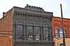 |
(#82003524) |
11 E. Main St. 36°08′53″N 81°09′04″W / 36.148056°N 81.151111°W |
Wilkesboro | |
| 9 | Thomas B. Finley House | Upload image | (#08000415) |
1014 E St. 36°09′41″N 81°09′03″W / 36.1614°N 81.150764°W |
North Wilkesboro | |
| 10 | Thomas B. Finley Law Office | Upload image | (#82003525) |
Broad and North Sts. 36°08′56″N 81°09′04″W / 36.148889°N 81.151111°W |
Wilkesboro | |
| 11 | J. L. Hemphill House | Upload image | (#82003526) |
203 N. Brook St. 36°08′49″N 81°09′53″W / 36.146944°N 81.164722°W |
Wilkesboro | |
| 12 | Holbrook Farm (Traphill, North Carolina) |  |
(#78001985) |
W of Traphill on SR 1743 36°20′35″N 81°03′26″W / 36.343056°N 81.057222°W |
Traphill | |
| 13 | Benjamin Hubbard House | Upload image | (#08001390) |
US 18 on the N., one mile E. of NC 1106 36°05′13″N 81°12′22″W / 36.086867°N 81.206111°W |
Moravian Falls | |
| 14 | Johnson-Hubbard House |  |
(#82003527) |
113 E. Main St. 36°08′54″N 81°09′03″W / 36.148333°N 81.150833°W |
Wilkesboro | |
| 15 | Old Wilkes County Jail |  |
(#71000628) |
N. Bridge St. 36°08′56″N 81°09′09″W / 36.148889°N 81.1525°W |
Wilkesboro | |
| 16 | Southern Railway Depot |  |
(#04000965) |
Jct. of Ninth St. and CBD Loop 36°09′31″N 81°08′45″W / 36.158611°N 81.145833°W |
North Wilkesboro | |
| 17 | St. Paul's Episcopal Church and Cemetery | Upload image | (#82001308) |
Cowles St. between Woodland Blvd. and West St. 36°08′57″N 81°09′18″W / 36.149167°N 81.155°W |
Wilkesboro | |
| 18 | Traphill Historic District | Upload image | (#80002905) |
SR 1002 and SR 1749 36°20′48″N 81°01′26″W / 36.346667°N 81.023889°W |
Traphill | |
| 19 | Wilkes County Courthouse |  |
(#79001764) |
E. Main St. between Bridge and Broad Sts. 36°08′55″N 81°09′07″W / 36.148611°N 81.151944°W |
Wilkesboro | Now the Wilkes County Heritage Museum |
| 20 | Wilkes Hosiery Mills | Upload image | (#08000369) |
407 F. St. 36°09′56″N 81°08′31″W / 36.165483°N 81.142064°W |
North Wilkesboro | |
| 21 | Wilkesboro Presbyterian Church |  |
(#82003528) |
205 E. Main St. 36°08′54″N 81°08′59″W / 36.148333°N 81.149722°W |
Wilkesboro | |
| 22 | Wilkesboro-Smithey Hotel |  |
(#82003529) |
Broad and E. Main Sts. 36°08′55″N 81°09′04″W / 36.148611°N 81.151111°W |
Wilkesboro |
See also
| Wikimedia Commons has media related to National Register of Historic Places in Wilkes County, North Carolina. |
- National Register of Historic Places listings in North Carolina
- List of National Historic Landmarks in North Carolina
References
- ↑ The latitude and longitude information provided in this table was derived originally from the National Register Information System, which has been found to be fairly accurate for about 99% of listings. For about 1% of NRIS original coordinates, experience has shown that one or both coordinates are typos or otherwise extremely far off; some corrections may have been made. A more subtle problem causes many locations to be off by up to 150 yards, depending on location in the country: most NRIS coordinates were derived from tracing out latitude and longitudes off of USGS topographical quadrant maps created under the North American Datum of 1927, which differs from the current, highly accurate WGS84 GPS system used by most on-line maps. Chicago is about right, but NRIS longitudes in Washington are higher by about 4.5 seconds, and are lower by about 2.0 seconds in Maine. Latitudes differ by about 1.0 second in Florida. Some locations in this table may have been corrected to current GPS standards.
- ↑ "National Register of Historic Places: Weekly List Actions". National Park Service, United States Department of the Interior. Retrieved on May 1, 2015.
- ↑ Numbers represent an ordering by significant words. Various colorings, defined here, differentiate National Historic Landmarks and historic districts from other NRHP buildings, structures, sites or objects.
- ↑ "National Register Information System". National Register of Historic Places. National Park Service. 2008-04-24.
- ↑ The eight-digit number below each date is the number assigned to each location in the National Register Information System database, which can be viewed by clicking the number.
- ↑ "Old Wilkes, Inc.: Our Projects". North Wilkesboro, North Carolina: Old Wilkes, Inc. 2004. Retrieved May 9, 2009.


| ||||||||||||||||||||||||||
| |||||||||||||||||||||||||