| [3] |
Name on the Register[4] |
Image |
Date listed[5] |
Location |
City or town |
Description |
|---|
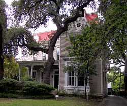
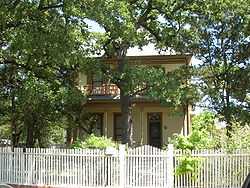
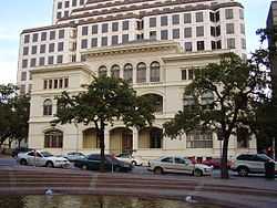
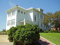
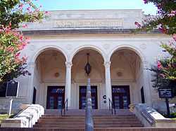
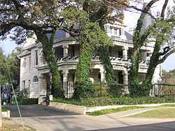
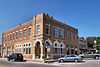
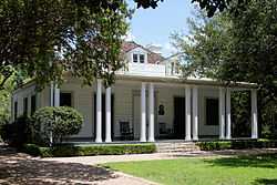
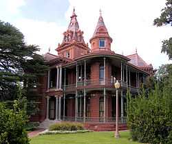
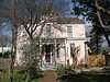
| 1 |
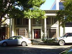
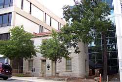
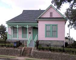
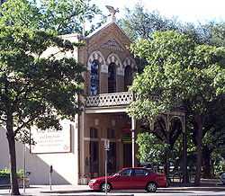
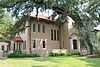
1918 State Office Building and 1933 State Highway Building |
|
01998-01-07-0000January 7, 1998
(#97001625) |
1019 Brazos and 125 E. 11th Sts.
30°16′20″N 97°44′25″W / 30.272222°N 97.740278°W / 30.272222; -97.740278 (1918 State Office Building and 1933 State Highway Building) |
Austin |
97001625
|
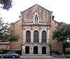
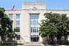
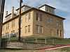
| 2 |
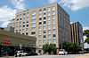
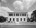
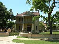
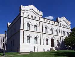
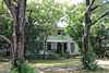
Administration Building |
|
01993-10-21-0000October 21, 1993
(#86003845) |
1820 E. Eighth St.
30°16′10″N 97°43′46″W / 30.269444°N 97.729444°W / 30.269444; -97.729444 (Administration Building) |
Austin |
86003845
|
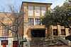
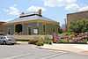
| 3 |
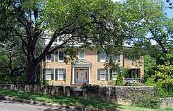
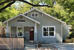
Arnold Bakery |
|
02004-01-14-0000January 14, 2004
(#03001416) |
1010 E. Eleventh St.
30°16′09″N 97°43′46″W / 30.269167°N 97.729444°W / 30.269167; -97.729444 (Arnold Bakery) |
Austin |
03001416
|
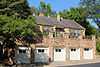
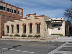
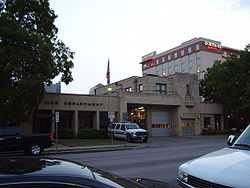
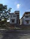
| 4 |
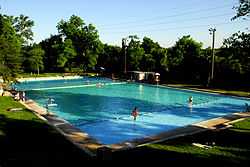
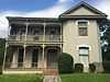
Austin Central Fire Station #1 |
|
02000-05-05-0000May 5, 2000
(#00000454) |
401 E. Fifth St.
30°15′57″N 97°44′22″W / 30.265833°N 97.739444°W / 30.265833; -97.739444 (Austin Central Fire Station #1) |
Austin |
00000454
|
| 5 |
Austin Daily Tribune Building |
|
02000-11-08-0000November 8, 2000
(#00001358) |
920 Colorado
30°16′19″N 97°44′35″W / 30.271944°N 97.743056°W / 30.271944; -97.743056 (Austin Daily Tribune Building) |
Austin |
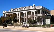
00001358
|
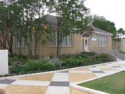
| 6 |
Austin Public Library |
|
01993-05-06-0000May 6, 1993
(#93000389) |
810 Guadalupe St
30°16′18″N 97°44′45″W / 30.271667°N 97.745833°W / 30.271667; -97.745833 (Austin Public Library) |
Austin |
93000389
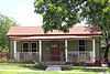
|
| 7 |
Austin US Courthouse |
|
02001-04-25-0000April 25, 2001
(#01000432) |
200 West Eighth St.
30°16′14″N 97°44′38″W / 30.270556°N 97.743889°W / 30.270556; -97.743889 (Austin US Courthouse) |
Austin |
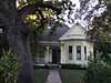
01000432
|
| 8 |
Aynesworth-Wright House |
Upload image |
01980-09-27-0000September 27, 1980
(#80004156) |
N of Austin at 11693 Research Blvd.
30°25′04″N 97°44′44″W / 30.417778°N 97.745556°W / 30.417778; -97.745556 (Aynesworth-Wright House) |
Austin |
80004156
|
| 9 |
Bailetti House |
|
01985-09-17-0000September 17, 1985
(#85002268) |
1006 Waller St.
30°16′09″N 97°43′46″W / 30.269167°N 97.729444°W / 30.269167; -97.729444 (Bailetti House) |
Austin |
85002268
|
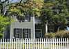
| 10 |
Charles W. Barnes House |
|
01985-09-17-0000September 17, 1985
(#85002266) |
1105 E. 12th St.
30°16′20″N 97°43′42″W / 30.272222°N 97.728333°W / 30.272222; -97.728333 (Charles W. Barnes House) |
Austin |
85002266
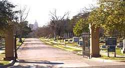
|
| 11 |
William Braxton Barr House |
|
01983-01-10-0000January 10, 1983
(#83003164) |
NE of Austin at 10463 Sprinkle Rd.
30°21′06″N 97°38′50″W / 30.351667°N 97.647222°W / 30.351667; -97.647222 (William Braxton Barr House) |
Austin |
83003164
|
| 12 |
Barton Springs Archeological and Historical District |
Upload image |
01985-11-27-0000November 27, 1985
(#85003213) |
Address Restricted
|
Austin |
85003213
|
| 13 |
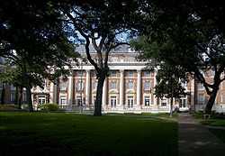
Battle Hall |
|
01970-08-25-0000August 25, 1970
(#70000763) |
South Mall, University of Texas campus
30°17′07″N 97°44′25″W / 30.285278°N 97.740278°W / 30.285278; -97.740278 (Battle Hall) |
Austin |
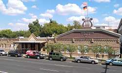
|
| 14 |
Judge Robert Lynn Batts House |
|
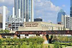
01984-08-22-0000August 22, 1984
(#84002002) |
1505 Windsor Rd.
30°16′49″N 97°45′11″W / 30.280278°N 97.753056°W / 30.280278; -97.753056 (Judge Robert Lynn Batts House) |
Austin |
|
| 15 |
Bertram Building |
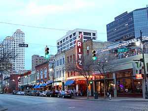
|
02012-08-28-0000August 28, 2012
(#12000590) |
1601 Guadalupe Street
30°16′44″N 97°44′33″W / 30.27901°N 97.74240°W / 30.27901; -97.74240 (Bertram Building) |
Austin |
12000590
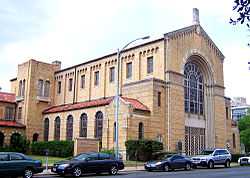
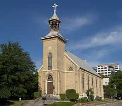
|
| 16 |
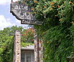
Bluebonnet Tourist Camp |
|
01990-08-16-0000August 16, 1990
(#90001188) |
4407 Guadalupe St.
30°18′37″N 97°43′59″W / 30.310139°N 97.733056°W / 30.310139; -97.733056 (Bluebonnet Tourist Camp) |
Austin |
|
| 17 |
Boardman-Webb-Bugg House |
|
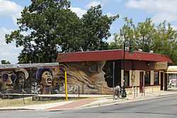
01980-01-08-0000January 8, 1980
(#80004152) |
602 W. 9th St.
30°16′22″N 97°44′52″W / 30.272778°N 97.747778°W / 30.272778; -97.747778 (Boardman-Webb-Bugg House) |
Austin |
80004152
|
| 18 |
Bremond Block Historic District |
|
01970-04-03-0000April 3, 1970
(#70000764) |
Roughly bounded by Guadalupe, San Antonio, 7th and 8th Sts.
30°16′14″N 97°44′47″W / 30.270556°N 97.746389°W / 30.270556; -97.746389 (Bremond Block Historic District) |
Austin |
|
| 19 |
Genaro P. and Carolina Briones House |
|
01998-08-07-0000August 7, 1998
(#98000280) |
1204 E. 7th St.
30°15′56″N 97°43′47″W / 30.265556°N 97.729722°W / 30.265556; -97.729722 (Genaro P. and Carolina Briones House) |
Austin |
|
| 20 |
Brizendine House |
|
01974-07-22-0000July 22, 1974
(#74002090) |
507 W. 11th St.
30°16′27″N 97°44′47″W / 30.274028°N 97.746319°W / 30.274028; -97.746319 (Brizendine House) |
Austin |
|
| 21 |
Brown Building |
|
01997-04-24-0000April 24, 1997
(#97000364) |
708 Colorado St.
30°16′12″N 97°44′46″W / 30.27°N 97.746111°W / 30.27; -97.746111 (Brown Building) |
Austin |
|
| 22 |
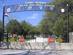
Camp Mabry Historic District |
|
01996-08-30-0000August 30, 1996
(#96000967) |
2210 W. 35th St.
30°18′56″N 97°45′38″W / 30.315556°N 97.760556°W / 30.315556; -97.760556 (Camp Mabry Historic District) |
Austin |
|
| 23 |
Carrington-Covert House |
|
01970-08-25-0000August 25, 1970
(#70000765) |
1511 Colorado St.
30°16′40″N 97°44′24″W / 30.277778°N 97.74°W / 30.277778; -97.74 (Carrington-Covert House) |
Austin |
|
| 24 |
Daniel H. and William T. Caswell Houses |
|
01975-04-21-0000April 21, 1975
(#75002004) |
1404 and 1502 West Ave.
30°16′45″N 97°44′51″W / 30.279167°N 97.7475°W / 30.279167; -97.7475 (Daniel H. and William T. Caswell Houses) |
Austin |
|
| 25 |
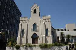
Central Christian Church |
|
01992-07-16-0000July 16, 1992
(#92000889) |
1110 Guadalupe St.
30°16′29″N 97°44′40″W / 30.274722°N 97.744444°W / 30.274722; -97.744444 (Central Christian Church) |
Austin |
|
| 26 |
Chapman House |
|
02010-09-09-0000September 9, 2010
(#10000739) |
901 E 12th St.
30°16′19″N 97°43′50″W / 30.271806°N 97.730694°W / 30.271806; -97.730694 (Chapman House) |
Austin |
|
| 27 |
City Cemetery |
|
01985-09-17-0000September 17, 1985
(#85002297) |
16th & Navasota
30°16′36″N 97°43′34″W / 30.276667°N 97.726111°W / 30.276667; -97.726111 (City Cemetery) |
Austin |
|
| 28 |
Clarksville Historic District |
|
01976-12-01-0000December 1, 1976
(#76002070) |
Bounded by W. Lynn, Waterson, W. 10th and MO-PAC Expwy.
30°16′51″N 97°45′44″W / 30.280833°N 97.762222°W / 30.280833; -97.762222 (Clarksville Historic District) |
Austin |
|
| 29 |
Commercial Building at 4113 Guadalupe Street |
|
01990-08-16-0000August 16, 1990
(#90001187) |
4113 Guadalupe St.
30°18′24″N 97°44′07″W / 30.306667°N 97.735278°W / 30.306667; -97.735278 (Commercial Building at 4113 Guadalupe Street) |
Austin |
|
| 30 |
Community Center |
|
01985-09-17-0000September 17, 1985
(#85002267) |
1192 Angelina St.
30°16′19″N 97°43′31″W / 30.272028°N 97.725278°W / 30.272028; -97.725278 (Community Center) |
Austin |
|
| 31 |
Congress Avenue Historic District |
|
01978-08-11-0000August 11, 1978
(#78002989) |
Congress Ave. from Cesar Chavez to 11th St.
30°16′04″N 97°44′33″W / 30.267778°N 97.7425°W / 30.267778; -97.7425 (Congress Avenue Historic District) |
Austin |
|
| 32 |
Connelly-Yerwood House |
|
02003-04-18-0000April 18, 2003
(#03000279) |
1115 E 12th St.
30°16′19″N 97°43′41″W / 30.271944°N 97.728056°W / 30.271944; -97.728056 (Connelly-Yerwood House) |
Austin |
|
| 33 |
Dr. Beadie E. and Willie R. Conner House and Park |
Upload image |
01997-09-19-0000September 19, 1997
(#97001110) |
3111 E. 13th St.
30°16′37″N 97°42′03″W / 30.276944°N 97.700833°W / 30.276944; -97.700833 (Dr. Beadie E. and Willie R. Conner House and Park) |
Austin |
|
| 34 |
Frank M. and Annie G. Covert House |
|
01990-08-16-0000August 16, 1990
(#90001185) |
3912 Ave. G
30°18′07″N 97°43′48″W / 30.301944°N 97.73°W / 30.301944; -97.73 (Frank M. and Annie G. Covert House) |
Austin |
|
| 35 |
Andrew M. Cox Ranch Site |
Upload image |
01975-12-06-0000December 6, 1975
(#75002009) |
Barton Creek near Loop 360 & MoPac
30°14′35″N 97°48′21″W / 30.2431°N 97.8057°W / 30.2431; -97.8057 (Andrew M. Cox Ranch Site) |
Austin |
|
| 36 |
Cox-Craddock House |
|
02001-05-30-0000May 30, 2001
(#01000612) |
720 E. 32nd St.
30°17′32″N 97°43′46″W / 30.292222°N 97.729444°W / 30.292222; -97.729444 (Cox-Craddock House) |
Austin |
|
| 37 |
Thomas Cranfill House |
Upload image |
02004-12-29-0000December 29, 2004
(#04001416) |
1901 Cliff St.
30°17′05″N 97°45′05″W / 30.284722°N 97.751389°W / 30.284722; -97.751389 (Thomas Cranfill House) |
Austin |
|
| 38 |
Cranfill Apartments |
Upload image |
02013-08-20-0000August 20, 2013
(#13000613) |
1909 Cliff St., Building B
Coordinates missing |
Austin |
|
| 39 |
Deep Eddy Bathing Beach |
|
02003-06-23-0000June 23, 2003
(#03000560) |
301 Quarry St.
30°16′36″N 97°46′22″W / 30.276667°N 97.772778°W / 30.276667; -97.772778 (Deep Eddy Bathing Beach) |
Austin |
|
| 40 |
Delta Kappa Gamma Society International Headquarters Building |
|
02012-04-10-0000April 10, 2012
(#12000198) |
416 West 12th Street
30°16′31″N 97°44′41″W / 30.27540°N 97.7448°W / 30.27540; -97.7448 (Delta Kappa Gamma Society International Headquarters Building) |
Austin |
|
| 41 |
Delwood Duplex Historic District |
|
02011-03-21-0000March 21, 2011
(#11000132) |
Roughly bounded between Maplewood Ave. and Kirkwood, Ashwood, and Wrightwood Rds.
30°17′40″N 97°42′52″W / 30.294444°N 97.714444°W / 30.294444; -97.714444 (Delwood Duplex Historic District) |
Austin |
Historic Residential Suburbs in the United States, 1830-1960 MPS
|
| 42 |
J. Frank Dobie House |
|
01991-05-20-0000May 20, 1991
(#91000575) |
702 E. 26th St.
30°17′21″N 97°43′56″W / 30.289167°N 97.732222°W / 30.289167; -97.732222 (J. Frank Dobie House) |
Austin |
|
| 43 |
Driskill Hotel |
|
01969-11-25-0000November 25, 1969
(#69000212) |
117 E. 7th St.
30°16′05″N 97°44′29″W / 30.268056°N 97.741389°W / 30.268056; -97.741389 (Driskill Hotel) |
Austin |
|
| 44 |
East Main Street Historic District |
|
02012-09-10-0000September 10, 2012
(#12000788) |
111, 113, 115, & 117 E. Main St.
30°26′25″N 97°37′11″W / 30.44036°N 97.61986°W / 30.44036; -97.61986 (East Main Street Historic District) |
Pflugerville |
|
| 45 |
Evans Industrial Building |
|
01982-06-17-0000June 17, 1982
(#82004525) |
Huston-Tillotson College Campus, 1820 E 8th
30°15′48″N 97°42′41″W / 30.263333°N 97.711389°W / 30.263333; -97.711389 (Evans Industrial Building) |
Austin |
|
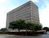
| 46 |
Federal Office Building |
|
02011-04-27-0000April 27, 2011
(#11000211) |
300 E. 8th Ave.
30°16′10″N 97°44′20″W / 30.269444°N 97.738889°W / 30.269444; -97.738889 (Federal Office Building) |
Austin |
|
| 47 |
Fischer House |
|
01982-12-16-0000December 16, 1982
(#82001741) |
1008 West Ave.
30°16′28″N 97°44′56″W / 30.274444°N 97.748889°W / 30.274444; -97.748889 (Fischer House) |
Austin |
|
| 48 |
Seymour and Barbara Fogel House |
|
02003-04-02-0000April 2, 2003
(#03000186) |
2411 Kinney Rd.
30°14′39″N 97°46′27″W / 30.244167°N 97.774167°W / 30.244167; -97.774167 (Seymour and Barbara Fogel House) |
Austin |
|
| 49 |
French Legation |
|
01969-11-25-0000November 25, 1969
(#69000213) |
802 San Marcos St.
30°16′01″N 97°43′56″W / 30.266944°N 97.732222°W / 30.266944; -97.732222 (French Legation) |
Austin |
|
| 50 |
George Washington Carver Library |
|
02005-03-30-0000March 30, 2005
(#05000241) |
1165 Angelina St.
30°16′18″N 97°43′28″W / 30.271667°N 97.724444°W / 30.271667; -97.724444 (George Washington Carver Library) |
Austin |
|
| 51 |
German American Ladies College |
|
02013-08-13-0000August 13, 2013
(#13000601) |
1604 E. 11th St.
30°16′03″N 97°43′26″W / 30.26758°N 97.72390°W / 30.26758; -97.72390 (German American Ladies College) |
Austin |
|
| 52 |
Gethsemane Lutheran Church |
|
01970-08-25-0000August 25, 1970
(#70000766) |
1510 Congress Ave.
30°16′40″N 97°44′22″W / 30.277778°N 97.739444°W / 30.277778; -97.739444 (Gethsemane Lutheran Church) |
Austin |
#70000766
|
| 53 |
Gethsemane Lutheran Church |
|
02011-12-30-0000December 30, 2011
(#11000983) |
200 W. Anderson Ln.
30°20′44″N 97°42′20″W / 30.34553°N 97.70547°W / 30.34553; -97.70547 (Gethsemane Lutheran Church) |
Austin |
#04001398
|
| 54 |
Gilfillan House |
|
01980-09-27-0000September 27, 1980
(#80004153) |
603 W. 8th St.
30°16′17″N 97°44′53″W / 30.271389°N 97.748056°W / 30.271389; -97.748056 (Gilfillan House) |
Austin |
|
| 55 |
Goodman Building |
|
01973-04-13-0000April 13, 1973
(#73001976) |
202 W. 13th St.
30°16′28″N 97°44′33″W / 30.274444°N 97.7425°W / 30.274444; -97.7425 (Goodman Building) |
Austin |
|
| 56 |
Governor's Mansion |
|
01970-08-25-0000August 25, 1970
(#70000896) |
1010 Colorado St.
30°16′22″N 97°44′34″W / 30.272778°N 97.742778°W / 30.272778; -97.742778 (Governor's Mansion) |
Austin |
|
| 57 |
Granger House and The Perch |
|
02006-11-29-0000November 29, 2006
(#06001083) |
805 W. 16th St.
30°16′48″N 97°44′52″W / 30.28°N 97.747778°W / 30.28; -97.747778 (Granger House and The Perch) |
Austin |
|
| 58 |
Green Pastures |
|
01980-09-27-0000September 27, 1980
(#80004154) |
811 W. Live Oak St.
30°14′42″N 97°45′45″W / 30.245°N 97.7625°W / 30.245; -97.7625 (Green Pastures) |
Austin |
|
| 59 |
Haehnel Building |
|
01985-09-17-0000September 17, 1985
(#85002295) |
1101 E. 11th St.
30°16′08″N 97°43′45″W / 30.268889°N 97.729167°W / 30.268889; -97.729167 (Haehnel Building) |
Austin |
|
| 60 |
Hancock Golf Course |
|
02014-09-30-0000September 30, 2014
(#14000821) |
811 E. 41st Street
30°17′56″N 97°43′29″W / 30.2990°N 97.7246°W / 30.2990; -97.7246 (Hancock Golf Course) |
Austin |
|
| 61 |
John Hancock House |
|
01973-04-13-0000April 13, 1973
(#73001977) |
1306 Colorado St.
30°16′33″N 97°44′31″W / 30.275972°N 97.742028°W / 30.275972; -97.742028 (John Hancock House) |
Austin |
|
| 62 |
Haynes-DeLashwah House |
|
01983-03-03-0000March 3, 1983
(#83004033) |
1209 Rosewood Ave.
30°16′06″N 97°43′35″W / 30.268333°N 97.726389°W / 30.268333; -97.726389 (Haynes-DeLashwah House) |
Austin |
|
| 63 |
Hildreth-Flanagan-Heierman House |
|
01990-08-16-0000August 16, 1990
(#90001184) |
3909 Ave. G
30°18′04″N 97°43′47″W / 30.301111°N 97.729722°W / 30.301111; -97.729722 (Hildreth-Flanagan-Heierman House) |
Austin |
|
| 64 |
Henry Hirshfeld House and Cottage |
|
01973-04-13-0000April 13, 1973
(#73001978) |
303 and 305 W. 9th St.
30°16′17″N 97°44′40″W / 30.271389°N 97.744444°W / 30.271389; -97.744444 (Henry Hirshfeld House and Cottage) |
Austin |
|
| 65 |
Hofheintz-Reissig Store |
Upload image |
01983-06-23-0000June 23, 1983
(#83003165) |
600 E. 3rd St.
30°15′49″N 97°44′15″W / 30.263611°N 97.7375°W / 30.263611; -97.7375 (Hofheintz-Reissig Store) |
Austin |
|
| 66 |
Goldie Horton-Porter House |
Upload image |
01990-10-04-0000October 4, 1990
(#90001535) |
2402 Windsor Rd.
30°17′22″N 97°45′22″W / 30.289444°N 97.756111°W / 30.289444; -97.756111 (Goldie Horton-Porter House) |
Austin |
|
| 67 |
House at 1170 San Bernard Street |
|
01985-09-17-0000September 17, 1985
(#85002269) |
1170 San Bernard St.
30°16′12″N 97°43′33″W / 30.27°N 97.725833°W / 30.27; -97.725833 (House at 1170 San Bernard Street) |
Austin |
|
| 68 |
House at 1400 Canterbury Street |
|
01985-09-17-0000September 17, 1985
(#85002274) |
1400 Canterbury St.
30°15′27″N 97°43′50″W / 30.2575°N 97.730556°W / 30.2575; -97.730556 (House at 1400 Canterbury Street) |
Austin |
|
| 69 |
Hyde Park Historic District |
|
01990-08-16-0000August 16, 1990
(#90001191) |
Roughly bounded by Ave. A, 45th St., Duval St., and 40th St.
30°18′27″N 97°43′49″W / 30.3075°N 97.730278°W / 30.3075; -97.730278 (Hyde Park Historic District) |
Austin |
|
| 70 |
Hyde Park Presbyterian Church |
|
01990-08-16-0000August 16, 1990
(#90001175) |
3915 Ave. B
30°18′14″N 97°44′04″W / 30.303889°N 97.734444°W / 30.303889; -97.734444 (Hyde Park Presbyterian Church) |
Austin |
|
| 71 |
Robert Irvin House |
|
01985-09-17-0000September 17, 1985
(#85002270) |
1008 E. 9th St.
30°16′04″N 97°43′50″W / 30.267778°N 97.730556°W / 30.267778; -97.730556 (Robert Irvin House) |
Austin |
|
| 72 |
A. J. Jernigan House |
|
01983-09-22-0000September 22, 1983
(#83003166) |
602 Harthan
30°16′25″N 97°45′28″W / 30.273611°N 97.757778°W / 30.273611; -97.757778 (A. J. Jernigan House) |
Austin |
|
| 73 |
Phillip W. Jobe House |
|
01985-09-17-0000September 17, 1985
(#85002278) |
1113 E. 9th St.
30°16′00″N 97°43′43″W / 30.266667°N 97.728611°W / 30.266667; -97.728611 (Phillip W. Jobe House) |
Austin |
|
| 74 |
C.E. Johnson House |
|
01985-09-17-0000September 17, 1985
(#85002282) |
1022 E. 7th St.
30°15′57″N 97°43′50″W / 30.265833°N 97.730556°W / 30.265833; -97.730556 (C.E. Johnson House) |
Austin |
|
| 75 |
Kappa Kappa Gamma House |
|
02013-08-13-0000August 13, 2013
(#13000602) |
2001 University Ave.
30°16′58″N 97°44′22″W / 30.28272°N 97.73935°W / 30.28272; -97.73935 (Kappa Kappa Gamma House) |
Austin |
|
| 76 |
Keith House |
Upload image |
01998-05-08-0000May 8, 1998
(#98000448) |
2400 Harris Blvd.
30°17′27″N 97°45′24″W / 30.290833°N 97.756667°W / 30.290833; -97.756667 (Keith House) |
Austin |
|
| 77 |
Laguna Gloria |
|
01975-12-06-0000December 6, 1975
(#75002005) |
3809 W. 35th St.
30°18′40″N 97°46′25″W / 30.311111°N 97.773611°W / 30.311111; -97.773611 (Laguna Gloria) |
Austin |
|
| 78 |
Lamar Boulevard Bridge |
|
01994-07-07-0000July 7, 1994
(#94000678) |
Lamar Blvd. over the Colorado R.
30°15′55″N 97°45′22″W / 30.265278°N 97.756111°W / 30.265278; -97.756111 (Lamar Boulevard Bridge) |
Austin |
|
| 79 |
Charles P. Ledbetter House |
|
01990-08-16-0000August 16, 1990
(#90001178) |
3904 Ave. C
30°18′11″N 97°44′03″W / 30.303056°N 97.734167°W / 30.303056; -97.734167 (Charles P. Ledbetter House) |
Austin |
|
| 80 |
Levi Rock Shelter |
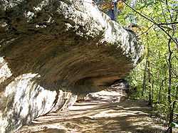
Upload image |
01971-06-21-0000June 21, 1971
(#71000965) |
Near Hwy 71 and the Pedernales River on Lick Creek
30°22′53″N 98°05′17″W / 30.381389°N 98.088056°W / 30.381389; -98.088056 (Levi Rock Shelter) |
Austin |
|
| 81 |
Limerick-Frazier House |
|
02005-03-30-0000March 30, 2005
(#05000238) |
810 E. 13th St.
30°16′24″N 97°43′50″W / 30.273333°N 97.730694°W / 30.273333; -97.730694 (Limerick-Frazier House) |
Austin |
|
| 82 |
Little Campus |
|
01974-08-13-0000August 13, 1974
(#74002091) |
Bounded by 18th, Oldham, 19th, and Red River Sts.
30°16′42″N 97°43′53″W / 30.278333°N 97.731389°W / 30.278333; -97.731389 (Little Campus) |
Austin |
|
| 83 |
Littlefield House |
|
01970-08-25-0000August 25, 1970
(#70000767) |
24th St. and Whitis Ave.
30°17′17″N 97°44′27″W / 30.288056°N 97.740833°W / 30.288056; -97.740833 (Littlefield House) |
Austin |
|
| 84 |
Long Hog Hollow Archeological District |
Upload image |
01984-05-25-0000May 25, 1984
(#84002003) |
Address Restricted
|
Austin |
|
| 85 |
Lung House |
|
02014-02-05-0000February 5, 2014
(#13001159) |
1605 Canterbury St.
30°15′23″N 97°43′45″W / 30.256343°N 97.729109°W / 30.256343; -97.729109 (Lung House) |
Austin |
|
| 86 |
John W. Maddox House |
|
01985-09-17-0000September 17, 1985
(#85002293) |
1115 E. 3rd St.
30°15′40″N 97°43′54″W / 30.261111°N 97.731667°W / 30.261111; -97.731667 (John W. Maddox House) |
Austin |
|
| 87 |
Peter and Clotilde Shipe Mansbendel House |
|
01990-08-16-0000August 16, 1990
(#90001183) |
3824 Ave. F
30°18′04″N 97°43′55″W / 30.301111°N 97.731944°W / 30.301111; -97.731944 (Peter and Clotilde Shipe Mansbendel House) |
Austin |
|
| 88 |
Mather-Kirkland House |
|
01978-12-08-0000December 8, 1978
(#78002990) |
402 Academy
30°15′07″N 97°44′38″W / 30.251944°N 97.743889°W / 30.251944; -97.743889 (Mather-Kirkland House) |
Austin |
|
| 89 |
Mayfield-Gutsch Estate |
|
01994-09-29-0000September 29, 1994
(#94001159) |
3505 W. 35th St.
30°18′46″N 97°46′14″W / 30.312778°N 97.770556°W / 30.312778; -97.770556 (Mayfield-Gutsch Estate) |
Austin |
|
| 90 |
Arthur N. and Jane Y. McCallum House |
|
01996-08-22-0000August 22, 1996
(#96000936) |
613 W. 32nd St.
30°17′56″N 97°44′28″W / 30.298889°N 97.741111°W / 30.298889; -97.741111 (Arthur N. and Jane Y. McCallum House) |
Austin |
|
| 91 |
Robert H. and Edith Ethel McCauley House |
|
01990-08-16-0000August 16, 1990
(#90001236) |
4415 Ave. A
30°18′37″N 97°43′55″W / 30.310139°N 97.731944°W / 30.310139; -97.731944 (Robert H. and Edith Ethel McCauley House) |
Austin |
|
| 92 |
Floyd McGown House |
|
01985-09-17-0000September 17, 1985
(#85002290) |
1202 Garden St.
30°15′27″N 97°43′58″W / 30.2575°N 97.732778°W / 30.2575; -97.732778 (Floyd McGown House) |
Austin |
|
| 93 |
McKinney Homestead |
|
01974-10-16-0000October 16, 1974
(#74002093) |
SW of Austin between TX 71 and U.S. 183
30°11′23″N 97°43′15″W / 30.189722°N 97.720833°W / 30.189722; -97.720833 (McKinney Homestead) |
Austin |
|
| 94 |
Fannie Moss Miller House |
|
02008-04-16-0000April 16, 2008
(#08000318) |
900 Rio Grande St.,
30°16′23″N 97°44′55″W / 30.273056°N 97.748611°W / 30.273056; -97.748611 (Fannie Moss Miller House) |
Austin |
|
| 95 |
Millett Opera House |
|
01978-03-21-0000March 21, 1978
(#78002991) |
110 E. 9th St.
30°16′15″N 97°44′27″W / 30.270833°N 97.740833°W / 30.270833; -97.740833 (Millett Opera House) |
Austin |
|
| 96 |
Missouri, Kansas and Texas Land Co. House |
|
01990-08-16-0000August 16, 1990
(#90001179) |
3908 Ave. C
30°18′12″N 97°44′02″W / 30.303333°N 97.733889°W / 30.303333; -97.733889 (Missouri, Kansas and Texas Land Co. House) |
Austin |
|
| 97 |
Montopolis Bridge |
|
01996-10-10-0000October 10, 1996
(#96001118) |
US 183, 8.1 mi (13.0 km). S of jct. with I-35
30°14′43″N 97°41′29″W / 30.2453°N 97.6913°W / 30.2453; -97.6913 (Montopolis Bridge) |
Austin |
|
| 98 |
Moonlight Towers |
|
01976-07-12-0000July 12, 1976
(#76002071) |
Austin and vicinity
30°16′17″N 97°44′41″W / 30.271389°N 97.744722°W / 30.271389; -97.744722 (Moonlight Towers) |
Austin |
|
| 99 |
Moore's Crossing Historic District |
|
01996-10-16-0000October 16, 1996
(#96001091) |
Roughly bounded by FM 973, old Burleson Rd. and Onion Cr.
30°10′03″N 97°39′43″W / 30.1675°N 97.661944°W / 30.1675; -97.661944 (Moore's Crossing Historic District) |
Austin |
|
| 100 |
Moore-Hancock Farmstead |
|
01994-09-02-0000September 2, 1994
(#94001079) |
4811 Sinclair Ave.
30°19′15″N 97°44′30″W / 30.320972°N 97.741528°W / 30.320972; -97.741528 (Moore-Hancock Farmstead) |
Austin |
|
| 101 |
Charles B. Moreland House |
|
01985-09-17-0000September 17, 1985
(#85002276) |
1301 E. Cesar Chavez
30°15′34″N 97°43′54″W / 30.259444°N 97.731528°W / 30.259444; -97.731528 (Charles B. Moreland House) |
Austin |
|
| 102 |
Chester and Lorine Nagel House |
|
01997-04-17-0000April 17, 1997
(#97000361) |
3215 Churchill Dr.
30°18′15″N 97°45′03″W / 30.304167°N 97.750833°W / 30.304167; -97.750833 (Chester and Lorine Nagel House) |
Austin |
|
| 103 |
Neill-Cochran House |
|
01970-08-25-0000August 25, 1970
(#70000768) |
2310 San Gabriel St.
30°17′15″N 97°44′53″W / 30.2875°N 97.748056°W / 30.2875; -97.748056 (Neill-Cochran House) |
Austin |
|
| 104 |
Newton House |
|
01987-04-02-0000April 2, 1987
(#87000578) |
1013 E. Ninth St.
30°16′02″N 97°43′48″W / 30.267222°N 97.73°W / 30.267222; -97.73 (Newton House) |
Austin |
|
| 105 |
Elisabet Ney Studio and Museum |
|
01972-11-29-0000November 29, 1972
(#72001374) |
304 E. 44th St.
30°18′23″N 97°43′34″W / 30.306389°N 97.726111°W / 30.306389; -97.726111 (Elisabet Ney Studio and Museum) |
Austin |
|
| 106 |
Norwood Building |
|
02011-02-07-0000February 7, 2011
(#10001224) |
114 W 7th St.
30°16′10″N 97°44′35″W / 30.269444°N 97.743194°W / 30.269444; -97.743194 (Norwood Building) |
Austin |
|
| 107 |
Oakwood Cemetery Annex |
|
02003-10-30-0000October 30, 2003
(#03001103) |
1601 Comal St.
30°16′36″N 97°43′25″W / 30.276667°N 97.723611°W / 30.276667; -97.723611 (Oakwood Cemetery Annex) |
Austin |
|
| 108 |
Old Bakery |
|
01969-12-17-0000December 17, 1969
(#69000214) |
1006 Congress Ave.
30°16′20″N 97°44′30″W / 30.272153°N 97.741528°W / 30.272153; -97.741528 (Old Bakery) |
Austin |
|
| 109 |
Old Land Office Building |
|
01970-08-25-0000August 25, 1970
(#70000769) |
108 E. 11th St.
30°16′21″N 97°44′22″W / 30.2725°N 97.739444°W / 30.2725; -97.739444 (Old Land Office Building) |
Austin |
|
| 110 |
Old West Austin Historic District |
|
02003-09-12-0000September 12, 2003
(#03000937) |
Roughly bounded by W. 13th, Lamar Blvd., W. 35th and Mo-Pac Expy.
30°17′32″N 97°45′18″W / 30.292222°N 97.755°W / 30.292222; -97.755 (Old West Austin Historic District) |
Austin |
Boundary increase on January 16, 2004. Ref #03000937 and 03001413
|
| 111 |
Oliphant-Walker House |
|
01990-08-16-0000August 16, 1990
(#90001177) |
3900 Ave. C
30°18′10″N 97°44′04″W / 30.302778°N 97.734444°W / 30.302778; -97.734444 (Oliphant-Walker House) |
Austin |
|
| 112 |
Page-Gilbert House |
|
01990-08-16-0000August 16, 1990
(#90001186) |
3913 Ave. G
30°18′06″N 97°43′47″W / 30.301667°N 97.729722°W / 30.301667; -97.729722 (Page-Gilbert House) |
Austin |
|
| 113 |
Michael Paggi House |
|
01975-04-16-0000April 16, 1975
(#75002006) |
200 Lee Barton Dr.
30°15′49″N 97°45′24″W / 30.26367°N 97.7567°W / 30.26367; -97.7567 (Michael Paggi House) |
Austin |
|
| 114 |
Paramount Theatre |
|
01976-06-23-0000June 23, 1976
(#76002072) |
713 Congress Ave.
30°16′10″N 97°44′31″W / 30.269444°N 97.742083°W / 30.269444; -97.742083 (Paramount Theatre) |
Austin |
|
| 115 |
James F. and Susie R. Parker House |
|
01990-08-16-0000August 16, 1990
(#90001181) |
3906 Ave. D
30°18′10″N 97°43′59″W / 30.302778°N 97.733056°W / 30.302778; -97.733056 (James F. and Susie R. Parker House) |
Austin |
|
| 116 |
Perry Estate-St. Mary's Academy |
|
02001-08-08-0000August 8, 2001
(#01000874) |
701 E. 41st St.
30°18′04″N 97°43′25″W / 30.301111°N 97.723611°W / 30.301111; -97.723611 (Perry Estate-St. Mary's Academy) |
Austin |
|
| 117 |
Edgar H. Perry, Jr. House |
|
02014-07-11-0000July 11, 2014
(#14000404) |
801 Park Boulevard
30°18′07″N 97°43′23″W / 30.301854°N 97.723031°W / 30.301854; -97.723031 (Edgar H. Perry, Jr. House) |
Austin |
|
| 118 |
George A. Peterson House |
|
01985-09-17-0000September 17, 1985
(#85002273) |
1012 E. 8th St.
30°16′00″N 97°43′50″W / 30.266667°N 97.730556°W / 30.266667; -97.730556 (George A. Peterson House) |
Austin |
|
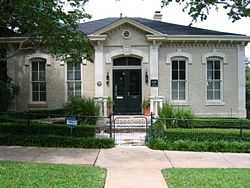
| 119 |
Joseph O. Polhemus House |
|
01985-09-17-0000September 17, 1985
(#85002299) |
912 E. 2nd St.
30°15′41″N 97°44′03″W / 30.261389°N 97.734167°W / 30.261389; -97.734167 (Joseph O. Polhemus House) |
Austin |
|
| 120 |
William Sidney Porter House |
|
01973-06-18-0000June 18, 1973
(#73001979) |
409 E. 5th S.
30°15′56″N 97°44′20″W / 30.265556°N 97.738889°W / 30.265556; -97.738889 (William Sidney Porter House) |
Austin |
|
| 121 |
Rainey Street Historic District |
|
01985-09-17-0000September 17, 1985
(#85002302) |
70-97 Rainey St.
30°15′33″N 97°44′18″W / 30.259167°N 97.738333°W / 30.259167; -97.738333 (Rainey Street Historic District) |
Austin |
|
| 122 |
F. T. and Belle Ramsey House |
|
01990-08-16-0000August 16, 1990
(#90001176) |
4412 Ave. B
30°18′34″N 97°43′53″W / 30.309444°N 97.731389°W / 30.309444; -97.731389 (F. T. and Belle Ramsey House) |
Austin |
|
| 123 |
Rather House |
|
01979-10-24-0000October 24, 1979
(#79003013) |
3105 Duval St.
30°17′34″N 97°43′56″W / 30.292778°N 97.732222°W / 30.292778; -97.732222 (Rather House) |
Austin |
|
| 124 |
Raymond-Morley House |
|
01974-11-20-0000November 20, 1974
(#74002092) |
510 Baylor St.
30°16′18″N 97°45′19″W / 30.271667°N 97.755278°W / 30.271667; -97.755278 (Raymond-Morley House) |
Austin |
|
| 125 |
Louis and Mathilde Reuter House |
|
01987-12-07-0000December 7, 1987
(#87002100) |
806 Rosedale Terrace
30°14′28″N 97°44′41″W / 30.241111°N 97.744722°W / 30.241111; -97.744722 (Louis and Mathilde Reuter House) |
Austin |
|
| 126 |
Alice H. Robbins House |
|
01990-08-16-0000August 16, 1990
(#90001235) |
4311 Ave. A
30°18′32″N 97°43′58″W / 30.308944°N 97.732778°W / 30.308944; -97.732778 (Alice H. Robbins House) |
Austin |
|
| 127 |
Robinson-Macken House |
|
01985-09-12-0000September 12, 1985
(#85002300) |
702 Rio Grande St.
30°16′48″N 97°44′56″W / 30.28°N 97.748889°W / 30.28; -97.748889 (Robinson-Macken House) |
Austin |
|
| 128 |
Edward H. Rogers Homestead |
|
01974-12-27-0000December 27, 1974
(#74002094) |
N of Austin off TX 1325
30°23′53″N 97°43′44″W / 30.398056°N 97.728889°W / 30.398056; -97.728889 (Edward H. Rogers Homestead) |
Austin |
|
| 129 |
Rogers-Bell House |
|
01988-06-24-0000June 24, 1988
(#88000703) |
1001 E. Eighth St.
30°16′00″N 97°43′53″W / 30.266667°N 97.731389°W / 30.266667; -97.731389 (Rogers-Bell House) |
Austin |
|
| 130 |
Roy-Hardin House |
Upload image |
02005-08-17-0000August 17, 2005
(#05000893) |
1803 Evergreen Ave.
30°14′58″N 97°45′53″W / 30.249444°N 97.764722°W / 30.249444; -97.764722 (Roy-Hardin House) |
Austin |
|
| 131 |
Royal Arch Masonic Lodge |
|
02005-04-28-0000April 28, 2005
(#05000362) |
311 W. 7th St.
30°16′16″N 97°44′43″W / 30.271111°N 97.745278°W / 30.271111; -97.745278 (Royal Arch Masonic Lodge) |
Austin |
|
| 132 |
George W. Sampson House |
|
01982-07-08-0000July 8, 1982
(#82004526) |
1003 Rio Grande
30°16′25″N 97°44′52″W / 30.273611°N 97.747778°W / 30.273611; -97.747778 (George W. Sampson House) |
Austin |
|
| 133 |
Santa Rita Courts |
|
02008-04-17-0000April 17, 2008
(#08000319) |
Roughly bounded by E. 2nd, Pedernales, Santa Rita & Corta Sts.,
30°15′22″N 97°43′01″W / 30.256111°N 97.716944°W / 30.256111; -97.716944 (Santa Rita Courts) |
Austin |
|
| 134 |
Kurt and Meta Schemedes House |
|
02000-06-15-0000June 15, 2000
(#00000696) |
804 Baylor St.
30°16′26″N 97°45′15″W / 30.273889°N 97.754167°W / 30.273889; -97.754167 (Kurt and Meta Schemedes House) |
Austin |
|
| 135 |
J. P. Schneider Store |
|
01979-01-29-0000January 29, 1979
(#79003014) |
401 W. 2nd St.
30°15′55″N 97°44′52″W / 30.265278°N 97.747778°W / 30.265278; -97.747778 (J. P. Schneider Store) |
Austin |
|
| 136 |
Scholz Garten |
|
01979-07-27-0000July 27, 1979
(#79003015) |
1607 San Jacinto
30°16′40″N 97°44′11″W / 30.277778°N 97.736389°W / 30.277778; -97.736389 (Scholz Garten) |
Austin |
|
| 137 |
Walter Schulze House and Industrial Structure |
Upload image |
01986-04-25-0000April 25, 1986
(#86000864) |
102 Chicon St.
30°15′59″N 97°43′27″W / 30.266389°N 97.724167°W / 30.266389; -97.724167 (Walter Schulze House and Industrial Structure) |
Austin |
|
| 138 |
Zachary T., Sr., and Sallie Lee Scott House |
Upload image |
01998-09-07-0000September 7, 1998
(#98001087) |
2408 Sweetbrush Dr.
30°18′02″N 97°46′38″W / 30.300556°N 97.777222°W / 30.300556; -97.777222 (Zachary T., Sr., and Sallie Lee Scott House) |
Austin |
|
| 139 |
Scottish Rite Dormitory |
|
01998-04-23-0000April 23, 1998
(#98000404) |
210 W. 27th St.
30°17′32″N 97°44′21″W / 30.292222°N 97.739167°W / 30.292222; -97.739167 (Scottish Rite Dormitory) |
Austin |
|
| 140 |
Seaholm Power Plant |
|
02013-08-20-0000August 20, 2013
(#13000614) |
800 W. Cesar Chavez St.
30°15′59″N 97°45′10″W / 30.2665°N 97.7527°W / 30.2665; -97.7527 (Seaholm Power Plant) |
Austin |
|
| 141 |
Rev. Henry M. and Jennie Sears House |
|
01990-08-16-0000August 16, 1990
(#90001174) |
209 W. 39th St.
30°18′09″N 97°44′04″W / 30.3025°N 97.734444°W / 30.3025; -97.734444 (Rev. Henry M. and Jennie Sears House) |
Austin |
|
| 142 |
Shadow Lawn Historic District |
|
01990-08-16-0000August 16, 1990
(#90001192) |
Roughly bounded by Ave. G, 38th St., Duval St., and 39th St.
30°17′59″N 97°43′48″W / 30.299722°N 97.73°W / 30.299722; -97.73 (Shadow Lawn Historic District) |
Austin |
|
| 143 |
Sheeks-Robertson House |
|
01976-06-24-0000June 24, 1976
(#76002073) |
610 W. Lynn St.
30°16′34″N 97°45′43″W / 30.276111°N 97.761944°W / 30.276111; -97.761944 (Sheeks-Robertson House) |
Austin |
|
| 144 |
Col. Monroe M. Shipe House |
|
01983-03-29-0000March 29, 1983
(#83003167) |
3816 Ave. G
30°18′03″N 97°43′52″W / 30.300833°N 97.731111°W / 30.300833; -97.731111 (Col. Monroe M. Shipe House) |
Austin |
|
| 145 |
Shotgun at 1206 Canterbury Street |
Upload image |
01985-09-17-0000September 17, 1985
(#85002285) |
1206 Canterbury St.
30°15′29″N 97°43′18″W / 30.258056°N 97.721667°W / 30.258056; -97.721667 (Shotgun at 1206 Canterbury Street) |
Austin |
|
| 146 |
Shotguns at 1203-1205 Bob Harrison |
|
01985-09-17-0000September 17, 1985
(#85002284) |
1203-1205 Bob Harrison
30°16′25″N 97°43′37″W / 30.273611°N 97.726944°W / 30.273611; -97.726944 (Shotguns at 1203-1205 Bob Harrison) |
Austin |
|
| 147 |
Simms House |
|
02005-03-30-0000March 30, 2005
(#05000242) |
906 Mariposa Dr.
30°14′28″N 97°44′37″W / 30.241111°N 97.743611°W / 30.241111; -97.743611 (Simms House) |
Austin |
|
| 148 |
Sixth Street Historic District |
|
01975-12-30-0000December 30, 1975
(#75002132) |
Roughly bounded by 5th, 7th, Lavaca Sts. and I-35
30°16′02″N 97°44′23″W / 30.267222°N 97.739722°W / 30.267222; -97.739722 (Sixth Street Historic District) |
Austin |
|
| 149 |
Smith Rock Shelter |
|
01974-10-01-0000October 1, 1974
(#74002095) |
In McKinney Falls State Park
30°11′03″N 97°43′26″W / 30.184167°N 97.723889°W / 30.184167; -97.723889 (Smith Rock Shelter) |
Austin |
|
| 150 |
Smith-Marcuse-Lowry House |
|
01990-08-16-0000August 16, 1990
(#90001180) |
3913 Ave. C
30°18′12″N 97°44′00″W / 30.303333°N 97.733333°W / 30.303333; -97.733333 (Smith-Marcuse-Lowry House) |
Austin |
|
| 151 |
Smith-Clark and Smith-Bickler Houses |
|
01979-04-20-0000April 20, 1979
(#79003016) |
502 and 504 W. 14th St.
30°16′39″N 97°44′41″W / 30.2775°N 97.744722°W / 30.2775; -97.744722 (Smith-Clark and Smith-Bickler Houses) |
Austin |
|
| 152 |
Richmond Kelley Smoot House |
|
01982-08-12-0000August 12, 1982
(#82004527) |
1316 W. 6th St.
30°16′28″N 97°45′35″W / 30.274444°N 97.759722°W / 30.274444; -97.759722 (Richmond Kelley Smoot House) |
Austin |
|
| 153 |
Southgate-Lewis House |
|
01985-09-17-0000September 17, 1985
(#85002265) |
1501 E. 12th St.
30°16′23″N 97°43′25″W / 30.273056°N 97.723611°W / 30.273056; -97.723611 (Southgate-Lewis House) |
Austin |
|
| 154 |
Southwestern Telegraph and Telephone Building |
|
01978-02-14-0000February 14, 1978
(#78002993) |
410 Congress Ave.
30°16′00″N 97°44′37″W / 30.26668°N 97.74352°W / 30.26668; -97.74352 (Southwestern Telegraph and Telephone Building) |
Austin |
|
| 155 |
St. David's Episcopal Church |
|
01978-08-02-0000August 2, 1978
(#78002994) |
304 E. 7th St.
30°16′06″N 97°44′21″W / 30.268333°N 97.739167°W / 30.268333; -97.739167 (St. David's Episcopal Church) |
Austin |
|
| 156 |
St. Edward's University Main Building and Holy Cross Dormitory |
|
01973-03-07-0000March 7, 1973
(#73001980) |
3001 S. Congress St.
30°13′46″N 97°45′17″W / 30.229444°N 97.754722°W / 30.229444; -97.754722 (St. Edward's University Main Building and Holy Cross Dormitory) |
Austin |
|
| 157 |
St. Mary's Cathedral |
|
01973-04-02-0000April 2, 1973
(#73001981) |
201-207 10th St.
30°16′15″N 97°44′23″W / 30.270833°N 97.739722°W / 30.270833; -97.739722 (St. Mary's Cathedral) |
Austin |
|
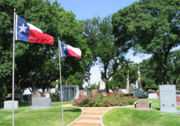
| 158 |
State Cemetery of Texas |
|
01986-05-12-0000May 12, 1986
(#86001085) |
901 Navasota St.
30°15′54″N 97°43′34″W / 30.265°N 97.726111°W / 30.265; -97.726111 (State Cemetery of Texas) |
Austin |
|
| 159 |
State Lunatic Asylum |
|
01987-12-04-0000December 4, 1987
(#87002115) |
4110 Guadalupe
30°18′27″N 97°44′12″W / 30.3075°N 97.736667°W / 30.3075; -97.736667 (State Lunatic Asylum) |
Austin |
|
| 160 |
Stavely-Kunz-Johnson House |
|
01980-08-19-0000August 19, 1980
(#80004155) |
1402 E. Cesar Chavez
30°15′30″N 97°43′47″W / 30.258333°N 97.729722°W / 30.258333; -97.729722 (Stavely-Kunz-Johnson House) |
Austin |
|
| 161 |
Swedish Hill Historic District |
|
01986-05-12-0000May 12, 1986
(#86001088) |
900-1000 blks. of E. Fourteenth St. and 900 blk. of E. Fifteenth St.
30°16′28″N 97°43′45″W / 30.274444°N 97.729167°W / 30.274444; -97.729167 (Swedish Hill Historic District) |
Austin |
|
| 162 |
Teachers State Association of Texas Building |
|
02005-04-28-0000April 28, 2005
(#05000361) |
1191 Navasota
30°16′08″N 97°44′35″W / 30.268889°N 97.743056°W / 30.268889; -97.743056 (Teachers State Association of Texas Building) |
Austin |
|
| 163 |
Texas Federation of Women's Clubs Headquarters |
|
01985-10-24-0000October 24, 1985
(#85003377) |
2312 San Gabriel St.
30°17′16″N 97°44′53″W / 30.287778°N 97.748056°W / 30.287778; -97.748056 (Texas Federation of Women's Clubs Headquarters) |
Austin |
|
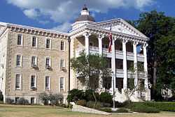
| 164 |
Texas State Capitol |
|
01970-06-22-0000June 22, 1970
(#70000770) |
Congress and 11th Sts.
30°16′28″N 97°44′22″W / 30.274444°N 97.739444°W / 30.274444; -97.739444 (Texas State Capitol) |
Austin |
|
| 165 |
U.S. Post Office and Federal Building |
|
01970-08-25-0000August 25, 1970
(#70000771) |
126 W. 6th St.
30°16′07″N 97°44′36″W / 30.268611°N 97.743333°W / 30.268611; -97.743333 (U.S. Post Office and Federal Building) |
Austin |
|
| 166 |
University Baptist Church |
|
01998-07-31-0000July 31, 1998
(#98000955) |
2130 Guadalupe St.
30°17′05″N 97°44′31″W / 30.284722°N 97.741944°W / 30.284722; -97.741944 (University Baptist Church) |
Austin |
|
| 167 |
University Junior High School |
|
02001-04-19-0000April 19, 2001
(#01000396) |
1925 San Jacinto Blvd.
30°17′09″N 97°44′18″W / 30.285833°N 97.738333°W / 30.285833; -97.738333 (University Junior High School) |
Austin |
|
| 168 |
Victory Grill |
|
01998-10-16-0000October 16, 1998
(#98001226) |
1104 E. 11th St.
30°16′09″N 97°43′43″W / 30.269167°N 97.728611°W / 30.269167; -97.728611 (Victory Grill) |
Austin |
|
| 169 |
Wahrenberger House |
|
01978-02-23-0000February 23, 1978
(#78002995) |
208 W. 14th St.
30°16′36″N 97°44′30″W / 30.276667°N 97.741667°W / 30.276667; -97.741667 (Wahrenberger House) |
Austin |
|
| 170 |
Walnut Creek Archeological District |
Upload image |
01981-09-24-0000September 24, 1981
(#81000633) |
Address Restricted
|
Austin |
81000633
|
| 171 |
James M. and Leana B. Walsh House |
|
02014-02-05-0000February 5, 2014
(#13001160) |
3701 Bonnie Rd.
30°17′46″N 97°46′56″W / 30.296211°N 97.782261°W / 30.296211; -97.782261 (James M. and Leana B. Walsh House) |
Austin |
|
| 172 |
Wesley United Methodist Church |
|
01985-09-17-0000September 17, 1985
(#85002281) |
1164 San Bernard St.
30°16′11″N 97°43′34″W / 30.269722°N 97.726111°W / 30.269722; -97.726111 (Wesley United Methodist Church) |
Austin |
|
| 173 |
West Line Historic District |
|
02005-10-12-0000October 12, 2005
(#05001166) |
Roughly bounded by Baylor St., W. Fifth and Sixth Sts., MoPac Expressway
30°16′43″N 97°45′35″W / 30.278611°N 97.759722°W / 30.278611; -97.759722 (West Line Historic District) |
Austin |
|
| 174 |
West Sixth Street Bridge at Shoal Creek |
|
02014-08-18-0000August 18, 2014
(#14000499) |
West Sixth Street at Shoal Creek
30°16′14″N 97°45′04″W / 30.270462°N 97.751182°W / 30.270462; -97.751182 (West Sixth Street Bridge at Shoal Creek) |
Austin |
|
| 175 |
Westgate Tower |
|
02010-10-12-0000October 12, 2010
(#10000820) |
1122 Colorado St.
30°16′27″N 97°44′34″W / 30.274097°N 97.742847°W / 30.274097; -97.742847 (Westgate Tower) |
Austin |
|
| 176 |
Westhill |
|
01979-07-26-0000July 26, 1979
(#79003017) |
1703 West Ave.
30°16′52″N 97°44′45″W / 30.281111°N 97.745833°W / 30.281111; -97.745833 (Westhill) |
Austin |
|
| 177 |
W.T. and Clotilde V. Williams House |
|
01990-08-16-0000August 16, 1990
(#90001182) |
3820 Ave. F
30°18′03″N 97°43′56″W / 30.300833°N 97.732222°W / 30.300833; -97.732222 (W.T. and Clotilde V. Williams House) |
Austin |
|
| 178 |
Willow-Spence Streets Historic District |
|
01985-09-17-0000September 17, 1985
(#85002264) |
Portions of Willow, Spence, Canterbury, San Marcos & Waller Sts.
30°15′32″N 97°44′03″W / 30.258889°N 97.734167°W / 30.258889; -97.734167 (Willow-Spence Streets Historic District) |
Austin |
|
| 179 |
Wilshire Historic District |
Upload image |
02011-06-08-0000June 8, 2011
(#11000347) |
Bounded by Southern Pacific Railroad, Ardenwood Rd., Wilshire Blvd. & the Delwood III subdivision
30°17′51″N 97°42′50″W / 30.2975°N 97.713889°W / 30.2975; -97.713889 (Wilshire Historic District) |
Austin |
|
| 180 |
Woodlawn |
|
01970-08-25-0000August 25, 1970
(#70000772) |
6 Niles Rd.
30°17′13″N 97°45′29″W / 30.286944°N 97.758056°W / 30.286944; -97.758056 (Woodlawn) |
Austin |
|
| 181 |
Wooldridge Park |
|
01979-08-01-0000August 1, 1979
(#79003018) |
Guadalupe St.
30°16′20″N 97°44′43″W / 30.272222°N 97.745278°W / 30.272222; -97.745278 (Wooldridge Park) |
Austin |
|
| 182 |
Goodall Wooten House |
|
01975-04-03-0000April 3, 1975
(#75002008) |
700 W. 19th St.
30°16′58″N 97°44′44″W / 30.282778°N 97.745556°W / 30.282778; -97.745556 (Goodall Wooten House) |
Austin |
|
| 183 |
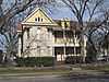
Worrell-Ettlinger House |
|
02004-10-12-0000October 12, 2004
(#04001152) |
3110 Harris Park Ave.
30°17′38″N 97°43′52″W / 30.293889°N 97.731111°W / 30.293889; -97.731111 (Worrell-Ettlinger House) |
Austin |
|
| 184 |
Wroe-Bustin House |
|
01997-01-25-0000January 25, 1997
(#96001626) |
506 Baylor St.
30°16′28″N 97°45′21″W / 30.274444°N 97.755833°W / 30.274444; -97.755833 (Wroe-Bustin House) |
Austin |
|
| 185 |
Youth Council Site (41TV382) |
Upload image |
01979-04-24-0000April 24, 1979
(#79003450) |
Address Restricted
|
Austin |
|
| 186 |
Zilker Park Historic District |
|
01997-05-23-0000May 23, 1997
(#97000479) |
2100 Barton Springs Rd.
30°15′49″N 97°46′36″W / 30.263611°N 97.776667°W / 30.263611; -97.776667 (Zilker Park Historic District) |
Austin |
|
| 187 |
Ziller House |
|
01998-05-08-0000May 8, 1998
(#98000449) |
1110 Blanco
30°16′40″N 97°45′16″W / 30.277778°N 97.754444°W / 30.277778; -97.754444 (Ziller House) |
Austin |
|


.jpg)

.jpg)