National Register of Historic Places listings in Talladega County, Alabama
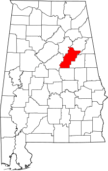
Location of Talladega County in Alabama
This is a list of the National Register of Historic Places listings in Talladega County, Alabama.
This is intended to be a complete list of the properties and districts on the National Register of Historic Places in Talladega County, Alabama, United States. Latitude and longitude coordinates are provided for many National Register properties and districts; these locations may be seen together in a Google map.[1]
There are 23 properties and districts listed on the National Register in the county, including 2 National Historic Landmarks.
- This National Park Service list is complete through NPS recent listings posted May 1, 2015.[2]
Current listings
| [3] | Name on the Register | Image | Date listed[4] | Location | City or town | Description |
|---|---|---|---|---|---|---|
| 1 | Benjamin H. Averiett House | Upload image | (#86002034) |
State Route 8 33°08′23″N 86°22′16″W / 33.139722°N 86.371111°W |
Sylacauga | |
| 2 | William Averiett House | 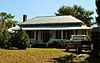 |
(#86002038) |
Off State Route 8 33°08′02″N 86°23′58″W / 33.133889°N 86.399444°W |
Sylacauga | |
| 3 | Boxwood | 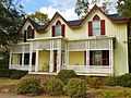 |
(#83002983) |
406 E. North St., E. 33°26′44″N 86°05′47″W / 33.445556°N 86.096389°W |
Talladega | |
| 4 | Charles Butler House | 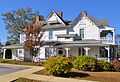 |
(#96000054) |
Junction of 1st St. and 10th Ave. 33°16′38″N 86°21′26″W / 33.277222°N 86.357222°W |
Childersburg | |
| 5 | B.B. Comer Memorial Library | 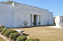 |
(#05000972) |
711 N. Broadway Ave. 33°10′39″N 86°15′04″W / 33.1775°N 86.251111°W |
Sylacauga | The building currently houses the Isabel Anderson Comer Museum & Arts Center |
| 6 | J.L.M. Curry House | 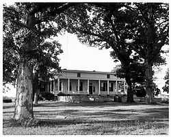 |
(#66000154) |
3 mi (4.8 km) northeast of Talladega on State Route 21 33°27′21″N 86°02′40″W / 33.455833°N 86.044444°W |
Talladega | |
| 7 | Elston House | Upload image | (#76000357) |
10 mi (16 km) north of Talladega on Turner's Mill Rd. 33°32′48″N 86°01′05″W / 33.546667°N 86.018056°W |
Talladega | |
| 8 | First Presbyterian Church | 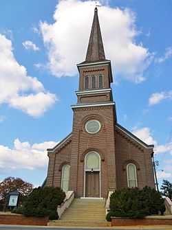 |
(#83003489) |
130 North St., E. 33°26′08″N 86°06′02″W / 33.435556°N 86.100556°W |
Talladega | |
| 9 | Goodwin-Hamilton House | 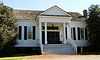 |
(#86002041) |
Marble Valley Rd. 33°07′03″N 86°24′47″W / 33.1175°N 86.413056°W |
Sylacauga | |
| 10 | Hightower Brothers Livery Stable | 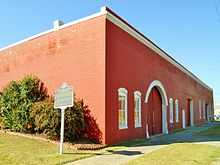 |
(#97000650) |
413 Norton Ave. 33°10′21″N 86°15′17″W / 33.1725°N 86.254722°W |
Sylacauga | |
| 11 | Idlewild | 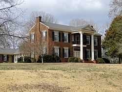 |
(#93001012) |
State Route 5, 0.1 mi (0.16 km) north of State Route 21 33°30′37″N 86°02′45″W / 33.510278°N 86.045833°W |
Talladega | |
| 12 | Jemison House Complex | 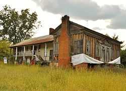 |
(#90001507) |
South of the junction of Chocolocco and Cheaha Creeks 33°32′02″N 86°02′45″W / 33.533889°N 86.045833°W |
Eastaboga | |
| 13 | Kymulga Mill And Covered Bridge | 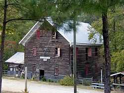 |
(#76000356) |
4.5 mi (7.2 km) northeast of Childersburg on State Route 46 33°20′03″N 86°18′01″W / 33.334167°N 86.300278°W |
Childersburg | |
| 14 | Lawler-Whiting House | .jpg) |
(#86001157) |
State Route 21 south of Talladega 33°21′21″N 86°10′07″W / 33.355833°N 86.168611°W |
Talladega | |
| 15 | Silk Stocking District | 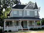 |
(#79000403) |
Roughly bounded by Coffee, 2nd, McMillan, and Court Sts. 33°25′54″N 86°05′54″W / 33.431667°N 86.098333°W |
Talladega | |
| 16 | Swayne Hall | 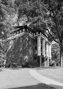 |
(#74002223) |
Talladega College campus 33°25′46″N 86°07′03″W / 33.429444°N 86.1175°W |
Talladega | |
| 17 | Sylacauga Historic Commercial District | 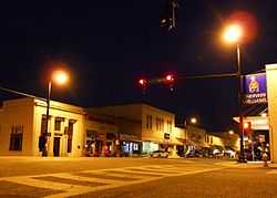 |
(#04000563) |
Roughly bounded by Broadway Ave., W. 1st., Anniston Ave., and W. 4th St. 33°10′14″N 86°15′08″W / 33.170556°N 86.252222°W |
Sylacauga | |
| 18 | Talladega College Historic District | 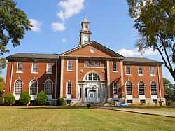 |
(#90001316) |
Junction of Battle St. and Martin Luther King Dr. 33°26′00″N 86°06′51″W / 33.433333°N 86.114167°W |
Talladega | |
| 19 | Talladega Courthouse Square Historic District |  |
(#72000181) |
Courthouse Sq.; also roughly bounded by N. East, E. North, and S. East, and Coffee and Spring Sts. 33°26′06″N 86°06′09″W / 33.435°N 86.1025°W |
Talladega | Second set of boundaries represent a boundary increase of June 30, 1988 |
| 20 | Thornhill | .jpg) |
(#98000104) |
29229 State Route 21 33°24′06″N 86°08′27″W / 33.401667°N 86.140833°W |
Talladega | |
| 21 | William Watters House | Upload image | (#87001652) |
County Highway 8 33°08′50″N 86°24′42″W / 33.147222°N 86.411667°W |
Sylacauga | |
| 22 | Welch-Averiett House | 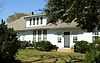 |
(#86002044) |
State Route 8 33°08′43″N 86°23′24″W / 33.145278°N 86.39°W |
Sylacauga | |
| 23 | Winterboro Stagecoach Inn | 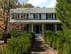 |
(#05000651) |
22901 State Route 21 33°19′31″N 86°11′48″W / 33.325278°N 86.196667°W |
Winterboro |
See also
| Wikimedia Commons has media related to National Register of Historic Places in Talladega County, Alabama. |
- List of National Historic Landmarks in Alabama
- National Register of Historic Places listings in Alabama
References
- ↑ The latitude and longitude information provided in this table was derived originally from the National Register Information System, which has been found to be fairly accurate for about 99% of listings. For about 1% of NRIS original coordinates, experience has shown that one or both coordinates are typos or otherwise extremely far off; some corrections may have been made. A more subtle problem causes many locations to be off by up to 150 yards, depending on location in the country: most NRIS coordinates were derived from tracing out latitude and longitudes off of USGS topographical quadrant maps created under the North American Datum of 1927, which differs from the current, highly accurate WGS84 GPS system used by most on-line maps. Chicago is about right, but NRIS longitudes in Washington are higher by about 4.5 seconds, and are lower by about 2.0 seconds in Maine. Latitudes differ by about 1.0 second in Florida. Some locations in this table may have been corrected to current GPS standards.
- ↑ "National Register of Historic Places: Weekly List Actions". National Park Service, United States Department of the Interior. Retrieved on May 1, 2015.
- ↑ Numbers represent an ordering by significant words. Various colorings, defined here, differentiate National Historic Landmarks and historic districts from other NRHP buildings, structures, sites or objects.
- ↑ The eight-digit number below each date is the number assigned to each location in the National Register Information System database, which can be viewed by clicking the number.
| |||||||||||||||||||||


| |||||||||||||||||||||||||||||||||