| [3] |
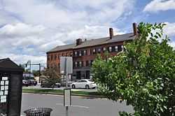
Name on the Register[4] |
Image |
Date listed[5] |
Location |
City or town |
Description |
|---|
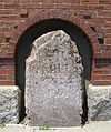
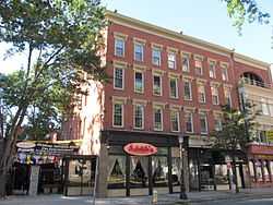
| 1 |
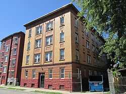
1767 Milestones |
|
01971-04-07-0000April 7, 1971
(#71000084) |
Between Boston and Springfield along Old Post Rd.
42°06′25″N 72°34′46″W / 42.106944°N 72.579444°W / 42.106944; -72.579444 (1767 Milestones) |
Springfield |
The one Springfield marker is in storage at the Springfield Armory museum. Other markers are found in Worcester, Middlesex, Norfolk, and Suffolk counties.
|
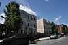
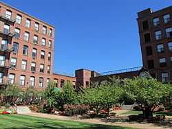
| 2 |
Ames Hill/Crescent Hill District |
|
01974-05-01-0000May 1, 1974
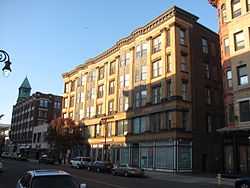
(#74000368) |
Bounded by sections of Central, Maple, Mill, and Pine Sts., Crescent Hill, Ames Hill Drive, and Maple Ct.
42°05′24″N 72°34′37″W / 42.09°N 72.576944°W / 42.09; -72.576944 (Ames Hill/Crescent Hill District) |
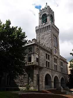
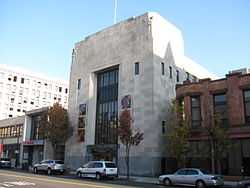
Springfield |
|
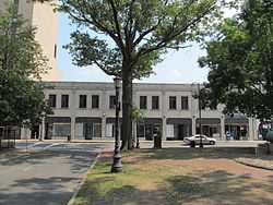
| 3 |
Apremont Triangle Historic District |
|
01983-05-27-0000May 27, 1983
(#83000735) |
Junction of Pearl, Hillman, Bridge, and Chestnut
42°06′19″N 72°35′21″W / 42.105278°N 72.589167°W / 42.105278; -72.589167 (Apremont Triangle Historic District) |
Springfield |
|
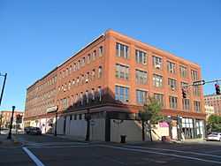
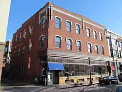
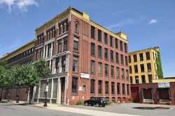
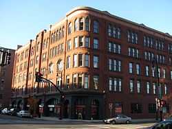
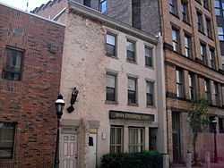
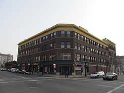
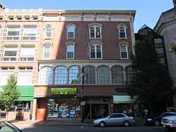
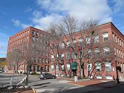
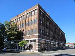
| 4 |
Bangs Block |
|
01983-02-24-0000February 24, 1983
(#83000736) |
1119 Main St.
42°06′00″N 72°35′10″W / 42.1°N 72.586°W / 42.1; -72.586 (Bangs Block) |
Springfield |
|
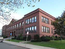
| 5 |
Baystate Corset Block |
|
01983-02-24-0000February 24, 1983
(#83000737) |
395-405 Dwight St. and 99 Taylor St.
42°06′21″N 72°35′31″W / 42.105833°N 72.591944°W / 42.105833; -72.591944 (Baystate Corset Block) |
Springfield |
|
| 6 |
Belle and Franklin Streets Historic District |
|
01989-03-02-0000March 2, 1989
(#89000039) |
77-103 Belle St. and 240-298 Franklin St.
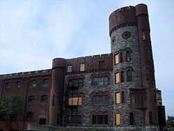
42°06′45″N 72°35′31″W / 42.1125°N 72.591944°W / 42.1125; -72.591944 (Belle and Franklin Streets Historic District) |
Springfield |
|
| 7 |
Bicycle Club Building |
|
01983-02-24-0000February 24, 1983
(#83000738) |
264-270 Worthington St.
42°06′18″N 72°35′32″W / 42.105°N 72.592222°W / 42.105; -72.592222 (Bicycle Club Building) |
Springfield |
|
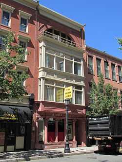
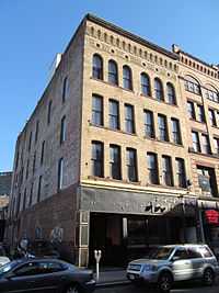
| 8 |
Burbach Block |
|
01983-02-24-0000February 24, 1983
(#83000739) |
1113-1115 Main St.
42°06′00″N 72°35′09″W / 42.1°N 72.585833°W / 42.1; -72.585833 (Burbach Block) |
Springfield |
|
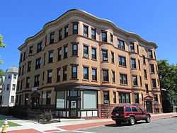
| 9 |
The Calhoun Apartments |
|
02009-11-05-0000November 5, 2009
(#09000881) |
1391-1399 Dwight St. and 85 Jefferson Ave.
42°06′58″N 72°36′13″W / 42.116103°N 72.6035°W / 42.116103; -72.6035 (The Calhoun Apartments) |
Springfield |
|
| 10 |
Carlton House Block |
|
01983-02-24-0000February 24, 1983
(#83000741) |
9-13 Hampden St.
42°06′13″N 72°35′40″W / 42.103611°N 72.594444°W / 42.103611; -72.594444 (Carlton House Block) |
Springfield |
|
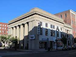
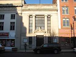
| 11 |
Chapin National Bank Building |
|
01983-02-24-0000February 24, 1983
(#83000742) |
1675-1677 Main St.
42°06′16″N 72°35′42″W / 42.104444°N 72.595°W / 42.104444; -72.595 (Chapin National Bank Building) |
Springfield |
|
| 12 |
Colonial Block |
|
01983-02-24-0000February 24, 1983
(#83000743) |
1139-55 Main St.
42°06′01″N 72°35′11″W / 42.100278°N 72.586389°W / 42.100278; -72.586389 (Colonial Block) |
Springfield |
|
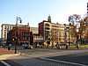
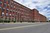
| 13 |
Court Square Historic District |
|
01974-05-02-0000May 2, 1974
(#74000370) |
Bounded by Main, State, Broadway, Pynchon Sts. and City HallPl.
42°06′02″N 72°35′22″W / 42.100556°N 72.589444°W / 42.100556; -72.589444 (Court Square Historic District) |
Springfield |
|
| 14 |
Cutler and Porter Block |
|
01983-02-24-0000February 24, 1983
(#83000744) |
109 Lyman St.
42°06′24″N 72°35′31″W / 42.106667°N 72.591944°W / 42.106667; -72.591944 (Cutler and Porter Block) |
Springfield |
|
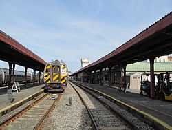
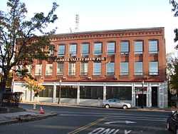
| 15 |
Downtown Springfield Railroad District |
|
01983-05-27-0000May 27, 1983
(#83000745) |
Roughly bounded by Lyman, Main, Murray, and Spring Sts.
42°06′31″N 72°35′25″W / 42.108611°N 72.590278°W / 42.108611; -72.590278 (Downtown Springfield Railroad District) |
Springfield |
|
| 16 |
Driscoll's Block |
|
01983-02-24-0000February 24, 1983
(#83000746) |
211-13 Worthington St.
42°06′14″N 72°35′33″W / 42.103889°N 72.5925°W / 42.103889; -72.5925 (Driscoll's Block) |
Springfield |
|
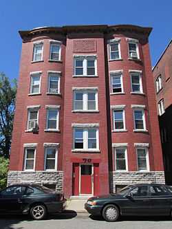
| 17 |
Ethel Apartment House |
|
01987-03-06-0000March 6, 1987
(#87000353) |
70 Patton St.
42°06′54″N 72°35′57″W / 42.115°N 72.599167°W / 42.115; -72.599167 (Ethel Apartment House) |
Springfield |
|
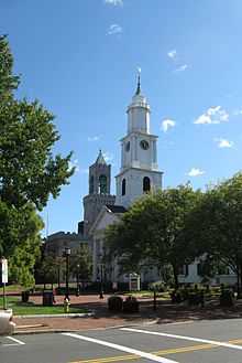
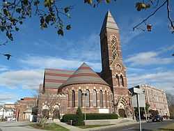
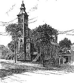
| 18 |
First Church of Christ, Congregational |
|
01972-02-01-0000February 1, 1972
(#72000135) |
50 Elm St.
42°06′03″N 72°35′23″W / 42.100833°N 72.589722°W / 42.100833; -72.589722 (First Church of Christ, Congregational) |
Springfield |
|
| 19 |
Fitzgerald's Stearns Square Block |
Upload image |
01983-02-24-0000February 24, 1983
(#83000747) |
300-308 Bridge St.
42°06′15″N 72°35′30″W / 42.104167°N 72.591667°W / 42.104167; -72.591667 (Fitzgerald's Stearns Square Block) |
Springfield |
Apparently demolished.
|
| 20 |
Forest Park Heights Historic District |
|
01982-08-31-0000August 31, 1982
(#82004942) |
Off MA 21
42°05′04″N 72°34′19″W / 42.084444°N 72.571944°W / 42.084444; -72.571944 (Forest Park Heights Historic District) |
Springfield |
|
| 21 |
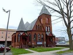
French Congregational Church |
|
01983-02-24-0000February 24, 1983
(#83004288) |
33-37 Bliss St.
42°05′58″N 72°35′16″W / 42.099444°N 72.587778°W / 42.099444; -72.587778 (French Congregational Church) |
Springfield |
|
| 22 |
Fuller Block |
|
01983-02-24-0000February 24, 1983
(#83000748) |
1531-1545 Main St.
42°06′12″N 72°35′33″W / 42.103333°N 72.5925°W / 42.103333; -72.5925 (Fuller Block) |
Springfield |
|
| 23 |
Guenther & Handel's Block |
|
01983-02-24-0000February 24, 1983
(#83000749) |
7-9 Stockbridge St.
42°06′02″N 72°35′11″W / 42.100556°N 72.586389°W / 42.100556; -72.586389 (Guenther & Handel's Block) |
Springfield |
|
| 24 |
Gunn and Hubbard Blocks |
|
01980-12-03-0000December 3, 1980
(#80000474) |
463-477 State St.
42°06′27″N 72°34′40″W / 42.1075°N 72.577778°W / 42.1075; -72.577778 (Gunn and Hubbard Blocks) |
Springfield |
|
| 25 |
Hampden County Courthouse |
|
01972-02-01-0000February 1, 1972
(#72000134) |
Elm St.
42°06′01″N 72°35′20″W / 42.100278°N 72.588889°W / 42.100278; -72.588889 (Hampden County Courthouse) |
Springfield |
|
| 26 |
Hampden Savings Bank |
|
01983-02-24-0000February 24, 1983
(#83000750) |
1665 Main St.
42°06′16″N 72°35′40″W / 42.104444°N 72.594444°W / 42.104444; -72.594444 (Hampden Savings Bank) |
Springfield |
|
| 27 |
Haynes Hotel Waters Building |
|
01983-02-24-0000February 24, 1983
(#83000751) |
1386-1402 Main St.
42°06′08″N 72°35′26″W / 42.102222°N 72.590556°W / 42.102222; -72.590556 (Haynes Hotel Waters Building) |
Springfield |
|
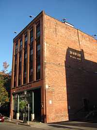
| 28 |
Henking Hotel and Cafe |
Upload image |
01983-02-24-0000February 24, 1983
(#83000752) |
15-21 Lyman St.
42°06′30″N 72°35′39″W / 42.108333°N 72.594167°W / 42.108333; -72.594167 (Henking Hotel and Cafe) |
Springfield |
Demolished.[6]
|
| 29 |
Hibernian Block |
Upload image |
01983-02-24-0000February 24, 1983
(#83000753) |
345-349 Worthington St.
42°06′21″N 72°35′26″W / 42.105833°N 72.590556°W / 42.105833; -72.590556 (Hibernian Block) |
Springfield |
Listed on register as "Hiberian Block"; building has been demolished.[7]
|
| 30 |
Hooker Apartments |
|
02013-07-29-0000July 29, 2013
(#13000596) |
2772-2786 Main & 7 Greenwich Sts.
42°06′58″N 72°36′25″W / 42.116175°N 72.606961°W / 42.116175; -72.606961 (Hooker Apartments) |
Springfield |
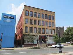
|
| 31 |
Indian Orchard Branch Library |
|
01999-02-26-0000February 26, 1999
(#99000258) |
44 Oak St.
42°09′33″N 72°30′17″W / 42.159167°N 72.504722°W / 42.159167; -72.504722 (Indian Orchard Branch Library) |
Springfield |
|
| 32 |
Kennedy-Worthington Blocks |
|
01979-06-14-0000June 14, 1979
(#79000347) |
1585-1623 Main St. and 166-190 Worthington St.
42°06′15″N 72°35′36″W / 42.104167°N 72.593333°W / 42.104167; -72.593333 (Kennedy-Worthington Blocks) |
Springfield |
|
| 33 |
Kenwyn Apartments |
|
01994-11-14-0000November 14, 1994
(#94001467) |
6 Kenwood Park and 413-415 Belmont Ave.
42°05′14″N 72°33′47″W / 42.087222°N 72.563056°W / 42.087222; -72.563056 (Kenwyn Apartments) |
Springfield |
|
| 34 |
Laurel Hall |
|
01987-03-06-0000March 6, 1987
(#87000355) |
72-74 Patton St.
42°06′36″N 72°35′53″W / 42.11°N 72.598°W / 42.11; -72.598 (Laurel Hall) |
Springfield |
|
| 35 |
Maple-Union Corners |
|
01976-04-26-0000April 26, 1976
(#76000243) |
77, 83, 76-78, 80-84 Maple St.
42°06′05″N 72°34′56″W / 42.101389°N 72.582222°W / 42.101389; -72.582222 (Maple-Union Corners) |
Springfield |
|
| 36 |
Masonic Temple |
|
01983-11-10-0000November 10, 1983
(#83003979) |
339-341 State St.
42°06′20″N 72°34′52″W / 42.105556°N 72.581111°W / 42.105556; -72.581111 (Masonic Temple) |
Springfield |
|
| 37 |
McIntosh Building |
|
01983-02-24-0000February 24, 1983
(#83000754) |
158-64 Chestnut St.
42°06′21″N 72°35′25″W / 42.105833°N 72.590278°W / 42.105833; -72.590278 (McIntosh Building) |
Springfield |
|
| 38 |
McKinney Building |
|
01983-02-24-0000February 24, 1983
(#83000755) |
1121-27 Main St.
42°06′00″N 72°35′10″W / 42.1°N 72.586111°W / 42.1; -72.586111 (McKinney Building) |
Springfield |
|
| 39 |
McKnight District |
|
01976-04-26-0000April 26, 1976
(#76000255) |
Roughly bounded by Penn Central, State St., the Armory, and includes both sides of Campus Pl., and Dartmouth St.
42°06′52″N 72°34′19″W / 42.114444°N 72.571944°W / 42.114444; -72.571944 (McKnight District) |
Springfield |
|
| 40 |
Memorial Square District |
|
01977-08-29-0000August 29, 1977
(#77000180) |
Main and Plainfield Sts.
42°06′37″N 72°36′10″W / 42.110278°N 72.602778°W / 42.110278; -72.602778 (Memorial Square District) |
Springfield |
|
| 41 |
Mills-Hale-Owen Blocks |
Upload image |
01985-10-31-0000October 31, 1985
(#85003424) |
959-991 Main St.
42°05′56″N 72°35′06″W / 42.098889°N 72.585°W / 42.098889; -72.585 (Mills-Hale-Owen Blocks) |
Springfield |
Apparently demolished.
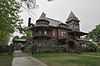
|
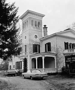
| 42 |
Mills-Stebbins Villa |
|
01973-10-15-0000October 15, 1973
(#73000299) |
3 Crescent Hill
42°05′27″N 72°34′41″W / 42.090833°N 72.578056°W / 42.090833; -72.578056 (Mills-Stebbins Villa) |
Springfield |
|
| 43 |
Milton-Bradley Company |
|
01983-02-24-0000February 24, 1983
(#83000756) |
Park, Cross, and Willow Sts.
42°06′01″N 72°35′01″W / 42.100278°N 72.583611°W / 42.100278; -72.583611 (Milton-Bradley Company) |
Springfield |
|
| 44 |
Morgan Block |
|
01983-05-27-0000May 27, 1983
(#83000757) |
313-333 Bridge St.
42°06′15″N 72°35′27″W / 42.104167°N 72.590833°W / 42.104167; -72.590833 (Morgan Block) |
Springfield |
|
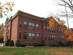
| 45 |
Myrtle Street School |
|
01985-01-03-0000January 3, 1985
(#85000024) |
64 Myrtle St.
42°09′30″N 72°30′25″W / 42.158333°N 72.506944°W / 42.158333; -72.506944 (Myrtle Street School) |
Springfield |
|
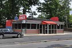
| 46 |
New Bay Diner Restaurant |
|
02003-12-04-0000December 4, 2003
(#03001244) |
950 Bay St.
42°07′51″N 72°33′17″W / 42.130833°N 72.554722°W / 42.130833; -72.554722 (New Bay Diner Restaurant) |
Springfield |
|
| 47 |
Olmsted-Hixon-Albion Block |
|
01983-02-24-0000February 24, 1983
(#83000758) |
1645-1659 Main St.
42°06′15″N 72°35′40″W / 42.104167°N 72.594444°W / 42.104167; -72.594444 (Olmsted-Hixon-Albion Block) |
Springfield |
|
| 48 |
Outing Park Historic District |
|
02012-03-07-0000March 7, 2012
(#12000068) |
Roughly bounded by Saratoga, Niagara, Oswego, & Bayoone Sts.
42°05′45″N 72°34′47″W / 42.095802°N 72.579773°W / 42.095802; -72.579773 (Outing Park Historic District) |
Springfield |
|
| 49 |
Patton and Loomis Block |
|
01983-02-24-0000February 24, 1983
(#83000759) |
1628-40 Main St.
42°06′14″N 72°35′40″W / 42.103889°N 72.594444°W / 42.103889; -72.594444 (Patton and Loomis Block) |
Springfield |
|
| 50 |
Patton Building |
|
01983-02-24-0000February 24, 1983
(#83000760) |
15-19 Hampden St.
42°06′13″N 72°35′40″W / 42.103611°N 72.594444°W / 42.103611; -72.594444 (Patton Building) |
Springfield |
|
| 51 |
Produce Exchange Building |
|
01983-02-24-0000February 24, 1983
(#83000761) |
194-206 Chestnut and 115-125 Lyman St.
42°06′25″N 72°35′30″W / 42.106944°N 72.591667°W / 42.106944; -72.591667 (Produce Exchange Building) |
Springfield |
|
| 52 |
Quadrangle-Mattoon Street Historic District |
|
01974-05-08-0000May 8, 1974
(#74000371) |
Bounded by Chestnut St. to the W, State St. to the S, and includes properties on Mattoon, Salem, Edwards and Elliot Sts.
42°06′16″N 72°35′10″W / 42.104444°N 72.586111°W / 42.104444; -72.586111 (Quadrangle-Mattoon Street Historic District) |
Springfield |
|
| 53 |
Radding Building |
|
01983-02-24-0000February 24, 1983
(#83000762) |
143-147 State St.
42°06′04″N 72°35′13″W / 42.101111°N 72.586944°W / 42.101111; -72.586944 (Radding Building) |
Springfield |
|
| 54 |
Republican Block |
|
01978-01-26-0000January 26, 1978
(#78000447) |
1365 Main St.
42°06′08″N 72°35′25″W / 42.102222°N 72.590278°W / 42.102222; -72.590278 (Republican Block) |
Springfield |
|
| 55 |
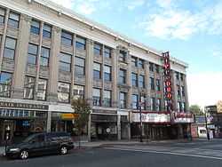
Julia Sanderson Theater |
|
01979-05-10-0000May 10, 1979
(#79000348) |
1676-1708 Main St.
42°06′14″N 72°35′44″W / 42.103889°N 72.595556°W / 42.103889; -72.595556 (Julia Sanderson Theater) |
Springfield |
|
| 56 |
Smith Carriage Company District |
|
01983-02-24-0000February 24, 1983
(#83000763) |
Bounded by Main, Peabody, Willow, and Park Sts.
42°06′00″N 72°35′05″W / 42.1°N 72.584722°W / 42.1; -72.584722 (Smith Carriage Company District) |
Springfield |
|
| 57 |
Smith's Building |
|
01983-02-24-0000February 24, 1983
(#83000764) |
201-207 Worthington St.
42°06′14″N 72°35′34″W / 42.103889°N 72.592778°W / 42.103889; -72.592778 (Smith's Building) |
Springfield |
|
| 58 |
South Congregational Church |
|
01976-04-30-0000April 30, 1976
(#76000245) |
45 Maple St.
42°06′08″N 72°35′01″W / 42.102222°N 72.583611°W / 42.102222; -72.583611 (South Congregational Church) |
Springfield |
|
| 59 |
South Main Street School |
|
01985-01-03-0000January 3, 1985
(#85000025) |
11 Acushnet Ave.
42°05′31″N 72°34′46″W / 42.091944°N 72.579444°W / 42.091944; -72.579444 (South Main Street School) |
Springfield |
|
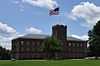
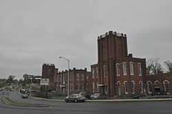
| 60 |
Springfield Armory National Historic Site |
|
01966-10-15-0000October 15, 1966
(#66000898) |
Armory Sq.
42°06′29″N 72°34′54″W / 42.108056°N 72.581667°W / 42.108056; -72.581667 (Springfield Armory National Historic Site) |
Springfield |
|
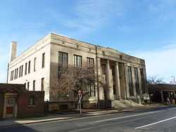
| 61 |
Springfield District Court |
|
01983-02-24-0000February 24, 1983
(#83000765) |
1600 E. Columbus Ave.
42°06′03″N 72°35′29″W / 42.100833°N 72.591389°W / 42.100833; -72.591389 (Springfield District Court) |
Springfield |
|
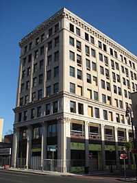
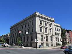
| 62 |
Springfield Fire & Marine Insurance Co. |
|
01983-02-24-0000February 24, 1983
(#83000766) |
195 State St.
42°06′06″N 72°35′11″W / 42.101667°N 72.586389°W / 42.101667; -72.586389 (Springfield Fire & Marine Insurance Co.) |
Springfield |
|
| 63 |
Springfield Safe Deposit and Trust Company |
|
02003-11-08-0000November 8, 2003
(#03001118) |
127-131 State St.
42°06′05″N 72°35′12″W / 42.101389°N 72.586667°W / 42.101389; -72.586667 (Springfield Safe Deposit and Trust Company) |
Springfield |
|
| 64 |
Springfield Steam Power Company Block |
|
01983-02-24-0000February 24, 1983
(#83000767) |
51-59 Taylor St.
42°06′18″N 72°35′33″W / 42.105°N 72.5925°W / 42.105; -72.5925 (Springfield Steam Power Company Block) |
Springfield |
|
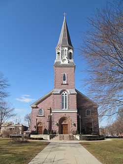
| 65 |
St. Joseph's Church |
|
01983-02-24-0000February 24, 1983
(#83002999) |
Howard St. and E. Columbus Ave.
42°05′52″N 72°35′16″W / 42.097778°N 72.587778°W / 42.097778; -72.587778 (St. Joseph's Church) |
Springfield |
Demolished in 2008.[8]
|
| 66 |
Stacy Building |
|
01983-05-27-0000May 27, 1983
(#83000768) |
41-43 Taylor St.
42°06′17″N 72°35′35″W / 42.104722°N 72.593056°W / 42.104722; -72.593056 (Stacy Building) |
Springfield |
|
| 67 |
State Armory |
|
01976-05-03-0000May 3, 1976
(#76000254) |
29 Howard St.
42°05′55″N 72°35′12″W / 42.098611°N 72.586667°W / 42.098611; -72.586667 (State Armory) |
Springfield |
|
| 68 |
Stearns Building |
|
01983-02-24-0000February 24, 1983
(#83000770) |
289-309 Bridge St.
42°06′14″N 72°35′28″W / 42.103889°N 72.591111°W / 42.103889; -72.591111 (Stearns Building) |
Springfield |
|
| 69 |
Trinity Block |
|
01983-02-24-0000February 24, 1983
(#83000771) |
266-84 Bridge St.
42°06′15″N 72°35′35″W / 42.104167°N 72.593056°W / 42.104167; -72.593056 (Trinity Block) |
Springfield |
|
| 70 |
Union Trust Company Building |
|
01978-01-09-0000January 9, 1978
(#78000448) |
1351 Main St.
42°06′08″N 72°35′22″W / 42.102222°N 72.589444°W / 42.102222; -72.589444 (Union Trust Company Building) |
Springfield |
|
| 71 |
United Electric Co. Building |
|
01983-02-24-0000February 24, 1983
(#83000772) |
73 State St.
42°06′00″N 72°35′18″W / 42.1°N 72.588333°W / 42.1; -72.588333 (United Electric Co. Building) |
Springfield |
|
| 72 |
Upper Worthington Historic District |
|
01983-03-31-0000March 31, 1983
(#83000773) |
Worthington, Federal, Summit and Armory Sts.
42°06′47″N 72°34′52″W / 42.113056°N 72.581111°W / 42.113056; -72.581111 (Upper Worthington Historic District) |
Springfield |
|
| 73 |
The Verona Apartments |
|
02009-11-05-0000November 5, 2009
(#09000882) |
1245-1255 Dwight St. and 6-10 Allendale St.
42°06′51″N 72°36′07″W / 42.114283°N 72.601931°W / 42.114283; -72.601931 (The Verona Apartments) |
Springfield |
|
| 74 |
W C A Boarding House |
|
01983-02-24-0000February 24, 1983
(#83000776) |
19 Bliss St.
42°05′59″N 72°35′14″W / 42.099722°N 72.587222°W / 42.099722; -72.587222 (W C A Boarding House) |
Springfield |
|
| 75 |
Walker Building |
|
01983-02-24-0000February 24, 1983
(#83000775) |
1228-1244 Main St.
42°06′03″N 72°35′17″W / 42.100833°N 72.588056°W / 42.100833; -72.588056 (Walker Building) |
Springfield |
|
| 76 |
Wason-Springfield Steam Power Blocks |
|
01979-06-19-0000June 19, 1979
(#79000349) |
27-43 Lyman St. and 26-50 Taylor St.
42°06′17″N 72°35′37″W / 42.104722°N 72.593611°W / 42.104722; -72.593611 (Wason-Springfield Steam Power Blocks) |
Springfield |
|
| 77 |
Water Shops Armory |
|
01980-12-03-0000December 3, 1980
(#80000476) |
1 Allen St.
42°05′43″N 72°33′48″W / 42.095278°N 72.563333°W / 42.095278; -72.563333 (Water Shops Armory) |
Springfield |
|
| 78 |
Wells Block |
|
01983-02-24-0000February 24, 1983
(#83000777) |
250-264 Worthington St.
42°06′18″N 72°35′35″W / 42.105°N 72.593056°W / 42.105; -72.593056 (Wells Block) |
Springfield |
|
| 79 |
Whitcomb Warehouse |
|
01983-02-24-0000February 24, 1983
(#83004291) |
32-34 Hampden St.
42°06′13″N 72°35′44″W / 42.103611°N 72.595556°W / 42.103611; -72.595556 (Whitcomb Warehouse) |
Springfield |
|
| 80 |
Willy's Overland Block |
|
01983-02-24-0000February 24, 1983
(#83000778) |
151-157 Chestnut and 10-20 Winter Sts.
42°06′21″N 72°35′24″W / 42.105833°N 72.59°W / 42.105833; -72.59 (Willy's Overland Block) |
Springfield |
|
| 81 |
Winchester Square Historic District |
|
01979-05-10-0000May 10, 1979
(#79000350) |
U.S. 20
42°06′38″N 72°33′45″W / 42.110556°N 72.5625°W / 42.110556; -72.5625 (Winchester Square Historic District) |
Springfield |
|
| 82 |
Worthy Hotel |
|
01983-02-24-0000February 24, 1983
(#83000779) |
1571 Main St.
42°06′13″N 72°35′34″W / 42.103611°N 72.592778°W / 42.103611; -72.592778 (Worthy Hotel) |
Springfield |
|