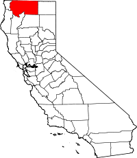
National Register of Historic Places listings in Siskiyou County, California
This list includes properties and districts listed on the National Register of Historic Places in Siskiyou County, California. Click the "Map of all coordinates" link to the right to view a Google map of all properties and districts with latitude and longitude coordinates in the table below.[1]
-
- This National Park Service list is complete through NPS recent listings posted May 1, 2015.[2]
| [3] | Name on the Register[4] | Image | Date listed[5] | Location | City or town | Description |
|---|---|---|---|---|---|---|
| 1 | Captain Jack's Stronghold | 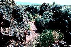 |
(#73000259) |
S of Tulelake, Lava Beds National Monument 41°49′18″N 121°30′18″W / 41.821667°N 121.505°W |
Tulelake | |
| 2 | Dunsmuir Historic Commercial District | 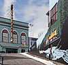 |
(#82000993) |
Roughly bounded by Sacramento and Shasta Aves., Spruce and Cedar Sts. (both sides) 41°12′37″N 122°16′16″W / 41.210278°N 122.271111°W |
Dunsmuir | |
| 3 | Edgewood Store | 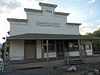 |
(#04000140) |
24505 Edgewood Rd. 41°27′28″N 122°25′52″W / 41.457778°N 122.431111°W |
Edgewood | |
| 4 | Lewis Falkenstein House | 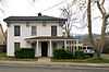 |
(#79000554) |
401 S. Gold Street 41°43′48″N 122°38′30″W / 41.73°N 122.641667°W |
Yreka | |
| 5 | Forest House | Upload image | (#11000433) |
4204 California State Route 3 41°40′31″N 122°41′02″W / 41.675278°N 122.683889°W |
Yreka vicinity | |
| 6 | Fort Jones House | 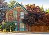 |
(#76000533) |
Main St. 41°36′19″N 122°50′28″W / 41.605278°N 122.841111°W |
Fort Jones | |
| 7 | William Harlow Cabin | Upload image | (#91000699) |
Elliot Cr. Rd. No. 1050, 1 mi. from Joe Bar Subdivision 41°59′59″N 123°06′04″W / 41.999722°N 123.101111°W |
Seiad Valley | |
| 8 | Hospital Rock Army Camp Site | 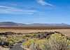 |
(#73000227) |
S of Tulelake, Lava Beds National Monument 41°49′45″N 121°28′31″W / 41.829167°N 121.475278°W |
Tulelake | |
| 9 | Hotel Macdoel | Upload image | (#82002275) |
Montezuma Ave. and Mt. Shasta St. 41°49′43″N 122°00′10″W / 41.828611°N 122.002778°W |
Macdoel | |
| 10 | Lava Beds National Monument Archeological District | 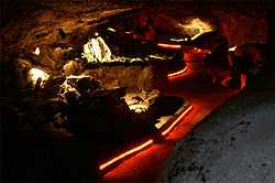 |
(#75002182) |
Address Restricted |
Tulelake | |
| 11 | Lower Klamath National Wildlife Refuge | 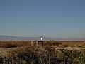 |
(#66000238) |
Lower Klamath Lake, E of Dorris (see also Klamath County, Oregon) 41°56′48″N 121°39′53″W / 41.946667°N 121.664722°W |
Dorris | This national wildlife refuge, established in 1908, was the first large block of public land set aside for wildlife management purposes. Because of the refuge's extensive overlap with the Klamath Basin water reclamation project, it has become an ongoing example of the tensions between conservation and economic demands in public land management.[6] |
| 12 | McCloud | 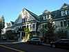 |
(#90000444) |
Roughly bounded by Columbero Dr., Main St., W. Minnesota Ave., and Lawndale Ct. 41°15′16″N 122°08′18″W / 41.254444°N 122.138333°W |
McCloud | |
| 13 | Sawyers Bar Catholic Church | 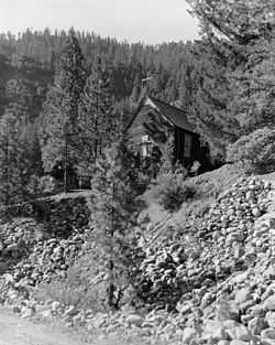 |
(#78000792) |
Klamath National Forest 41°18′03″N 123°08′10″W / 41.300833°N 123.136111°W |
Sawyers Bar | |
| 14 | Shasta Inn and Weed Lumber Company Boarding House | 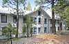 |
(#80000869) |
829 and 877 N. Davis St. 41°25′53″N 122°22′48″W / 41.431389°N 122.38°W |
Weed | |
| 15 | Thomas-Wright Battle Site | Upload image | (#78000366) |
S of Tulelake in Lava Beds National Monument 41°46′13″N 121°31′25″W / 41.770278°N 121.523611°W |
Tulelake | |
| 16 | West Miner Street-Third Street Historic District | 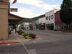 |
(#72000258) |
102-402 W. Miner St. and 122-419 3rd St. 41°44′01″N 122°38′07″W / 41.733611°N 122.635278°W |
Yreka | |
| 17 | White's Gulch Arrastra | Upload image | (#78000793) |
E of Swayers Bar 41°16′53″N 123°04′31″W / 41.281389°N 123.075278°W |
Sawyers Bar | |
| 18 | Yreka Carnegie Library | 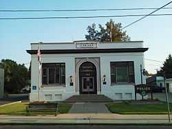 |
(#92000270) |
412 W. Miner St. 41°43′57″N 122°38′17″W / 41.7325°N 122.638056°W |
Yreka |
See also
| Wikimedia Commons has media related to National Register of Historic Places in Siskiyou County, California. |
- National Register of Historic Places listings in California
- List of National Historic Landmarks in California
- California Historical Landmarks in Siskiyou County, California
References
- ↑ The latitude and longitude information provided in this table was derived originally from the National Register Information System, which has been found to be fairly accurate for about 99% of listings. For about 1% of NRIS original coordinates, experience has shown that one or both coordinates are typos or otherwise extremely far off; some corrections may have been made. A more subtle problem causes many locations to be off by up to 150 yards, depending on location in the country: most NRIS coordinates were derived from tracing out latitude and longitudes off of USGS topographical quadrant maps created under the North American Datum of 1927, which differs from the current, highly accurate WGS84 GPS system used by most on-line maps. Chicago is about right, but NRIS longitudes in Washington are higher by about 4.5 seconds, and are lower by about 2.0 seconds in Maine. Latitudes differ by about 1.0 second in Florida. Some locations in this table may have been corrected to current GPS standards.
- ↑ "National Register of Historic Places: Weekly List Actions". National Park Service, United States Department of the Interior. Retrieved on May 1, 2015.
- ↑ Numbers represent an ordering by significant words. Various colorings, defined here, differentiate National Historic Landmarks and historic districts from other NRHP buildings, structures, sites or objects.
- ↑ "National Register Information System". National Register of Historic Places. National Park Service. 2008-04-24.
- ↑ The eight-digit number below each date is the number assigned to each location in the National Register Information System database, which can be viewed by clicking the number.
- ↑ National Park Service. "National Historic Landmark Program: NHL Database". Retrieved February 19, 2012.
| ||||||||||||||||||||||||||
| |||||||||||||||||||||||||||||||||