National Register of Historic Places listings in Shelby County, Ohio
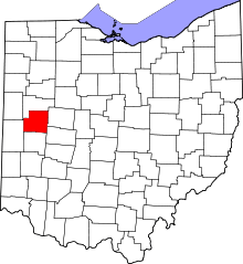
Location of Shelby County in Ohio
This is a list of the National Register of Historic Places listings in Shelby County, Ohio.
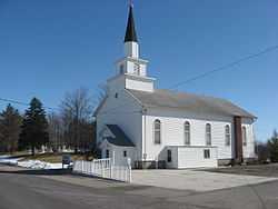
This is intended to be a complete list of the properties and districts on the National Register of Historic Places in Shelby County, Ohio, United States. The locations of National Register properties and districts for which the latitude and longitude coordinates are included below, may be seen in a Google map.[1]
There are 19 properties and districts listed on the National Register in the county, including 1 National Historic Landmark. Another property was once listed but has been removed.
- This National Park Service list is complete through NPS recent listings posted May 1, 2015.[2]
Current listings
| [3] |
Name on the Register[4] |
Image |
Date listed[5] |
Location |
City or town |
Description |
|---|
| 1 |
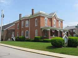
Anna Town Hall |
|
01978-09-20-0000September 20, 1978
(#78002187) |
209 W. Main St.[6]
40°23′41″N 84°10′33″W / 40.394722°N 84.175833°W / 40.394722; -84.175833 (Anna Town Hall) |
Anna |
|
| 2 |
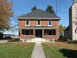
Botkins Elementary School |
|
01979-07-26-0000July 26, 1979
(#79002851) |
Main St.
40°28′08″N 84°10′57″W / 40.468889°N 84.1825°W / 40.468889; -84.1825 (Botkins Elementary School) |
Botkins |
|
| 3 |
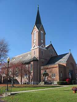
Emanuel Lutheran Church of Montra |
|
01982-05-13-0000May 13, 1982
(#82003640) |
Montra Rd. in Montra
40°25′54″N 84°05′35″W / 40.431667°N 84.093056°W / 40.431667; -84.093056 (Emanuel Lutheran Church of Montra) |
Jackson Township |
|
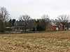
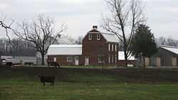
| 4 |
Fulton Farm |
|
01979-05-08-0000May 8, 1979
(#79001947) |
804 S. Brooklyn Ave.
40°16′34″N 84°08′55″W / 40.276111°N 84.148611°W / 40.276111; -84.148611 (Fulton Farm) |
Sidney |
|
| 5 |
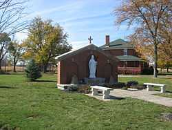
Immaculate Conception Rectory at Botkins |
|
01979-07-26-0000July 26, 1979
(#79002876) |
116 N. Mill St.
40°28′09″N 84°10′28″W / 40.469167°N 84.174444°W / 40.469167; -84.174444 (Immaculate Conception Rectory at Botkins) |
Botkins |
|
| 6 |
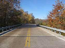
Lockington Covered Bridge |
|
01975-06-10-0000June 10, 1975
(#75001532) |
1 mile east of Lockington on State Route 132
40°12′36″N 84°12′53″W / 40.21°N 84.214722°W / 40.21; -84.214722 (Lockington Covered Bridge) |
Orange and Washington Townships |
Burned circa 1989[7]
|
| 7 |
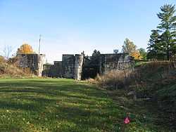
Lockington Locks Historical Area |
|
01969-12-17-0000December 17, 1969
(#69000147) |
Miami and Erie Canal between Lockington and Washington Township
40°12′34″N 84°14′38″W / 40.209444°N 84.243889°W / 40.209444; -84.243889 (Lockington Locks Historical Area) |
Lockington and Washington Township |
Extends into Washington Township in Miami County
|
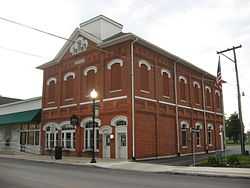
| 8 |
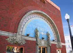
People's Federal Savings and Loan Association |
|
01972-06-05-0000June 5, 1972
(#72001042) |
101 E. Court St.
40°17′02″N 84°09′24″W / 40.283889°N 84.156667°W / 40.283889; -84.156667 (People's Federal Savings and Loan Association) |
Sidney |
Designed by Louis Sullivan, 1917; still an operating thrift
|
| 9 |
Port Jefferson School |
|
01982-06-02-0000June 2, 1982
(#82003641) |
Wall and Spring Sts.
40°19′48″N 84°05′33″W / 40.33°N 84.0925°W / 40.33; -84.0925 (Port Jefferson School) |
Port Jefferson |
|
| 10 |
Sacred Heart of Jesus Rectory |
|
01979-07-26-0000July 26, 1979
(#79002874) |
State Routes 29 and 119 at McCartyville
40°23′42″N 84°15′17″W / 40.395093°N 84.254609°W / 40.395093; -84.254609 (Sacred Heart of Jesus Rectory) |
Van Buren Township |
|
| 11 |
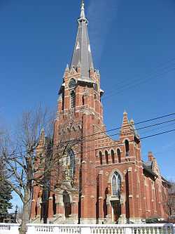
St. Michael Catholic Church Complex |
|
01979-07-26-0000July 26, 1979
(#79002825) |
State Route 705 east of State Route 66
40°21′05″N 84°22′19″W / 40.351389°N 84.371944°W / 40.351389; -84.371944 (St. Michael Catholic Church Complex) |
Fort Loramie |
|
| 12 |
St. Patrick Catholic Church and Rectory |
|
01979-07-26-0000July 26, 1979
(#79002836) |
Hoying and Wright-Puthoff Rds. in St. Patrick
40°22′13″N 84°17′19″W / 40.370278°N 84.288611°W / 40.370278; -84.288611 (St. Patrick Catholic Church and Rectory) |
Van Buren Township |
|
| 13 |
St. Remy Catholic Church |
|
01979-07-26-0000July 26, 1979
(#79002834) |
Main St. and Russia-Versailles Rd.
40°14′01″N 84°24′53″W / 40.233522°N 84.414792°W / 40.233522; -84.414792 (St. Remy Catholic Church) |
Russia |
|
| 14 |
Shelby House |
|
01978-12-08-0000December 8, 1978
(#78002188) |
403 W. State St.
40°28′02″N 84°11′13″W / 40.467222°N 84.186944°W / 40.467222; -84.186944 (Shelby House) |
Botkins |
|
| 15 |
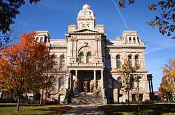
Sidney Courthouse Square Historic District |
|
01980-09-27-0000September 27, 1980
(#80003232) |
Roughly bounded by North and South Sts. and West and Miami Aves.
40°17′06″N 84°09′21″W / 40.285°N 84.155833°W / 40.285; -84.155833 (Sidney Courthouse Square Historic District) |
Sidney |
|
| 16 |
Sidney Walnut Avenue Historic District |
|
01983-12-29-0000December 29, 1983
(#83004338) |
Walnut Ave. from Poplar to Michigan Sts., and 228, 228½, and 238 W. North St.
40°17′12″N 84°09′37″W / 40.286667°N 84.160278°W / 40.286667; -84.160278 (Sidney Walnut Avenue Historic District) |
Sidney |
|
| 17 |
Sidney Waterworks and Electric Light Building |
|
01978-12-29-0000December 29, 1978
(#78002190) |
121 N. Brooklyn Ave.
40°17′07″N 84°08′56″W / 40.285347°N 84.149°W / 40.285347; -84.149 (Sidney Waterworks and Electric Light Building) |
Sidney |
|
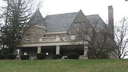
| 18 |
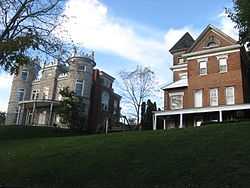
Whitby Mansion |
|
01976-12-12-0000December 12, 1976
(#76001526) |
429 N. Ohio Ave.
40°17′26″N 84°09′26″W / 40.290556°N 84.157222°W / 40.290556; -84.157222 (Whitby Mansion) |
Sidney |
|
| 19 |
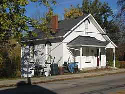
Wilson-Lenox House |
|
01980-03-27-0000March 27, 1980
(#80003233) |
West of Sidney at 9804 Houston Rd.
40°15′21″N 84°14′55″W / 40.255833°N 84.248611°W / 40.255833; -84.248611 (Wilson-Lenox House) |
Washington Township |
|
Former listing
See also
References
- ↑ The latitude and longitude information provided in this table was derived originally from the National Register Information System, which has been found to be fairly accurate for about 99% of listings. For about 1% of NRIS original coordinates, experience has shown that one or both coordinates are typos or otherwise extremely far off; some corrections may have been made. A more subtle problem causes many locations to be off by up to 150 yards, depending on location in the country: most NRIS coordinates were derived from tracing out latitude and longitudes off of USGS topographical quadrant maps created under the North American Datum of 1927, which differs from the current, highly accurate WGS84 GPS system used by most on-line maps. Chicago is about right, but NRIS longitudes in Washington are higher by about 4.5 seconds, and are lower by about 2.0 seconds in Maine. Latitudes differ by about 1.0 second in Florida. Some locations in this table may have been corrected to current GPS standards.
- ↑ "National Register of Historic Places: Weekly List Actions". National Park Service, United States Department of the Interior. Retrieved on May 1, 2015.
- ↑ 3.0 3.1 Numbers represent an ordering by significant words. Various colorings, defined here, differentiate National Historic Landmarks and historic districts from other NRHP buildings, structures, sites or objects.
- ↑ "National Register Information System". National Register of Historic Places. National Park Service. 2008-04-24.
- ↑ The eight-digit number below each date is the number assigned to each location in the National Register Information System database, which can be viewed by clicking the number.
- ↑ Contact Us, Village of Anna. Accessed 2009-06-11.
- ↑ Sayre, Jim. Long-Gone Bridge Remains on National Register of Historic Places, Shelby County Ohio Historical Society, August 1998. Accessed 2009-06-11.
|
|---|
| | Lists by county | | |
|---|
| | Lists by city | |
|---|
| | Other lists | |
|---|
| |
|