| [3] |
Name on the Register |
Image |
Date listed[4] |
Location |
City or town |
Description |
|---|
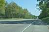
| 1 |
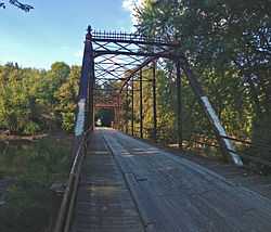
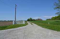
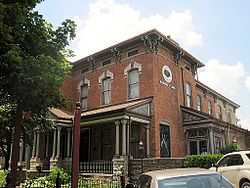
Bolivia Road Bridge |
|
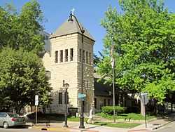
02004-01-28-0000January 28, 2004
(#03001464) |
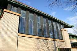
Across the North Fork of the Sangamon River
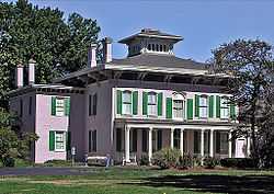
39°46′03″N 89°20′44″W / 39.767500°N 89.345556°W / 39.767500; -89.345556 (Bolivia Road Bridge) |
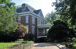
Bolivia |
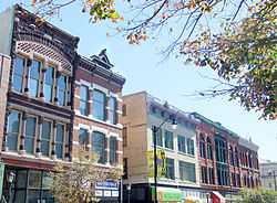
Extends into Christian County
|
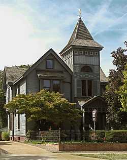
| 2 |
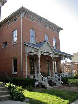
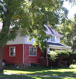
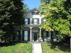
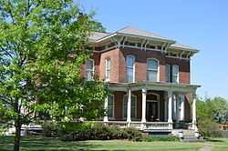
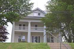
H. P. Boult House |
|
01982-06-03-0000June 3, 1982
(#82002598) |
1123 S. 2nd St.
39°47′18″N 89°39′13″W / 39.788333°N 89.653611°W / 39.788333; -89.653611 (H. P. Boult House) |
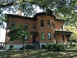
Springfield |
|
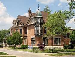
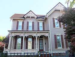
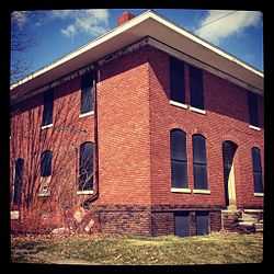
| 3 |
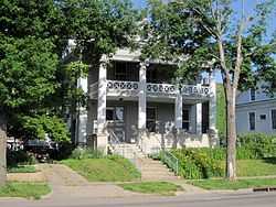
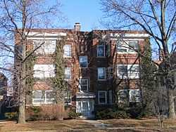
Bressmer-Baker House |
|
01982-06-29-0000June 29, 1982
(#82002599) |
913 6th St.
39°47′30″N 89°38′54″W / 39.791667°N 89.648333°W / 39.791667; -89.648333 (Bressmer-Baker House) |
Springfield |
|
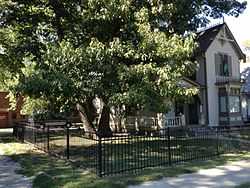
| 4 |
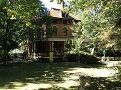
John F. Bretz House and Warehouse |
|
02000-08-10-0000August 10, 2000
(#00000945) |
1113 N. Fifth St.
39°48′50″N 89°38′58″W / 39.813889°N 89.649444°W / 39.813889; -89.649444 (John F. Bretz House and Warehouse) |
Springfield |
|
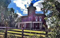
| 5 |
George M. Brinkerhoff House |
|
01978-12-18-0000December 18, 1978
(#78001186) |
1500 N. 5th St.
39°49′16″N 89°38′54″W / 39.821111°N 89.648333°W / 39.821111; -89.648333 (George M. Brinkerhoff House) |
Springfield |
|
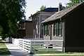
| 6 |
Brunk Farmstead |
Upload image |
01999-12-17-0000December 17, 1999
(#99001569) |
KOA Campground Rd., 1 mile south of E. Lake Dr.
39°41′51″N 89°35′12″W / 39.697500°N 89.586667°W / 39.697500; -89.586667 (Brunk Farmstead) |
Rochester |
|
| 7 |
Caldwell Farmstead |
|
01984-08-16-0000August 16, 1984
(#84001145) |
Illinois Route 4
39°42′09″N 89°42′21″W / 39.702500°N 89.705833°W / 39.702500; -89.705833 (Caldwell Farmstead) |
Chatham |
|
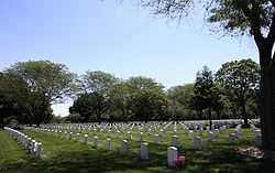
| 8 |
Camp Butler National Cemetery |
|
01997-08-15-0000August 15, 1997
(#97000891) |
5063 Camp Butler Rd.
39°49′58″N 89°33′21″W / 39.832778°N 89.555833°W / 39.832778; -89.555833 (Camp Butler National Cemetery) |
Springfield |
|
| 9 |
Camp Lincoln Commissary Building |
|
01984-11-13-0000November 13, 1984
(#84000333) |
1301 N. MacArthur Boulevard
39°49′15″N 89°40′08″W / 39.820833°N 89.668889°W / 39.820833; -89.668889 (Camp Lincoln Commissary Building) |
Springfield |
|
| 10 |
Central Springfield Historic District |
|
01978-08-29-0000August 29, 1978
(#78001187) |
Roughly bounded by 14th, 7th, Jefferson, and Washington Sts.; also 6th St. from Capitol to Monroe St.
39°48′01″N 89°38′56″W / 39.800278°N 89.648889°W / 39.800278; -89.648889 (Central Springfield Historic District) |
Springfield |
Second set of boundaries represents a boundary increase of 01986-11-19-0000November 19, 1986
|
| 11 |
Christ Episcopal Church |
|
01980-09-12-0000September 12, 1980
(#80001410) |
611 E. Jackson St.
39°47′50″N 89°38′51″W / 39.797222°N 89.647500°W / 39.797222; -89.647500 (Christ Episcopal Church) |
Springfield |
|
| 12 |
Clayville Tavern |
Upload image |
01973-05-08-0000May 8, 1973
(#73000718) |
0.5 miles southeast of Pleasant Plains on Illinois Route 125
39°52′00″N 89°53′49″W / 39.866667°N 89.896944°W / 39.866667; -89.896944 (Clayville Tavern) |
Pleasant Plains |
|
| 13 |
Susan Lawrence Dana House |
|
01974-07-30-0000July 30, 1974
(#74000774) |
301 Lawrence Ave.
39°47′39″N 89°39′05″W / 39.794167°N 89.651389°W / 39.794167; -89.651389 (Susan Lawrence Dana House) |
Springfield |
|
| 14 |
Edwards Place |
|
01969-12-17-0000December 17, 1969
(#69000058) |
700 N. 4th St.
39°48′34″N 89°39′01″W / 39.809444°N 89.650278°W / 39.809444; -89.650278 (Edwards Place) |
Springfield |
|
| 15 |
Executive Mansion |
|
01976-07-19-0000July 19, 1976
(#76000728) |
4th and Jackson Sts.
39°47′48″N 89°39′00″W / 39.796667°N 89.650000°W / 39.796667; -89.650000 (Executive Mansion) |
Springfield |
|
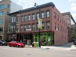
| 16 |
Fisher Building-Latham Block |
|
02000-04-28-0000April 28, 2000
(#00000411) |
111, 113, and 115 N. 6th St.
39°48′08″N 89°38′53″W / 39.802167°N 89.648084°W / 39.802167; -89.648084 (Fisher Building-Latham Block) |
Springfield |
|
| 17 |
Cornelius Flagg Farmstead |
|
01993-02-03-0000February 3, 1993
(#92001848) |
Tipton School Rd., 0.4 miles (0.64 km) west of Interstate 55 Business and 0.4 miles south of Andrew Rd.
39°53′27″N 89°36′57″W / 39.890833°N 89.615833°W / 39.890833; -89.615833 (Cornelius Flagg Farmstead) |
Sherman |
|
| 18 |
Clarkson W. Freeman House |
|
01980-09-29-0000September 29, 1980
(#80001411) |
704 W. Monroe St.
39°47′57″N 89°39′49″W / 39.799167°N 89.663611°W / 39.799167; -89.663611 (Clarkson W. Freeman House) |
Springfield |
|
| 19 |
Hugh M. Garvey House |
Upload image |
02009-11-10-0000November 10, 2009
(#09000898) |
8 Fair Oaks Dr.
39°46′54″N 89°41′13″W / 39.781736°N 89.687014°W / 39.781736; -89.687014 (Hugh M. Garvey House) |
Leland Grove |
|
| 20 |
Fred Gottschalk Grocery Store |
|
01985-03-18-0000March 18, 1985
(#85000607) |
301 W. Edwards St.
39°47′47″N 89°39′28″W / 39.796389°N 89.657778°W / 39.796389; -89.657778 (Fred Gottschalk Grocery Store) |
Springfield |
|
| 21 |
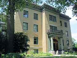
Cong. James M. Graham House |
|
01989-05-01-0000May 1, 1989
(#89000342) |
413 S. 7th St.
39°47′52″N 89°38′48″W / 39.797778°N 89.646667°W / 39.797778; -89.646667 (Cong. James M. Graham House) |
Springfield |
|
| 22 |
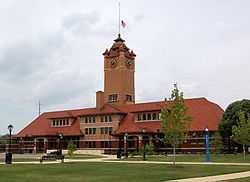
Great Western Railroad Depot |
|
02014-08-25-0000August 25, 2014
(#14000510) |
930 E. Monroe St.
39°47′57″N 89°38′33″W / 39.799268°N 89.6424°W / 39.799268; -89.6424 (Great Western Railroad Depot) |
Springfield |
|
| 23 |
Heimberger House |
Upload image |
02014-04-21-0000April 21, 2014
(#14000154) |
653-655 W. Vine St.
39°47′18″N 89°39′55″W / 39.788333°N 89.665278°W / 39.788333; -89.665278 (Heimberger House) |
Springfield |
|
| 24 |
Hickox Apartments |
|
01984-11-13-0000November 13, 1984
(#84000337) |
4th and Cook Sts.
39°47′43″N 89°39′04″W / 39.795278°N 89.651111°W / 39.795278; -89.651111 (Hickox Apartments) |
Springfield |
|
| 25 |
Virgil Hickox House |
|
01982-03-05-0000March 5, 1982
(#82002600) |
518 E. Capitol Ave.
39°47′53″N 89°38′55″W / 39.798056°N 89.648611°W / 39.798056; -89.648611 (Virgil Hickox House) |
Springfield |
|
| 26 |
Elijah Iles House |
|
01978-02-23-0000February 23, 1978
(#78001188) |
628 S. 7th St.
39°47′43″N 89°38′47″W / 39.795139°N 89.646389°W / 39.795139; -89.646389 (Elijah Iles House) |
Springfield |
|
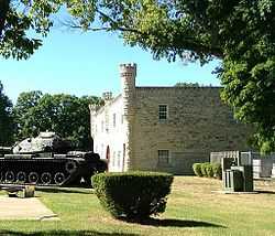
| 27 |
Illinois Department of Mines and Minerals-Springfield Mine Rescue Station |
|
01985-07-05-0000July 5, 1985
(#85001481) |
609 Princeton Ave.
39°46′29″N 89°38′53″W / 39.774722°N 89.648056°W / 39.774722; -89.648056 (Illinois Department of Mines and Minerals-Springfield Mine Rescue Station) |
Springfield |
|
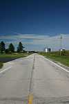
| 28 |
Illinois Route 4-North of Auburn |
|
01998-08-06-0000August 6, 1998
(#98000979) |
Curran and Snell Rd.
39°37′01″N 89°44′48″W / 39.616944°N 89.746667°W / 39.616944; -89.746667 (Illinois Route 4-North of Auburn) |
Auburn |
|
| 29 |
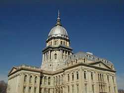
Illinois State Capitol |
|
01985-11-21-0000November 21, 1985
(#85003178) |
Capitol Ave. and 2nd St.
39°47′54″N 89°39′16″W / 39.798333°N 89.654444°W / 39.798333; -89.654444 (Illinois State Capitol) |
Springfield |
|
| 30 |
Illinois State Fairgrounds |
|
01990-05-14-0000May 14, 1990
(#90000720) |
Junction of Sangamon Ave. and Peoria Rd.
39°50′11″N 89°38′27″W / 39.836389°N 89.640833°W / 39.836389; -89.640833 (Illinois State Fairgrounds) |
Springfield |
|
| 31 |
Jennings Ford Automobile Dealership |
|
02006-05-31-0000May 31, 2006
(#06000450) |
431 S. 4th St.
39°47′51″N 89°39′04″W / 39.797500°N 89.651111°W / 39.797500; -89.651111 (Jennings Ford Automobile Dealership) |
Springfield |
|
| 32 |
Alvin S. Keys House |
Upload image |
01994-05-06-0000May 6, 1994
(#94000432) |
1600 Park Dr.
39°46′55″N 89°41′03″W / 39.781944°N 89.684167°W / 39.781944; -89.684167 (Alvin S. Keys House) |
Leland Grove |
|
| 33 |
Lazy A Motel |
|
01994-11-08-0000November 8, 1994
(#94001268) |
2840 Peoria Rd.
39°50′21″N 89°37′59″W / 39.839167°N 89.633056°W / 39.839167; -89.633056 (Lazy A Motel) |
Springfield |
|
| 34 |
John L. Lewis House |
|
01979-09-10-0000September 10, 1979
(#79000867) |
1132 W. Lawrence Ave.
39°47′38″N 89°40′22″W / 39.793889°N 89.672778°W / 39.793889; -89.672778 (John L. Lewis House) |
Springfield |
|
| 35 |
Lincoln Colored Home |
|
01998-08-06-0000August 6, 1998
(#98000985) |
427 S. 12th St.
39°47′51″N 89°38′23″W / 39.7975000°N 89.639722°W / 39.7975000; -89.639722 (Lincoln Colored Home) |
Springfield |
|
| 36 |
Lincoln Home National Historic Site |
|
01971-08-18-0000August 18, 1971
(#71000076) |
8th and Jackson Sts.
39°47′50″N 89°38′41″W / 39.797222°N 89.644722°W / 39.797222; -89.644722 (Lincoln Home National Historic Site) |
Springfield |
|
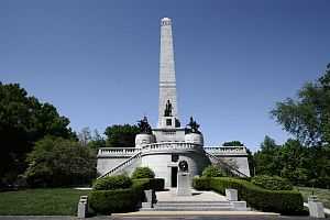
| 37 |
Lincoln Tomb |
|
01966-10-15-0000October 15, 1966
(#66000330) |
Oak Ridge Cemetery
39°49′23″N 89°39′23″W / 39.823056°N 89.656389°W / 39.823056; -89.656389 (Lincoln Tomb) |
Springfield |
|
| 38 |
Abraham Lincoln Memorial Garden |
Upload image |
01992-08-12-0000August 12, 1992
(#92001016) |
2301 E. Lake Dr.
39°41′51″N 89°35′46″W / 39.697500°N 89.596111°W / 39.697500; -89.596111 (Abraham Lincoln Memorial Garden) |
Springfield |
|
| 39 |
Vachel Lindsay House |
|
01971-11-11-0000November 11, 1971
(#71000297) |
603 S. 5th St.
39°47′45″N 89°38′59″W / 39.795833°N 89.649722°W / 39.795833; -89.649722 (Vachel Lindsay House) |
Springfield |
|
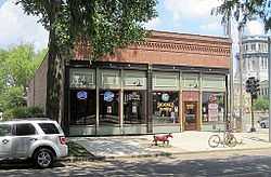
| 40 |
Maid-Rite Sandwich Shop |
|
01984-08-16-0000August 16, 1984
(#84001146) |
118 N. Pasfield St.
39°48′09″N 89°39′30″W / 39.802500°N 89.658333°W / 39.802500; -89.658333 (Maid-Rite Sandwich Shop) |
Springfield |
|
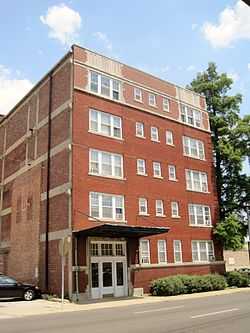
| 41 |
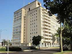
Bell Miller Apartments |
|
01995-11-07-0000November 7, 1995
(#95001242) |
835 S. 2nd St.
39°47′33″N 89°39′14″W / 39.792500°N 89.653889°W / 39.792500; -89.653889 (Bell Miller Apartments) |
Springfield |
|
| 42 |
Joseph Miller House |
Upload image |
01980-11-24-0000November 24, 1980
(#80001408) |
Buckhart Rd.
39°45′26″N 89°28′28″W / 39.757361°N 89.474444°W / 39.757361; -89.474444 (Joseph Miller House) |
Rochester |
|
| 43 |
Oak Ridge Cemetery |
|
01995-08-04-0000August 4, 1995
(#95000986) |
1441 Monument Ave.
39°49′25″N 89°39′28″W / 39.823611°N 89.657778°W / 39.823611; -89.657778 (Oak Ridge Cemetery) |
Springfield |
|
| 44 |
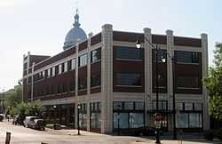
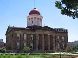
Old State Capitol |
|
01966-10-15-0000October 15, 1966
(#66000331) |
Bounded by 5th, 6th, Adams, and Washington Sts.
39°48′04″N 89°38′53″W / 39.801111°N 89.648056°W / 39.801111; -89.648056 (Old State Capitol) |
Springfield |
|
| 45 |
Power Farmstead |
|
01989-05-01-0000May 1, 1989
(#89000341) |
County Road 9500N, 0.5 miles east of Cantrall
39°56′39″N 89°39′45″W / 39.944167°N 89.662500°W / 39.944167; -89.662500 (Power Farmstead) |
Cantrall |
|
| 46 |
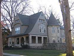
Price-Prather House |
|
01991-05-13-0000May 13, 1991
(#91000574) |
Junction of Main and Elkhart Sts.
39°57′17″N 89°32′47″W / 39.954722°N 89.546389°W / 39.954722; -89.546389 (Price-Prather House) |
Williamsville |
|
| 47 |
Price/Wheeler House |
|
01985-02-14-0000February 14, 1985
(#85000269) |
618 S. 7th St.
39°47′43″N 89°38′46″W / 39.795278°N 89.646111°W / 39.795278; -89.646111 (Price/Wheeler House) |
Springfield |
|
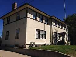
| 48 |
Rippon-Kinsella House |
|
01992-02-27-0000February 27, 1992
(#92000073) |
1317 N. Third St.
39°49′01″N 89°39′06″W / 39.816944°N 89.651667°W / 39.816944; -89.651667 (Rippon-Kinsella House) |
Springfield |
|
| 49 |
Joseph Ross House |
Upload image |
02006-03-02-0000March 2, 2006
(#06000092) |
5200 Passfield Rd.
39°43′41″N 89°26′04″W / 39.728056°N 89.434444°W / 39.728056; -89.434444 (Joseph Ross House) |
Rochester |
|
| 50 |
Route 66 by Carpenter Park |
|
02002-05-09-0000May 9, 2002
(#02000461) |
Old U.S. Route 66 between Cabin Smoke Trail and north bank of the Sangamon River
39°52′21″N 89°36′51″W / 39.872500°N 89.614167°W / 39.872500; -89.614167 (Route 66 by Carpenter Park) |
Springfield |
|
| 51 |
Route 66 South of Lake Springfield |
|
02009-05-12-0000May 12, 2009
(#09000296) |
Old U.S. Route 66/Olde Carriage Way
39°40′31″N 89°37′29″W / 39.675250°N 89.624722°W / 39.675250; -89.624722 (Route 66 South of Lake Springfield) |
Springfield |
|
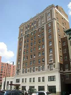
| 52 |
St. Nicholas Hotel |
|
01983-02-10-0000February 10, 1983
(#83000336) |
400 E. Jefferson St.
39°48′09″N 89°39′01″W / 39.802500°N 89.650278°W / 39.802500; -89.650278 (St. Nicholas Hotel) |
Springfield |
|
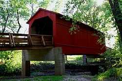
| 53 |
Sugar Creek Covered Bridge |
|
01978-01-09-0000January 9, 1978
(#78001185) |
Southeast of Chatham off Interstate 55
39°38′25″N 89°39′43″W / 39.640278°N 89.661944°W / 39.640278; -89.661944 (Sugar Creek Covered Bridge) |
Chatham |
|
| 54 |
Taft Farmstead |
|
01980-11-20-0000November 20, 1980
(#80001409) |
County Road 3
39°45′08″N 89°33′34″W / 39.752222°N 89.559444°W / 39.752222; -89.559444 (Taft Farmstead) |
Rochester |
|
| 55 |
Taylor Apartments |
|
02004-09-15-0000September 15, 2004
(#04000976) |
117 S. Grand Ave. W
39°47′14″N 89°39′20″W / 39.787222°N 89.655694°W / 39.787222; -89.655694 (Taylor Apartments) |
Springfield |
|
| 56 |
Tiger-Anderson House |
Upload image |
01986-06-11-0000June 11, 1986
(#86001316) |
County Road 3 North
39°50′39″N 89°42′31″W / 39.844167°N 89.708611°W / 39.844167; -89.708611 (Tiger-Anderson House) |
Springfield |
|
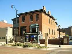
| 57 |
Town House |
|
02005-06-03-0000June 3, 2005
(#05000603) |
718 7th St.
39°47′39″N 89°38′47″W / 39.794167°N 89.646389°W / 39.794167; -89.646389 (Town House) |
Springfield |
|
| 58 |
Union Station |
|
01978-11-27-0000November 27, 1978
(#78001189) |
Madison St.
39°48′13″N 89°38′54″W / 39.803611°N 89.648333°W / 39.803611; -89.648333 (Union Station) |
Springfield |
|
| 59 |
US ARMY Aircraft P-51D-25NA 44-73287 |
Upload image |
01999-03-11-0000March 11, 1999
(#99000254) |
Capital Airport, 0.5 miles north of the junction of Illinois Route 29 and Veterans Parkway
39°50′27″N 89°40′33″W / 39.840833°N 89.675833°W / 39.840833; -89.675833 (US ARMY Aircraft P-51D-25NA 44-73287) |
Springfield |
|
| 60 |
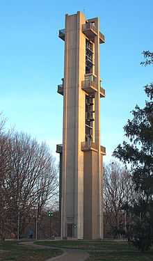
Washington Park |
|
01992-05-22-0000May 22, 1992
(#92000483) |
Bounded by Fayette Ave., Williams Boulevard, Walnut St., MacArthur Boulevard, S. Grand Ave. and Chatham Rd.
39°47′20″N 89°40′37″W / 39.788889°N 89.676944°W / 39.788889; -89.676944 (Washington Park) |
Springfield |
|
| 61 |
Howard K. Weber House |
|
01979-10-01-0000October 1, 1979
(#79000868) |
925 S. 7th St.
39°47′30″N 89°38′48″W / 39.791667°N 89.646667°W / 39.791667; -89.646667 (Howard K. Weber House) |
Springfield |
|
| 62 |
Gov. Richard Yates House |
|
01984-03-01-0000March 1, 1984
(#84001148) |
1190 Williams Boulevard
39°47′24″N 89°40′20″W / 39.790000°N 89.672222°W / 39.790000; -89.672222 (Gov. Richard Yates House) |
Springfield |
|