| [3] |
Name on the Register[4] |
Image |
Date listed[5] |
Location |
Description |
|---|
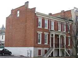
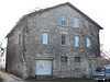
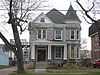
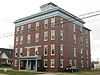
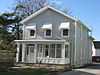
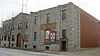
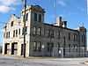
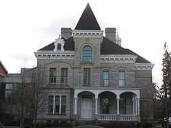
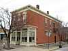
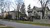
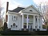
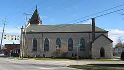
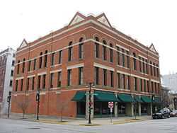
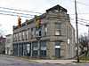
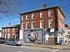
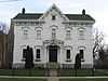
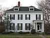
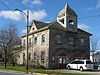
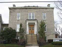
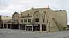
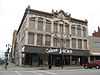
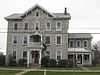
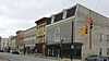
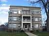
| 1 |
Adams Street Double House |
|
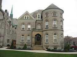
01975-10-10-0000October 10, 1975
(#75001384) |
106-108 E. Adams St.
41°27′13″N 82°42′35″W / 41.453611°N 82.709722°W / 41.453611; -82.709722 (Adams Street Double House) |
|
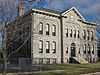
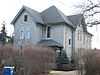
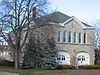
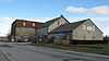
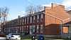
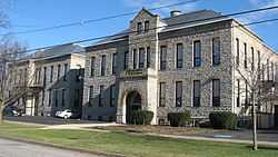
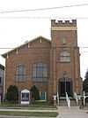
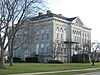
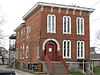
| 2 |
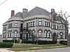
Barker School |
|
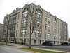
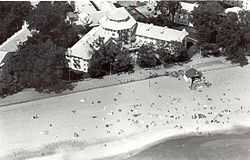
01982-10-20-0000October 20, 1982
(#82001374) |
1925 Barker St.
41°26′43″N 82°43′38″W / 41.445278°N 82.727222°W / 41.445278; -82.727222 (Barker School) |
|
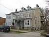
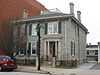
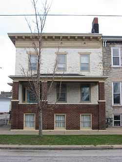
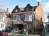
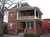
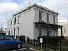
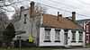
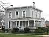
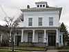
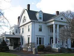
| 3 |
Freeland T. Barney House |
|
01982-10-20-0000October 20, 1982
(#82001375) |
215-213 Fulton St.
41°27′14″N 82°42′59″W / 41.453888°N 82.716388°W / 41.453888; -82.716388 (Freeland T. Barney House) |
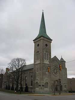
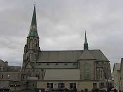
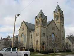
|
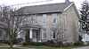
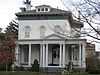
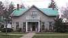
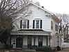
| 4 |
Bates-Cockrem House |
|
01982-10-20-0000October 20, 1982
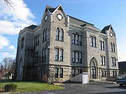
(#82001376) |
325 Lawrence St.
41°27′07″N 82°43′01″W / 41.451944°N 82.716944°W / 41.451944; -82.716944 (Bates-Cockrem House) |
|
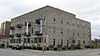
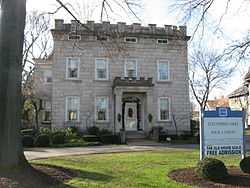
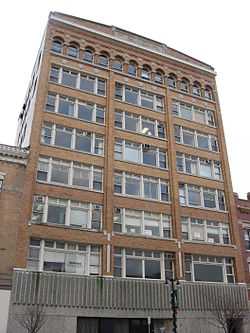
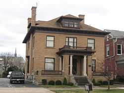
| 5 |
Bavarian Brewery |
|
01982-10-20-0000October 20, 1982
(#82001377) |
1816-1820 W. Jefferson St.
41°26′56″N 82°43′32″W / 41.448888°N 82.725555°W / 41.448888; -82.725555 (Bavarian Brewery) |
|
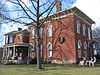
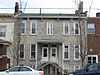
| 6 |
Lucas Beecher House |
|
01979-05-07-0000May 7, 1979
(#79001827) |
215 W. Washington Row
41°27′18″N 82°42′44″W / 41.455000°N 82.712361°W / 41.455000; -82.712361 (Lucas Beecher House) |
|
| 7 |
Bing's Hotel |
|
01982-10-20-0000October 20, 1982
(#82001378) |
302 E. Water St.
41°27′29″N 82°42′32″W / 41.458056°N 82.708889°W / 41.458056; -82.708889 (Bing's Hotel) |
|
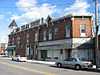
| 8 |
John Boalt House |
|
01982-10-20-0000October 20, 1982
(#82001379) |
631 Wayne St.
41°27′03″N 82°42′25″W / 41.450833°N 82.706944°W / 41.450833; -82.706944 (John Boalt House) |
|
| 9 |
Boeckling Building |
|
01982-10-20-0000October 20, 1982
(#82001380) |
103-105 W. Shoreline Dr.
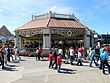
41°27′28″N 82°42′47″W / 41.457778°N 82.713194°W / 41.457778; -82.713194 (Boeckling Building) |
|
| 10 |
G.A. Boeckling House |
|
01983-01-20-0000January 20, 1983
(#83001960) |
614 Columbus Ave.
41°27′03″N 82°42′30″W / 41.450833°N 82.708333°W / 41.450833; -82.708333 (G.A. Boeckling House) |
|
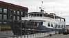
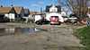
| 11 |
G.A. BOECKLING (side-paddlewheel steamboat) |
|
01983-03-03-0000March 3, 1983
(#83001959) |
Jackson Street Dock
41°27′29″N 82°42′52″W / 41.458055°N 82.714444°W / 41.458055; -82.714444 (G.A. BOECKLING (side-paddlewheel steamboat)) |
Burned to the waterline in 1989.
|
| 12 |
Boy with the Boot Fountain |
|
01982-10-20-0000October 20, 1982
(#82001381) |
W. Washington St. Park
41°27′16″N 82°42′46″W / 41.454444°N 82.712778°W / 41.454444; -82.712778 (Boy with the Boot Fountain) |
|
| 13 |
Cable Park Historic District |
|
01988-01-21-0000January 21, 1988
(#87002506) |
1103-1234 Wayne St.
41°26′47″N 82°42′14″W / 41.446388°N 82.703888°W / 41.446388; -82.703888 (Cable Park Historic District) |
|
| 14 |
Frank Cable House |
|
01982-10-20-0000October 20, 1982
(#82001382) |
809 W. Washington St.
41°27′11″N 82°43′01″W / 41.453056°N 82.716944°W / 41.453056; -82.716944 (Frank Cable House) |
|
| 15 |
Laurence Cable House |
|
01982-10-20-0000October 20, 1982
(#82001383) |
910 W. Monroe St.
41°26′52″N 82°42′54″W / 41.447777°N 82.715000°W / 41.447777; -82.715000 (Laurence Cable House) |
|
| 16 |
Campbell School |
|
01982-10-20-0000October 20, 1982
(#82001384) |
1215 Campbell St.
41°26′44″N 82°42′25″W / 41.445555°N 82.706944°W / 41.445555; -82.706944 (Campbell School) |
|
| 17 |
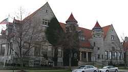
Carnegie Library |
|
01975-11-12-0000November 12, 1975
(#75001385) |
Adams and Columbus Ave.
41°27′12″N 82°42′38″W / 41.453333°N 82.710555°W / 41.453333; -82.710555 (Carnegie Library) |
|
| 18 |
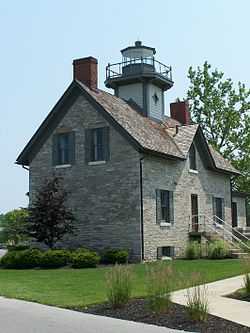
Cedar Point Light |
|
01984-07-19-0000July 19, 1984
(#84003667) |
Cedar Point amusement park
41°29′17″N 82°41′37″W / 41.488056°N 82.693611°W / 41.488056; -82.693611 (Cedar Point Light) |
Originally listed in 1982 as the "U.S. Coast Guard Building"[4]
|
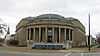
| 19 |
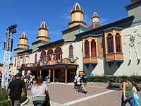
Coliseum |
|
01982-10-20-0000October 20, 1982
(#82001385) |
Main Midway at Cedar Point amusement park
41°28′53″N 82°40′54″W / 41.481389°N 82.681667°W / 41.481389; -82.681667 (Coliseum) |
|
| 20 |
Columbus Avenue Historic District |
|
01983-01-20-0000January 20, 1983
(#83001961) |
102-162 Columbus Ave.
41°27′25″N 82°42′43″W / 41.456944°N 82.711944°W / 41.456944; -82.711944 (Columbus Avenue Historic District) |
|
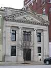
| 21 |
Commercial Banking & Trust Co. |
|
01982-10-20-0000October 20, 1982
(#82001386) |
115 E. Washington Row
41°27′20″N 82°42′39″W / 41.455555°N 82.710833°W / 41.455555; -82.710833 (Commercial Banking & Trust Co.) |
|
| 22 |
Converse-Mertz Apartments |
|
01982-10-20-0000October 20, 1982
(#82001388) |
301-303 E. Washington St.
41°27′23″N 82°42′28″W / 41.456255°N 82.707777°W / 41.456255; -82.707777 (Converse-Mertz Apartments) |
|
| 23 |
Eleutheros Cooke House |
|
01982-10-20-0000October 20, 1982
(#82001390) |
410 Columbus Ave.
41°27′12″N 82°42′35″W / 41.453388°N 82.709722°W / 41.453388; -82.709722 (Eleutheros Cooke House) |
|
| 24 |
Eleutheros Cooke House |
|
01982-10-20-0000October 20, 1982
(#82001389) |
1415 Columbus Ave.
41°26′38″N 82°42′18″W / 41.443889°N 82.705°W / 41.443889; -82.705 (Eleutheros Cooke House) |
|
| 25 |
Cooke-Robertson House |
|
01982-10-20-0000October 20, 1982
(#82001387) |
412 Columbus Ave.
41°27′12″N 82°42′35″W / 41.453333°N 82.709722°W / 41.453333; -82.709722 (Cooke-Robertson House) |
|
| 26 |
William D. Curtis House |
|
01982-10-20-0000October 20, 1982
(#82001391) |
1411 Hayes Ave.
41°26′35″N 82°42′38″W / 41.443166°N 82.710555°W / 41.443166; -82.710555 (William D. Curtis House) |
|
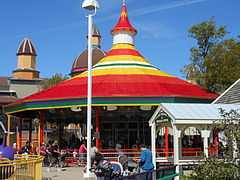
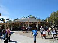
| 27 |
William H. Dentzel 1921 Carousel |
Upload image |
01990-11-08-0000November 8, 1990
(#90000627) |
Frontiertown at Cedar Point amusement park
41°29′04″N 82°41′32″W / 41.484444°N 82.692222°W / 41.484444; -82.692222 (William H. Dentzel 1921 Carousel) |
|
| 28 |
William H. Dentzel 1924 Carousel |
|
01990-11-08-0000November 8, 1990
(#90000625) |
Kiddy Kingdom at Cedar Point amusement park
41°28′51″N 82°40′51″W / 41.480833°N 82.680833°W / 41.480833; -82.680833 (William H. Dentzel 1924 Carousel) |
|
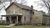
| 29 |
George J. Doerzbach House |
|
01987-04-23-0000April 23, 1987
(#87000639) |
1208-1210 Central Ave.
41°26′44″N 82°42′51″W / 41.445555°N 82.714166°W / 41.445555; -82.714166 (George J. Doerzbach House) |
|
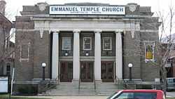
| 30 |
Emmanuel Church |
|
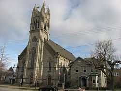
01982-10-20-0000October 20, 1982
(#82001392) |
334 Columbus Ave.
41°27′14″N 82°42′37″W / 41.453889°N 82.710278°W / 41.453889; -82.710278 (Emmanuel Church) |
|
| 31 |
Engels And Krudwig Wine Company Buildings |
|
01976-07-30-0000July 30, 1976
(#76001417) |
220 E. Water St.
41°27′28″N 82°42′35″W / 41.457778°N 82.709722°W / 41.457778; -82.709722 (Engels And Krudwig Wine Company Buildings) |
|
| 32 |
Herman Engels House |
|
01982-10-20-0000October 20, 1982
(#82001393) |
117 Hancock St.
41°27′28″N 82°42′32″W / 41.457777°N 82.708888°W / 41.457777; -82.708888 (Herman Engels House) |
|
| 33 |
Engine House No. 1 |
|
01982-10-20-0000October 20, 1982
(#82001394) |
901 W. Market St.
41°27′15″N 82°43′06″W / 41.454166°N 82.718333°W / 41.454166; -82.718333 (Engine House No. 1) |
|
| 34 |
Engine House No. 3 |
|
01975-04-01-0000April 1, 1975
(#75001386) |
Meigs St. and Sycamore Line
41°27′09″N 82°41′53″W / 41.4525°N 82.698056°W / 41.4525; -82.698056 (Engine House No. 3) |
|
| 35 |
Erie County Jail |
|
01982-10-20-0000October 20, 1982
(#82001395) |
204 W. Adams St.
41°27′11″N 82°42′40″W / 41.453055°N 82.711111°W / 41.453055; -82.711111 (Erie County Jail) |
|
| 36 |
Erie County Office Building |
|
01974-11-20-0000November 20, 1974
(#74001470) |
1202 Sycamore Line
41°26′52″N 82°41′49″W / 41.447777°N 82.696944°W / 41.447777; -82.696944 (Erie County Office Building) |
|
| 37 |
Erie County Oil Products Co. |
|
01982-10-20-0000October 20, 1982
(#82001396) |
649 Tiffin Ave.
41°26′48″N 82°43′37″W / 41.446666°N 82.726944°W / 41.446666; -82.726944 (Erie County Oil Products Co.) |
|
| 38 |
Exchange Hotel |
|
01975-10-29-0000October 29, 1975
(#75001388) |
202-204 E. Water St.
41°27′28″N 82°42′37″W / 41.457777°N 82.710277°W / 41.457777; -82.710277 (Exchange Hotel) |
Burned down in 1977.
|
| 39 |
Facer's Store |
|
01982-10-20-0000October 20, 1982
(#82001397) |
279 E. Market St.
41°27′26″N 82°42′31″W / 41.457333°N 82.708722°W / 41.457333; -82.708722 (Facer's Store) |
|
| 40 |
Feick Building |
|
02009-10-22-0000October 22, 2009
(#09000848) |
158-160 E. Market St.
41°27′22″N 82°42′38″W / 41.456244°N 82.710506°W / 41.456244; -82.710506 (Feick Building) |
|
| 41 |
First Church of Christ, Scientist |
|
01982-10-20-0000October 20, 1982
(#82001398) |
128 E. Adams St.
41°27′14″N 82°42′32″W / 41.453888°N 82.709022°W / 41.453888; -82.709022 (First Church of Christ, Scientist) |
|
| 42 |
First Congregational Church |
|
01982-10-20-0000October 20, 1982
(#82001399) |
431 Columbus Ave.
41°27′09″N 82°42′36″W / 41.4525°N 82.71°W / 41.4525; -82.71 (First Congregational Church) |
|
| 43 |
Follett-Moss-Moss Residences |
|
01974-12-31-0000December 31, 1974
(#74001471) |
404, 414, 428 Wayne St.
41°27′13″N 82°42′28″W / 41.453611°N 82.707778°W / 41.453611; -82.707778 (Follett-Moss-Moss Residences) |
|
| 44 |
Fox's Brewery-Diamond Wine Co. |
|
01982-10-20-0000October 20, 1982
(#82001400) |
334 Harrison St.
41°27′03″N 82°43′29″W / 41.450833°N 82.724722°W / 41.450833; -82.724722 (Fox's Brewery-Diamond Wine Co.) |
|
| 45 |
Godfrey-Johnson House |
|
01982-10-20-0000October 20, 1982
(#82001401) |
417 Columbus Ave.
41°27′11″N 82°42′37″W / 41.452944°N 82.710277°W / 41.452944; -82.710277 (Godfrey-Johnson House) |
|
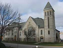
| 46 |
Grace Episcopal Church |
|
01982-10-20-0000October 20, 1982
(#82001402) |
315 Wayne St.
41°27′17″N 82°42′34″W / 41.454722°N 82.709444°W / 41.454722; -82.709444 (Grace Episcopal Church) |
|
| 47 |
Henry Graefe House |
|
01982-10-20-0000October 20, 1982
(#82001403) |
1429 Columbus Ave.
41°26′36″N 82°42′17″W / 41.443333°N 82.704722°W / 41.443333; -82.704722 (Henry Graefe House) |
William Warren Sabin architect
|
| 48 |
Great American Racing Derby |
|
01990-11-08-0000November 8, 1990
(#90000626) |
Main Midway at Cedar Point amusement park
41°28′50″N 82°41′00″W / 41.480556°N 82.683333°W / 41.480556; -82.683333 (Great American Racing Derby) |
|
| 49 |
Rice Harper House |
|
01982-10-20-0000October 20, 1982
(#82001404) |
403 E. Washington St.
41°27′25″N 82°42′22″W / 41.456944°N 82.706111°W / 41.456944; -82.706111 (Rice Harper House) |
|
| 50 |
Hemminger Saloon |
|
01982-10-20-0000October 20, 1982
(#82001405) |
333 W. Market St.
41°27′20″N 82°42′51″W / 41.455555°N 82.714166°W / 41.455555; -82.714166 (Hemminger Saloon) |
|
| 51 |
Hinde & Dauch Paper Co. |
|
01982-10-20-0000October 20, 1982
(#82001408) |
407 Decatur St.
41°27′08″N 82°42′48″W / 41.452222°N 82.713333°W / 41.452222; -82.713333 (Hinde & Dauch Paper Co.) |
|
| 52 |
Hinde & Dauch Paper Co. |
|
01982-10-20-0000October 20, 1982
(#82001407) |
401 W. Shoreline Dr.
41°27′28″N 82°42′55″W / 41.457778°N 82.715278°W / 41.457778; -82.715278 (Hinde & Dauch Paper Co.) |
|
| 53 |
Hinde & Dauch Paper Co. |
|
01982-10-20-0000October 20, 1982
(#82001406) |
409 W. Water St.
41°27′24″N 82°42′54″W / 41.456666°N 82.715000°W / 41.456666; -82.715000 (Hinde & Dauch Paper Co.) |
|
| 54 |
James J. Hinde House |
|
01982-10-20-0000October 20, 1982
(#82001409) |
317 Fulton St.
41°27′09″N 82°42′57″W / 41.452500°N 82.715833°W / 41.452500; -82.715833 (James J. Hinde House) |
|
| 55 |
Holy Angels Church |
|
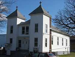
01982-10-20-0000October 20, 1982
(#82001410) |
W. Jefferson St. at Tiffin Ave. and Clinton St.
41°26′57″N 82°43′23″W / 41.449167°N 82.723056°W / 41.449167; -82.723056 (Holy Angels Church) |
|
| 56 |
Hotel Rieger |
|
02005-06-10-0000June 10, 2005
(#05000578) |
232 Jackson St.
41°27′19″N 82°42′47″W / 41.455278°N 82.713056°W / 41.455278; -82.713056 (Hotel Rieger) |
|
| 57 |
Lester Hubbard House |
|
01982-10-20-0000October 20, 1982
(#82001411) |
134 E. Adams St.
41°27′14″N 82°42′31″W / 41.453889°N 82.708611°W / 41.453889; -82.708611 (Lester Hubbard House) |
|
| 58 |
S.B. Hubbard House |
|
01982-10-20-0000October 20, 1982
(#82001412) |
1205 Columbus Ave.
41°26′43″N 82°42′21″W / 41.445388°N 82.705833°W / 41.445388; -82.705833 (S.B. Hubbard House) |
|
| 59 |
Independent Order of Odd Fellows Temple |
|
02003-05-01-0000May 1, 2003
(#03000327) |
231 W. Washington Row
41°27′18″N 82°42′46″W / 41.455°N 82.712778°W / 41.455; -82.712778 (Independent Order of Odd Fellows Temple) |
|
| 60 |
Jackson Jr. High School |
|
01982-10-20-0000October 20, 1982
(#82001413) |
414 W. Madison St.
41°27′01″N 82°42′42″W / 41.450166°N 82.711666°W / 41.450166; -82.711666 (Jackson Jr. High School) |
|
| 61 |
Kerber's Marine Grocery |
|
01982-10-20-0000October 20, 1982
(#82001414) |
1006 Tiffin Ave.
41°26′46″N 82°43′37″W / 41.446111°N 82.726888°W / 41.446111; -82.726888 (Kerber's Marine Grocery) |
|
| 62 |
August Kuebeler House |
|
01982-10-20-0000October 20, 1982
(#82001416) |
1319 Tiffin Ave.
41°26′40″N 82°43′46″W / 41.444444°N 82.729444°W / 41.444444; -82.729444 (August Kuebeler House) |
|
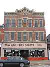
| 63 |
Kuebeler-Stang Block |
|
01982-10-20-0000October 20, 1982
(#82001415) |
634 Hancock St.
41°27′05″N 82°42′18″W / 41.451388°N 82.704888°W / 41.451388; -82.704888 (Kuebeler-Stang Block) |
|
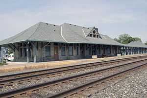
| 64 |
Lake Shore And Michigan Southern Railroad Depot |
|
01975-07-17-0000July 17, 1975
(#75001389) |
N. Depot at Carr St.
41°26′26″N 82°43′07″W / 41.440556°N 82.718611°W / 41.440556; -82.718611 (Lake Shore And Michigan Southern Railroad Depot) |
|
| 65 |
Ebenezer Lane House |
|
01982-10-20-0000October 20, 1982
(#82001417) |
318 Huron Ave.
41°27′18″N 82°42′31″W / 41.455000°N 82.708611°W / 41.455000; -82.708611 (Ebenezer Lane House) |
|
| 66 |
Lea Block |
|
01982-10-20-0000October 20, 1982
(#82001418) |
174-186 E. Market St.
41°27′23″N 82°42′37″W / 41.456388°N 82.710277°W / 41.456388; -82.710277 (Lea Block) |
|
| 67 |
Henry Lotz Store |
|
01982-10-20-0000October 20, 1982
(#82001419) |
1119 W. Washington St.
41°27′08″N 82°43′13″W / 41.452222°N 82.720277°W / 41.452222; -82.720277 (Henry Lotz Store) |
|
| 68 |
Mad River Block |
|
01974-10-16-0000October 16, 1974
(#74001472) |
1002-1018 W. Adams St.
41°27′03″N 82°43′06″W / 41.450833°N 82.718333°W / 41.450833; -82.718333 (Mad River Block) |
|
| 69 |
Ogden Mallory House |
|
01982-10-20-0000October 20, 1982
(#82001420) |
410 Warren St.
41°27′20″N 82°42′13″W / 41.455555°N 82.703611°W / 41.455555; -82.703611 (Ogden Mallory House) |
|
| 70 |
George March House |
|
01982-10-20-0000October 20, 1982
(#82001421) |
532 Wayne St.
41°27′08″N 82°42′25″W / 41.452222°N 82.706944°W / 41.452222; -82.706944 (George March House) |
|
| 71 |
James E. Marshall House |
|
01982-10-20-0000October 20, 1982
(#82001422) |
514 Wayne St.
41°27′08″N 82°42′26″W / 41.452222°N 82.707222°W / 41.452222; -82.707222 (James E. Marshall House) |
|
| 72 |
McKenster-Groff House |
|
01982-10-20-0000October 20, 1982
(#82001423) |
334 E. Washington St.
41°27′22″N 82°42′23″W / 41.456111°N 82.706389°W / 41.456111; -82.706389 (McKenster-Groff House) |
|
| 73 |
William Gordon Melville-Milne House |
|
01979-03-28-0000March 28, 1979
(#79001828) |
319 Lawrence St.
41°27′07″N 82°43′02″W / 41.451944°N 82.717222°W / 41.451944; -82.717222 (William Gordon Melville-Milne House) |
|
| 74 |
John Mertz House |
|
01992-08-21-0000August 21, 1992
(#92001077) |
610 W. Washington St.
41°27′12″N 82°42′55″W / 41.453333°N 82.715277°W / 41.453333; -82.715277 (John Mertz House) |
|
| 75 |
Monroe School |
|
01982-10-20-0000October 20, 1982
(#82001424) |
328 E. Monroe St.
41°27′05″N 82°42′13″W / 41.451389°N 82.703611°W / 41.451389; -82.703611 (Monroe School) |
|
| 76 |
Moss-Foster House |
|
01982-10-20-0000October 20, 1982
(#82001425) |
621 Wayne St.
41°27′04″N 82°42′26″W / 41.451111°N 82.707222°W / 41.451111; -82.707222 (Moss-Foster House) |
|
| 77 |
Daniel C. Muller Carousel |
|
01982-10-20-0000October 20, 1982
(#82001426) |
Main Midway at Cedar Point amusement park
41°28′44″N 82°40′46″W / 41.478750°N 82.679583°W / 41.478750; -82.679583 (Daniel C. Muller Carousel) |
|
| 78 |
Murschel House |
|
01982-10-20-0000October 20, 1982
(#82001427) |
1221 N. Depot St.
41°26′28″N 82°43′06″W / 41.441111°N 82.718333°W / 41.441111; -82.718333 (Murschel House) |
|
| 79 |
No. 5 Fire Station |
|
01982-10-20-0000October 20, 1982
(#82001428) |
W. Madison and Tiffin Ave.
41°26′51″N 82°43′33″W / 41.447611°N 82.725833°W / 41.447611; -82.725833 (No. 5 Fire Station) |
|
| 80 |
Old First Church |
|
01982-10-20-0000October 20, 1982
(#82001430) |
265 Jackson St.
41°27′16″N 82°42′47″W / 41.454444°N 82.713055°W / 41.454444; -82.713055 (Old First Church) |
|
| 81 |
Osborne School |
|
01982-10-20-0000October 20, 1982
(#82001431) |
922 W. Osborne St.
41°26′32″N 82°42′55″W / 41.442222°N 82.715277°W / 41.442222; -82.715277 (Osborne School) |
|
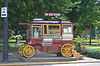
| 82 |
Red Popcorn Wagon |
|
01982-10-20-0000October 20, 1982
(#82001432) |
102 W. Washington Row
41°27′18″N 82°42′41″W / 41.455111°N 82.711333°W / 41.455111; -82.711333 (Red Popcorn Wagon) |
|
| 83 |
Joseph Root House |
|
01982-10-20-0000October 20, 1982
(#82001433) |
231 E. Adams St.
41°27′18″N 82°42′27″W / 41.454888°N 82.707500°W / 41.454888; -82.707500 (Joseph Root House) |
|
| 84 |
Ross Hardware |
|
01982-10-20-0000October 20, 1982
(#82001434) |
708 Hancock St.
41°27′04″N 82°42′17″W / 41.451111°N 82.704722°W / 41.451111; -82.704722 (Ross Hardware) |
|
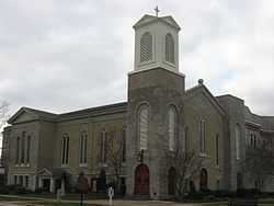
| 85 |
St. Mary's Catholic Church |
|
01975-10-10-0000October 10, 1975
(#75001391) |
429 Central Ave.
41°27′05″N 82°42′50″W / 41.451389°N 82.713889°W / 41.451389; -82.713889 (St. Mary's Catholic Church) |
|
| 86 |
St. Mary's Girls Grade School |
|
01982-10-20-0000October 20, 1982
(#82001438) |
514 Decatur St.
41°27′04″N 82°42′44″W / 41.451000°N 82.712222°W / 41.451000; -82.712222 (St. Mary's Girls Grade School) |
|
| 87 |
St. Mary's Rectory |
|
01982-10-20-0000October 20, 1982
(#82001439) |
429 Central Ave.
41°27′06″N 82°42′49″W / 41.451666°N 82.713611°W / 41.451666; -82.713611 (St. Mary's Rectory) |
|
| 88 |
St. Mary's School |
|
01982-10-20-0000October 20, 1982
(#82001440) |
410 W. Jefferson St.
41°27′05″N 82°43′25″W / 41.451389°N 82.723611°W / 41.451389; -82.723611 (St. Mary's School) |
|
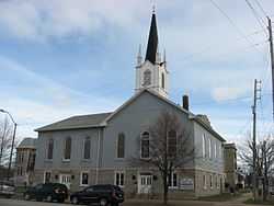
| 89 |
Sts. Peter & Paul Church and Rectory |
|
01983-01-20-0000January 20, 1983
(#83001963) |
Columbus Ave. at E. Jefferson St.
41°27′08″N 82°42′32″W / 41.452222°N 82.708889°W / 41.452222; -82.708889 (Sts. Peter & Paul Church and Rectory) |
|
| 90 |
St. Stephen's AME Church |
|
01982-10-20-0000October 20, 1982
(#82001441) |
312 Neil St.
41°26′56″N 82°42′11″W / 41.448888°N 82.703055°W / 41.448888; -82.703055 (St. Stephen's AME Church) |
|
| 91 |
Schine State Theatre |
|
01982-10-20-0000October 20, 1982
(#82001435) |
101-109 Columbus Ave.
41°27′25″N 82°42′45″W / 41.456944°N 82.712500°W / 41.456944; -82.712500 (Schine State Theatre) |
|
| 92 |
Second Baptist Church |
|
02002-05-14-0000May 14, 2002
(#02000061) |
315 Decatur St.
41°27′12″N 82°42′51″W / 41.453333°N 82.714167°W / 41.453333; -82.714167 (Second Baptist Church) |
|
| 93 |
Walter Simpson House |
|
01982-10-20-0000October 20, 1982
(#82001436) |
521 Hancock St.
41°27′10″N 82°42′22″W / 41.452778°N 82.706111°W / 41.452778; -82.706111 (Walter Simpson House) |
|
| 94 |
William A. Simpson House |
|
01982-10-20-0000October 20, 1982
(#82001437) |
230 E. Washington St.
41°27′21″N 82°42′29″W / 41.455833°N 82.708056°W / 41.455833; -82.708056 (William A. Simpson House) |
|
| 95 |
Rush R. Sloane House |
|
01975-02-24-0000February 24, 1975
(#75001390) |
403 E. Adams St.
41°27′20″N 82°42′19″W / 41.455555°N 82.705277°W / 41.455555; -82.705277 (Rush R. Sloane House) |
|
| 96 |
John Stang House |
|
01982-10-20-0000October 20, 1982
(#82001442) |
629 Columbus Ave.
41°27′01″N 82°42′31″W / 41.450277°N 82.708611°W / 41.450277; -82.708611 (John Stang House) |
|
| 97 |
Henry Stoffel Blacksmith Shop |
|
01982-10-20-0000October 20, 1982
(#82001443) |
321 E. Market St. (rear)
41°27′28″N 82°42′28″W / 41.457777°N 82.707777°W / 41.457777; -82.707777 (Henry Stoffel Blacksmith Shop) |
|
| 98 |
Adam J. Stoll House |
|
01982-10-20-0000October 20, 1982
(#82001444) |
531 Wayne St.
41°27′07″N 82°42′27″W / 41.451944°N 82.7075°W / 41.451944; -82.7075 (Adam J. Stoll House) |
|
| 99 |
Stone's Block |
|
01982-10-20-0000October 20, 1982
(#82001445) |
202 Columbus Ave.
41°27′22″N 82°42′41″W / 41.456111°N 82.711388°W / 41.456111; -82.711388 (Stone's Block) |
|
| 100 |
Sycamore School |
|
01974-11-19-0000November 19, 1974
(#74001473) |
3rd and Sycamore Sts.
41°27′03″N 82°41′51″W / 41.450833°N 82.6975°W / 41.450833; -82.6975 (Sycamore School) |
|
| 101 |
Taylor-Frohman House |
|
01982-10-20-0000October 20, 1982
(#82001446) |
1315 Columbus Ave.
41°26′40″N 82°42′19″W / 41.444444°N 82.705277°W / 41.444444; -82.705277 (Taylor-Frohman House) |
|
| 102 |
Third National Bank |
|
01982-10-20-0000October 20, 1982
(#82001447) |
220 W. Market St.
41°27′20″N 82°42′46″W / 41.455556°N 82.712778°W / 41.455556; -82.712778 (Third National Bank) |
|
| 103 |
William T. Townsend House |
|
01982-10-20-0000October 20, 1982
(#82001448) |
515 W. Washington St.
41°27′14″N 82°42′54″W / 41.453888°N 82.715000°W / 41.453888; -82.715000 (William T. Townsend House) |
|
| 104 |
U.S. Post Office |
|
01982-10-20-0000October 20, 1982
(#82001450) |
W. Washington and Jackson Sts.
41°27′14″N 82°42′46″W / 41.453889°N 82.712778°W / 41.453889; -82.712778 (U.S. Post Office) |
|
| 105 |
Ernst Von Schulenburg House |
|
01982-10-20-0000October 20, 1982
(#82001451) |
922 W. Adams St.
41°27′04″N 82°43′02″W / 41.451111°N 82.717222°W / 41.451111; -82.717222 (Ernst Von Schulenburg House) |
|
| 106 |
James Wadsworth House |
|
01982-10-20-0000October 20, 1982
(#82001452) |
519 Huron Ave.
41°27′12″N 82°42′18″W / 41.453333°N 82.705138°W / 41.453333; -82.705138 (James Wadsworth House) |
|
| 107 |
Wagner Palace |
|
01982-10-20-0000October 20, 1982
(#82001453) |
804-806 Hayes Ave.
41°26′55″N 82°42′27″W / 41.448611°N 82.707500°W / 41.448611; -82.707500 (Wagner Palace) |
|
| 108 |
Water Street Commercial Buildings |
|
01975-03-18-0000March 18, 1975
(#75001392) |
101-165 E. Water St. and 101-231 W. Water St.
41°27′26″N 82°42′45″W / 41.457222°N 82.7125°W / 41.457222; -82.7125 (Water Street Commercial Buildings) |
|
| 109 |
West Market School |
|
01982-10-20-0000October 20, 1982
(#82001454) |
211 Fulton St.
41°27′15″N 82°43′00″W / 41.454055°N 82.716666°W / 41.454055; -82.716666 (West Market School) |
|
| 110 |
Samuel M. White House |
|
01976-06-16-0000June 16, 1976
(#76001419) |
304 E. Adams St.
41°27′17″N 82°42′25″W / 41.454722°N 82.706833°W / 41.454722; -82.706833 (Samuel M. White House) |
|
| 111 |
Wichman's Grocery |
|
01982-10-20-0000October 20, 1982
(#82001455) |
1118 W. Washington St.
41°27′06″N 82°43′13″W / 41.451666°N 82.720277°W / 41.451666; -82.720277 (Wichman's Grocery) |
|
| 112 |
Willdred Flats |
|
01993-03-11-0000March 11, 1993
(#93000152) |
1116 Columbus Ave.
41°26′47″N 82°42′20″W / 41.446255°N 82.705555°W / 41.446255; -82.705555 (Willdred Flats) |
|
| 113 |
Zion Lutheran Church |
|
01982-10-20-0000October 20, 1982
(#82001456) |
501-503 Columbus Ave.
41°27′08″N 82°42′35″W / 41.452222°N 82.709722°W / 41.452222; -82.709722 (Zion Lutheran Church) |
|