| [3] |
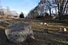
Name on the Register[4] |
Image |
Date listed[5] |
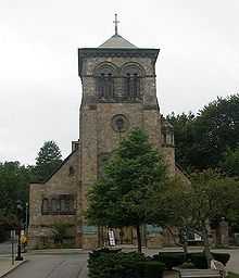
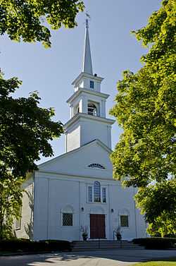
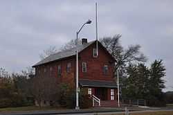
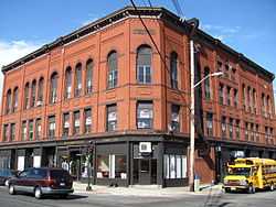
Location |
City or town |
Description |
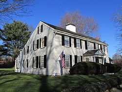
|---|
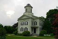
| 1 |
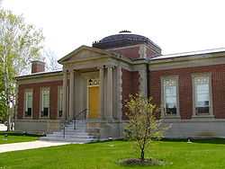
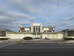
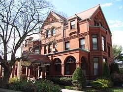
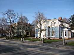
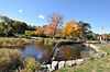
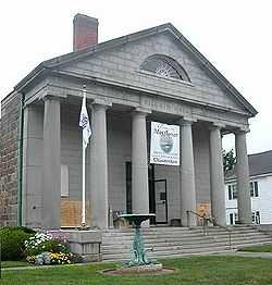
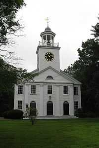
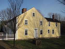
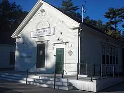
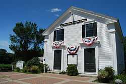
Frederic C. Adams Public Library |
|
02001-06-06-0000June 6, 2001
(#01000625) |
33 Summer St.
41°59′45″N 70°43′48″W / 41.995833°N 70.73°W / 41.995833; -70.73 (Frederic C. Adams Public Library) |
Kingston |
|
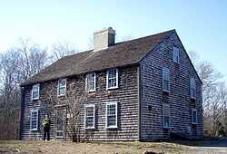
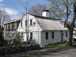
| 2 |
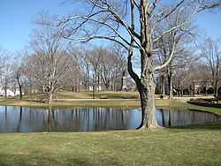
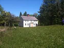
John and Priscilla Alden Family Sites |
|
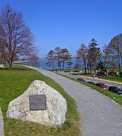
01978-12-14-0000December 14, 1978
(#78000476) |
105 Alden St.
42°02′42″N 70°41′09″W / 42.045°N 70.685833°W / 42.045; -70.685833 (John and Priscilla Alden Family Sites) |
Duxbury |
|
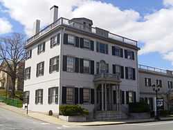
| 3 |
Bartlett-Russell-Hedge House |
|
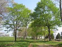
01976-04-30-0000April 30, 1976
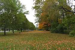
(#76001614) |
32 Court St.
41°57′27″N 70°40′02″W / 41.9575°N 70.667222°W / 41.9575; -70.667222 (Bartlett-Russell-Hedge House) |
Plymouth |
|
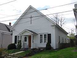
| 4 |
Bethel African Methodist Episcopal Church and Parsonage |
|
02007-03-19-0000March 19, 2007
(#07000168) |
6 Sever St.
41°57′25″N 70°40′08″W / 41.956944°N 70.668889°W / 41.956944; -70.668889 (Bethel African Methodist Episcopal Church and Parsonage) |
Plymouth |
|
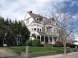
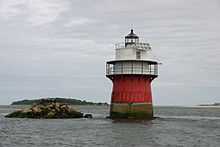
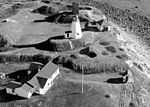
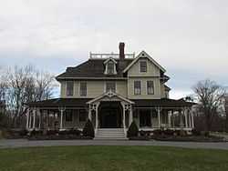
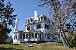
| 5 |
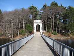
Bird Island Light |
|
01987-09-28-0000September 28, 1987
(#87002030) |
Sippican Harbor
41°40′07″N 70°43′04″W / 41.668611°N 70.717778°W / 41.668611; -70.717778 (Bird Island Light) |
Marion |
|
| 6 |
Boston Harbor Islands Archeological District |
|
01985-12-21-0000December 21, 1985
(#85003323) |
Locations in and around Boston Harbor
42°19′07″N 70°56′45″W / 42.3186°N 70.9458°W / 42.3186; -70.9458 (Boston Harbor Islands Archeological District) |
Hingham, Hull |
Extends into Quincy and Weymouth in Norfolk County and Boston and Winthrop in Suffolk County
|
| 7 |
Bradford House |
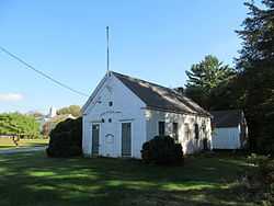
|
02006-03-15-0000March 15, 2006
(#06000128) |
50 Landing Rd.
41°59′17″N 70°43′27″W / 41.988056°N 70.724167°W / 41.988056; -70.724167 (Bradford House) |
Kingston |
|
| 8 |
Captain Daniel Bradford House |
|
01986-02-20-0000February 20, 1986
(#86000301) |
251 Harrison St.
42°02′21″N 70°41′08″W / 42.039167°N 70.685556°W / 42.039167; -70.685556 (Captain Daniel Bradford House) |
Duxbury |
|
| 9 |
Capt. Gamaliel Bradford House |
|
01978-02-17-0000February 17, 1978
(#78001402) |
West of Duxbury at 942 Tremont St.
42°02′18″N 70°41′22″W / 42.038333°N 70.689444°W / 42.038333; -70.689444 (Capt. Gamaliel Bradford House) |
Duxbury |
|
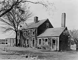
| 10 |
Capt. Gershom Bradford House |
|
01978-02-08-0000February 8, 1978
(#78001403) |
West of Duxbury at 931 Tremont St.
42°02′16″N 70°41′21″W / 42.037778°N 70.689167°W / 42.037778; -70.689167 (Capt. Gershom Bradford House) |
Duxbury |
|
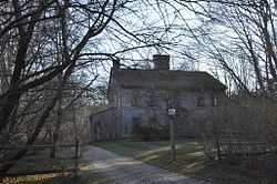
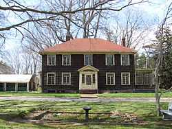
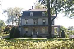
| 11 |
Bradford-Union Street Historic District |
|
01983-11-10-0000November 10, 1983
(#83004094) |
Bradford, Union, Emerald, Water Cure, and Freedom Sts.
41°57′19″N 70°39′38″W / 41.955278°N 70.660556°W / 41.955278; -70.660556 (Bradford-Union Street Historic District) |
Plymouth |
|
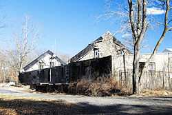
| 12 |
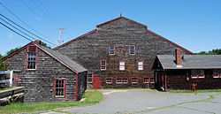
Bridgewater Iron Works |
|
02002-02-28-0000February 28, 2002
(#01000087) |
High Street
42°00′11″N 70°58′54″W / 42.003068°N 70.981756°W / 42.003068; -70.981756 (Bridgewater Iron Works) |
Bridgewater |
|
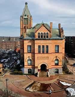
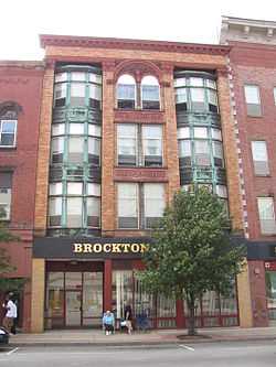
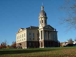
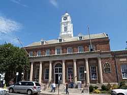
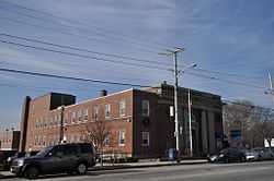
| 13 |
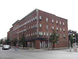
Brockton City Hall |
|
01976-03-26-0000March 26, 1976
(#76000296) |
45 School St.
42°04′56″N 71°01′07″W / 42.082222°N 71.018611°W / 42.082222; -71.018611 (Brockton City Hall) |
Brockton |
|
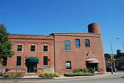
| 14 |
Brockton Edison Electric Illuminating Company Power Station |
|
01987-09-17-0000September 17, 1987
(#87000874) |
70 School St.
42°05′00″N 70°59′46″W / 42.083333°N 70.996111°W / 42.083333; -70.996111 (Brockton Edison Electric Illuminating Company Power Station) |
Brockton |
|
| 15 |
Bryant-Cushing House |
|
01976-03-26-0000March 26, 1976
(#76001613) |
768 Main St.
42°09′35″N 70°47′14″W / 42.159722°N 70.787222°W / 42.159722; -70.787222 (Bryant-Cushing House) |
Norwell |
|
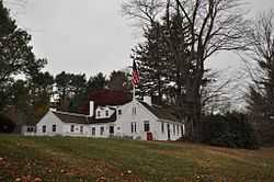
| 16 |
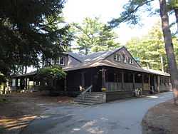
Camp Kiwanee Historic District |
|
02005-02-24-0000February 24, 2005
(#05000081) |
1 Camp Kiwanee Rd.
42°03′34″N 70°50′50″W / 42.059444°N 70.847222°W / 42.059444; -70.847222 (Camp Kiwanee Historic District) |
Hanson |
|
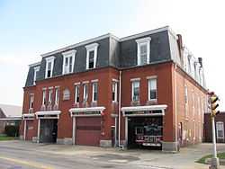
| 17 |
Central Fire Station |
|
01977-07-25-0000July 25, 1977
(#77000193) |
40 Pleasant St.
42°05′06″N 71°01′17″W / 42.085°N 71.021389°W / 42.085; -71.021389 (Central Fire Station) |
Brockton |
|
| 18 |
Thomas Chubbuck, Jr. House |
|
01992-08-07-0000August 7, 1992
(#92000954) |
1191 Main St.
42°10′37″N 70°53′09″W / 42.176944°N 70.885833°W / 42.176944; -70.885833 (Thomas Chubbuck, Jr. House) |
Hingham |
|
| 19 |
Clifford-Warren House |
|
01980-04-08-0000April 8, 1980
(#80000666) |
East of Plymouth at 3 Clifford Rd.
41°56′20″N 70°37′04″W / 41.938889°N 70.617778°W / 41.938889; -70.617778 (Clifford-Warren House) |
Plymouth |
|
| 20 |
Cole's Hill |
|
01966-10-15-0000October 15, 1966
(#66000142) |
Carver St.
41°57′27″N 70°39′46″W / 41.9575°N 70.662778°W / 41.9575; -70.662778 (Cole's Hill) |
Plymouth |
|
| 21 |
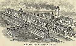
Commonwealth Shoe and Leather Co. |
|
02014-05-13-0000May 13, 2014
(#14000271) |
7 Marble Street
42°04′50″N 70°55′57″W / 42.080619°N 70.932468°W / 42.080619; -70.932468 (Commonwealth Shoe and Leather Co.) |
Whitman |
|
| 22 |
Conant's Hill Site |
|
01983-11-25-0000November 25, 1983
(#09000091) |
End of Station St., ½ mile south of Main St.[6]
41°45′51″N 70°43′51″W / 41.764094°N 70.730928°W / 41.764094; -70.730928 (Conant's Hill Site) |
Wareham |
|
| 23 |
Curtis Building |
|
01982-04-15-0000April 15, 1982
(#82004424) |
105-109 Main St.
42°04′59″N 71°01′15″W / 42.083056°N 71.020833°W / 42.083056; -71.020833 (Curtis Building) |
Brockton |
|
| 24 |
Cushing Homestead |
|
01973-06-04-0000June 4, 1973
(#73000326) |
210 East Street
42°14′25″N 70°51′45″W / 42.240278°N 70.8625°W / 42.240278; -70.8625 (Cushing Homestead) |
Hingham |
|
| 25 |
Dr. Edgar Everett Dean House |
|
01978-05-05-0000May 5, 1978
(#78000471) |
81 Green St.
42°05′05″N 71°01′22″W / 42.084722°N 71.022778°W / 42.084722; -71.022778 (Dr. Edgar Everett Dean House) |
Brockton |
|
| 26 |
District 7 School House |
|
02005-08-11-0000August 11, 2005
(#05000876) |
565 Main St.
42°02′25″N 70°51′46″W / 42.0403°N 70.8628°W / 42.0403; -70.8628 (District 7 School House) |
Hanson |
|
| 27 |
Duxbury Pier Light |
|
02014-06-04-0000June 4, 2014
(#14000287) |
Mouth of Duxbury Bay at Plymouth Bay, 5.1 mi. NNE. of Plymouth Rock
41°59′15″N 70°38′55″W / 41.987425°N 70.648547°W / 41.987425; -70.648547 (Duxbury Pier Light) |
Plymouth |
|
| 28 |
East Bridgewater Common Historic District |
|
01999-05-12-0000May 12, 1999
(#99000559) |
Central and Plymouth Sts, and Morse Ave.
42°01′47″N 70°57′09″W / 42.029722°N 70.9525°W / 42.029722; -70.9525 (East Bridgewater Common Historic District) |
East Bridgewater |
|
| 29 |
East Rochester Church and Cemetery Historic District |
|
02008-01-09-0000January 9, 2008
(#07001361) |
355 County Rd.
41°47′05″N 70°46′39″W / 41.784722°N 70.7775°W / 41.784722; -70.7775 (East Rochester Church and Cemetery Historic District) |
Rochester |
|
| 30 |
D.W. Field Park |
|
02000-11-24-0000November 24, 2000
(#00001341) |
Between Pond St., Avon St., and Pleasant St.
42°06′17″N 71°02′47″W / 42.104722°N 71.046389°W / 42.104722; -71.046389 (D.W. Field Park) |
Brockton |
Extends into Avon in Norfolk County
|
| 31 |
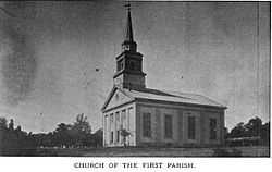
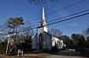
First Parish Church |
|
01978-07-21-0000July 21, 1978
(#78001404) |
Southwest of Duxbury at Tremont and Depot Sts.
42°02′06″N 70°41′33″W / 42.035°N 70.6925°W / 42.035; -70.6925 (First Parish Church) |
Duxbury |
|
| 32 |
First Parish Church of Plymouth |
|
02014-12-02-0000December 2, 2014
(#14000973) |
19 Town Sq.
41°57′20″N 70°39′54″W / 41.9555°N 70.6649°W / 41.9555; -70.6649 (First Parish Church of Plymouth) |
Plymouth |
|
| 33 |
First Trinitarian Congregational Church |
|
02002-09-12-0000September 12, 2002
(#02001037) |
381 Country Way
42°12′00″N 70°45′37″W / 42.2°N 70.760278°W / 42.2; -70.760278 (First Trinitarian Congregational Church) |
Scituate |
|
| 34 |
Forest Avenue School |
|
01982-07-15-0000July 15, 1982
(#82004425) |
Memorial Drive
42°04′11″N 71°02′27″W / 42.069722°N 71.040833°W / 42.069722; -71.040833 (Forest Avenue School) |
Brockton |
|
| 35 |
Franklin Block |
|
01989-02-21-0000February 21, 1989
(#89000042) |
1102-1110 Main St.
42°03′49″N 71°00′57″W / 42.063611°N 71.015833°W / 42.063611; -71.015833 (Franklin Block) |
Brockton |
|
| 36 |
Goldthwaite Block |
|
01982-04-15-0000April 15, 1982
(#82004427) |
99-103 Main St.
42°05′00″N 71°01′12″W / 42.083284°N 71.019963°W / 42.083284; -71.019963 (Goldthwaite Block) |
Brockton |
|
| 37 |
Grand Army of the Republic Hall |
|
01997-05-16-0000May 16, 1997
(#97000438) |
34 School St.
42°07′36″N 70°54′52″W / 42.126667°N 70.914444°W / 42.126667; -70.914444 (Grand Army of the Republic Hall) |
Rockland |
|
| 38 |
Hanover Center Historic District |
|
01996-05-09-0000May 9, 1996
(#96000476) |
Roughly Silver St. from Lantern Ln. to Hanover St.
42°07′06″N 70°50′40″W / 42.118333°N 70.844444°W / 42.118333; -70.844444 (Hanover Center Historic District) |
Hanover |
|
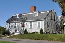
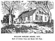
| 39 |
Harlow Old Fort House |
|
01974-12-27-0000December 27, 1974
(#74001762) |
119 Sandwich St.
41°57′07″N 70°39′26″W / 41.951944°N 70.657222°W / 41.951944; -70.657222 (Harlow Old Fort House) |
Plymouth |
|
| 40 |
Sgt. William Harlow Family Homestead |
|
01982-04-15-0000April 15, 1982
(#82004434) |
8 Winter St.
41°57′06″N 70°39′15″W / 41.951667°N 70.654167°W / 41.951667; -70.654167 (Sgt. William Harlow Family Homestead) |
Plymouth |
|
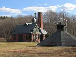
| 41 |
Hatch Homestead and Mill Historic District |
|
02009-09-11-0000September 11, 2009
(#09000698) |
385 Union St..
42°07′21″N 70°46′12″W / 42.1226°N 70.770°W / 42.1226; -70.770 (Hatch Homestead and Mill Historic District) |
Marshfield |
|
| 42 |
Hillside |
|
01975-09-18-0000September 18, 1975
(#75001626) |
230 Summer St.
41°56′54″N 70°40′48″W / 41.948333°N 70.68°W / 41.948333; -70.68 (Hillside) |
Plymouth |
|
| 43 |
Howard Block |
|
01982-04-15-0000April 15, 1982
(#82004969) |
93-97 Main St.
42°05′01″N 71°01′11″W / 42.083527°N 71.019839°W / 42.083527; -71.019839 (Howard Block) |
Brockton |
|
| 44 |
Jabez Howland House |
|
01974-10-09-0000October 9, 1974
(#74002032) |
33 Sandwich St.
41°57′16″N 70°39′47″W / 41.954444°N 70.663056°W / 41.954444; -70.663056 (Jabez Howland House) |
Plymouth |
|
| 45 |
Hull Shore Drive, Nantasket Avenue, Metropolitan Park System of Greater Boston MPS |
|
02004-01-21-0000January 21, 2004
(#03001470) |
Hull Shore Dr., Nantasket Ave.
42°16′20″N 70°51′39″W / 42.272222°N 70.860833°W / 42.272222; -70.860833 (Hull Shore Drive, Nantasket Avenue, Metropolitan Park System of Greater Boston MPS) |
Hull |
|
| 46 |
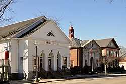
Island Grove Park National Register District |
|
02002-03-06-0000March 6, 2002
(#02000127) |
Park Ave.
42°06′46″N 70°51′40″W / 42.112778°N 70.861111°W / 42.112778; -70.861111 (Island Grove Park National Register District) |
Abington |
|
| 47 |
Capt. Benjamin James House |
|
01983-11-29-0000November 29, 1983
(#83004095) |
301 Driftway
42°10′37″N 70°44′35″W / 42.176944°N 70.743056°W / 42.176944; -70.743056 (Capt. Benjamin James House) |
Scituate |
|
| 48 |
King Caesar House |
|
01978-03-29-0000March 29, 1978
(#78000477) |
King Caesar Rd.
42°02′43″N 70°39′52″W / 42.045278°N 70.664444°W / 42.045278; -70.664444 (King Caesar House) |
Duxbury |
|
| 49 |
Gardner J. Kingman House |
|
01977-07-25-0000July 25, 1977
(#77000196) |
309 Main St.
42°04′45″N 71°01′15″W / 42.079167°N 71.020833°W / 42.079167; -71.020833 (Gardner J. Kingman House) |
Brockton |
|
| 50 |
Kingston Center Historic District |
|
02002-10-04-0000October 4, 2002
(#02001085) |
Main and Green Sts
41°59′42″N 70°44′00″W / 41.995°N 70.733333°W / 41.995; -70.733333 (Kingston Center Historic District) |
Kingston |
|
| 51 |
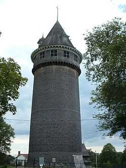
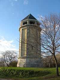
Lawson Tower |
|
01976-09-28-0000September 28, 1976
(#76001963) |
Off First Parish Rd.
42°12′01″N 70°45′21″W / 42.200278°N 70.755833°W / 42.200278; -70.755833 (Lawson Tower) |
Scituate |
|
| 52 |
Lincoln Historic District |
|
01991-01-07-0000January 7, 1991
(#90001728) |
Roughly North and South Sts. from West to Water Sts., Main St. south to Garrison Rd., and Lincoln St. and Fearing Rd. north to Miles
42°14′23″N 70°53′27″W / 42.239722°N 70.890833°W / 42.239722; -70.890833 (Lincoln Historic District) |
Hingham |
|
| 53 |
Gen. Benjamin Lincoln House |
|
01972-11-28-0000November 28, 1972
(#72001303) |
181 North St.
42°14′35″N 70°53′35″W / 42.243056°N 70.893056°W / 42.243056; -70.893056 (Gen. Benjamin Lincoln House) |
Hingham |
|
| 54 |
Lower Union Street Historic District |
|
01989-04-07-0000April 7, 1989
(#89000219) |
Union St. from Water St. to Market St.
42°07′38″N 70°54′57″W / 42.127222°N 70.915833°W / 42.127222; -70.915833 (Lower Union Street Historic District) |
Rockland |
|
| 55 |
Lyman Block |
|
01982-04-15-0000April 15, 1982
(#82004430) |
83-91 Main St.
42°05′01″N 71°01′15″W / 42.083611°N 71.020833°W / 42.083611; -71.020833 (Lyman Block) |
Brockton |
|
| 56 |
Marshfield Hills Historic District |
|
02009-12-18-0000December 18, 2009
(#09001096) |
Bow, Highland, Main, Old Main, Pleasant, and Prospect Sts., Glen
42°08′45″N 70°44′23″W / 42.145936°N 70.739764°W / 42.145936; -70.739764 (Marshfield Hills Historic District) |
Marshfield |
|
| 57 |
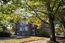
William H. McElwain School |
|
02013-01-14-0000January 14, 2013
(#12001170) |
250 Main St.
41°59′44″N 70°58′53″W / 41.995445°N 70.981468°W / 41.995445; -70.981468 (William H. McElwain School) |
Bridgewater |
|
| 58 |
Men of Kent Cemetery |
|
02013-06-25-0000June 25, 2013
(#13000442) |
Meeting House Lane
42°11′12″N 70°43′44″W / 42.18667°N 70.72894°W / 42.18667; -70.72894 (Men of Kent Cemetery) |
Scituate |
|
| 59 |
Middleborough Center Historic District |
|
02000-06-15-0000June 15, 2000
(#00000685) |
Roughly bounded by Conraill RR, Frank, Pierce, School, North Sts., Nemasket R., and East Grove St.
41°53′32″N 70°54′43″W / 41.8922°N 70.9119°W / 41.8922; -70.9119 (Middleborough Center Historic District) |
Middleborough |
|
| 60 |
Middleborough Waterworks |
|
01990-03-02-0000March 2, 1990
(#90000129) |
E. Grove St. at the Nemasket River and Wareham St. at Barden Hill Rd.
41°53′11″N 70°53′46″W / 41.886389°N 70.896111°W / 41.886389; -70.896111 (Middleborough Waterworks) |
Middleborough |
|
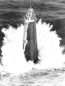
| 61 |
Minot's Ledge Light |
|
01987-06-15-0000June 15, 1987
(#87001489) |
Minot's Ledge
42°16′04″N 70°45′38″W / 42.267778°N 70.760556°W / 42.267778; -70.760556 (Minot's Ledge Light) |
Scituate |
|
| 62 |
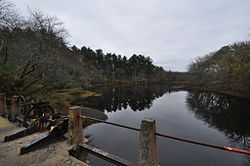
Muttock Historic and Archeological District |
|
02000-05-18-0000May 18, 2000
(#00000504) |
Oliver Mills Park
41°54′26″N 70°54′50″W / 41.907344°N 70.913981°W / 41.907344; -70.913981 (Muttock Historic and Archeological District) |
Middleborough |
Ruins of millworks first established by Peter Oliver.
|
| 63 |
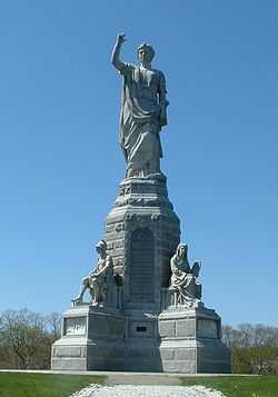
National Monument to the Forefathers |
|
01974-08-30-0000August 30, 1974
(#74002033) |
Allerton St.
41°57′36″N 70°40′36″W / 41.96°N 70.676667°W / 41.96; -70.676667 (National Monument to the Forefathers) |
Plymouth |
|
| 64 |
Ned Point Light |
|
01987-06-15-0000June 15, 1987
(#87001488) |
Ned Point Rd.
41°38′53″N 70°46′16″W / 41.648056°N 70.771111°W / 41.648056; -70.771111 (Ned Point Light) |
Mattapoisett |
|
| 65 |
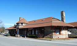
North Abington Depot |
|
01976-05-13-0000May 13, 1976
(#76001612) |
Railroad St.
42°07′45″N 70°56′32″W / 42.129167°N 70.942222°W / 42.129167; -70.942222 (North Abington Depot) |
Abington |
|
| 66 |
North Rochester Congregational Church |
|
02008-03-21-0000March 21, 2008
(#07001400) |
289 North Ave.
41°46′57″N 70°53′39″W / 41.7825°N 70.894167°W / 41.7825; -70.894167 (North Rochester Congregational Church) |
Rochester |
|
| 67 |
Norwell Village Area Historic District |
|
01982-06-02-0000June 2, 1982
(#82004432) |
MA 123
42°09′41″N 70°47′28″W / 42.161389°N 70.791111°W / 42.161389; -70.791111 (Norwell Village Area Historic District) |
Norwell |
|
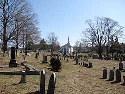
| 68 |
Old Burial Hill |
|
02013-08-07-0000August 7, 2013
(#13000582) |
Church, School & S. Russell Sts.
41°57′22″N 70°39′58″W / 41.956°N 70.666°W / 41.956; -70.666 (Old Burial Hill) |
Plymouth |
|
| 69 |
Old County Courthouse |
|
01972-02-23-0000February 23, 1972
(#72001297) |
Leyden and Market Sts.
41°57′20″N 70°39′53″W / 41.955556°N 70.664722°W / 41.955556; -70.664722 (Old County Courthouse) |
Plymouth |
|
| 70 |
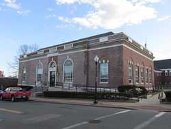
Old Post Office Building |
|
01978-03-08-0000March 8, 1978
(#78000474) |
Crescent St.
42°04′51″N 71°01′10″W / 42.080833°N 71.019444°W / 42.080833; -71.019444 (Old Post Office Building) |
Brockton |
|
| 71 |
Old Ship Meetinghouse |
|
01966-10-15-0000October 15, 1966
(#66000777) |
Main St.
42°14′28″N 70°53′16″W / 42.241111°N 70.887778°W / 42.241111; -70.887778 (Old Ship Meetinghouse) |
Hingham |
|
| 72 |
Old Shipbuilder's Historic District |
|
01986-08-21-0000August 21, 1986
(#86001899) |
Both sides of Washington St. from Powder Point Ave. to north of South Duxbury
42°02′17″N 70°40′31″W / 42.038056°N 70.675278°W / 42.038056; -70.675278 (Old Shipbuilder's Historic District) |
Duxbury |
|
| 73 |
Moses Packard House |
|
01978-02-17-0000February 17, 1978
(#78000475) |
647 Main St.
42°04′20″N 71°01′11″W / 42.072222°N 71.019722°W / 42.072222; -71.019722 (Moses Packard House) |
Brockton |
|
| 74 |
Paragon Park Carousel |
|
01999-09-14-0000September 14, 1999
(#99001081) |
1 Wharf Ave.
42°16′12″N 70°51′26″W / 42.27°N 70.857222°W / 42.27; -70.857222 (Paragon Park Carousel) |
Hull |
|
| 75 |
Parting Ways Archeological District |
|
01979-03-19-0000March 19, 1979
(#79000367) |
Plympton Road[7]
41°56′44″N 70°44′00″W / 41.945567°N 70.733233°W / 41.945567; -70.733233 (Parting Ways Archeological District) |
Plymouth |
|
| 76 |
Pembroke Friends Meetinghouse |
|
02006-09-06-0000September 6, 2006
(#06000786) |
Washington St. and Schoosett St.
42°06′17″N 70°48′18″W / 42.104722°N 70.805°W / 42.104722; -70.805 (Pembroke Friends Meetinghouse) |
Pembroke |
|
| 77 |
Phoenix Building |
|
01989-04-07-0000April 7, 1989
(#89000220) |
315-321 Union St.
42°08′16″N 70°54′59″W / 42.137778°N 70.916389°W / 42.137778; -70.916389 (Phoenix Building) |
Rockland |
|
| 78 |
Peter Pierce Store |
|
01976-04-30-0000April 30, 1976
(#76001611) |
N. Main and Jackson Sts.
41°53′35″N 70°54′28″W / 41.893056°N 70.907778°W / 41.893056; -70.907778 (Peter Pierce Store) |
Middleborough |
Now the police station.
|
| 79 |
Pilgrim Hall |
|
01972-04-11-0000April 11, 1972
(#72001298) |
75 Court St.
41°57′33″N 70°40′08″W / 41.959167°N 70.668889°W / 41.959167; -70.668889 (Pilgrim Hall) |
Plymouth |
|
| 80 |
Pillsbury Summer House |
|
02004-11-27-0000November 27, 2004
(#04001257) |
45 Old Cove Rd.
42°03′04″N 70°40′15″W / 42.051111°N 70.670833°W / 42.051111; -70.670833 (Pillsbury Summer House) |
Duxbury |
|
| 81 |
Pinewoods Camp |
|
02009-12-16-0000December 16, 2009
(#09001151) |
80 Cornish Field Rd.
41°51′17″N 70°36′16″W / 41.854692°N 70.604397°W / 41.854692; -70.604397 (Pinewoods Camp) |
Plymouth |
|
| 82 |
Plymouth Antiquarian House |
|
01974-12-27-0000December 27, 1974
(#74002034) |
126 Water St.
41°57′37″N 70°40′04″W / 41.960278°N 70.667778°W / 41.960278; -70.667778 (Plymouth Antiquarian House) |
Plymouth |
|
| 83 |
Plymouth Light Station |
|
01977-03-08-0000March 8, 1977
(#77000655) |
Southeast of Duxbury at Gurnet Point
42°00′12″N 70°36′04″W / 42.003333°N 70.601111°W / 42.003333; -70.601111 (Plymouth Light Station) |
Plymouth |
|
| 84 |
Plymouth Post Office Building |
|
01986-10-23-0000October 23, 1986
(#86002926) |
5 Main St.
41°57′21″N 70°39′50″W / 41.955833°N 70.663889°W / 41.955833; -70.663889 (Plymouth Post Office Building) |
Plymouth |
|
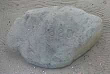
| 85 |
Plymouth Rock |
|
01970-07-01-0000July 1, 1970
(#70000680) |
Water St.
41°57′29″N 70°39′45″W / 41.958056°N 70.6625°W / 41.958056; -70.6625 (Plymouth Rock) |
Plymouth |
|
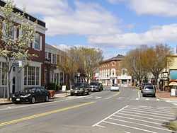
| 86 |
Plymouth Village Historic District |
|
01982-06-02-0000June 2, 1982
(#82004435) |
Roughly bounded by Water, Main, and Brewster Sts.
41°57′26″N 70°39′49″W / 41.957222°N 70.663611°W / 41.957222; -70.663611 (Plymouth Village Historic District) |
Plymouth |
|
| 87 |
Plympton Village Historic District |
|
02007-03-07-0000March 7, 2007
(#07000120) |
Main St., Elm St., Parsonage Rd., Mayflower Rd.
41°57′11″N 70°48′51″W / 41.953°N 70.814161°W / 41.953; -70.814161 (Plympton Village Historic District) |
Plympton |
|
| 88 |
Point Allerton Lifesaving Station |
|
01981-06-11-0000June 11, 1981
(#81000110) |
Nantasket Ave.
42°18′20″N 70°54′01″W / 42.305556°N 70.900278°W / 42.305556; -70.900278 (Point Allerton Lifesaving Station) |
Hull |
|
| 89 |
Rockland Almshouse |
|
01983-04-28-0000April 28, 1983
(#83000600) |
198 Spring St.
42°06′52″N 70°54′45″W / 42.114444°N 70.9125°W / 42.114444; -70.9125 (Rockland Almshouse) |
Rockland |
Now the North River Collaborative.
|
| 90 |
Rockland High School |
|
01989-03-23-0000March 23, 1989
(#89000217) |
394 Union St.
42°08′56″N 70°55′05″W / 42.148889°N 70.918056°W / 42.148889; -70.918056 (Rockland High School) |
Rockland |
|
| 91 |
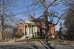
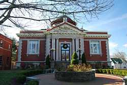
Rockland Memorial Library |
|
01989-03-23-0000March 23, 1989
(#89000221) |
382 Union St.
42°08′20″N 70°55′04″W / 42.138889°N 70.917778°W / 42.138889; -70.917778 (Rockland Memorial Library) |
Rockland |
|
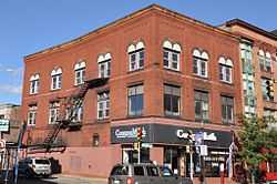
| 92 |
Rockland Trust Company |
|
01989-04-07-0000April 7, 1989
(#89000218) |
288 Union St.
42°08′10″N 70°54′59″W / 42.136111°N 70.916389°W / 42.136111; -70.916389 (Rockland Trust Company) |
Rockland |
|
| 93 |
Sachem Rock Farm |
|
02006-12-11-0000December 11, 2006
(#06001129) |
355 Plymouth St.
42°01′06″N 70°57′06″W / 42.018333°N 70.951667°W / 42.018333; -70.951667 (Sachem Rock Farm) |
East Bridgewater |
|
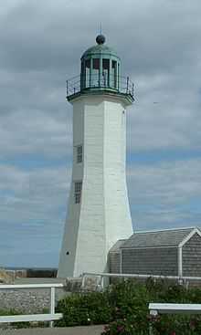
| 94 |
Scituate Light |
|
01987-06-15-0000June 15, 1987
(#87001490) |
Cedar Pt.
42°12′07″N 70°42′55″W / 42.201944°N 70.715278°W / 42.201944; -70.715278 (Scituate Light) |
Scituate |
|
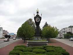
| 95 |
Snow Fountain and Clock |
|
01977-07-25-0000July 25, 1977
(#77000197) |
N. Main and E. Main Sts.
42°05′45″N 71°01′11″W / 42.095833°N 71.019722°W / 42.095833; -71.019722 (Snow Fountain and Clock) |
Brockton |
|
| 96 |
South Hingham Historic District |
|
01998-07-24-0000July 24, 1998
(#98000838) |
Roughly along Main St. from Cushing St. to Tower Brook Rd.
42°12′40″N 70°53′06″W / 42.211111°N 70.885°W / 42.211111; -70.885 (South Hingham Historic District) |
Hingham |
|
| 97 |
South Middleborough Historic District |
|
02009-06-19-0000June 19, 2009
(#09000438) |
Locust, Spruce, and Wareham Sts.
41°49′27″N 70°49′38″W / 41.824119°N 70.827239°W / 41.824119; -70.827239 (South Middleborough Historic District) |
Middleborough |
|
| 98 |
South Street Historic District |
|
01983-10-06-0000October 6, 1983
(#83004096) |
Roughly South St. from Main St. to Warren Ave.
42°03′47″N 71°01′11″W / 42.063056°N 71.019722°W / 42.063056; -71.019722 (South Street Historic District) |
Brockton |
|
| 99 |
Richard Sparrow House |
|
01974-10-09-0000October 9, 1974
(#74002035) |
42 Summer St.
41°57′15″N 70°39′54″W / 41.954167°N 70.665°W / 41.954167; -70.665 (Richard Sparrow House) |
Plymouth |
|
| 100 |
Alexander Standish House |
|
01978-07-12-0000July 12, 1978
(#78001407) |
341 Standish St.
42°00′30″N 70°40′45″W / 42.008333°N 70.679167°W / 42.008333; -70.679167 (Alexander Standish House) |
Duxbury |
|
| 101 |
Stetson House |
|
01979-09-07-0000September 7, 1979
(#79000366) |
Hanover St.
42°06′58″N 70°50′39″W / 42.116111°N 70.844167°W / 42.116111; -70.844167 (Stetson House) |
Hanover |
|
| 102 |
Stetson-Ford House |
|
01998-03-09-0000March 9, 1998
(#98000120) |
2 Meadow Farms Way
42°07′18″N 70°47′05″W / 42.121667°N 70.784722°W / 42.121667; -70.784722 (Stetson-Ford House) |
Norwell |
|
| 103 |
The Tack Factory |
Upload image |
01980-12-03-0000December 3, 1980
(#80000472) |
Southwest of Norwell at 49 Tiffany Rd.
42°07′21″N 70°48′33″W / 42.1225°N 70.809167°W / 42.1225; -70.809167 (The Tack Factory) |
Norwell |
Demolished by fire in 1983.[8]
|
| 104 |
Tarkiln School |
|
02009-08-26-0000August 26, 2009
(#09000647) |
245 Summer Street
42°02′09″N 70°44′27″W / 42.035833°N 70.740833°W / 42.035833; -70.740833 (Tarkiln School) |
Duxbury |
Misspelled "Tarklin" in the National Register.
|
| 105 |
Telegraph Hill |
|
01976-07-12-0000July 12, 1976
(#76000953) |
Farina Road
42°18′15″N 70°54′16″W / 42.3043°N 70.9044°W / 42.3043; -70.9044 (Telegraph Hill) |
Hull |
|
| 106 |
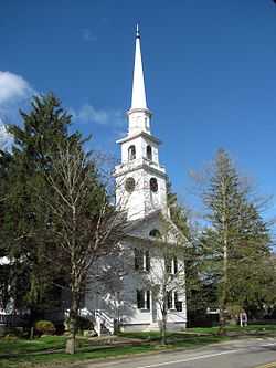
Third Meetinghouse |
|
01976-01-02-0000January 2, 1976
(#76000956) |
1 Fairhaven Rd.
41°39′43″N 70°49′13″W / 41.661944°N 70.820278°W / 41.661944; -70.820278 (Third Meetinghouse) |
Mattapoisett |
|
| 107 |
Thomas-Webster Estate |
|
01993-04-05-0000April 5, 1993
(#93000206) |
238 Webster St.
42°04′46″N 70°40′46″W / 42.079444°N 70.679444°W / 42.079444; -70.679444 (Thomas-Webster Estate) |
Marshfield |
|
| 108 |
Tom Thumb House |
|
01993-04-16-0000April 16, 1993
(#93000298) |
351 Plymouth St.
41°55′16″N 70°55′08″W / 41.921111°N 70.918889°W / 41.921111; -70.918889 (Tom Thumb House) |
Middleborough |
|
| 109 |
Tobey Homestead |
|
01986-06-05-0000June 5, 1986
(#86001219) |
Main St. and Sandwich Rd.
41°45′24″N 70°42′51″W / 41.756667°N 70.714167°W / 41.756667; -70.714167 (Tobey Homestead) |
Wareham |
|
| 110 |
Town Brook Historic and Archeological District |
|
01995-10-12-0000October 12, 1995
(#95001176) |
Address restricted
41°57′01″N 70°40′08″W / 41.950278°N 70.668889°W / 41.950278; -70.668889 (Town Brook Historic and Archeological District) |
Plymouth |
|
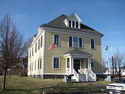
| 111 |
Town Hall |
|
01976-10-22-0000October 22, 1976
(#76000955) |
Bedford St.
41°50′45″N 70°57′02″W / 41.845833°N 70.950556°W / 41.845833; -70.950556 (Town Hall) |
Lakeville |
|
| 112 |
Tremont Nail Factory District |
|
01976-10-22-0000October 22, 1976
(#76001964) |
21 Elm St.
41°45′59″N 70°43′20″W / 41.766389°N 70.722222°W / 41.766389; -70.722222 (Tremont Nail Factory District) |
Wareham |
|
| 113 |
US Post Office-Middleborough Main |
|
01987-10-19-0000October 19, 1987
(#87001774) |
90 Center St.
41°53′33″N 70°54′40″W / 41.8925°N 70.911111°W / 41.8925; -70.911111 (US Post Office-Middleborough Main) |
Middleborough |
|
| 114 |
WPA Field House and Pump Station |
|
02009-05-29-0000May 29, 2009
(#09000355) |
7-19 Henry Turner Bailey Rd.
42°13′06″N 70°47′16″W / 42.21833°N 70.78773°W / 42.21833; -70.78773 (WPA Field House and Pump Station) |
Scituate |
|
| 115 |
Wampanoag Royal Cemetery |
|
01975-11-11-0000November 11, 1975
(#75001625) |
Bedford Street
41°47′43″N 70°54′45″W / 41.79538°N 70.91238°W / 41.79538; -70.91238 (Wampanoag Royal Cemetery) |
Lakeville |
|
| 116 |
Wampanucket Site |
|
01973-06-04-0000June 4, 1973
(#73001596) |
near Assawompset Pond[9]
|
Middleborough |
Paleo-Indian site
|
| 117 |
War Memorial Park |
|
02008-05-21-0000May 21, 2008
(#08000445) |
River St.
42°09′46″N 71°00′31″W / 42.1629°N 71.00858°W / 42.1629; -71.00858 (War Memorial Park) |
West Bridgewater |
|
| 118 |
C.P. Washburn Grain Mill |
Upload image |
01980-04-08-0000April 8, 1980
(#80000667) |
Central and Cambridge Sts.
41°53′37″N 70°55′10″W / 41.893611°N 70.919444°W / 41.893611; -70.919444 (C.P. Washburn Grain Mill) |
Middleborough |
Demolished.[10]
|
| 119 |
Daniel Webster Law Office and Library |
|
01974-05-30-0000May 30, 1974
(#74002053) |
Careswell and Webster Sts.
42°04′18″N 70°40′26″W / 42.071667°N 70.673889°W / 42.071667; -70.673889 (Daniel Webster Law Office and Library) |
Marshfield |
|
| 120 |
Whitman Park |
|
02004-03-18-0000March 18, 2004
(#04000187) |
Park, Maple, Whitman, and Hayden Aves.
42°04′59″N 70°55′06″W / 42.083056°N 70.918333°W / 42.083056; -70.918333 (Whitman Park) |
Whitman |
|
| 121 |
Isaac Winslow House |
|
02000-08-15-0000August 15, 2000
(#00000872) |
634 Careswell St.
42°04′18″N 70°40′23″W / 42.0716°N 70.6730°W / 42.0716; -70.6730 (Isaac Winslow House) |
Marshfield |
|
| 122 |
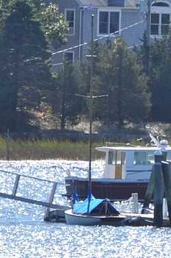
WITCH (catboat) |
|
02008-06-18-0000June 18, 2008
(#08000533) |
35 Lydia Island Rd.
41°44′04″N 70°39′45″W / 41.734422°N 70.662486°W / 41.734422; -70.662486 (WITCH (catboat)) |
Wareham |
|
| 123 |
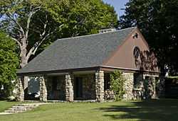
Woodworth House |
Upload image |
01996-04-09-0000April 9, 1996
(#96000317) |
47 Old Oaken Bucket Rd.
42°10′39″N 70°45′23″W / 42.1775°N 70.756389°W / 42.1775; -70.756389 (Woodworth House) |
Scituate |
|
| 124 |
Wright Memorial Library |
|
02007-07-11-0000July 11, 2007
(#07000680) |
147 St. George St.
42°02′55″N 70°40′48″W / 42.048611°N 70.68°W / 42.048611; -70.68 (Wright Memorial Library) |
Duxbury |
|

.jpg)


.jpg)

.jpg)


.jpg)