| [3] |
Name on the Register[4] |
Image |
Date listed[5] |
Location |
City or town |
Description |
|---|
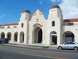
| 1 |
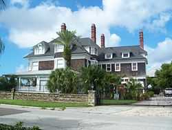
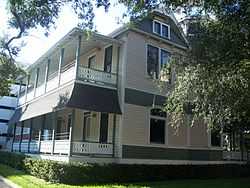
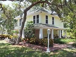
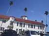
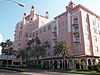
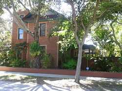
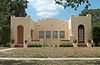
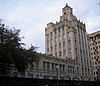
Alexander Hotel |
|
01984-11-01-0000November 1, 1984
(#84000200) |
535 Central Avenue
27°46′16″N 82°38′28″W / 27.771111°N 82.641111°W / 27.771111; -82.641111 (Alexander Hotel) |
St. Petersburg |
|
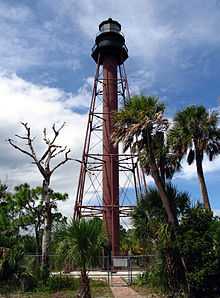
| 2 |
Anclote Key Lighthouse |
|
01999-04-01-0000April 1, 1999
(#99000410) |
Southern end of Anclote Key Island
28°10′00″N 82°50′42″W / 28.166667°N 82.845°W / 28.166667; -82.845 (Anclote Key Lighthouse) |
Anclote Key Island |
|
| 3 |
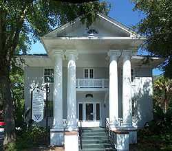
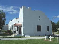
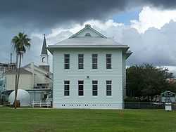
Andrews Memorial Chapel |
|
01972-07-31-0000July 31, 1972
(#72000346) |
Buena Vista and San Mateo
28°02′03″N 82°47′03″W / 28.034305°N 82.784282°W / 28.034305; -82.784282 (Andrews Memorial Chapel) |
Dunedin |
|
| 4 |
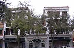
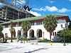
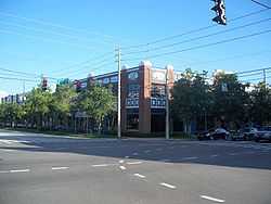
Arcade Hotel |
|
01984-01-12-0000January 12, 1984
(#84000943) |
210 Pinellas Avenue
28°08′40″N 82°45′24″W / 28.144444°N 82.756667°W / 28.144444; -82.756667 (Arcade Hotel) |
Tarpon Springs |
|
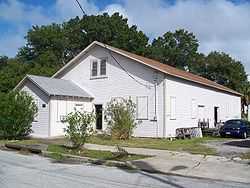
| 5 |
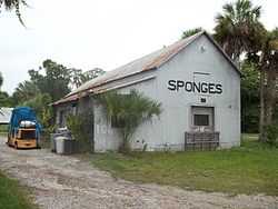
N. G. Arfaras Sponge Packing House |
|
01991-04-10-0000April 10, 1991
(#91000412) |
26 West Park Street
28°09′00″N 82°45′26″W / 28.15°N 82.757222°W / 28.15; -82.757222 (N. G. Arfaras Sponge Packing House) |
Tarpon Springs |
|
| 6 |
Bay Pines Site (8Pi64) |
|
01983-02-23-0000February 23, 1983
(#83001443) |
Address Restricted
27°48′37″N 82°46′42″W / 27.810278°N 82.778333°W / 27.810278; -82.778333 (Bay Pines Site (8Pi64)) |
Bay Pines |
|
| 7 |
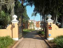
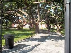
Bay Pines Veterans Administration Home and Hospital Historic District |
|
02012-06-27-0000June 27, 2012
(#12000363) |
10000 Bay Pines Blvd.
27°48′49″N 82°46′41″W / 27.81361°N 82.778056°W / 27.81361; -82.778056 (Bay Pines Veterans Administration Home and Hospital Historic District) |
Bay Pines |
United States Second Generation Veterans Hospitals MPS
|
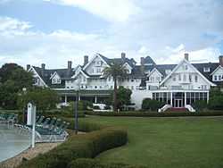
| 8 |
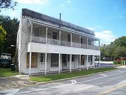
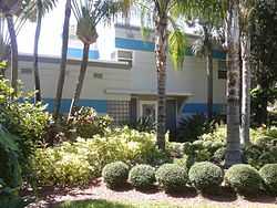
Belleview-Biltmore Hotel |
|
01979-12-26-0000December 26, 1979
(#79000687) |
Off State Road 697
27°56′37″N 82°49′06″W / 27.943611°N 82.818333°W / 27.943611; -82.818333 (Belleview-Biltmore Hotel) |
Clearwater |
|
| 9 |
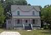
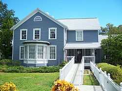
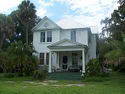
Willis S. Blatchley House |
|
02009-09-23-0000September 23, 2009
(#09000747) |
232 Lee Street
28°01′11″N 82°47′24″W / 28.019758°N 82.790021°W / 28.019758; -82.790021 (Willis S. Blatchley House) |
Dunedin |
|
| 10 |
Boone House |
|
01986-07-03-0000July 3, 1986
(#86001457) |
601 Fifth Avenue North
27°46′38″N 82°38′31″W / 27.777222°N 82.641944°W / 27.777222; -82.641944 (Boone House) |
St. Petersburg |
|
| 11 |
Casa Coe da Sol |
|
01980-07-17-0000July 17, 1980
(#80000963) |
510 Park Street
27°46′39″N 82°44′46″W / 27.7775°N 82.746111°W / 27.7775; -82.746111 (Casa Coe da Sol) |
St. Petersburg |
|
| 12 |
Casa De Muchas Flores |
|
01985-01-31-0000January 31, 1985
(#85000160) |
1446 Park Street North
27°47′11″N 82°45′09″W / 27.786389°N 82.7525°W / 27.786389; -82.7525 (Casa De Muchas Flores) |
St. Petersburg |
|
| 13 |
Central High School |
|
01984-08-01-0000August 1, 1984
(#84000946) |
2501-5th Avenue North
27°46′40″N 82°40′06″W / 27.777778°N 82.668333°W / 27.777778; -82.668333 (Central High School) |
St. Petersburg |
Now part of St. Petersburg High School
|
| 14 |
Cleveland Street Post Office |
|
01980-08-07-0000August 7, 1980
(#80000962) |
650 Cleveland Street
27°57′56″N 82°47′50″W / 27.965556°N 82.797222°W / 27.965556; -82.797222 (Cleveland Street Post Office) |
Clearwater |
|
| 15 |
Dennis Hotel |
|
01986-04-17-0000April 17, 1986
(#86000804) |
326 First Avenue North
27°46′12″N 82°37′33″W / 27.77°N 82.625833°W / 27.77; -82.625833 (Dennis Hotel) |
St. Petersburg |
|
| 16 |
Domestic Science and Manual Training School |
|
01999-10-14-0000October 14, 1999
(#99001250) |
440–442 Second Avenue North
27°46′22″N 82°38′22″W / 27.772778°N 82.639444°W / 27.772778; -82.639444 (Domestic Science and Manual Training School) |
St. Petersburg |
|
| 17 |
Don Ce Sar Hotel |
|
01975-04-03-0000April 3, 1975
(#75000563) |
3400 Gulf Boulevard
27°42′32″N 82°44′15″W / 27.708889°N 82.7375°W / 27.708889; -82.7375 (Don Ce Sar Hotel) |
St. Pete Beach |
|
| 18 |
J. O. Douglas House |
|
01979-11-29-0000November 29, 1979
(#79000691) |
209 Scotland Street
28°00′38″N 82°47′29″W / 28.010556°N 82.791389°W / 28.010556; -82.791389 (J. O. Douglas House) |
Dunedin |
|
| 19 |
Downtown St. Petersburg Historic District |
|
02004-04-30-0000April 30, 2004
(#04000364) |
Bounded by 5th Avenue North, Beach Drive Northeast, Central Avenue, and 9th Street North
27°46′34″N 82°38′19″W / 27.776111°N 82.638611°W / 27.776111; -82.638611 (Downtown St. Petersburg Historic District) |
St. Petersburg |
|
| 20 |
DUCHESS (Sponge Hooking Boat) |
|
01990-08-02-0000August 2, 1990
(#90001133) |
Tarpon Springs Sponge Docks at Dodecanese Boulevard
28°09′19″N 82°45′43″W / 28.155278°N 82.761944°W / 28.155278; -82.761944 (DUCHESS (Sponge Hooking Boat)) |
Tarpon Springs |
Part of the Tarpon Springs Sponge Boats MPS
|
| 21 |
Dunedin Isles Golf Club Golf Course |
Upload image |
02014-06-04-0000June 4, 2014
(#14000283) |
1050 Palm Blvd.
28°02′30″N 82°46′37″W / 28.0416957°N 82.7768169°W / 28.0416957; -82.7768169 (Dunedin Isles Golf Club Golf Course) |
Dunedin |
|
| 22 |
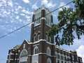
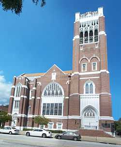
First Methodist Church of St. Petersburg |
|
01990-09-13-0000September 13, 1990
(#90001433) |
212 Third Street, North
27°46′31″N 82°38′15″W / 27.775278°N 82.6375°W / 27.775278; -82.6375 (First Methodist Church of St. Petersburg) |
St. Petersburg |
|
| 23 |
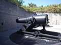
Fort Desoto Batteries |
|
01977-12-02-0000December 2, 1977
(#77000407) |
8 miles (13 km) south of St. Petersburg on Mullet Key
27°36′53″N 82°44′13″W / 27.614722°N 82.736944°W / 27.614722; -82.736944 (Fort Desoto Batteries) |
St. Petersburg |
|
| 24 |
GEORGE N. CRETEKOS (Sponge Diving Boat) |
|
01990-08-03-0000August 3, 1990
(#90001135) |
Tarpon Springs Sponge Docks at Dodecanese Boulevard
28°09′19″N 82°45′43″W / 28.155278°N 82.761944°W / 28.155278; -82.761944 (GEORGE N. CRETEKOS (Sponge Diving Boat)) |
Tarpon Springs |
Part of the Tarpon Springs Sponge Boats MPS
|
| 25 |
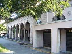
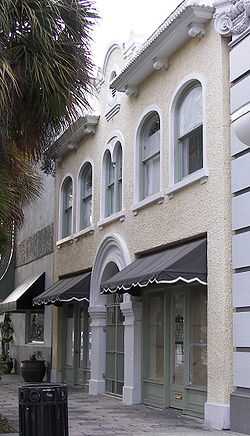
Green-Richman Arcade |
|
01998-01-30-0000January 30, 1998
(#98000027) |
689 Central Avenue
27°46′17″N 82°38′37″W / 27.771389°N 82.643611°W / 27.771389; -82.643611 (Green-Richman Arcade) |
St. Petersburg |
|
| 26 |
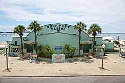
Gulfport Casino |
|
02014-08-08-0000August 8, 2014
(#14000477) |
5500 Shore Blvd.
27°44′15″N 82°42′28″W / 27.7376°N 82.7078°W / 27.7376; -82.7078 (Gulfport Casino) |
Gulfport |
|
| 27 |
Harbor Oaks Residential District |
|
01988-03-15-0000March 15, 1988
(#87002133) |
Roughly bounded by Druid Road, South Fort Harrison Avenue, Lotus Path, & Clearwater Harbor
27°57′21″N 82°48′11″W / 27.955833°N 82.803056°W / 27.955833; -82.803056 (Harbor Oaks Residential District) |
Clearwater |
|
| 28 |
James Henry House |
|
02013-04-16-0000April 16, 2013
(#13000164) |
950 12th St., N.
27°46′54″N 82°39′04″W / 27.781798°N 82.651081°W / 27.781798; -82.651081 (James Henry House) |
St. Petersburg |
|
| 29 |
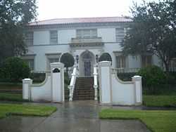
Ingleside |
|
01992-04-28-0000April 28, 1992
(#92000405) |
333 South Bayshore Boulevard
27°59′18″N 82°41′25″W / 27.988333°N 82.690278°W / 27.988333; -82.690278 (Ingleside) |
Safety Harbor |
|
| 30 |
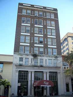
Louis Johnson Building |
|
01987-12-03-0000December 3, 1987
(#87001632) |
161 First Street, Southwest
27°54′55″N 82°47′19″W / 27.915278°N 82.788611°W / 27.915278; -82.788611 (Louis Johnson Building) |
Largo |
|
| 31 |
Jungle Prada Site |
|
02003-02-04-0000February 4, 2003
(#03000007) |
Address Restricted
27°47′19″N 82°45′08″W / 27.788611°N 82.752222°W / 27.788611; -82.752222 (Jungle Prada Site) |
St. Petersburg |
|
| 32 |
Kenwood Historic District |
|
02003-08-04-0000August 4, 2003
(#03000729) |
Roughly bounded by 9th Avenue, 19th Street, 1st Avenue, 31st Street, 5th Ave, and 34th Street
27°40′40″N 82°41′08″W / 27.677778°N 82.685556°W / 27.677778; -82.685556 (Kenwood Historic District) |
St. Petersburg |
|
| 33 |
S. H. Kress and Company Building |
|
02001-10-01-0000October 1, 2001
(#01001057) |
475 Central Avenue
27°46′15″N 82°38′25″W / 27.770833°N 82.640278°W / 27.770833; -82.640278 (S. H. Kress and Company Building) |
St. Petersburg |
|
| 34 |
John & Florence McKeage House |
|
02013-04-09-0000April 9, 2013
(#13000145) |
209 Park St., S.
27°46′08″N 82°44′29″W / 27.768905°N 82.741465°W / 27.768905; -82.741465 (John & Florence McKeage House) |
St. Petersburg |
|
| 35 |
E. R. Meres Sponge Packing House |
|
01991-04-10-0000April 10, 1991
(#91000411) |
106 Read Street
28°08′57″N 82°45′42″W / 28.149167°N 82.761667°W / 28.149167; -82.761667 (E. R. Meres Sponge Packing House) |
Tarpon Springs |
|
| 36 |
Mount Olive African Methodist Episcopal Church |
|
02000-02-03-0000February 3, 2000
(#99000802) |
600 Jones Street
27°58′08″N 82°47′54″W / 27.968889°N 82.798333°W / 27.968889; -82.798333 (Mount Olive African Methodist Episcopal Church) |
Clearwater |
|
| 37 |
N.K. SYMI (Sponge Diving Boat) |
|
01990-08-02-0000August 2, 1990
(#90001132) |
Tarpon Springs Sponge Docks at Dodecanese Boulevard
28°09′19″N 82°45′43″W / 28.155278°N 82.761944°W / 28.155278; -82.761944 (N.K. SYMI (Sponge Diving Boat)) |
Tarpon Springs |
Part of the Tarpon Springs Sponge Boats MPS
|
| 38 |
North Shore Historic District |
|
02003-02-20-0000February 20, 2003
(#03000040) |
Bounded by 4th Street, 5th Avenue, Tampa Bay, and 30th Ave
27°47′17″N 82°37′58″W / 27.788056°N 82.632778°W / 27.788056; -82.632778 (North Shore Historic District) |
St. Petersburg |
|
| 39 |
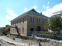
Old Belleair Town Hall |
|
01994-05-06-0000May 6, 1994
(#94000421) |
903 Ponce de Leon Boulevard
27°56′05″N 82°48′14″W / 27.934722°N 82.803889°W / 27.934722; -82.803889 (Old Belleair Town Hall) |
Belleair |
|
| 40 |
Old Pinellas County Courthouse |
|
01992-06-25-0000June 25, 1992
(#92000828) |
315 Court Street
27°57′43″N 82°48′05″W / 27.961944°N 82.801389°W / 27.961944; -82.801389 (Old Pinellas County Courthouse) |
Clearwater |
|
| 41 |
Old Tarpon Springs City Hall |
|
01990-08-10-0000August 10, 1990
(#90001117) |
101 South Pinellas Avenue
28°08′42″N 82°45′24″W / 28.145°N 82.756667°W / 28.145; -82.756667 (Old Tarpon Springs City Hall) |
Tarpon Springs |
|
| 42 |
Old Tarpon Springs High School |
|
01990-10-11-0000October 11, 1990
(#90001538) |
324 East Pine Street
28°09′02″N 82°45′06″W / 28.150556°N 82.751667°W / 28.150556; -82.751667 (Old Tarpon Springs High School) |
Tarpon Springs |
|
| 43 |
Pass-a-Grille Historic District |
|
01989-10-19-0000October 19, 1989
(#89001734) |
Roughly bounded by 12th Avenue, Gulf Boulevard, 4th Avenue, and Gulf Avenue
27°41′17″N 82°44′14″W / 27.688056°N 82.737222°W / 27.688056; -82.737222 (Pass-a-Grille Historic District) |
St. Pete Beach |
There was a boundary increase on September 15, 2003 (refnum 03000943)
|
| 44 |
Potter House |
|
01986-06-13-0000June 13, 1986
(#86001258) |
577 Second Street South
27°45′51″N 82°38′09″W / 27.764167°N 82.635833°W / 27.764167; -82.635833 (Potter House) |
St. Petersburg |
Demolished by 1990[6]
|
| 45 |
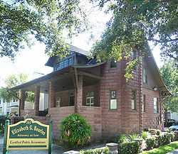
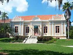
Donald Roebling Estate |
|
01979-12-19-0000December 19, 1979
(#79000689) |
700 Orange Avenue
27°57′27″N 82°48′17″W / 27.9575°N 82.804722°W / 27.9575; -82.804722 (Donald Roebling Estate) |
Clearwater |
|
| 46 |
Roser Park Historic District |
|
01998-04-01-0000April 1, 1998
(#98000295) |
Roughly bounded by 5th and 9th Streets South and 6th and 11th Avenues South
27°45′35″N 82°38′31″W / 27.759722°N 82.641944°W / 27.759722; -82.641944 (Roser Park Historic District) |
St. Petersburg |
|
| 47 |
Maurice and Thelma Rothman House |
|
02013-02-27-0000February 27, 2013
(#13000034) |
1018 Park St., N.
27°46′54″N 82°44′57″W / 27.781588°N 82.749122°W / 27.781588; -82.749122 (Maurice and Thelma Rothman House) |
St. Petersburg |
|
| 48 |
Round Lake Historic District |
|
02003-09-29-0000September 29, 2003
(#03000824) |
Roughly 5th Avenue, 9th Street, 13th Avenue, and 4th Street
27°39′50″N 82°38′22″W / 27.663889°N 82.639444°W / 27.663889; -82.639444 (Round Lake Historic District) |
St. Petersburg |
|
| 49 |
Safety Harbor Site |
|
01966-10-15-0000October 15, 1966
(#66000270) |
Address Restricted
28°00′27″N 82°40′48″W / 28.0075°N 82.68°W / 28.0075; -82.68 (Safety Harbor Site) |
Safety Harbor |
|
| 50 |
Safford House |
|
01974-10-16-0000October 16, 1974
(#74000654) |
Parken Place
28°08′53″N 82°45′36″W / 28.148056°N 82.76°W / 28.148056; -82.76 (Safford House) |
Tarpon Springs |
|
| 51 |
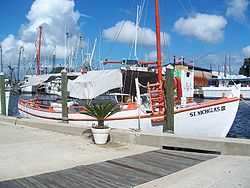
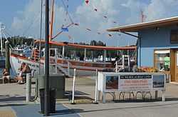
ST. NICHOLAS III (Sponge Diving Boat) |
|
01990-08-03-0000August 3, 1990
(#90001136) |
Tarpon Springs Sponge Docks at Dodecanese Boulevard
28°09′19″N 82°45′43″W / 28.155278°N 82.761944°W / 28.155278; -82.761944 (ST. NICHOLAS III (Sponge Diving Boat)) |
Tarpon Springs |
Part of the Tarpon Springs Sponge Boats MPS
|
| 52 |
ST. NICHOLAS VI (Sponge Diving Boat) |
|
01990-08-03-0000August 3, 1990
(#90001134) |
Tarpon Springs Sponge Docks at Dodecanese Boulevard
28°09′19″N 82°45′43″W / 28.155278°N 82.761944°W / 28.155278; -82.761944 (ST. NICHOLAS VI (Sponge Diving Boat)) |
Tarpon Springs |
Part of the Tarpon Springs Sponge Boats MPS
|
| 53 |
St. Petersburg Lawn Bowling Club |
|
01980-07-09-0000July 9, 1980
(#80004602) |
536 4th Avenue, North
27°46′33″N 82°38′27″W / 27.775833°N 82.640833°W / 27.775833; -82.640833 (St. Petersburg Lawn Bowling Club) |
St. Petersburg |
|
| 54 |
St. Petersburg Public Library |
|
01986-06-13-0000June 13, 1986
(#86001259) |
280 Fifth Street North
27°46′29″N 82°38′26″W / 27.774722°N 82.640556°W / 27.774722; -82.640556 (St. Petersburg Public Library) |
St. Petersburg |
|
| 55 |
St. Petersburg Woman's Club |
|
01994-07-15-0000July 15, 1994
(#94000708) |
40 Snell Isle Boulevard
27°47′34″N 82°38′10″W / 27.792778°N 82.636111°W / 27.792778; -82.636111 (St. Petersburg Woman's Club) |
St. Petersburg |
|
| 56 |
Sanitary Public Market |
|
02002-06-27-0000June 27, 2002
(#02000680) |
1825 4th Street North
27°47′24″N 82°38′18″W / 27.79°N 82.638333°W / 27.79; -82.638333 (Sanitary Public Market) |
St. Petersburg |
|
| 57 |
Snell Arcade |
|
01982-11-04-0000November 4, 1982
(#82001037) |
405 Central Avenue
27°46′16″N 82°38′20″W / 27.771111°N 82.638889°W / 27.771111; -82.638889 (Snell Arcade) |
St. Petersburg |
|
| 58 |
South Ward School |
|
01979-06-18-0000June 18, 1979
(#79000690) |
610 South Fort Harrison Avenue
27°57′29″N 82°48′02″W / 27.958056°N 82.800556°W / 27.958056; -82.800556 (South Ward School) |
Clearwater |
|
| 59 |
Studebaker Building |
|
01985-07-05-0000July 5, 1985
(#85001485) |
600 Fourth Street South
27°45′49″N 82°38′18″W / 27.763611°N 82.638333°W / 27.763611; -82.638333 (Studebaker Building) |
St. Petersburg |
|
| 60 |
Sunset Hotel |
Upload image |
02014-11-24-0000November 24, 2014
(#14000952) |
7401 Central Ave.
27°46′17″N 82°44′28″W / 27.771305°N 82.741007°W / 27.771305; -82.741007 (Sunset Hotel) |
St. Petersburg |
|
| 61 |
Tarpon Springs Greektown Historic District |
|
02014-06-02-0000June 2, 2014
(#14000321) |
Bounded by Dodecanese & Roosevelt Blvds., W. Tarpon & N. Pinellas Aves.
28°09′08″N 82°45′36″W / 28.1521461°N 82.7600243°W / 28.1521461; -82.7600243 (Tarpon Springs Greektown Historic District) |
Tarpon Springs |
|
| 62 |
Tarpon Springs Historic District |
|
01990-12-06-0000December 6, 1990
(#90001762) |
Roughly bounded by Read Street, Hibiscus Street, Orange Street, Levis Avenue, Lemon Street, and Spring Bayou
28°09′04″N 82°47′13″W / 28.151111°N 82.786944°W / 28.151111; -82.786944 (Tarpon Springs Historic District) |
Tarpon Springs |
|
| 63 |
U.S. Post Office |
|
01975-04-04-0000April 4, 1975
(#75000564) |
Southwestern corner of 1st Avenue North and 4th Street North
27°46′17″N 82°38′21″W / 27.771389°N 82.639167°W / 27.771389; -82.639167 (U.S. Post Office) |
St. Petersburg |
|
| 64 |
Veillard House |
|
01982-10-29-0000October 29, 1982
(#82001038) |
262 North 4th Avenue
27°46′34″N 82°38′24″W / 27.776111°N 82.64°W / 27.776111; -82.64 (Veillard House) |
St. Petersburg |
|
| 65 |
Vinoy Park Hotel |
|
01978-09-11-0000September 11, 1978
(#78000955) |
501 Fifth Avenue Northeast
27°46′41″N 82°37′44″W / 27.778056°N 82.628889°W / 27.778056; -82.628889 (Vinoy Park Hotel) |
St. Petersburg |
|
| 66 |
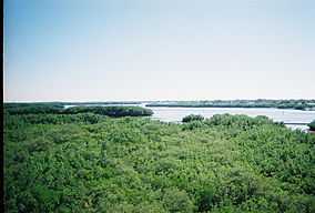
Weedon Island Site |
|
01972-06-13-0000June 13, 1972
(#72000347) |
Address Restricted
27°50′42″N 82°36′07″W / 27.845°N 82.601944°W / 27.845; -82.601944 (Weedon Island Site) |
St. Petersburg |
|
| 67 |
John C. Williams House |
|
01975-04-24-0000April 24, 1975
(#75000565) |
444 5th Avenue South
27°45′55″N 82°38′23″W / 27.765278°N 82.639722°W / 27.765278; -82.639722 (John C. Williams House) |
St. Petersburg |
|


_Sponge_Hooking_Boat.gif)
_Sponge_Diving_Boat.gif)
.jpg)
_Sponge_Diving_Boat.gif)


_01.jpg)