| [3] |
Name on the Register[4] |
Image |
Date listed[5] |
Location |
City or town |
Description |
|---|
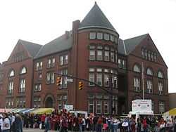
| 1 |
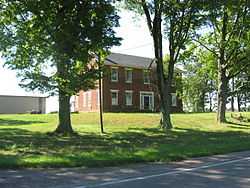
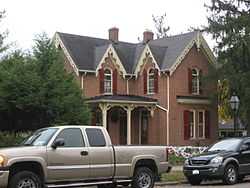
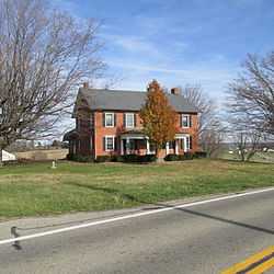
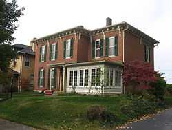
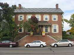
William Marshall Anderson House |
|
01979-11-29-0000November 29, 1979
(#79001925) |
131 W. Union St.
39°35′57″N 82°56′50″W / 39.599167°N 82.947222°W / 39.599167; -82.947222 (William Marshall Anderson House) |
Circleville |
|
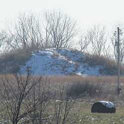
| 2 |
Arledge Mounds I and II |
|
01974-07-30-0000July 30, 1974
(#74001591) |
Off State Route 56 southeast of Circleville[6]
39°33′00″N 82°52′27″W / 39.550000°N 82.874167°W / 39.550000; -82.874167 (Arledge Mounds I and II) |
Pickaway Township |
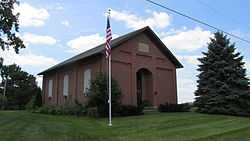
Not along any road[7]
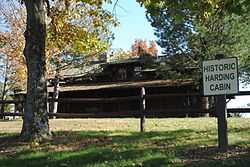
|
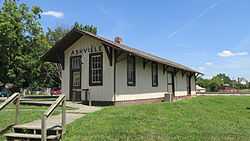
| 3 |
Ashville Depot |
|
01980-02-25-0000February 25, 1980
(#80003209) |
Madison and Cromley Sts.
39°42′54″N 82°57′20″W / 39.715°N 82.955556°W / 39.715; -82.955556 (Ashville Depot) |
Ashville |
|
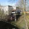
| 4 |
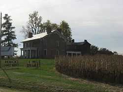
Bazore Mill |
|
01978-12-19-0000December 19, 1978
(#78002172) |
South of Williamsport on State Route 138 at Deer Creek
39°33′04″N 83°06′31″W / 39.551111°N 83.108611°W / 39.551111; -83.108611 (Bazore Mill) |
Deer Creek Township |
|
| 5 |
Bellevue |
|
01976-03-17-0000March 17, 1976
(#76001508) |
North of Kingston on State Route 159
39°29′01″N 82°54′07″W / 39.483611°N 82.901944°W / 39.483611; -82.901944 (Bellevue) |
Pickaway Township |
|
| 6 |
Joseph Black Farmhouse |
|
01982-08-09-0000August 9, 1982
(#02001459) |
9862 Heffner Rd.
39°30′51″N 82°50′47″W / 39.514047°N 82.846325°W / 39.514047; -82.846325 (Joseph Black Farmhouse) |
Pickaway Township |
|
| 7 |
Granville M. Bulen House and Farm Complex |
|
02014-02-24-0000February 24, 2014
(#14000028) |
10001 Bulen-Pierce Rd., south of Lockbourne
39°47′14″N 82°58′34″W / 39.787333°N 82.976111°W / 39.787333; -82.976111 (Granville M. Bulen House and Farm Complex) |
Harrison Township |
|
| 8 |
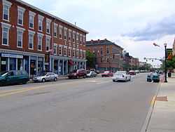
Circleville Historic District |
|
01978-05-16-0000May 16, 1978
(#78002171) |
Main and Court Sts.
39°36′07″N 82°56′42″W / 39.601903°N 82.945097°W / 39.601903; -82.945097 (Circleville Historic District) |
Circleville |
|
| 9 |
W.C. Clemmons Mound |
|
01974-05-02-0000May 2, 1974
(#74001594) |
Southern side of Florence Chapel Rd., northwest of Fox[8]
39°38′57″N 83°01′44″W / 39.649167°N 83.028889°W / 39.649167; -83.028889 (W.C. Clemmons Mound) |
Jackson Township |
Near Fox
|
| 10 |
Fridley-Oman Farm |
|
01975-12-06-0000December 6, 1975
(#75001517) |
West of Marcy in Slate Run Metropolitan Park
39°45′13″N 82°50′54″W / 39.753611°N 82.848333°W / 39.753611; -82.848333 (Fridley-Oman Farm) |
Madison Township |
|
| 11 |
Gill-Morris Farm |
|
01986-08-14-0000August 14, 1986
(#86001658) |
10104 State Route 56, southeast of Circleville
39°32′19″N 82°50′36″W / 39.538611°N 82.843333°W / 39.538611; -82.843333 (Gill-Morris Farm) |
Salt Creek Township |
|
| 12 |
Horn Mound |
|
01974-08-07-0000August 7, 1974
(#74001595) |
Dead end of Armstrong Road, southeast of Tarlton[9]
39°31′20″N 82°44′22″W / 39.522222°N 82.739444°W / 39.522222; -82.739444 (Horn Mound) |
Salt Creek Township |
Near Tarlton
|
| 13 |
Horsey-Barthelmas Farm |
|
01980-07-24-0000July 24, 1980
(#80003210) |
West of Circleville on State Route 104
39°33′18″N 83°00′32″W / 39.555°N 83.008889°W / 39.555; -83.008889 (Horsey-Barthelmas Farm) |
Wayne Township |
|
| 14 |
Lawndale Farm Complex |
|
01984-04-19-0000April 19, 1984
(#84003795) |
26476 Gay Dreisbach Rd., south of Circleville
39°32′49″N 82°55′10″W / 39.546944°N 82.919444°W / 39.546944; -82.919444 (Lawndale Farm Complex) |
Pickaway Township |
|
| 15 |
Luthor List Mound |
|
01974-10-16-0000October 16, 1974
(#74001592) |
Along the Kingston Pike, southeast of Circleville[10]
39°34′31″N 82°55′29″W / 39.5753°N 82.9247°W / 39.5753; -82.9247 (Luthor List Mound) |
Circleville Township |
Also known as the Burning Mound[4]
|
| 16 |
Matthew McCrea House |
|
01988-09-29-0000September 29, 1988
(#88001714) |
428 E. Main St.
39°35′58″N 82°56′12″W / 39.599444°N 82.936597°W / 39.599444; -82.936597 (Matthew McCrea House) |
Circleville |
|
| 17 |
Memorial Hall |
|
01980-11-21-0000November 21, 1980
(#80003211) |
165 E. Main St.
39°36′03″N 82°56′34″W / 39.600944°N 82.942761°W / 39.600944; -82.942761 (Memorial Hall) |
Circleville |
|
| 18 |
Morris House |
|
01979-08-03-0000August 3, 1979
(#79001926) |
149 W. Union St.
39°35′58″N 82°56′56″W / 39.599306°N 82.948942°W / 39.599306; -82.948942 (Morris House) |
Circleville |
|
| 19 |
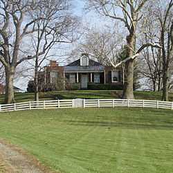
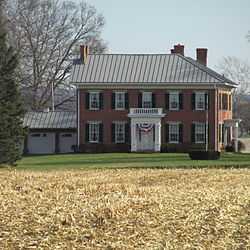
Mount Oval |
|
01974-07-25-0000July 25, 1974
(#74001593) |
Off U.S. Route 23, south of Circleville
39°31′42″N 82°57′59″W / 39.528333°N 82.966389°W / 39.528333; -82.966389 (Mount Oval) |
Pickaway Township |
|
| 20 |
Perrill-Goodman Farm House |
|
01985-03-14-0000March 14, 1985
(#85000565) |
Goodman Rd., south of Groveport
39°47′18″N 82°52′56″W / 39.788333°N 82.882222°W / 39.788333; -82.882222 (Perrill-Goodman Farm House) |
Madison Township |
|
| 21 |
Stevenson Peters House |
|
01984-02-09-0000February 9, 1984
(#84003797) |
9860 State Route 188, northeast of Circleville
39°40′29″N 82°50′17″W / 39.674722°N 82.838056°W / 39.674722; -82.838056 (Stevenson Peters House) |
Walnut Township |
|
| 22 |
Redlands |
|
01982-05-14-0000May 14, 1982
(#82003630) |
1960 N. Court St., north of Circleville
39°38′06″N 82°56′31″W / 39.635°N 82.941944°W / 39.635; -82.941944 (Redlands) |
Circleville Township |
|
| 23 |
Renick Farm |
|
01982-03-05-0000March 5, 1982
(#82003631) |
North of South Bloomfield on U.S. Route 23
39°45′01″N 82°59′28″W / 39.750278°N 82.991111°W / 39.750278; -82.991111 (Renick Farm) |
Harrison Township |
|
| 24 |
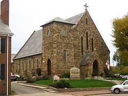
Saint Philip's Episcopal Church |
|
01986-05-15-0000May 15, 1986
(#86001064) |
129 W. Mound St.
39°35′59″N 82°56′50″W / 39.599722°N 82.947222°W / 39.599722; -82.947222 (Saint Philip's Episcopal Church) |
Circleville |
|
| 25 |
Scioto Township District No. 2 Schoolhouse |
|
01987-05-06-0000May 6, 1987
(#87000634) |
8143 Snyder Rd., east of Orient
39°47′45″N 83°05′38″W / 39.795833°N 83.093889°W / 39.795833; -83.093889 (Scioto Township District No. 2 Schoolhouse) |
Scioto Township |
|
| 26 |
The Shack |
|
01974-05-23-0000May 23, 1974
(#74001596) |
Northwest of Williamsport
39°38′07″N 83°13′47″W / 39.635278°N 83.229722°W / 39.635278; -83.229722 (The Shack) |
Monroe Township |
|
| 27 |
Tick Ridge Mound District |
|
01975-06-11-0000June 11, 1975
(#75001518) |
Tick Ridge Peninsula in Deer Creek State Park[11]
39°36′56″N 83°14′15″W / 39.615556°N 83.237500°W / 39.615556; -83.237500 (Tick Ridge Mound District) |
Monroe Township |
|
| 28 |
Ansel T. Walling House |
|
01987-12-14-0000December 14, 1987
(#87002145) |
146 W. Union St.
39°35′58″N 82°56′55″W / 39.599444°N 82.948611°W / 39.599444; -82.948611 (Ansel T. Walling House) |
Circleville |
|
| 29 |
Watt-Groce-Fickhardt House |
|
01985-08-23-0000August 23, 1985
(#85001804) |
360 E. Main St.
39°36′00″N 82°56′20″W / 39.6°N 82.938889°W / 39.6; -82.938889 (Watt-Groce-Fickhardt House) |
Circleville |
|