National Register of Historic Places listings in Perry County, Arkansas
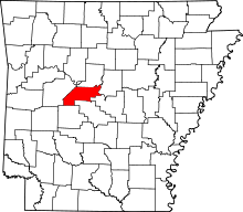
Location of Perry County in Arkansas
This is a list of the National Register of Historic Places listings in Perry County, Arkansas.
This is intended to be a complete list of the properties and districts on the National Register of Historic Places in Perry County, Arkansas, United States. The locations of National Register properties and districts for which the latitude and longitude coordinates are included below, may be seen in a Google map.[1]
There are 14 properties and districts listed on the National Register in the county.
Contents: Counties in Arkansas
|
|
- This National Park Service list is complete through NPS recent listings posted May 1, 2015.[2]
Current listings
| [3] |
Name on the Register[4] |
Image |
Date listed[5] |
Location |
City or town |
Description |
|---|
| 1 |
Bigelow Methodist Episcopal Church, South |
Upload image |
01996-04-04-0000April 4, 1996
(#96000353) |
West of the junction of Volman and Emma Sts.
34°59′57″N 92°37′49″W / 34.999167°N 92.630278°W / 34.999167; -92.630278 (Bigelow Methodist Episcopal Church, South) |
Bigelow |
|
| 2 |
Bigelow Rosenwald School |
Upload image |
02004-05-26-0000May 26, 2004
(#04000491) |
Junction of Highway 60 and Bethel AME Rd.
35°04′30″N 92°33′55″W / 35.075°N 92.565278°W / 35.075; -92.565278 (Bigelow Rosenwald School) |
Toad Suck |
|
| 3 |
Camp House |
Upload image |
02013-09-30-0000September 30, 2013
(#13000787) |
4684 W. AR 60
34°58′23″N 92°59′08″W / 34.973026°N 92.985632°W / 34.973026; -92.985632 (Camp House) |
Aplin |
|
| 4 |
Camp Ouachita Girl Scout Camp Historic District |
Upload image |
01992-02-03-0000February 3, 1992
(#90001826) |
Area surrounding and north of Lake Sylvia in the Ouachita National Forest
34°52′12″N 92°49′15″W / 34.87°N 92.820833°W / 34.87; -92.820833 (Camp Ouachita Girl Scout Camp Historic District) |
Paron |
|
| 5 |
Fourche LaFave River Bridge |
|
01995-05-26-0000May 26, 1995
(#95000643) |
Highway 7 over the Fourche La Fave River
34°57′07″N 93°09′08″W / 34.951944°N 93.152222°W / 34.951944; -93.152222 (Fourche LaFave River Bridge) |
Nimrod |
|
| 6 |
Hawks Schoolhouse |
Upload image |
02002-01-28-0000January 28, 2002
(#01001528) |
County Road 7
34°52′06″N 93°12′30″W / 34.868333°N 93.208333°W / 34.868333; -93.208333 (Hawks Schoolhouse) |
Ava |
|
| 7 |
Hollis Country Store |
Upload image |
02002-12-27-0000December 27, 2002
(#02001598) |
2125 Highway 7, S.
34°52′28″N 93°06′38″W / 34.874444°N 93.110556°W / 34.874444; -93.110556 (Hollis Country Store) |
Hollis |
|
| 8 |
Houston Methodist Episcopal Church, South |
Upload image |
01994-05-20-0000May 20, 1994
(#94000494) |
Southwestern side of Highway 60, near its junction with Highway 216
35°01′54″N 92°41′33″W / 35.031667°N 92.6925°W / 35.031667; -92.6925 (Houston Methodist Episcopal Church, South) |
Houston |
|
| 9 |
Perry County Courthouse |
Upload image |
01976-07-06-0000July 6, 1976
(#76000443) |
Main and Pine Sts.
35°00′19″N 92°48′07″W / 35.005278°N 92.801944°W / 35.005278; -92.801944 (Perry County Courthouse) |
Perryville |
|
| 10 |
Perryville American Legion Building |
Upload image |
01990-09-05-0000September 5, 1990
(#90001377) |
Plum and Main Sts.
35°00′18″N 92°48′12″W / 35.005°N 92.803333°W / 35.005; -92.803333 (Perryville American Legion Building) |
Perryville |
|
| 11 |
Perryville Commercial Historic District |
Upload image |
02012-01-26-0000January 26, 2012
(#11001048) |
Roughly bounded by Arkansas Highway 10, Magnolia, Main & Plum Sts.
35°00′17″N 92°48′07″W / 35.004783°N 92.801878°W / 35.004783; -92.801878 (Perryville Commercial Historic District) |
Perryville |
|
| 12 |
C.L. Sailor House |
Upload image |
01998-07-23-0000July 23, 1998
(#98000880) |
Wilson St.
34°59′44″N 92°37′58″W / 34.995556°N 92.632778°W / 34.995556; -92.632778 (C.L. Sailor House) |
Bigelow |
|
| 13 |
South Fourche LaFave River Bridge |
Upload image |
02004-09-24-0000September 24, 2004
(#04001044) |
Highway 7
34°52′22″N 93°06′38″W / 34.872778°N 93.110556°W / 34.872778; -93.110556 (South Fourche LaFave River Bridge) |
Hollis |
|
| 14 |
Wallace Bridge |
|
02008-08-01-0000August 1, 2008
(#08000724) |
County Road 18
34°56′11″N 93°03′19″W / 34.93628°N 93.05539°W / 34.93628; -93.05539 (Wallace Bridge) |
Nimrod |
|
Former listings
| [3] |
Name on the Register |
Image |
Date listed | Date removed |
Location |
City or town |
Summary |
|---|
| 1 |
Cypress Creek Bridge |
Upload image |
01990-04-09-0000April 9, 1990
(#90000537) | 02002-01-14-0000January 14, 2002 |
County Road 64, over Cypress Creek
|
Perry vicinity |
|
See also
References
- ↑ The latitude and longitude information provided in this table was derived originally from the National Register Information System, which has been found to be fairly accurate for about 99% of listings. For about 1% of NRIS original coordinates, experience has shown that one or both coordinates are typos or otherwise extremely far off; some corrections may have been made. A more subtle problem causes many locations to be off by up to 150 yards, depending on location in the country: most NRIS coordinates were derived from tracing out latitude and longitudes off of USGS topographical quadrant maps created under the North American Datum of 1927, which differs from the current, highly accurate WGS84 GPS system used by most on-line maps. Chicago is about right, but NRIS longitudes in Washington are higher by about 4.5 seconds, and are lower by about 2.0 seconds in Maine. Latitudes differ by about 1.0 second in Florida. Some locations in this table may have been corrected to current GPS standards.
- ↑ "National Register of Historic Places: Weekly List Actions". National Park Service, United States Department of the Interior. Retrieved on May 1, 2015.
- ↑ 3.0 3.1 Numbers represent an ordering by significant words. Various colorings, defined here, differentiate National Historic Landmarks and historic districts from other NRHP buildings, structures, sites or objects.
- ↑ "National Register Information System". National Register of Historic Places. National Park Service. 2009-03-13.
- ↑ The eight-digit number below each date is the number assigned to each location in the National Register Information System database, which can be viewed by clicking the number.
|
|---|
| | Topics | |
|---|
| | Lists by states | |
|---|
| | Lists by insular areas | |
|---|
| | Lists by associated states | |
|---|
| | Other areas | |
|---|
|
-
 Category Category
-
 Portal Portal
-
 WikiProject WikiProject
|
|
.jpg)
(15371).jpg)