| [2] |
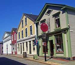
Name on the Register[3] |
Image |
Date listed[4] |
Location |
Description |
|---|
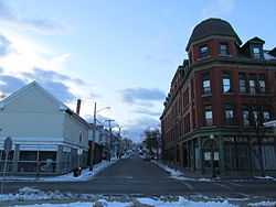
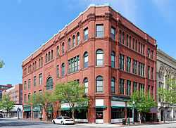
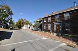
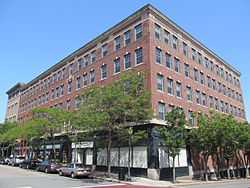
| 1 |
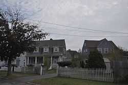
Acushnet Heights Historic District |
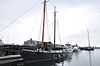
|
01989-12-01-0000December 1, 1989
(#89002035) |
Roughly bounded by Summer, Weld, Purchase, Pope, County, and Robeson
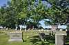
41°38′52″N 70°55′53″W / 41.647778°N 70.931389°W / 41.647778; -70.931389 (Acushnet Heights Historic District) |
|
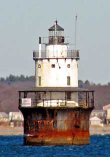
| 2 |
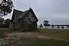
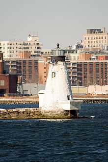
Butler Flats Light |
|
01987-06-15-0000June 15, 1987
(#87001530) |
New Bedford Channel
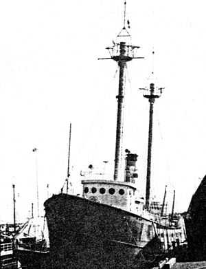
41°36′07″N 70°53′54″W / 41.601944°N 70.898333°W / 41.601944; -70.898333 (Butler Flats Light) |
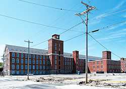
|
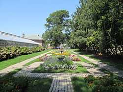
| 3 |
Buttonwood Park Historic District |
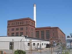
|
02000-08-24-0000August 24, 2000
(#00000915) |
Kempton St., Rockdale Ave., Hawthorne St., and Brownell Ave.
41°37′55″N 70°57′07″W / 41.631944°N 70.951944°W / 41.631944; -70.951944 (Buttonwood Park Historic District) |
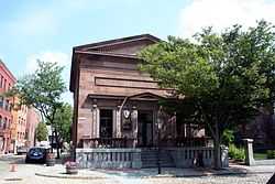
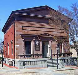
|
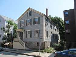
| 4 |
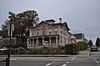
Sgt. William H. Carney House |
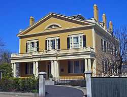
|
01975-04-21-0000April 21, 1975
(#75000243) |
128 Mill St.
41°38′15″N 70°55′59″W / 41.6375°N 70.933056°W / 41.6375; -70.933056 (Sgt. William H. Carney House) |
|
| 5 |
Central New Bedford Historic District |
|
01980-04-24-0000April 24, 1980
(#80000430) |
Roughly bounded by Acushnet Ave. and School, Middle, and 6th Sts.
41°38′06″N 70°55′39″W / 41.635°N 70.9275°W / 41.635; -70.9275 (Central New Bedford Historic District) |
|
| 6 |
County Street Historic District |
|
01976-08-11-0000August 11, 1976
(#76000229) |
Roughly bounded by Acushnet, Page, Middle, and Bedford Sts. (both sides)
41°37′55″N 70°55′55″W / 41.631944°N 70.931944°W / 41.631944; -70.931944 (County Street Historic District) |
|
| 7 |
Dawson Building |
|
01982-09-30-0000September 30, 1982
(#82001900) |
1851 Purchase St.
41°39′N 70°56′W / 41.65°N 70.93°W / 41.65; -70.93 (Dawson Building) |
|
| 8 |
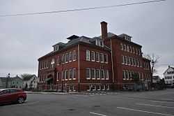
Thomas Donaghy School |
|
01989-03-02-0000March 2, 1989
(#89000041) |
68 South St.
41°37′33″N 70°55′25″W / 41.625833°N 70.923611°W / 41.625833; -70.923611 (Thomas Donaghy School) |
|
| 9 |
ERNESTINA (schooner) |
|
01985-01-03-0000January 3, 1985
(#85000022) |
Steamship Wharf
41°38′01″N 70°55′16″W / 41.633611°N 70.921111°W / 41.633611; -70.921111 (ERNESTINA (schooner)) |
|
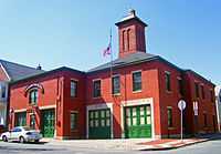
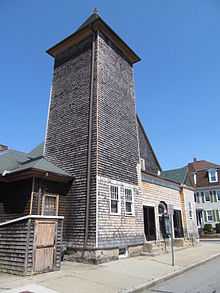
| 10 |
Fire Station No. 4 |
|
01975-07-24-0000July 24, 1975
(#75000250) |
79 S. 6th St.
41°37′41″N 70°55′38″W / 41.628056°N 70.927222°W / 41.628056; -70.927222 (Fire Station No. 4) |
1867 building was oldest fire station in state when closed; now home of New Bedford Fire Museum
|
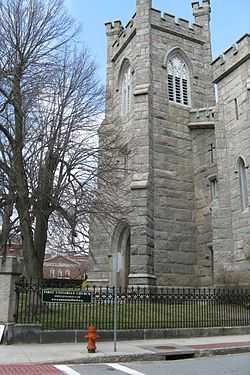
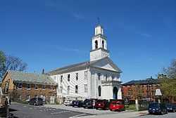
| 11 |
First Baptist Church |
|
01975-04-21-0000April 21, 1975
(#75000251) |
149 William St.
41°38′06″N 70°55′44″W / 41.635°N 70.928889°W / 41.635; -70.928889 (First Baptist Church) |
|
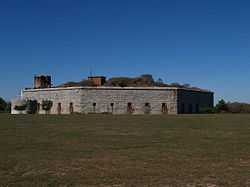
| 12 |
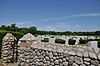
Fort Taber District |
|
01973-02-08-0000February 8, 1973
(#73001954) |
Wharf Rd. within Fort Rodman Military Reservation
41°35′36″N 70°54′14″W / 41.593333°N 70.903889°W / 41.593333; -70.903889 (Fort Taber District) |
|
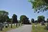
| 13 |
Griffin Street Cemetery |
|
02014-03-19-0000March 19, 2014
(#14000062) |
S. 2nd & Griffin Sts.
41°37′42″N 70°55′22″W / 41.628323°N 70.922738°W / 41.628323; -70.922738 (Griffin Street Cemetery) |
|
| 14 |
Hazelwood Park |
|
02010-06-24-0000June 24, 2010
(#10000389) |
597-603 Brock Ave.
41°36′24″N 70°54′48″W / 41.606667°N 70.913333°W / 41.606667; -70.913333 (Hazelwood Park) |
|
| 15 |
Head of the River Historic District |
|
02009-12-02-0000December 2, 2009
(#09000965) |
2-28 Mill Rd., 2-13 Tarkiln Hill Rd.
41°40′54″N 70°55′09″W / 41.681736°N 70.919186°W / 41.681736; -70.919186 (Head of the River Historic District) |
Extends into Acushnet.
|
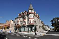
| 16 |
Hotel Waverly |
|
01990-01-26-0000January 26, 1990
(#89002326) |
1162-1166 Acushnet Ave.
41°39′26″N 70°55′38″W / 41.657222°N 70.927222°W / 41.657222; -70.927222 (Hotel Waverly) |
|
| 17 |
Howland Mill Village Historic District |
|
01996-05-30-0000May 30, 1996
(#96000609) |
Roughly bounded by Bolton, Winsper, Hemlock Sts., and Rockdale Ave.
41°36′58″N 70°56′00″W / 41.616111°N 70.933333°W / 41.616111; -70.933333 (Howland Mill Village Historic District) |
|
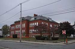
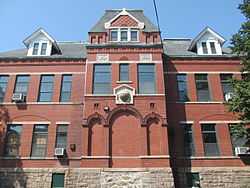
| 18 |
Robert C. Ingraham School |
|
02010-03-02-0000March 2, 2010
(#10000056) |
80 Rivet St.
41°37′14″N 70°55′20″W / 41.6206°N 70.9223°W / 41.6206; -70.9223 (Robert C. Ingraham School) |
|
| 19 |
Jewish Cemetery |
|
02014-04-15-0000April 15, 2014
(#14000155) |
Old Plainville Road
41°40′51″N 70°58′01″W / 41.6808°N 70.9670°W / 41.6808; -70.9670 (Jewish Cemetery) |
|
| 20 |
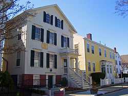
Nathan and Mary Johnson Properties |
|
02000-02-16-0000February 16, 2000
(#00000260) |
17-19 and 21 7th Street
41°37′59″N 70°55′44″W / 41.633056°N 70.928889°W / 41.633056; -70.928889 (Nathan and Mary Johnson Properties) |
National Historic Landmark; home and meetinghouse of African-American abolitionist couple who took in Frederick Douglass after he escaped from slavery
|
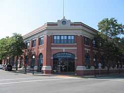
| 21 |
Lightship No. 114 |
|
01990-05-30-0000May 30, 1990
(#90000777) |
formerly State Pier
41°38′08″N 70°55′16″W / 41.635556°N 70.921111°W / 41.635556; -70.921111 (Lightship No. 114) |
Scrapped.
|
| 22 |
Manomet Mills |
|
02012-05-24-0000May 24, 2012
(#12000304) |
194-194R, 200 Riverside Ave.
41°40′03″N 70°55′12″W / 41.667494°N 70.920035°W / 41.667494; -70.920035 (Manomet Mills) |
|
| 23 |
Merrill's Wharf Historic District |
|
01977-11-11-0000November 11, 1977
(#77000167) |
MacArthur Dr.
41°37′59″N 70°55′15″W / 41.633056°N 70.920833°W / 41.633056; -70.920833 (Merrill's Wharf Historic District) |
Encompasses Steamship Pier and adjacent Coal Pocket Pier.
|
| 24 |
Moreland Terrace Historic District |
|
01996-06-03-0000June 3, 1996
(#96000610) |
Roughly bounded by Moreland Terrace, Ash, Bedford, and Page Sts.
41°37′40″N 70°56′11″W / 41.627778°N 70.936389°W / 41.627778; -70.936389 (Moreland Terrace Historic District) |
|
| 25 |
New Bedford Gas and Edison Light Complex |
|
02002-06-03-0000June 3, 2002
(#02000633) |
180 MacAuthur Dr.
41°37′49″N 70°55′16″W / 41.630278°N 70.921111°W / 41.630278; -70.921111 (New Bedford Gas and Edison Light Complex) |
|
| 26 |
New Bedford Historic District |
|
01966-11-13-0000November 13, 1966
(#66000773) |
Bounded by Front St. on the east, Elm St. on the north, Acushnet Ave. on the west, and Commercial St. on the south
41°38′07″N 70°55′27″W / 41.635278°N 70.924167°W / 41.635278; -70.924167 (New Bedford Historic District) |
National Historic Landmark
|
| 27 |
New Bedford Whaling National Historical Park |
|
01996-11-12-0000November 12, 1996
(#03000283) |
33 William St.
41°38′08″N 70°55′27″W / 41.635692°N 70.924064°W / 41.635692; -70.924064 (New Bedford Whaling National Historical Park) |
|
| 28 |
North Bedford Historic District |
|
01979-09-19-0000September 19, 1979
(#00000899) |
Roughly bounded by Summer, Park, Pleasant, and Kempton Sts.
41°38′25″N 70°55′49″W / 41.640278°N 70.930278°W / 41.640278; -70.930278 (North Bedford Historic District) |
|
| 29 |
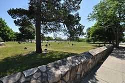
Oak Grove Cemetery |
|
02014-04-28-0000April 28, 2014
(#14000176) |
Parker St.
41°38′37″N 70°56′32″W / 41.6437°N 70.9422°W / 41.6437; -70.9422 (Oak Grove Cemetery) |
|
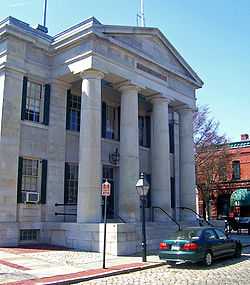
| 30 |
Old Third District Courthouse |
|
01971-09-28-0000September 28, 1971
(#71000083) |
2nd and William Sts.
41°38′09″N 70°55′29″W / 41.635833°N 70.924722°W / 41.635833; -70.924722 (Old Third District Courthouse) |
|
| 31 |
Palmer Island Light Station |
|
01980-03-26-0000March 26, 1980
(#80000433) |
New Bedford Harbor
41°37′34″N 70°54′35″W / 41.626111°N 70.909722°W / 41.626111; -70.909722 (Palmer Island Light Station) |
ARLHS USA-578
|
| 32 |
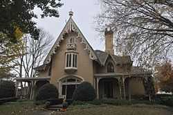
William J. Rotch Gothic Cottage |
|
02006-02-17-0000February 17, 2006
(#06000236) |
19 Irving St.
41°37′50″N 70°55′55″W / 41.630494°N 70.931811°W / 41.630494; -70.931811 (William J. Rotch Gothic Cottage) |
|
| 33 |
William Rotch, Jr. House |
|
02005-04-05-0000April 5, 2005
(#05000456) |
396 County Street
41°37′49″N 70°55′43″W / 41.630297°N 70.928686°W / 41.630297; -70.928686 (William Rotch, Jr. House) |
Early Richard Upjohn house for prominent whaling family
|
| 34 |
Rural Cemetery and Friends Cemetery |
|
02014-04-28-0000April 28, 2014
(#14000177) |
149 Dartmouth St.
41°37′22″N 70°56′07″W / 41.6229°N 70.9354°W / 41.6229; -70.9354 (Rural Cemetery and Friends Cemetery) |
|
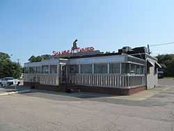
| 35 |
Shawmut Diner |
|
02003-11-28-0000November 28, 2003
(#03001208) |
943 Shawmut Ave.
41°39′32″N 70°56′51″W / 41.658889°N 70.9475°W / 41.658889; -70.9475 (Shawmut Diner) |
|
| 36 |
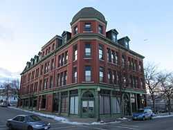
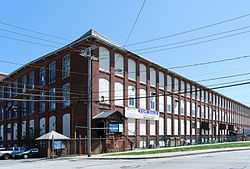
Bradford Smith Building |
Upload image |
01984-05-17-0000May 17, 1984
(#84002216) |
1927-1941 Purchase St.
41°39′04″N 70°55′49″W / 41.651111°N 70.930278°W / 41.651111; -70.930278 (Bradford Smith Building) |
Demolished.[5]
|
| 37 |
Thompson Street School |
|
01990-01-26-0000January 26, 1990
(#89002329) |
58 Crapo St.
41°37′17″N 70°55′37″W / 41.621389°N 70.926944°W / 41.621389; -70.926944 (Thompson Street School) |
|
| 38 |
Times and Olympia Buildings |
|
01983-07-07-0000July 7, 1983
(#83000725) |
908-912 and 880-898 Purchase St.
41°38′11″N 70°55′36″W / 41.636389°N 70.926667°W / 41.636389; -70.926667 (Times and Olympia Buildings) |
|
| 39 |
U.S. Customhouse |
|
01970-12-30-0000December 30, 1970
(#70000735) |
Southwestern corner of 2nd and Williams Sts.
41°38′07″N 70°55′29″W / 41.635278°N 70.924722°W / 41.635278; -70.924722 (U.S. Customhouse) |
Oldest U.S. Customs facility in continuous use; Greek Revival public building by Robert Mills
|
| 40 |
Union Baptist Church |
|
02008-06-16-0000June 16, 2008
(#08000532) |
109 Court St.
41°38′03″N 70°56′05″W / 41.634181°N 70.934775°W / 41.634181; -70.934775 (Union Baptist Church) |
|
| 41 |
Union Street Railway Carbarn, Repair Shop |
|
01978-10-02-0000October 2, 1978
(#78000431) |
1959 Purchase St.
41°39′07″N 70°55′52″W / 41.651944°N 70.931111°W / 41.651944; -70.931111 (Union Street Railway Carbarn, Repair Shop) |
|
| 42 |
Wamsutta Mills |
|
02008-08-19-0000August 19, 2008
(#08000794) |
Acushnet Ave., Logan, Wamsutta, and N. Front St.
41°39′05″N 70°55′39″W / 41.651479°N 70.927627°W / 41.651479; -70.927627 (Wamsutta Mills) |
|
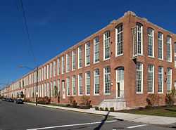
| 43 |
Whitman Mills |
|
02003-08-29-0000August 29, 2003
(#03000844) |
1, 90, and the eastern side of Riverside Ave., rear 1 and the southern and northern sides of Coffin Ave., and 10 Manomet St.
41°39′45″N 70°55′10″W / 41.6625°N 70.919444°W / 41.6625; -70.919444 (Whitman Mills) |
(#83004613) More Info |