National Register of Historic Places listings in Montgomery County, Ohio

This is a list of the National Register of Historic Places listings in Montgomery County, Ohio.
This is intended to be a complete list of the properties and districts on the National Register of Historic Places in Montgomery County, Ohio, United States. The locations of National Register properties and districts for which the latitude and longitude coordinates are included below, may be seen in a Google map.[1]
There are 145 properties and districts listed on the National Register in the county, including 6 National Historic Landmarks. The city of Dayton is the location of 103 of these properties and districts, including 5 National Historic Landmarks; they are listed separately, while the remaining properties and districts are listed here. Another 2 properties were once listed but have been removed.
- This National Park Service list is complete through NPS recent listings posted May 1, 2015.[2]
Current listings
Dayton
Outside of Dayton
| [3] | Name on the Register[4] | Image | Date listed[5] | Location | City or town | Description |
|---|---|---|---|---|---|---|
| 1 | Arnold Homestead | 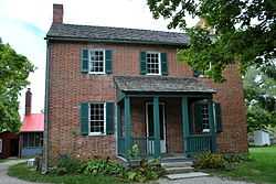 |
(#77001077) |
North of Dayton on State Route 201 39°52′20″N 84°05′46″W / 39.872222°N 84.096111°W |
Huber Heights | |
| 2 | Aullwood House and Garden | 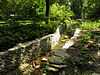 |
(#99000092) |
900 Aullwood Rd., northwest of Dayton 39°52′05″N 84°16′32″W / 39.868056°N 84.275556°W |
Butler Township | |
| 3 | Ausenbaugh-McElhenny House | 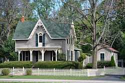 |
(#75001503) |
7373 Taylorsville Rd. 39°51′39″N 84°06′09″W / 39.860833°N 84.1025°W |
Huber Heights | |
| 4 | George Bixler Farm | 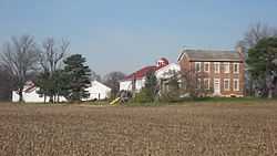 |
(#02000888) |
13213 Providence Pike, south of Brookville 39°48′19″N 84°25′40″W / 39.805278°N 84.427778°W |
Perry Township | |
| 5 | Robert Bradford House | 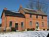 |
(#79001897) |
South of Centerville on Social Row Rd. 39°35′22″N 84°08′26″W / 39.589444°N 84.140556°W |
Washington Township | |
| 6 | Erma Bombeck House | Upload image | (#15000043) |
162 Cushwa Dr. 39°38′33″N 84°09′07″W / 39.6426°N 84.1519°W |
Centerville | |
| 7 | Carlisle Fort | 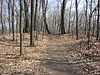 |
(#74001584) |
Western bank of Twin Creek, south of Germantown[6] 39°35′26″N 84°21′15″W / 39.5906°N 84.3543°W |
German Township | |
| 8 | Centerville Historic District | 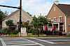 |
(#74001577) |
Irregular pattern at Franklin and Main Sts. 39°37′42″N 84°09′38″W / 39.628333°N 84.160556°W |
Centerville | |
| 9 | Deerwood Farm | 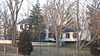 |
(#75001507) |
North of Dayton at 7200 Peters Pike 39°51′07″N 84°13′37″W / 39.851944°N 84.226944°W |
Butler Township | |
| 10 | Emmanuel's Evangelical Lutheran Church | 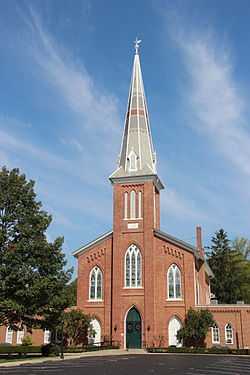 |
(#90001292) |
30 W. Warren St. 39°37′40″N 84°22′18″W / 39.627778°N 84.371667°W |
Germantown | |
| 11 | Joseph Flory House | 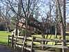 |
(#78002143) |
Northwest of Clayton on Diamond Mill Rd. 39°51′58″N 84°22′07″W / 39.866111°N 84.368611°W |
Clay Township | |
| 12 | Fox Hollow | 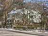 |
(#06000481) |
6320 Mad River Rd. 39°39′22″N 84°11′29″W / 39.656111°N 84.191389°W |
Washington Township | |
| 13 | Gunckel's Town Plan Historic District | 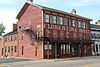 |
(#76001502) |
Roughly bounded by Mulberry and Walnut Sts. and Warren and Market Sts. 39°37′32″N 84°22′14″W / 39.625556°N 84.370556°W |
Germantown | |
| 14 | Hawthorn Hill | 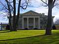 |
(#74001585) |
Harman and Park Aves. 39°43′20″N 84°10′34″W / 39.722222°N 84.176111°W |
Oakwood | |
| 15 | Jacob's Church | 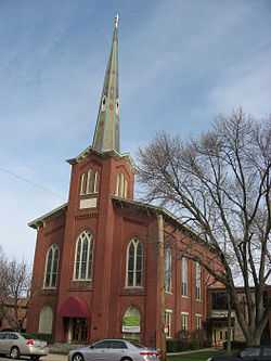 |
(#90001290) |
213 E. Central Ave. 39°38′31″N 84°17′11″W / 39.641944°N 84.286389°W |
Miamisburg | |
| 16 | Ethol Kellog House | 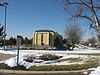 |
(#76001498) |
West of Centerville off State Route 725 on Yankee St. 39°37′47″N 84°12′02″W / 39.629722°N 84.200556°W |
Washington Township | |
| 17 | Charles F. Kettering House | 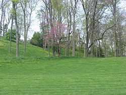 |
(#77001080) |
3965 Southern Boulevard 39°41′37″N 84°11′38″W / 39.693611°N 84.193889°W |
Kettering | Burned down in 1995. |
| 18 | Koehne-Poast Farm | 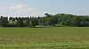 |
(#77001079) |
West of Germantown off State Route 725 39°37′29″N 84°23′08″W / 39.624722°N 84.385556°W |
German Township and Germantown | |
| 19 | Krug House | 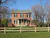 |
(#92000973) |
3473 Sweet Potato Ridge Rd. 39°53′30″N 84°19′10″W / 39.891667°N 84.319444°W |
Union | |
| 20 | Long-Mueller House | 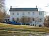 |
(#87000637) |
986 Laurelwood Rd. 39°42′02″N 84°11′16″W / 39.700556°N 84.187778°W |
Kettering | |
| 21 | Long-Romspert House |  |
(#87001522) |
1947 Far Hills Ave. 39°42′51″N 84°10′20″W / 39.714028°N 84.172222°W |
Oakwood | |
| 22 | Market Square | 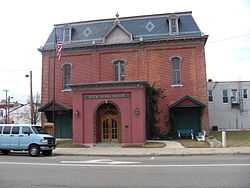 |
(#75001510) |
Both sides of Main St. including junctions at Central and Linden Aves. 39°38′27″N 84°17′22″W / 39.640833°N 84.289333°W |
Miamisburg | |
| 23 | Samuel Martindale House | 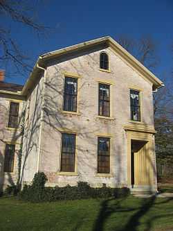 |
(#78002148) |
Northeast of Englewood off U.S. Route 40 39°53′43″N 84°16′54″W / 39.895278°N 84.281750°W |
Butler Township | |
| 24 | Miami-Erie Canal Lock No. 70 | 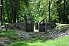 |
(#82001479) |
Fishburg and Endicott Rds. 39°50′28″N 84°09′32″W / 39.841111°N 84.158889°W |
Huber Heights | |
| 25 | Miamisburg Mound | 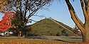 |
(#70000511) |
Southeast of Miamisburg on State Route 725 39°37′38″N 84°16′51″W / 39.627222°N 84.280833°W |
Miamisburg | |
| 26 | Normandy Farms | 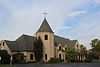 |
(#83004322) |
450 W. Alex-Bell Rd., northwest of Centerville 39°38′43″N 84°10′08″W / 39.645278°N 84.168889°W |
Washington Township | |
| 27 | Pease Homestead |  |
(#80003169) |
2123 Alexander-Bellbrook Rd., northwest of Centerville 39°40′17″N 84°12′23″W / 39.671389°N 84.206389°W |
Miami Township | |
| 28 | David Rohr Mansion and Carriage House |  |
(#78002149) |
Astoria Rd. and State Route 725 39°37′20″N 84°23′06″W / 39.622222°N 84.385°W |
Germantown | |
| 29 | Salem Bear Creek Church, Salem Evangelical Lutheran Church |  |
(#90001291) |
Roughly bounded by Union Rd., Dayton Germantown Pike, and Bear Creek 39°40′48″N 84°18′34″W / 39.68°N 84.309444°W |
Moraine | |
| 30 | Schantz Park Historic District |  |
(#92001492) |
Roughly bounded by Far Hills, Irving, Mahart and Schenck Aves. 39°43′54″N 84°10′37″W / 39.731667°N 84.176944°W |
Oakwood | |
| 31 | Adam Schantz, Sr., House |  |
(#80003178) |
314-316 Schantz Ave. 39°43′54″N 84°10′35″W / 39.731667°N 84.176389°W |
Oakwood | |
| 32 | Schuter Carpenter Shop and House |  |
(#80003179) |
3224 W. Alexandersville-Bellbrook Rd., east of West Carrollton 39°40′24″N 84°13′37″W / 39.673333°N 84.226944°W |
Miami Township | |
| 33 | Shuey's Mill |  |
(#75001508) |
Main St. 39°37′15″N 84°22′13″W / 39.620833°N 84.370278°W |
Germantown | |
| 34 | Skywood Farms |  |
(#96000117) |
732 W. Alex-Bell Rd., northwest of Centerville 39°38′58″N 84°10′46″W / 39.649444°N 84.179444°W |
Washington Township | |
| 35 | Samuel Spitler House | 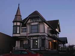 |
(#73001507) |
14 Market St. 39°50′08″N 84°24′50″W / 39.835556°N 84.413889°W |
Brookville | Designed by architect George Franklin Barber |
| 36 | John Stump House and Mill | 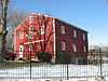 |
(#75001509) |
Southwest of Germantown at the junction of Sigel and Oxford Rds. 39°37′02″N 84°23′28″W / 39.617222°N 84.391111°W |
German Township | |
| 37 | Taylorsville Canal Inn | 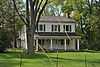 |
(#77001078) |
4240 Taylorsville Rd. 39°51′48″N 84°09′54″W / 39.863333°N 84.165°W |
Huber Heights | |
| 38 | Trailsend | 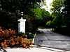 |
(#79001905) |
3500 Governors Trail 39°42′04″N 84°11′57″W / 39.701111°N 84.199167°W |
Kettering | |
| 39 | Trotwood Railroad Station and Depot | 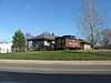 |
(#81000448) |
2 E. Main St. 39°47′49″N 84°18′40″W / 39.797083°N 84.311111°W |
Trotwood | |
| 40 | Watkins House | 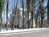 |
(#74001578) |
9950 Lebanon Pike, south of Centerville 39°35′57″N 84°09′40″W / 39.599167°N 84.161111°W |
Washington Township | |
| 41 | Wright Library |  |
(#13000981) |
1776 Far Hills Ave. 39°42′56″N 84°10′16″W / 39.715556°N 84.171111°W |
Oakwood | |
| 42 | Wolf Creek Mound |  |
(#73001511) |
Atop the highest hill at the confluence of Poplar Run and Wolf Creek, west of central Trotwood[7]:15 39°48′14″N 84°20′48″W / 39.803889°N 84.346667°W |
Trotwood |
Former listings
| [3] | Name on the Register | Image | Date listed | Date removed | Location | City or town | Summary |
|---|---|---|---|---|---|---|---|
| 1 | John Beard Farm | Upload image | (#75002151) | South of Vandalia on Mulberry Lane |
Vandalia | ||
| 2 | Germantown Covered Bridge | .jpg) |
(#71000647) | Center St., over Little Twin Creek |
Germantown |
See also
| Wikimedia Commons has media related to National Register of Historic Places in Montgomery County, Ohio. |
References
- ↑ The latitude and longitude information provided in this table was derived originally from the National Register Information System, which has been found to be fairly accurate for about 99% of listings. For about 1% of NRIS original coordinates, experience has shown that one or both coordinates are typos or otherwise extremely far off; some corrections may have been made. A more subtle problem causes many locations to be off by up to 150 yards, depending on location in the country: most NRIS coordinates were derived from tracing out latitude and longitudes off of USGS topographical quadrant maps created under the North American Datum of 1927, which differs from the current, highly accurate WGS84 GPS system used by most on-line maps. Chicago is about right, but NRIS longitudes in Washington are higher by about 4.5 seconds, and are lower by about 2.0 seconds in Maine. Latitudes differ by about 1.0 second in Florida. Some locations in this table may have been corrected to current GPS standards.
- ↑ "National Register of Historic Places: Weekly List Actions". National Park Service, United States Department of the Interior. Retrieved on May 1, 2015.
- ↑ 3.0 3.1 Numbers represent an ordering by significant words. Various colorings, defined here, differentiate National Historic Landmarks and historic districts from other NRHP buildings, structures, sites or objects.
- ↑ "National Register Information System". National Register of Historic Places. National Park Service. 2008-04-24.
- ↑ The eight-digit number below each date is the number assigned to each location in the National Register Information System database, which can be viewed by clicking the number.
- ↑ Location derived from Mills, William C. Archeological Atlas of Ohio. Columbus: Ohio State Archeological and Historical Society, 1914, page 57 and plate 57. The NRIS lists the site as "Address Restricted".
- ↑ Koleszar, Stephen C. An Archaeological Survey of Southwestern Ohio. Columbus: Ohio Historical Society, 1970.
- ↑ 44 FR 7562


| |||||||||||||||||||||||||||||||||||||