| [3] |
Name on the Register |
Image |
Date listed[4] |
Location |
City or town |
Description |
|---|
| 1 |
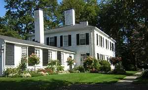
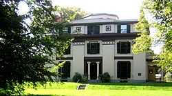
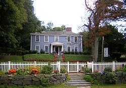
Belcher-Rowe House |
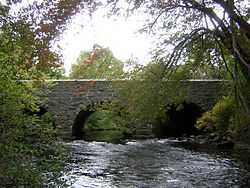
|
01982-04-01-0000April 1, 1982
(#82002748) |
26 Governor Belcher Lane
42°15′34″N 71°02′58″W / 42.259444°N 71.049444°W / 42.259444; -71.049444 (Belcher-Rowe House) |
|
|
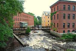
| 2 |
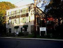
G.H. Bent Company Factory |
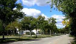
|
02000-02-10-0000February 10, 2000
(#00000075) |
7 Pleasant St.
42°14′42″N 71°04′10″W / 42.245°N 71.069444°W / 42.245; -71.069444 (G.H. Bent Company Factory) |
|
|
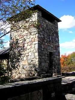
| 3 |
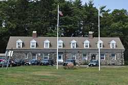
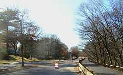
Blue Hills Headquarters |
|
01980-09-25-0000September 25, 1980
(#80000654) |
Hillside St.
42°12′53″N 71°05′35″W / 42.214826°N 71.09312°W / 42.214826; -71.09312 (Blue Hills Headquarters) |
|
|
| 4 |
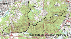
Blue Hills Reservation Parkways-Metropolitan Park System of Greater Boston |
|
02003-08-11-0000August 11, 2003
(#03000746) |
Parts of Blue Hill Rd., Chickatawbut Rd., Hillside St., Uniquity Rd., Wampatuck Rd., and Green St.
42°13′34″N 71°04′20″W / 42.226111°N 71.072222°W / 42.226111; -71.072222 (Blue Hills Reservation Parkways-Metropolitan Park System of Greater Boston) |
|
Extends into Quincy and into Braintree and Canton, elsewhere in Norfolk County
|
| 5 |
Blue Hills Parkway |
|
02003-06-23-0000June 23, 2003
(#03000574) |
Blue Hills Parkway, Milton
42°15′21″N 71°05′38″W / 42.255833°N 71.093889°W / 42.255833; -71.093889 (Blue Hills Parkway) |
|
|
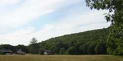
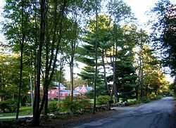
| 6 |
Brookwood Farm |
|
01980-09-25-0000September 25, 1980
(#80000655) |
Off Hillside Street
42°12′34″N 71°06′41″W / 42.209444°N 71.111389°W / 42.209444; -71.111389 (Brookwood Farm) |
|
Extends into Canton, elsewhere in Norfolk County
|
| 7 |
Brush Hill Historic District |
|
01998-08-20-0000August 20, 1998
(#98001081) |
Roughly Brush Hill Rd., from Robbins St. to Bradlee Rd., and Dana Ave., Brush Hill Ln. and Fairmount Ave.
42°14′45″N 71°06′35″W / 42.245833°N 71.109722°W / 42.245833; -71.109722 (Brush Hill Historic District) |
|
|
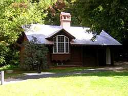
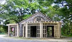
| 8 |
Comfort Station |
|
01980-09-25-0000September 25, 1980
(#80000658) |
Blue Hill Ave.
42°13′09″N 71°07′06″W / 42.219167°N 71.118333°W / 42.219167; -71.118333 (Comfort Station) |
|
|
| 9 |
Dorchester-Milton Lower Mills Industrial District |
|
01980-04-02-0000April 2, 1980
(#80000675) |
Both sides of the Neponset River; also Adams, River, and Medway Sts., Millers Lane, and Eliot and Adams Sts.
42°16′16″N 71°04′08″W / 42.271111°N 71.068889°W / 42.271111; -71.068889 (Dorchester-Milton Lower Mills Industrial District) |
|
Extends into Boston in Suffolk County; Second set of addresses represents a boundary increase
|
| 10 |
Eliot Memorial Bridge |
|
01980-09-25-0000September 25, 1980
(#80000662) |
Milton
42°12′42″N 71°06′49″W / 42.211667°N 71.113611°W / 42.211667; -71.113611 (Eliot Memorial Bridge) |
|
|
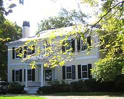
| 11 |
Capt. Robert B. Forbes House |
|
01966-11-13-0000November 13, 1966
(#66000651) |
215 Adams St.
42°15′47″N 71°03′49″W / 42.263056°N 71.063611°W / 42.263056; -71.063611 (Capt. Robert B. Forbes House) |
|
National Historic Landmark[5]
|
| 12 |
Great Blue Hill Observation Tower |
|
01980-09-25-0000September 25, 1980
(#80000661) |
Milton
42°12′43″N 71°06′49″W / 42.211944°N 71.113611°W / 42.211944; -71.113611 (Great Blue Hill Observation Tower) |
|
|
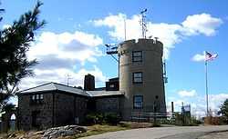
| 13 |
Great Blue Hill Weather Observatory |
|
01980-09-25-0000September 25, 1980
(#80000665) |
Milton
42°12′42″N 71°06′55″W / 42.211667°N 71.115278°W / 42.211667; -71.115278 (Great Blue Hill Weather Observatory) |
|
A National Historic Landmark as "Blue Hill Meteorological Observatory"[5]
|
| 14 |
Dr. Amos Holbrook House |
|
01975-02-13-0000February 13, 1975
(#75000289) |
203 Adams St.
42°15′55″N 71°03′59″W / 42.265278°N 71.066389°W / 42.265278; -71.066389 (Dr. Amos Holbrook House) |
|
|
| 15 |
Gov. Thomas Hutchinson's Ha-ha |
|
01975-02-13-0000February 13, 1975
(#75000290) |
100 and 122 Randolph Ave.
42°15′55″N 71°04′06″W / 42.265278°N 71.068333°W / 42.265278; -71.068333 (Gov. Thomas Hutchinson's Ha-ha) |
|
|
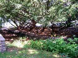
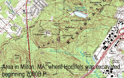
| 16 |
Massachusetts Hornfels-Braintree Slate Quarry |
|
01980-09-25-0000September 25, 1980
(#80000653) |
Address Restricted
|
|
|
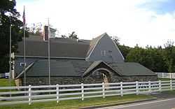
| 17 |
Metropolitan District Commission Stable |
|
01980-09-25-0000September 25, 1980
(#80000663) |
Hillside St.
42°12′56″N 71°05′33″W / 42.215556°N 71.0925°W / 42.215556; -71.0925 (Metropolitan District Commission Stable) |
|
|
| 18 |
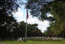
Milton Cemetery |
|
02004-06-02-0000June 2, 2004
(#04000537) |
211 Centre St.
42°15′24″N 71°03′55″W / 42.256556°N 71.065361°W / 42.256556; -71.065361 (Milton Cemetery) |
|
|
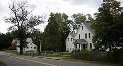
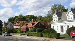
| 19 |
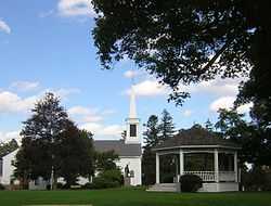
Milton Centre Historic District |
|
01988-04-28-0000April 28, 1988
(#88000428) |
Canton Ave. between Reedsdale Rd. and Thacher and Highland Sts.
42°15′12″N 71°04′47″W / 42.253333°N 71.079722°W / 42.253333; -71.079722 (Milton Centre Historic District) |
|
|
| 20 |
Milton Hill Historic District |
|
01995-06-09-0000June 9, 1995
(#95000698) |
Roughly bounded by Adams and School Sts., Randolph and Canton Aves., and Brook Rd.
42°15′52″N 71°03′59″W / 42.264444°N 71.066389°W / 42.264444; -71.066389 (Milton Hill Historic District) |
|
|
| 21 |
Neponset Valley Parkway, Metropolitan Park System of Greater Boston |
|
02005-01-24-0000January 24, 2005
(#04001573) |
Neponset Valley Parkway
42°14′05″N 71°07′26″W / 42.234722°N 71.123889°W / 42.234722; -71.123889 (Neponset Valley Parkway, Metropolitan Park System of Greater Boston) |
|
Extends into Boston in Suffolk County
|
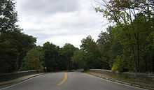
| 22 |
Paul's Bridge |
|
01972-12-11-0000December 11, 1972
(#72000140) |
Neponset Valley Parkway over the Neponset River
42°14′04″N 71°07′21″W / 42.234444°N 71.1225°W / 42.234444; -71.1225 (Paul's Bridge) |
|
Extends into Boston in Suffolk County
|
| 23 |
Railway Village Historic District |
|
02000-03-06-0000March 6, 2000
(#00000111) |
Roughly along Adams St., from Mechanic and Church Sts., and Washington St.
42°15′27″N 71°02′14″W / 42.257472°N 71.037278°W / 42.257472; -71.037278 (Railway Village Historic District) |
|
|
| 24 |
Refreshment Pavilion |
|
01980-09-25-0000September 25, 1980
(#80000659) |
Hillside St.
42°12′31″N 71°05′52″W / 42.208611°N 71.097778°W / 42.208611; -71.097778 (Refreshment Pavilion) |
|
|
| 25 |
Scott's Woods Historic District |
|
01992-11-05-0000November 5, 1992
(#92001528) |
Hillside St. between Randolph Ave. and MDC Blue Hills Reservation
42°13′27″N 71°04′50″W / 42.224167°N 71.080556°W / 42.224167; -71.080556 (Scott's Woods Historic District) |
|
|
| 26 |
Suffolk Resolves House |
|
01973-07-23-0000July 23, 1973
(#73000308) |
1370 Canton Ave.
42°14′03″N 71°06′32″W / 42.234167°N 71.108889°W / 42.234167; -71.108889 (Suffolk Resolves House) |
|
|
| 27 |
Truman Parkway-Metropolitan Park System of Greater Boston |
|
02005-01-05-0000January 5, 2005
(#04001430) |
Truman Parkway
42°14′53″N 71°06′59″W / 42.248056°N 71.116389°W / 42.248056; -71.116389 (Truman Parkway-Metropolitan Park System of Greater Boston) |
|
Extends into Boston in Suffolk County
|
| 28 |
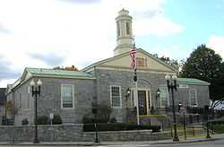
US Post Office-Milton Main |
|
01986-05-30-0000May 30, 1986
(#86001213) |
499 Adams St.
42°15′30″N 71°02′34″W / 42.258333°N 71.042778°W / 42.258333; -71.042778 (US Post Office-Milton Main) |
|
|