| [3] |
Name on the Register |
Image |
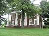
Date listed[4] |
Location |
City or town |
Description |
|---|
| 1 |
Adams House |
Upload image |
01989-02-08-0000February 8, 1989
(#88003357) |
Van Arsdell Pike
37°53′01″N 84°55′24″W / 37.883611°N 84.923333°W / 37.883611; -84.923333 (Adams House) |
Salvisa |
|
| 2 |
Archeological Site 15ME15 |
Upload image |
01985-07-11-0000July 11, 1985
(#85001507) |
Across the Salt River from the mouth of Dry Branch Creek[5]
37°43′50″N 84°51′48″W / 37.730556°N 84.863333°W / 37.730556; -84.863333 (Archeological Site 15ME15) |
Harrodsburg |
Also known as "Mercer Village"[6]
|
| 3 |
Aspen Hall |
|
01989-02-08-0000February 8, 1989
(#88003372) |
558 Aspen Hall Dr.
37°50′23″N 84°50′08″W / 37.839722°N 84.835556°W / 37.839722; -84.835556 (Aspen Hall) |
Harrodsburg |
|
| 4 |
Baldin House |
Upload image |
01989-02-08-0000February 8, 1989
(#88003349) |
South of Ebenezer on Ebenezer Rd.
37°52′32″N 84°48′57″W / 37.875556°N 84.815833°W / 37.875556; -84.815833 (Baldin House) |
Ebenezer |
|
| 5 |
Beaumont Avenue Residential District |
|
01989-02-08-0000February 8, 1989
(#88003359) |
338-538 Beaumont Ave.
37°45′24″N 84°50′36″W / 37.756667°N 84.843333°W / 37.756667; -84.843333 (Beaumont Avenue Residential District) |
Harrodsburg |
|
| 6 |
Boise House |
Upload image |
01989-02-08-0000February 8, 1989
(#88003356) |
Bohon Rd. east of Salt River
37°48′11″N 84°52′40″W / 37.803056°N 84.877778°W / 37.803056; -84.877778 (Boise House) |
Harrodsburg |
|
| 7 |
Bonta House |
Upload image |
01989-02-08-0000February 8, 1989
(#88003354) |
Northeast of Danville on U.S. Route 127
37°43′11″N 84°49′07″W / 37.719722°N 84.818611°W / 37.719722; -84.818611 (Bonta House) |
Danville |
|
| 8 |
Col. John Bowman House |
Upload image |
01989-02-08-0000February 8, 1989
(#88003353) |
Kennedy Bridge Rd.
37°44′21″N 84°43′39″W / 37.739167°N 84.7275°W / 37.739167; -84.7275 (Col. John Bowman House) |
Harrodsburg |
|
| 9 |
Burford Hill |
|
01989-02-08-0000February 8, 1989
(#88003367) |
Greenville St.
37°46′21″N 84°50′26″W / 37.7725°N 84.840556°W / 37.7725; -84.840556 (Burford Hill) |
Harrodsburg |
|
| 10 |
Burris House |
Upload image |
01989-02-08-0000February 8, 1989
(#88003362) |
South of Kirkwood Rd.
37°54′33″N 84°53′03″W / 37.909167°N 84.884167°W / 37.909167; -84.884167 (Burris House) |
Salvisa |
|
| 11 |
Nathaniel Burrus House |
Upload image |
01984-08-01-0000August 1, 1984
(#84001840) |
955 Vanarsdall Rd.
37°53′45″N 84°53′31″W / 37.895833°N 84.891944°W / 37.895833; -84.891944 (Nathaniel Burrus House) |
Harrodsburg |
|
| 12 |
Ambrose Burton House |
Upload image |
01983-08-11-0000August 11, 1983
(#83002826) |
Unity Rd.
37°51′09″N 84°50′18″W / 37.8525°N 84.838333°W / 37.8525; -84.838333 (Ambrose Burton House) |
Harrodsburg |
|
| 13 |
Cardwellton |
|
01977-11-17-0000November 17, 1977
(#77000636) |
103 E. Broadway
37°45′49″N 84°50′34″W / 37.763611°N 84.842778°W / 37.763611; -84.842778 (Cardwellton) |
Harrodsburg |
|
| 14 |
Clay Hill |
|
01976-11-07-0000November 7, 1976
(#76000925) |
433 Beaumont Ave.
37°45′29″N 84°50′33″W / 37.758056°N 84.8425°W / 37.758056; -84.8425 (Clay Hill) |
Harrodsburg |
|
| 15 |
College Street Historic District |
|
01979-02-09-0000February 9, 1979
(#79001023) |
College St. from North Lane to Factory St.
37°45′59″N 84°50′43″W / 37.766389°N 84.845278°W / 37.766389; -84.845278 (College Street Historic District) |
Harrodsburg |
|
| 16 |
Confederate Monument in Harrodsburg |
|
01997-07-17-0000July 17, 1997
(#97000677) |
Springhill Cemetery, 0.5 miles southeast of the junction of U.S. Route 127 and Kentucky Route 1989
37°46′09″N 84°50′29″W / 37.769167°N 84.841389°W / 37.769167; -84.841389 (Confederate Monument in Harrodsburg) |
Harrodsburg |
|
| 17 |
Cunningham House |
Upload image |
01989-02-09-0000February 9, 1989
(#88003361) |
West of railroad tracks in Bondville
37°55′15″N 84°52′24″W / 37.920833°N 84.873333°W / 37.920833; -84.873333 (Cunningham House) |
Salvisa |
|
| 18 |
Daniel Curry House |
|
01989-02-09-0000February 9, 1989
(#88003383) |
414 N. Main St.
37°46′03″N 84°50′36″W / 37.7675°N 84.843333°W / 37.7675; -84.843333 (Daniel Curry House) |
Harrodsburg |
|
| 19 |
Benjamin Daniel House |
Upload image |
01983-08-02-0000August 2, 1983
(#83002827) |
Northeast of Harrodsburg off U.S. Route 68
37°50′43″N 84°44′22″W / 37.845278°N 84.739444°W / 37.845278; -84.739444 (Benjamin Daniel House) |
Harrodsburg |
|
| 20 |
Daughters' College |
Upload image |
01980-04-02-0000April 2, 1980
(#80001656) |
638 Beaumont Dr.
37°45′09″N 84°50′34″W / 37.7525°N 84.842778°W / 37.7525; -84.842778 (Daughters' College) |
Harrodsburg |
|
| 21 |
Doricham |
|
01976-10-22-0000October 22, 1976
(#76000926) |
409 N. College St.
37°46′04″N 84°50′41″W / 37.767778°N 84.844722°W / 37.767778; -84.844722 (Doricham) |
Harrodsburg |
|
| 22 |
Peter Dunn House |
Upload image |
01989-02-09-0000February 9, 1989
(#88003358) |
South of McAfee off Old U.S. Route 127
37°50′42″N 84°51′19″W / 37.845°N 84.855278°W / 37.845; -84.855278 (Peter Dunn House) |
McAfee |
|
| 23 |
Dutch Reformed Church |
Upload image |
01973-02-16-0000February 16, 1973
(#73000819) |
3 miles southwest of Harrodsburg on Dry Branch Rd.
37°43′27″N 84°51′48″W / 37.724167°N 84.863333°W / 37.724167; -84.863333 (Dutch Reformed Church) |
Harrodsburg |
|
| 24 |
The Elms |
|
01989-02-09-0000February 9, 1989
(#88003370) |
354 E. Lexington
37°45′42″N 84°50′20″W / 37.761667°N 84.838889°W / 37.761667; -84.838889 (The Elms) |
Harrodsburg |
|
| 25 |
Fairview |
Upload image |
01984-08-01-0000August 1, 1984
(#84001883) |
2408 Lexington Rd.
37°48′22″N 84°46′41″W / 37.806111°N 84.778056°W / 37.806111; -84.778056 (Fairview) |
Harrodsburg |
|
| 26 |
Forsythe-Shewmaker House |
Upload image |
02012-02-28-0000February 28, 2012
(#12000048) |
603 Vanarsdall Rd.
37°53′42″N 84°52′42″W / 37.895091°N 84.878302°W / 37.895091; -84.878302 (Forsythe-Shewmaker House) |
Harrodsburg |
|
| 27 |
Froman-McCann House |
Upload image |
02004-07-27-0000July 27, 2004
(#02000344) |
532 Bailey Pike
37°46′22″N 84°46′52″W / 37.772778°N 84.781111°W / 37.772778; -84.781111 (Froman-McCann House) |
Harrodsburg |
|
| 28 |
Greek Revival Houses of Mercer County: Lynnwood, Walnut Hall, Glenworth |
Upload image |
01978-03-30-0000March 30, 1978
(#78001388) |
North and east of Harrodsburg off U.S. Route 127
37°45′45″N 84°47′16″W / 37.7625°N 84.787778°W / 37.7625; -84.787778 (Greek Revival Houses of Mercer County: Lynnwood, Walnut Hall, Glenworth) |
Harrodsburg |
|
| 29 |
Greystone |
Upload image |
01989-02-09-0000February 9, 1989
(#88003382) |
618 Beaumont Ave.
37°45′13″N 84°50′33″W / 37.753611°N 84.8425°W / 37.753611; -84.8425 (Greystone) |
Harrodsburg |
|
| 30 |
Floyd Gritton House |
Upload image |
01989-02-09-0000February 9, 1989
(#88003363) |
Bondville Rd. west of Salt River
37°56′06″N 84°54′13″W / 37.935°N 84.903611°W / 37.935; -84.903611 (Floyd Gritton House) |
Salvisa |
|
| 31 |
Harrodsburg Armory |
|
02000-03-24-0000March 24, 2000
(#00000281) |
130 N. College St.
37°45′48″N 84°50′45″W / 37.763472°N 84.845833°W / 37.763472; -84.845833 (Harrodsburg Armory) |
Harrodsburg |
|
| 32 |
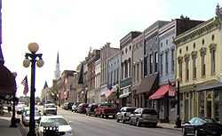
Harrodsburg Commercial District |
|
01980-04-03-0000April 3, 1980
(#80001657) |
Roughly bounded by Lexington, Greenville, and Chiles Sts. and Moreland and Beaumont Aves.
37°45′37″N 84°50′36″W / 37.760278°N 84.843333°W / 37.760278; -84.843333 (Harrodsburg Commercial District) |
Harrodsburg |
|
| 33 |
Honeysuckle Hill |
|
01983-08-11-0000August 11, 1983
(#83002828) |
712 Beaumont Ave.
37°45′01″N 84°50′18″W / 37.750278°N 84.838333°W / 37.750278; -84.838333 (Honeysuckle Hill) |
Harrodsburg |
|
| 34 |
Moses Jones House |
Upload image |
01979-02-09-0000February 9, 1979
(#79001024) |
North of Harrodsburg on Oregon Rd.
37°54′45″N 84°48′21″W / 37.9125°N 84.805833°W / 37.9125; -84.805833 (Moses Jones House) |
Harrodsburg |
|
| 35 |
Lexington and Cane Run Historic District |
Upload image |
02011-11-14-0000November 14, 2011
(#11000795) |
E. Lexington & Cane Run Sts.
37°45′43″N 84°50′17″W / 37.762072°N 84.838103°W / 37.762072; -84.838103 (Lexington and Cane Run Historic District) |
Harrodsburg |
|
| 36 |
Lexington, Harrodsburg, and Perryville Turnpike Rural Historic District |
Upload image |
02003-10-23-0000October 23, 2003
(#03000087) |
U.S. Route 68
37°48′35″N 84°46′52″W / 37.809722°N 84.781111°W / 37.809722; -84.781111 (Lexington, Harrodsburg, and Perryville Turnpike Rural Historic District) |
Harrodsburg |
|
| 37 |
Beriah Magoffin Monument |
|
01997-07-17-0000July 17, 1997
(#97000676) |
Springhill Cemetery, 0.5 miles southeast of the junction of U.S. Route 127 and KY 1989
37°46′10″N 84°50′20″W / 37.769444°N 84.838889°W / 37.769444; -84.838889 (Beriah Magoffin Monument) |
Harrodsburg |
|
| 38 |
Matheny-Taylor House |
|
01989-02-09-0000February 9, 1989
(#88003378) |
Poplar and College Sts.
37°45′42″N 84°50′45″W / 37.761667°N 84.845833°W / 37.761667; -84.845833 (Matheny-Taylor House) |
Harrodsburg |
|
| 39 |
McAfee Farm Historic District |
Upload image |
01989-02-09-0000February 9, 1989
(#88003360) |
South of McAfee on Old Louisville Rd.
37°50′18″N 84°51′49″W / 37.838333°N 84.863611°W / 37.838333; -84.863611 (McAfee Farm Historic District) |
McAfee |
|
| 40 |
George McAfee House |
Upload image |
01983-06-23-0000June 23, 1983
(#83002829) |
Off KY 1160
37°50′51″N 84°52′46″W / 37.8475°N 84.879444°W / 37.8475; -84.879444 (George McAfee House) |
Cornishville |
|
| 41 |
James McAfee House |
Upload image |
01983-06-23-0000June 23, 1983
(#83002830) |
Talmage Rd
37°51′24″N 84°52′20″W / 37.856667°N 84.872222°W / 37.856667; -84.872222 (James McAfee House) |
Harrodsburg |
|
| 42 |
Joseph McCoun-D.S. Sharp House |
Upload image |
02005-08-03-0000August 3, 2005
(#05000788) |
Junction of Bondville Rd. and Crews St.
37°55′13″N 84°52′16″W / 37.920278°N 84.871111°W / 37.920278; -84.871111 (Joseph McCoun-D.S. Sharp House) |
Bondville/Salvisa |
|
| 43 |
McGee House |
Upload image |
01989-02-09-0000February 9, 1989
(#88003364) |
Jackson Rd.
37°49′29″N 84°51′49″W / 37.824722°N 84.863611°W / 37.824722; -84.863611 (McGee House) |
Harrodsburg |
|
| 44 |
John McGee House |
Upload image |
01983-06-23-0000June 23, 1983
(#83002831) |
Jackson Rd.
37°49′48″N 84°52′43″W / 37.83°N 84.878611°W / 37.83; -84.878611 (John McGee House) |
Cornishville |
|
| 45 |
Mercer County Jailer's Residence |
|
01989-02-09-0000February 9, 1989
(#88003375) |
320 S. Chiles St.
37°45′35″N 84°50′42″W / 37.759722°N 84.845°W / 37.759722; -84.845 (Mercer County Jailer's Residence) |
Harrodsburg |
|
| 46 |
Millwood |
Upload image |
01976-07-06-0000July 6, 1976
(#76000928) |
South of Salvisa off U.S. Route 127
37°52′57″N 84°52′23″W / 37.8825°N 84.873056°W / 37.8825; -84.873056 (Millwood) |
Salvisa |
|
| 47 |
Moreland House |
Upload image |
01989-02-09-0000February 9, 1989
(#88003371) |
Off U.S. Route 68
37°45′58″N 84°49′47″W / 37.766111°N 84.829722°W / 37.766111; -84.829722 (Moreland House) |
Harrodsburg |
|
| 48 |
Morgan Row |
|
01973-02-16-0000February 16, 1973
(#73000820) |
222, 230, 232 S. Chiles St.
37°45′38″N 84°50′43″W / 37.760556°N 84.845278°W / 37.760556; -84.845278 (Morgan Row) |
Harrodsburg |
|
| 49 |
Joseph Morgan House |
Upload image |
01990-04-18-0000April 18, 1990
(#88003365) |
Moberly Rd.
37°46′48″N 84°51′48″W / 37.78°N 84.863333°W / 37.78; -84.863333 (Joseph Morgan House) |
Harrodsburg |
|
| 50 |
New Providence Presbyterian Church |
|
01975-10-10-0000October 10, 1975
(#75000806) |
3 miles south of Salvisa on U.S. Route 127
37°51′53″N 84°51′10″W / 37.864722°N 84.852778°W / 37.864722; -84.852778 (New Providence Presbyterian Church) |
Salvisa |
|
| 51 |
North Main Street Historic District |
|
02011-12-19-0000December 19, 2011
(#11000796) |
105-414 N. Main St., 109 W. Lexington, 101 W. Broadway, 163 E. Broadway
37°45′54″N 84°50′35″W / 37.764864°N 84.843042°W / 37.764864; -84.843042 (North Main Street Historic District) |
Harrodsburg |
|
| 52 |
Benjamin Passmore Hotel |
|
01990-06-18-0000June 18, 1990
(#88003374) |
N. Main St. and Broadway
37°45′50″N 84°50′36″W / 37.763889°N 84.843333°W / 37.763889; -84.843333 (Benjamin Passmore Hotel) |
Harrodsburg |
|
| 53 |
Benjamin Passmore House |
|
01989-02-08-0000February 8, 1989
(#88003376) |
111 W. Broadway
37°45′49″N 84°50′39″W / 37.763611°N 84.844167°W / 37.763611; -84.844167 (Benjamin Passmore House) |
Harrodsburg |
|
| 54 |
George Passmore House |
|
01989-02-09-0000February 9, 1989
(#88003379) |
Poplar and Greenville Sts.
37°45′39″N 84°50′32″W / 37.760833°N 84.842222°W / 37.760833; -84.842222 (George Passmore House) |
Harrodsburg |
|
| 55 |
Pioneer Memorial State Park |
|
01989-02-09-0000February 9, 1989
(#88003377) |
College Ave. between Lexington and Poplar Sts.
37°45′42″N 84°50′53″W / 37.761667°N 84.848056°W / 37.761667; -84.848056 (Pioneer Memorial State Park) |
Harrodsburg |
|
| 56 |
Dr. A.D. Price House |
|
01989-02-09-0000February 9, 1989
(#88003373) |
115 W. Poplar St.
37°45′41″N 84°50′39″W / 37.761389°N 84.844167°W / 37.761389; -84.844167 (Dr. A.D. Price House) |
Harrodsburg |
|
| 57 |
Roach-Ison House |
|
01989-02-09-0000February 9, 1989
(#88003352) |
Northeast of Harrodsburg off U.S. Route 68
37°46′13″N 84°49′38″W / 37.770278°N 84.827222°W / 37.770278; -84.827222 (Roach-Ison House) |
Harrodsburg |
|
| 58 |
St. Peter's AME Church |
|
01989-02-09-0000February 9, 1989
(#88003381) |
Lexington St. and U.S. Route 127
37°45′46″N 84°50′43″W / 37.762639°N 84.84525°W / 37.762639; -84.84525 (St. Peter's AME Church) |
Harrodsburg |
|
| 59 |
St. Philip's Episcopal Church |
|
01978-01-31-0000January 31, 1978
(#78001389) |
Short and Chiles Sts.
37°45′39″N 84°50′40″W / 37.760833°N 84.844444°W / 37.760833; -84.844444 (St. Philip's Episcopal Church) |
Harrodsburg |
|
| 60 |
Shaker West Lot Farm |
|
01983-06-23-0000June 23, 1983
(#83002832) |
Off U.S. Route 68
37°49′35″N 84°45′18″W / 37.826389°N 84.755°W / 37.826389; -84.755 (Shaker West Lot Farm) |
Harrodsburg |
|
| 61 |
Shakertown at Pleasant Hill Historic District |
|
01971-11-11-0000November 11, 1971
(#71000353) |
On U.S. Route 68
37°49′14″N 84°44′36″W / 37.820556°N 84.743333°W / 37.820556; -84.743333 (Shakertown at Pleasant Hill Historic District) |
Pleasant Hill |
|
| 62 |
Shawnee Springs |
Upload image |
01976-07-19-0000July 19, 1976
(#76000927) |
4 miles northeast of Harrodsburg on Curry Rd.
37°49′01″N 84°48′07″W / 37.816944°N 84.801944°W / 37.816944; -84.801944 (Shawnee Springs) |
Harrodsburg |
|
| 63 |
Smith-Williams House |
Upload image |
01989-02-09-0000February 9, 1989
(#88003355) |
South of Cane Run Pike
37°44′57″N 84°47′01″W / 37.749167°N 84.783611°W / 37.749167; -84.783611 (Smith-Williams House) |
Burgin |
|
| 64 |
Stone Quarters on Burgin Road |
Upload image |
01983-06-23-0000June 23, 1983
(#83002833) |
KY 152
37°45′40″N 84°49′15″W / 37.761111°N 84.820833°W / 37.761111; -84.820833 (Stone Quarters on Burgin Road) |
Harrodsburg |
|
| 65 |
Sutfield House |
|
01989-02-09-0000February 9, 1989
(#88003368) |
304 N. Main St.
37°45′54″N 84°50′36″W / 37.765°N 84.843333°W / 37.765; -84.843333 (Sutfield House) |
Harrodsburg |
|
| 66 |
Sutfield-Thompson House |
|
01977-09-13-0000September 13, 1977
(#77000637) |
362 N. Main
37°45′59″N 84°50′36″W / 37.766389°N 84.843333°W / 37.766389; -84.843333 (Sutfield-Thompson House) |
Harrodsburg |
|
| 67 |
Capt. Samuel Taylor House |
|
01977-04-13-0000April 13, 1977
(#77000638) |
Northeast of Harrodsburg on Chatham Pike
37°47′56″N 84°45′49″W / 37.798889°N 84.763611°W / 37.798889; -84.763611 (Capt. Samuel Taylor House) |
Harrodsburg |
|
| 68 |
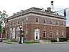
US Post Office-Harrodsburg |
|
01989-03-01-0000March 1, 1989
(#89000019) |
105 N. Main St.
37°45′45″N 84°50′35″W / 37.7625°N 84.843056°W / 37.7625; -84.843056 (US Post Office-Harrodsburg) |
Harrodsburg |
|
| 69 |
Wildwood |
Upload image |
01989-02-09-0000February 9, 1989
(#88003366) |
388 Curry Pike
37°48′19″N 84°48′43″W / 37.805278°N 84.811944°W / 37.805278; -84.811944 (Wildwood) |
Harrodsburg |
|
| 70 |
Williams House |
Upload image |
01990-06-18-0000June 18, 1990
(#88003351) |
Warwick Rd.
37°49′50″N 84°49′35″W / 37.830556°N 84.826389°W / 37.830556; -84.826389 (Williams House) |
Harrodsburg |
|
| 71 |
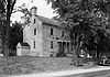
Archibald Woods House |
|
01983-10-29-0000October 29, 1983
(#83002834) |
129 N. East St.
37°45′46″N 84°50′27″W / 37.762778°N 84.840833°W / 37.762778; -84.840833 (Archibald Woods House) |
Harrodsburg |
Still owned by same family that built house on what was originally four-acre tract along south side of Town Creek near site of James Harrod's June 1774 'Big Spring' settlement. Six generations of the Woods family have lived here. Believed to have been modeled after Warren House (ca. 1760) near Smithfield, Surry County, Virginia. |