National Register of Historic Places listings in Maricopa County, Arizona
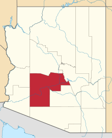
This is a list of the National Register of Historic Places listings in Maricopa County, Arizona which complements a list of National Register of Historic Places listings in Phoenix, Arizona. Together these are intended to be a complete list of the properties and districts on the National Register of Historic Places in Maricopa County, Arizona, United States. The locations of National Register properties and districts for which the latitude and longitude coordinates are included below, may be seen in a Google map.[1]
There are 377 properties and districts listed on the National Register in the county, including 3 that are also National Historic Landmarks. The city of Phoenix is the location of 200 of these properties and districts, including 1 National Historic Landmark; they are listed in the separate Phoenix NRHP list-article, while the remaining 177 properties and districts and 2 National Historic Landmarks are located elsewhere in the county, and are listed here.
- This National Park Service list is complete through NPS recent listings posted May 1, 2015.[2]
Current listings
| [3] | Name on the Register[4] | Image | Date listed[5] | Location | City or town | Description |
|---|---|---|---|---|---|---|
| 1 | 1931 Tempe Bridge |  |
(#81000137) |
Mill Ave. 33°25′49″N 111°56′22″W / 33.430278°N 111.939444°W |
Tempe | The first of the two Mill Avenue Bridges |
| 2 | 59th Avenue Residential Historic District |  |
(#06000767) |
Western side of 59th Ave. between Orangewood Ave. and Frier Dr. 33°32′53″N 112°11′11″W / 33.548056°N 112.186389°W |
Glendale | The District represents early rural development where homes were built on large, split lots.[6] |
| 3 | Administration/Science Building | 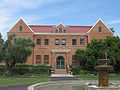 |
(#85002169) |
Arizona State University campus (Building 11) 33°25′15″N 111°55′57″W / 33.420833°N 111.9325°W |
Tempe | part of the Tempe Multiple Resource Area (MRA) |
| 4 | Alchesay Canyon Bridge | 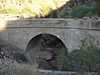 |
(#88001615) |
State Route 88 over Alchesay Canyon at milepost 241.1 33°40′05″N 111°09′30″W / 33.668056°N 111.158333°W |
Roosevelt | part of the Vehicular Bridges in Arizona Multiple Property Submission (MPS) |
| 5 | Alhambra Hotel | 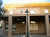 |
(#91000982) |
43 S. Macdonald 33°24′51″N 111°49′59″W / 33.414167°N 111.833056°W |
Mesa | Mesa’s longest operating place of lodging. This location is one of the stops on the Ghost Tour and Historical Walk.[7] |
| 6 | Alma Ward Meeting House | 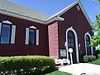 |
(#05001198) |
809 W. Main St. 33°25′00″N 111°50′55″W / 33.416667°N 111.848611°W |
Mesa | Three buildings which played a role in the formation of religious and educational development in Mesa.[7] |
| 7 | Dr. Lucius Charles Alston House | 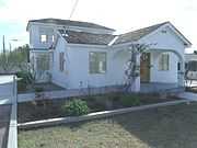 |
(#12000240) |
453 N. Pima St. 33°25′26″N 111°49′49″W / 33.423884°N 111.830351°W |
Mesa | Home of Dr. Lucius Charles Alston, the first African American doctor in Mesa.[7] |
| 8 | Ammo Bunker (S-1007) | -1.JPG) |
(#95000748) |
Southwest of Vosler Dr. (formerly Alaska Drive), at Arizona State University at the Polytechnic campus (formerly Williams Air Force Base). 33°17′43″N 111°40′43″W / 33.295278°N 111.678611°W |
Mesa | part of the Williams Air Force Base MPS |
| 9 | Ammo Bunker (S-1008) | -2.JPG) |
(#95000759) |
Southwest of Vosler Dr. (formerly Alaska Drive), at Arizona State University at the Polytechnic campus (formerly Williams Air Force Base). 33°17′39″N 111°40′40″W / 33.294167°N 111.677778°W |
Mesa | A good illustration of a typical utilitarian military support structure constructed at military bases in the United States during World War II.[7] |
| 10 | Andre Building | .jpg) |
(#79000419) |
401-403 S. Mill Ave. 33°25′34″N 111°56′20″W / 33.426111°N 111.938889°W |
Tempe | A classic revival building re-built in 1893 after the original burned.[8] |
| 11 | Angulo-Hostetter House |  |
(#00001266) |
150 North Wilbur 33°25′09″N 111°49′28″W / 33.419167°N 111.824444°W |
Mesa | A Colonial Revival home, constructed in 1902 with a 1938 addition, showing many Victorian features.[7] |
| 12 | Archeological Site No. AZ U:10:20(ASU) |  |
(#95000750) |
Address Restricted |
Mesa | Southwest Germann Site; part of the Hohokam and Euroamerican Land Use and Settlement Along the Northern Queen Creek Delta MPS |
| 13 | Archeological Site No. AZ U:10:25(ASU) | |
(#95000751) |
Address Restricted |
Mesa | Will E. Coyote Site; part of the Hohokam and Euroamerican Land Use and Settlement Along the Northern Queen Creek Delta MPS |
| 14 | Azatlan Archeological Site | |
(#95001283) |
Address Restricted |
Rio Verde Estates | |
| 15 | B. B. Moeur Activity Building | .jpg) |
(#85002171) |
Arizona State University campus (Building 37) 33°25′04″N 111°56′07″W / 33.417778°N 111.935278°W |
Tempe | Built in 1939 by the WPA as a women's activity center, this Federal Moderne style building is now home to the Mars Space Flight Facility.[9][10] |
| 16 | Beet Sugar Factory | 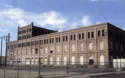 |
(#78000548) |
5243 W. Glendale Ave. 33°32′15″N 112°10′16″W / 33.5375°N 112.171111°W |
Glendale | Structure built in 1910 |
| 17 | Borden Homes Historic District | Upload image | (#11001072) |
1000-1100 blocks of S. Una & S. Butte Aves., & 1600-1700 blocks of E. 12th St. 33°24′58″N 111°54′42″W / 33.416164°N 111.91175°W |
Tempe | One of the earliest post-war neighborhoods in Tempe. |
| 18 | Borden Milk Co. Creamery and Ice Factory | 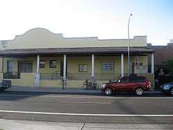 |
(#84000171) |
1300-1360 E. 8th St. 33°25′10″N 111°54′54″W / 33.419444°N 111.915°W |
Tempe | Originally built in 1892, the current Mission Revival architecture of the old creamery dates from 1927.[11] |
| 19 | Boulder Creek Bridge | 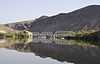 |
(#88001599) |
State Route 88 over Boulder Creek 33°32′01″N 111°25′23″W / 33.533611°N 111.423056°W |
Tortilla Flat | part of the Vehicular Bridges in Arizona MPS |
| 20 | Brazaletes Pueblo Site | |
(#75000349) |
Address Restricted |
Carefree | A large masonry pueblo north of Phoenix.[12] |
| 21 | Buckeye Union High School A-Wing | Upload image | (#09001160) |
902 E. Eason Ave. 33°22′23″N 112°34′39″W / 33.373156°N 112.577542°W |
Buckeye | |
| 22 | Buckhorn Baths Motel | 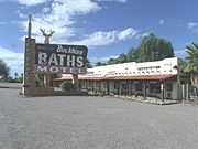 |
(#05000421) |
5900 E. Main St. 33°25′00″N 111°42′04″W / 33.416667°N 111.701111°W |
Mesa | A complex consisting of fourteen buildings including a bathhouse, a main office building, and individual room units.[7] |
| 23 | E.C. Bunch House | 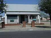 |
(#08000123) |
5602 W. Lamar Rd. 33°32′13″N 112°10′47″W / 33.536944°N 112.179722°W |
Glendale | A rare intact house built in 1898 in the Victorian folk-style architecture.[13] |
| 24 | Cactus Inn |  |
(#86001576) |
158 Yavapai 33°58′06″N 112°44′01″W / 33.968333°N 112.733611°W |
Wickenburg | part of the Wickenburg MRA |
| 25 | Cashion Archeological Site | |
(#78000547) |
Address Restricted |
Cashion | |
| 26 | Cave Creek Service Station | Upload image | (#00001126) |
6141 Cave Creek Rd. 33°49′55″N 111°56′51″W / 33.831944°N 111.9475°W |
Cave Creek | |
| 27 | Central School |  |
(#82002080) |
10304 N. 83rd Ave. 33°34′43″N 112°14′14″W / 33.578611°N 112.237222°W |
Peoria | The Peoria Central School was two room school built in 1906. It is currently occupied by the Peoria Arizona Historical Society Museum |
| 28 | Chandler Commercial Historic District |  |
(#00001127) |
Roughly bounded by Boston, Oregon, Buffalo, and Washington Sts. 33°18′11″N 111°50′30″W / 33.303056°N 111.841667°W |
Chandler | |
| 29 | Chandler High School |  |
(#07000836) |
350 N. Arizona Ave. 33°18′30″N 111°50′32″W / 33.308333°N 111.842222°W |
Chandler | |
| 30 | City Hall and Jail |  |
(#86001577) |
117 Yavapai 33°58′13″N 112°43′48″W / 33.970278°N 112.73°W |
Wickenburg | part of the Wickenburg MRA |
| 31 | Civil Engineering Maintenance Shop | 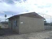 |
(#95000747) |
Northeastern corner of Unity Ave. (once known as Jct. of 11th and A Sts.), at Arizona State University at the Polytechnic campus (formally Williams Air Force Base). 33°18′14″N 111°40′45″W / 33.303889°N 111.679167°W |
Mesa | part of the Williams Air Force Base MPS |
| 32 | Demountable Hangar | 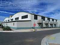 |
(#95000743) |
North Apron of Phoenix-Mesa Gateway Airport (formally Williams Air Force Base). 33°18′40″N 111°40′11″W / 33.311111°N 111.669722°W |
Mesa | part of the Williams Air Force Base MPS |
| 33 | George O. Dowdy Rental Cottage | 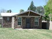 |
(#09000246) |
6818 N. 60th Ave. 33°32′15″N 112°11′21″W / 33.537506°N 112.189117°W |
Glendale | Built in 1926 |
| 34 | Rose Eisendrath House | Upload image | (#11000206) |
1400 N. College Ave. 33°26′36″N 111°55′57″W / 33.443333°N 111.9325°W |
Tempe | 1930 Pueblo Revival house built by noted Arizona architect Robert T. Evans[14] |
| 35 | Elias-Rodriguez House | .jpg) |
(#84000684) |
927 E. 8th St. 33°25′45″N 111°55′25″W / 33.429167°N 111.923611°W |
Tempe | part of the Tempe MRA |
| 36 | Elliott House | .jpg) |
(#84000693) |
1010 Maple Ave. 33°25′06″N 111°56′26″W / 33.418333°N 111.940556°W |
Tempe | part of the Tempe MRA |
| 37 | George Ellis House |  |
(#99001065) |
105 Cattle Track 33°31′32″N 111°54′57″W / 33.525556°N 111.915833°W |
Scottsdale | part of the Residential Properties Designed by George Ellis MPS |
| 38 | Evergreen Historic District | Upload image | (#99000706) |
Roughly between Country Club and Macdonald, north of University Dr. to 8th St. 33°25′34″N 111°50′05″W / 33.426111°N 111.834722°W |
Mesa | |
| 39 | Farmer-Goodwin House | .jpg) |
(#72000197) |
820 Farmer Ave. 33°25′17″N 111°57′08″W / 33.421389°N 111.952222°W |
Tempe | |
| 40 | First Methodist Episcopal Church of Glendale Sanctuary | 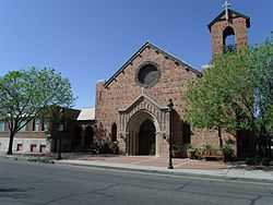 |
(#05001502) |
7102 N. 58th Dr. 33°32′24″N 112°11′04″W / 33.54°N 112.184444°W |
Glendale | Church built in 1926 |
| 41 | First National Bank of Glendale Building | 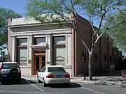 |
(#83002991) |
6838 N. 58th Dr. 33°32′18″N 112°11′03″W / 33.538333°N 112.184167°W |
Glendale | Building built in 1906 |
| 42 | First Presbyterian Church of Peoria |  |
(#12000493) |
10236 N. 83rd Ave. 33°34′41″N 112°14′17″W / 33.578131°N 112.238143°W |
Peoria | |
| 43 | Fish Creek Bridge | Upload image | (#88001600) |
Milepost 223.50 on State Route 88 33°32′14″N 111°17′46″W / 33.537222°N 111.296111°W |
Tortilla Flat | part of the Vehicular Bridges in Arizona MPS |
| 44 | Flagpole | 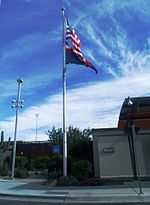 |
(#95000744) |
Once located at 10 St. between D and E Sts. and now located at the entrance of Phoenix-Mesa Gateway Airport (formally Williams Air Force Base). 33°18′25″N 111°40′45″W / 33.306944°N 111.679167°W |
Mesa | part of the Williams Air Force Base MPS |
| 45 | Floralcroft Historic District | 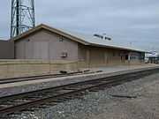 |
(#05001505) |
Roughly bounded by State St., 59th Ave., Myrtle St., Grand Ave., and 61st Ave. 33°32′35″N 112°11′16″W / 33.543056°N 112.187778°W |
Glendale | 1895 Santa Fe Depot located at Grand and Palmarie Aves. within the Floralcroft Historic District. |
| 46 | Fort McDowell | Upload image | (#92001050) |
Indian Route 1 off State Route 87 on the Yavapai Indian Reservation 33°38′11″N 111°40′30″W / 33.636389°N 111.675°W |
Fort McDowell | |
| 47 | Fortaleza | |
(#69000035) |
Address Restricted |
Gila Bend | |
| 48 | Frankenberg House | .jpg) |
(#81000138) |
129 E. University Dr. 33°25′18″N 111°56′10″W / 33.421667°N 111.936111°W |
Tempe | Dismantled and rebuilt at 150 S. Ash Ave in 1992. |
| 49 | Frankenberg House | .jpg) |
(#07001333) |
2222 S. Price Rd. 33°24′11″N 111°53′31″W / 33.40304°N 111.89197°W |
Tempe | |
| 50 | Fraser Fields Historic District | Upload image | (#10000535) |
Fraser Dr. W to Fraser Dr. E; Third Pl. to Pepper Pl. 33°25′08″N 111°48′43″W / 33.418889°N 111.811944°W |
Mesa vicinity | |
| 51 | Garcia School |  |
(#82002087) |
Yavapai St. and U.S. Route 89 33°58′21″N 112°43′55″W / 33.9725°N 112.731944°W |
Wickenburg | part of the Wickenburg MRA |
| 52 | Gatlin Site | 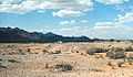 |
(#66000183) |
Address Restricted |
Gila Bend | |
| 53 | Gila Bend Overpass | Upload image | (#88001607) |
Business Route 8 over the Southern Pacific railroad line 32°56′58″N 112°41′46″W / 32.949444°N 112.696111°W |
Gila Bend | part of the Vehicular Bridges in Arizona MPS |
| 54 | Gilbert Elementary School |  |
(#80000762) |
Elliot and Gilbert Rds. 33°20′57″N 111°47′22″W / 33.349167°N 111.789444°W |
Gilbert | |
| 55 | Gillespie Dam Highway Bridge | 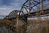 |
(#81000136) |
Northwest of Gila Bend 33°13′38″N 112°46′07″W / 33.227222°N 112.768611°W |
Gila Bend | part of the Vehicular Bridges in Arizona MPS |
| 56 | Glendale Gardens Historic District | Upload image | (#11001073) |
5002-5038 W. Gardenia Ave., 5007-5038 W. State Ave., & 7251-7321 N. 50th Dr. 33°32′41″N 112°10′03″W / 33.544661°N 112.167542°W |
Glendale | |
| 57 | Glendale Grammar School One-room Class Building | 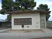 |
(#05001503) |
7301 N. 58th Dr. 33°32′40″N 112°10′55″W / 33.544444°N 112.181944°W |
Glendale | Structure built in 1920 |
| 58 | Glendale High School Auditorium | 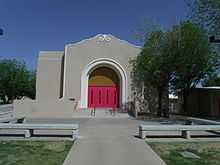 |
(#06000326) |
6216 W. Myrtle Ave. 33°32′20″N 112°11′37″W / 33.538889°N 112.193611°W |
Glendale | Auditorium built in 1939 |
| 59 | Glendale Townsite-Catlin Court Historic District | 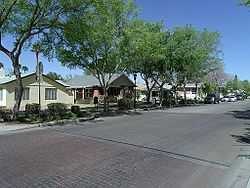 |
(#92000680) |
Roughly bounded by Gardenia, 58th, Myrtle, 57th, Palmaire, and 59th Aves. and 58th Dr. • Boundary increase (listed October 20, 2007, refnum 07001088): Generally bounded by 55th Ave., 59th Ave., Palmaire Ave. and Orangewood Ave. 33°32′37″N 112°11′05″W / 33.543611°N 112.184722°W |
Glendale | One of Glendale Arizona's earliest and most historic neighborhoods[15] |
| 60 | Glendale Tract Historic District | Upload image | (#05001506) |
51st Ave. and Northern Ave. 33°33′07″N 112°10′01″W / 33.551944°N 112.166944°W |
Glendale | |
| 61 | Glendale Woman's Club Clubhouse | 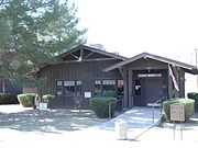 |
(#89001003) |
7032 N. 56th Ave. 33°32′23″N 112°10′50″W / 33.539722°N 112.180556°W |
Glendale | Structure built in 1912 |
| 62 | Gonzales-Martinez House |  |
(#84000708) |
320 W. 1st St. 33°25′46″N 111°56′34″W / 33.429444°N 111.942778°W |
Tempe | part of the Tempe MRA |
| 63 | Goodwin Building | .jpg) |
(#84000710) |
512-518 S. Mill Ave. 33°25′29″N 111°56′22″W / 33.424722°N 111.939444°W |
Tempe | part of the Tempe MRA |
| 64 | Grady Gammage Memorial Auditorium |  |
(#85002170) |
Northeastern corner of the intersection of Mill and Apache 33°24′59″N 111°56′14″W / 33.416389°N 111.937222°W |
Tempe | part of the Tempe MRA |
| 65 | Roy Hackett House | .jpg) |
(#74000458) |
401 and 405 Maple St. 33°25′34″N 111°56′25″W / 33.426111°N 111.940278°W |
Tempe | |
| 66 | Harrington-Birchett House | .jpg) |
(#84000716) |
202 E. 7th St. 33°25′24″N 111°56′07″W / 33.423333°N 111.935278°W |
Tempe | part of the Tempe MRA |
| 67 | Hassayampa River Bridge | 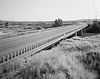 |
(#88001658) |
Old U.S. Route 80 over the Hassayampa River 33°20′54″N 112°43′17″W / 33.348333°N 112.721389°W |
Hassayampa | part of the Vehicular Bridges in Arizona MPS |
| 68 | C.T. Hayden House |  |
(#84000173) |
3 W. 1st St. 33°25′45″N 111°56′21″W / 33.429167°N 111.939167°W |
Tempe | Home of Charles T. Hayden; part of the Tempe MRA |
| 69 | Hiatt House | .jpg) |
(#84000720) |
1104 Ash Ave. 33°25′08″N 111°56′34″W / 33.418889°N 111.942778°W |
Tempe | part of the Tempe MRA |
| 70 | House at 160 Apache | 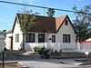 |
(#86001578) |
160 Apache 33°58′03″N 112°43′55″W / 33.9675°N 112.731944°W |
Wickenburg | part of the Wickenburg MRA |
| 71 | House at 170 Center | 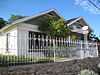 |
(#86001579) |
170 Center 33°58′00″N 112°43′54″W / 33.966667°N 112.731667°W |
Wickenburg | part of the Wickenburg MRA |
| 72 | House at 186 Washington |  |
(#86001580) |
186 Washington 33°57′59″N 112°43′43″W / 33.966389°N 112.728611°W |
Wickenburg | part of the Wickenburg MRA |
| 73 | Housing Storage Supply Warehouse | 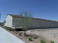 |
(#95000746) |
Northwestern corner of the junction of Innovation and Unity Aves. (once known as Jct. of 11th and A Sts.), at Arizona State University at the Polytechnic campus (formally Williams Air Force Base). 33°18′14″N 111°40′49″W / 33.303889°N 111.680278°W |
Mesa | part of the Williams Air Force Base MPS |
| 74 | Industrial Arts Building | .jpg) |
(#85002168) |
Arizona State University campus (building 4) 33°25′14″N 111°56′04″W / 33.420556°N 111.934444°W |
Tempe | part of the Tempe MRA |
| 75 | Initial Point of the Gila and Salt River Base Line and Meridian |  |
(#02001137) |
Summit of Monument Hill at 115th Ave. and Baseline Rd. 33°22′38″N 112°18′22″W / 33.377169°N 112.306172°W |
Avondale | See also: Gila and Salt River Meridian and Baseline Road (Arizona) |
| 76 | Irving School | 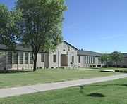 |
(#00001323) |
155 N. Center St. 33°25′08″N 111°49′49″W / 33.418889°N 111.830278°W |
Mesa | |
| 77 | Jacobs House |  |
(#86001581) |
355 N. Jefferson 33°58′10″N 112°44′02″W / 33.969444°N 112.733889°W |
Wickenburg | part of the Wickenburg MRA |
| 78 | Edward L. Jones House | 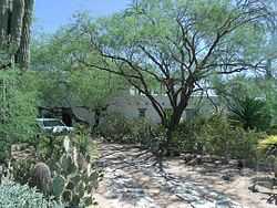 |
(#96001474) |
5555 N. Casa Blanca Dr. 33°31′03″N 111°56′17″W / 33.5175°N 111.938056°W |
Paradise Valley | House was built in 1925 |
| 79 | Louise Lincoln Kerr House and Studio |  |
(#10000173) |
6110 N. Scottsdale Rd. 33°31′34″N 111°55′40″W / 33.526164°N 111.927661°W |
Scottsdale | |
| 80 | Laird and Dines Building |  |
(#85003686) |
1 E. Fifth St. Coordinates missing |
Tempe | part of the Tempe MRA |
| 81 | Laird-Hugh House | .jpg) |
(#84000726) |
821 S. Farmer 33°25′15″N 111°56′35″W / 33.420833°N 111.943056°W |
Tempe | part of the Tempe MRA |
| 82 | Laveen School Auditorium | 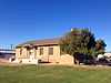 |
(#96000040) |
5001 W. Dobbins Rd. 33°21′45″N 112°10′03″W / 33.3625°N 112.1675°W |
Laveen | |
| 83 | Lehi School | 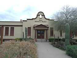 |
(#01000906) |
2345 N. Horne 33°27′30″N 111°48′46″W / 33.458333°N 111.812778°W |
Mesa | Currently home to the Mesa Historical Museum, and is at the center of the historic Lehi community. |
| 84 | Lewis and Pranty Creek Bridge | Upload image | (#88001601) |
Milepost 224.60 on State Route 88 33°31′30″N 111°18′24″W / 33.525°N 111.306667°W |
Tortilla Flat | part of the Vehicular Bridges in Arizona MPS |
| 85 | Samuel C. Long House | .jpg) |
(#80000765) |
27 E. 6th St. 33°25′27″N 111°56′17″W / 33.424167°N 111.938056°W |
Tempe | Dismantled and rebuilt at 150 S. Ash Ave in 1992. |
| 86 | MacLennan House |  |
(#86001582) |
338 Jefferson 33°09′32″N 112°43′07″W / 33.158889°N 112.718611°W |
Wickenburg | part of the Wickenburg MRA |
| 87 | Main Building, Tempe Normal School |  |
(#85000052) |
Arizona State University campus 33°25′14″N 111°55′59″W / 33.420556°N 111.933056°W |
Tempe | part of the Tempe MRA |
| 88 | Manistee Ranch | 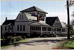 |
(#98000322) |
5127 W. Northern Ave. 33°33′07″N 112°10′12″W / 33.551944°N 112.17°W |
Glendale | Main mansion of the Manistee Ranch, built in 1897; part of the Tempe MRA |
| 89 | Masonic Hall | Upload image | (#86001583) |
108 Tegner 33°58′09″N 112°43′46″W / 33.969167°N 112.729444°W |
Wickenburg | part of the Wickenburg MRA |
| 90 | Matthews Hall | .jpg) |
(#85000053) |
Arizona State University campus (Building 172) 33°25′12″N 111°56′07″W / 33.42°N 111.935278°W |
Tempe | part of the Tempe MRA |
| 91 | McCullough-Price House |  |
(#09000311) |
300 S. Chandler Village Dr. 33°17′52″N 111°54′09″W / 33.29789°N 111.90239°W |
Chandler | Historic 1938 adobe house restored in the mid-2000s across from Chandler Fashion Center shopping mall |
| 92 | Jonas McNair House | 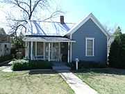 |
(#06000768) |
5919 W. Myrtle Ave. 33°32′31″N 112°11′11″W / 33.541944°N 112.186389°W |
Glendale | House built in 1897 |
| 93 | Mesa Grande | 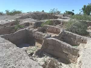 |
(#78000549) |
Junction of Date and 10th Sts.[16] 33°26′05″N 111°50′41″W / 33.434722°N 111.844722°W |
Mesa | |
| 94 | Mesa Journal-Tribune FHA Demonstration Home | 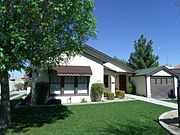 |
(#88003056) |
238 W. 2nd St. 33°25′11″N 111°50′14″W / 33.419722°N 111.837222°W |
Mesa | Relocated in 2002 from original location at 22 East First Avenue. |
| 95 | Mesa Woman's Club | 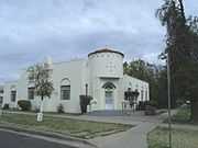 |
(#91000995) |
200 N. Macdonald 33°25′11″N 111°50′02″W / 33.419722°N 111.833889°W |
Mesa | |
| 96 | Midvale Archeological Site | |
(#90000933) |
Address Restricted |
Chandler | |
| 97 | Gov. Benjamin B. Moeur House |  |
(#12000295) |
34 E. 7th St. 33°25′25″N 111°56′18″W / 33.423517°N 111.938422°W |
Tempe | |
| 98 | Moeur Mark | Upload image | (#14000888) |
715 N. Mill Rd. 33°26′16″N 111°56′32″W / 33.4377°N 111.9421°W |
Tempe | |
| 99 | W. A. Moeur House | 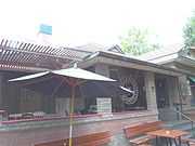 |
(#84000730) |
850 Ash Ave. 33°25′14″N 111°56′30″W / 33.420556°N 111.941667°W |
Tempe | part of the Tempe MRA |
| 100 | Mormon Flat Bridge | 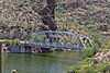 |
(#88001598) |
State Route 88 over Willow Creek 33°32′20″N 111°26′34″W / 33.538889°N 111.442778°W |
Tortilla Flat | part of the Vehicular Bridges in Arizona MPS |
| 101 | Morristown Store | 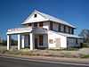 |
(#91001003) |
U.S. Route 89 northwest of Castle Hot Springs Rd. 33°51′19″N 112°37′19″W / 33.855278°N 112.621944°W |
Morristown | |
| 102 | Morrow-Hudson House | .jpg) |
(#84000733) |
1203 E. Alameda Dr. 33°23′59″N 111°55′01″W / 33.399722°N 111.916944°W |
Tempe | part of the Tempe MRA |
| 103 | C.P. Mullen House | .jpg) |
(#84000734) |
918 Mill Ave. 33°25′11″N 111°56′22″W / 33.419722°N 111.939444°W |
Tempe | part of the Tempe MRA |
| 104 | Municipal Light Plant | Upload image | (#86001584) |
245 N. Washington 33°58′12″N 112°43′58″W / 33.97°N 112.732778°W |
Wickenburg | part of the Wickenburg MRA |
| 105 | Myrtle Avenue Residential Historic District | 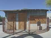 |
(#08001345) |
6305-6423 W. Myrtle Ave. 33°32′31″N 112°11′50″W / 33.542031°N 112.197181°W |
Glendale | Historic Morcomb's Service Station located in the Myrtle Avenue Residential Historic District |
| 106 | Northfield Historic District | 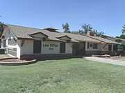 |
(#10000234) |
Bounded by W. State Ave (S), N. 59th Ave (E), W. Orangewood Ave (N), and N. 59th Lane (W) 33°32′42″N 112°11′14″W / 33.544936°N 112.187261°W |
Glendale | The Jack Shawver House, now known as the Keist Office Building, was built in 1952 and is located at 7508 North 59th Avenue, in the 59th Ave.. This Ranch style home was built outside any platted subdivision by Jack Shawver, partner of the Shawver Brothers Tillage Company. It is in the Northfield Historic District.[17] |
| 107 | Old Barber Shop |  |
(#86001585) |
68 Frontier 33°58′07″N 112°43′48″W / 33.968611°N 112.73°W |
Wickenburg | part of the Wickenburg MRA |
| 108 | Old Brick Post Office |  |
(#86001586) |
144 N. Frontier 33°58′09″N 112°43′50″W / 33.969167°N 112.730556°W |
Wickenburg | part of the Wickenburg MRA |
| 109 | Painted Rock Petroglyph Site | 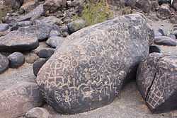 |
(#77000238) |
Along Rocky Point Road west of Theba[18] 33°01′24″N 113°02′55″W / 33.023333°N 113.048611°W |
Theba | |
| 110 | Palo Verde Ruin |  |
(#11000842) |
Palo Verde Open Space Park[19] 33°43′12″N 112°13′06″W / 33.72°N 112.218333°W |
Peoria | Area in the Palo Verde Park section of the Palo Verde Ruin. |
| 111 | Park of the Canals |  |
(#75000350) |
1710 N Horne Ave. 33°26′42″N 111°48′56″W / 33.445°N 111.815556°W |
Mesa | This is an ancient Hohokam canal cleaned out by the Mormon pioneers in 1875. |
| 112 | Niels Petersen House | .jpg) |
(#78000553) |
Southern Ave. and Priest St. 33°23′36″N 111°57′40″W / 33.393333°N 111.961111°W |
Tempe | |
| 113 | Petroglyph Site AZ U 1:165 | |
(#98001038) |
Address Restricted 33°46′42″N 111°55′04″W / 33.778333°N 111.917778°W |
Scottsdale | |
| 114 | Pine Creek Bridge | Upload image | (#88001602) |
Milepost 233.50 on State Route 88 33°35′54″N 111°12′08″W / 33.598333°N 111.202222°W |
Tortilla Flat | part of the Vehicular Bridges in Arizona MPS |
| 115 | President's House | .jpg) |
(#85000054) |
Arizona State University campus 33°25′13″N 111°55′56″W / 33.420278°N 111.932222°W |
Tempe | part of the Tempe MRA |
| 116 | Railroad Steam Wrecking Crane and Tool Car | 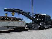 |
(#07001301) |
330 E. Ryan Rd. 33°16′12″N 111°50′07″W / 33.27°N 111.835278°W |
Chandler | |
| 117 | Byron Redden House | .jpg) |
(#84000738) |
948 Ash Ave. 33°25′08″N 111°56′31″W / 33.418889°N 111.941944°W |
Tempe | part of the Tempe MRA |
| 118 | Lowell Redden House | 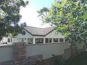 |
(#85000407) |
333 Carver St. 33°20′28″N 111°55′57″W / 33.341111°N 111.9325°W |
Tempe | part of the Tempe MRA |
| 119 | Rittenhouse Elementary School | 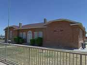 |
(#98000053) |
Ellsworth Rd., 1 mile (1.6 km) north of Rittenhouse Rd. 33°15′47″N 111°38′01″W / 33.263056°N 111.633611°W |
Queen Creek | 1925 Spanish Colonial Revival schoolhouse, currently houses The San Tan Museum |
| 120 | Roald Amundsen Pullman Private Railroad Car |  |
(#09000582) |
7301 Indian Bend Rd. 33°32′17″N 111°55′28″W / 33.538125°N 111.924581°W |
Scottsdale | Built in 1928, the Amundsen, on different occasions reportedly carried Presidents Hoover, Roosevelt, Truman and Eisenhower. |
| 121 | Robson Historic District | Upload image | (#03000530) |
Roughly bounded by Country Club Dr., Robson, and 2nd Sts. 33°25′16″N 111°50′14″W / 33.421111°N 111.837222°W |
Mesa | |
| 122 | Roosevelt Addition Historic District | 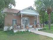 |
(#09000959) |
600 block of W. 3rd St. 33°25′38″N 111°56′54″W / 33.427225°N 111.948231°W |
Tempe | The Sampson-Tupper House was built in 1888 and is located at 601 W. 3rd St. It is in the Roosevelt Addition Historic District. |
| 123 | Safeway Pay 'n Takit |  |
(#86001587) |
42 N. Tegner 33°58′09″N 112°43′44″W / 33.969167°N 112.728889°W |
Wickenburg | part of the Wickenburg MRA |
| 124 | Sage Acres Historic District | Upload image | (#11001074) |
6021-6251 N. 48th Ave. & 4736 W. Bethany Home Rd. 33°31′33″N 112°09′43″W / 33.525969°N 112.161908°W |
Glendale | |
| 125 | Sahuaro Ranch | 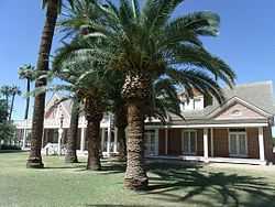 |
(#80000763) |
N. 59th Ave. 33°34′34″N 112°11′18″W / 33.576111°N 112.188333°W |
Glendale | Main mansion of the Sahuaro Ranch, built in 1886 |
| 126 | St. Mary's Church-Our Lady of Mount Carmel Catholic Church |  |
(#78000552) |
College and University Ave. 33°25′20″N 111°56′04″W / 33.422222°N 111.934444°W |
Tempe | |
| 127 | San Marcos Hotel |  |
(#82002078) |
1 San Marcos Pl. 33°18′14″N 111°50′27″W / 33.303889°N 111.840833°W |
Chandler | |
| 128 | Sands Estate Historic District | Upload image | (#11000192) |
Roughly bounded by W. Belmont Ave., W. Morten Ave., Orangewood Ave., and W. Vista Ave.[20] 33°32′51″N 112°10′56″W / 33.5475°N 112.182222°W |
Glendale | |
| 129 | Santa Fe Railroad Depot | 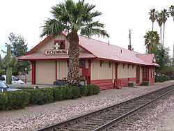 |
(#86001588) |
215 N. Frontier 33°58′10″N 112°43′54″W / 33.969444°N 112.731667°W |
Wickenburg | part of the Wickenburg MRA |
| 130 | Robert Scott House | 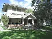 |
(#82002079) |
2230 E. Grandview St. 33°26′25″N 111°46′52″W / 33.440278°N 111.781111°W |
Mesa | |
| 131 | Scottsdale Grammar School |  |
(#94000571) |
7333 E. Scottsdale Mall 33°29′33″N 111°55′22″W / 33.4925°N 111.922778°W |
Scottsdale | Built in 1909, it is also known as "The Little Red Schoolhouse" |
| 132 | B.H. Scudder Rental House | 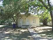 |
(#84000740) |
919 S. Maple Ave. 33°25′10″N 111°56′23″W / 33.419444°N 111.939722°W |
Tempe | Demolished in 1983; part of the Tempe MRA |
| 133 | Sears-Kay Ruin | |
(#95001310) |
Address Restricted |
Carefree | |
| 134 | Selleh House | .jpg) |
(#05001197) |
1104 S. Mill Ave. 33°25′02″N 111°56′22″W / 33.417222°N 111.939444°W |
Tempe | |
| 135 | Shride House |  |
(#86001589) |
57 Tegner 33°58′06″N 112°43′43″W / 33.968333°N 112.728611°W |
Wickenburg | part of the Wickenburg MRA |
| 136 | Silk Stocking Neighborhood Historic District | 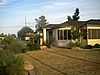 |
(#11000567) |
Generally bounded by Erie St., Chandler Blvd., Delaware St. & alley west of Washington St. 33°18′28″N 111°50′23″W / 33.307778°N 111.839722°W |
Chandler | |
| 137 | Sirrine House | 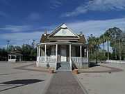 |
(#95001082) |
160 N. Center St. 33°25′10″N 111°49′54″W / 33.419444°N 111.831667°W |
Mesa | |
| 138 | Skeleton Cave Massacre Site | 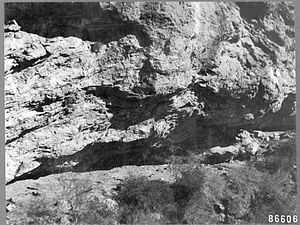 |
(#91000100) |
Address Restricted |
Apache Junction | See also: Yavapai people: Skeleton Cave |
| 139 | Southern Pacific Railroad Locomotive No. SP 2562 and Tender No. 8365 |  |
(#09000511) |
330 E. Ryan Rd. 33°16′11″N 111°50′10″W / 33.26965°N 111.836158°W |
Chandler | |
| 140 | Spangler-Wilbur House | 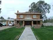 |
(#93001141) |
128 N. MacDonald St. 33°25′04″N 111°50′01″W / 33.417778°N 111.833611°W |
Mesa | |
| 141 | Storms House |  |
(#86001590) |
130 Center 33°58′01″N 112°43′51″W / 33.966944°N 112.730833°W |
Wickenburg | part of the Wickenburg MRA |
| 142 | Straugh House | 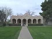 |
(#91000983) |
148 N. Macdonald 33°25′06″N 111°50′02″W / 33.418333°N 111.833889°W |
Mesa | |
| 143 | Suhwaro Hotel | 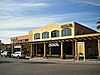 |
(#94000575) |
58 W. Buffalo St. 33°18′18″N 111°50′30″W / 33.305°N 111.841667°W |
Chandler | |
| 144 | Sun City DEVCO Model No.1 | Upload image | (#15000022) |
10801 W. Oakmont Dr. 33°36′04″N 112°17′32″W / 33.6011°N 112.2923°W |
Sun City | Now the Del Webb Sun Cities Museum. |
| 144 | Sun-Up Ranch | Upload image | (#88000558) |
W. Frontage Rd. off the Black Canyon Highway/Interstate 17 • Boundary decrease (listed January 8, 2009, refnum 08001307): W. Frontage Rd. of Black Canyon Hwy., 1.75 miles (2.82 km) north of Desert Hills interchange 33°53′49″N 112°08′59″W / 33.896944°N 112.149722°W |
New River | |
| 145 | Sunflower Ranger Station | Upload image | (#93000528) |
State Route 87 west of Punkin Center in the Tonto National Forest 33°53′39″N 111°28′55″W / 33.894167°N 111.481944°W |
Punkin Center | part of the Depression-Era USDA Forest Service Administrative Complexes in Arizona MPS |
| 146 | Taliesin West | 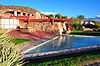 |
(#74000457) |
North of the junction of Shea Boulevard and 108th St. 33°36′22″N 111°50′16″W / 33.606111°N 111.837778°W |
Scottsdale | |
| 147 | Tempe Beach Stadium | 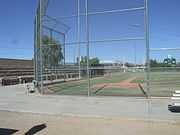 |
(#85000055) |
Ash at 1st St. 33°25′47″N 111°56′32″W / 33.429722°N 111.942222°W |
Tempe | part of the Tempe MRA |
| 148 | Tempe Butte |  |
(#11000175) |
Bounded on the north by Tempe Town Lake, on the west by Mill Ave. District, on the south by Arizona State University 33°25′41″N 111°56′08″W / 33.428056°N 111.935556°W |
Tempe | |
| 149 | Tempe Concrete Arch Highway Bridge |  |
(#84000743) |
Mill Ave. and Salt River 33°26′06″N 111°56′32″W / 33.435°N 111.942222°W |
Tempe | part of the Tempe MRA |
| 150 | Tempe Double Butte Cemetery, Pioneer Section | 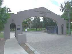 |
(#13000020) |
2505 W. Broadway Rd. 33°24′22″N 111°58′30″W / 33.406°N 111.975°W |
Tempe | Among the early Tempe settlers buried in the cemetery are Charles Trumbull Hayden (founder of Tempe), Carl T. Hayden (Senator), Benjamin B. Moeur (Governor) and John Howard Pyle (Governor). |
| 151 | Tempe Hardware Building | .jpg) |
(#80000767) |
520 S. Mill Ave. 33°25′33″N 111°56′20″W / 33.425833°N 111.938889°W |
Tempe | |
| 152 | Tempe Woman's Club | .jpg) |
(#00000461) |
1290 S. Mill Ave. 33°24′54″N 111°56′22″W / 33.415°N 111.939444°W |
Tempe | |
| 153 | Temple Historic District | 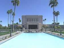 |
(#00001321) |
Roughly between Mesa Dr., Broadway Rd., Hobson, and Main Sts. 33°24′42″N 111°49′14″W / 33.411667°N 111.820556°W |
Mesa | Encompass the neighborhoods around the Mesa Arizona Temple |
| 154 | Thunderbird Estates and The McDonald Addition Historic District | Upload image | (#10000235) |
Bounded by West Northern Ave. (south), North 59th Ave. (west), and West Royal Palm Rd. (north), and including lots facing both sides of North 57th Ave. (east) 33°33′16″N 112°11′02″W / 33.554444°N 112.183889°W |
Glendale | |
| 155 | C.H. Tinker House |  |
(#05001504) |
6838 N. 59th Dr. 33°32′18″N 112°11′15″W / 33.538333°N 112.1875°W |
Glendale | House built in 1913 |
| 156 | Frank Titus House |  |
(#82002086) |
1310 N. Hayden Rd. 33°27′44″N 111°54′32″W / 33.462222°N 111.908889°W |
Scottsdale | |
| 157 | Town and Country Scottsdale Residential Historic District | Upload image | (#09000694) |
Bounded by 72nd Place on the west, 74th St. on the east, Oak St. on the north, and Monte Vista on the south 33°28′21″N 111°55′24″W / 33.472364°N 111.923256°W |
Scottsdale | |
| 158 | Tubercular Cabin | Upload image | (#01001172) |
6140 Skyline Dr. 33°49′45″N 111°56′51″W / 33.829167°N 111.9475°W |
Cave Creek | |
| 159 | University Park Historic District | .jpg) |
(#07001174) |
Bounded by 13th St., Forest Ave, alley between Apache Boulevard and 14th St., McAllister Ave., Union Pacific railroad line, and Mill Ave. 33°24′47″N 111°56′06″W / 33.412978°N 111.935108°W |
Tempe | |
| 160 | George B. Upton House |  |
(#86001592) |
171 Washington 33°58′08″N 112°43′52″W / 33.968889°N 112.731111°W |
Wickenburg | part of the Wickenburg MRA |
| 161 | Valley Field Riding and Polo Club |  |
(#08001405) |
2530 N. 64th St. 33°28′30″N 111°56′44″W / 33.475083°N 111.94565°W |
Scottsdale | The Valley Field Riding and Polo Club is located within the premises of a private gated community and is in a total state of abandonment. |
| 162 | Vernetta Hotel |  |
(#86001593) |
1 Apache St. 33°58′07″N 112°43′48″W / 33.968611°N 112.73°W |
Wickenburg | part of the Wickenburg MRA |
| 163 | Vienna Bakery | .jpg) |
(#80000764) |
415 S. Mill Ave. 33°25′34″N 111°56′17″W / 33.426111°N 111.938056°W |
Tempe | |
| 164 | Village Grove 1-6 Historic District | Upload image | (#10000236) |
Bounded by the canal at 66th St. to the west, 69th to the east, Oak St to the north, Almeria Rd to the south 33°28′12″N 111°56′09″W / 33.469958°N 111.935908°W |
Scottsdale | |
| 165 | Harry Walker House |  |
(#84000745) |
118 E. 7th St. 33°25′24″N 111°56′11″W / 33.423333°N 111.936389°W |
Tempe | part of the Tempe MRA |
| 166 | Water Pump Station and Water Tower | 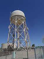 |
(#95000745) |
Northeastern corner of the junction of Innovation and Unity Aves. (once known as the Jct. of 12th and B Sts.) at Arizona State University at the Polytechnic campus (formally Williams Air Force Base). 33°18′17″N 111°40′51″W / 33.304722°N 111.680833°W |
Mesa | part of the Williams Air Force Base MPS |
| 167 | West Second Street Historic District | Upload image | (#99000707) |
Roughly between Robson St. and Center St., from 1st St. to 3rd St. • Boundary increase (listed June 20, 2003, refnum 03000531): Roughly bounded by Robson St., University Dr. and MacDonald St. 33°25′10″N 111°50′00″W / 33.419444°N 111.833333°W |
Mesa | |
| 168 | West Side-Clark Addition Historic District | Upload image | (#10000534) |
Date St. to Country Club Dr.; 2nd Pl. to Clark St. 33°25′10″N 111°50′32″W / 33.419444°N 111.842222°W |
Mesa vicinity | |
| 169 | E.M. White Dairy Barn | .jpg) |
(#84000176) |
1810 E. Apache 33°24′54″N 111°54′27″W / 33.415°N 111.9075°W |
Tempe | part of the Tempe MRA |
| 170 | Wickenburg-Boetto House |  |
(#06000912) |
225 S. Washington St. 33°57′59″N 112°43′43″W / 33.966389°N 112.728611°W |
Wickenburg | |
| 171 | Wickenburg High School and Annex |  |
(#86001595) |
250 S. Tegner 33°58′03″N 112°43′36″W / 33.9675°N 112.726667°W |
Wickenburg | 1925 Colonial Revival original school and 1935 annex; part of the Wickenburg MRA |
| 172 | Wickenburg High School Gymnasium |  |
(#86001594) |
252 S. Tegner 33°58′03″N 112°43′36″W / 33.9675°N 112.726667°W |
Wickenburg | WPA cast concrete structure from 1934; part of the Wickenburg MRA |
| 173 | Wickenburg Ice and Cold Storage | Upload image | (#86001596) |
48 S. Coconino 33°58′05″N 112°43′43″W / 33.968056°N 112.728611°W |
Wickenburg | part of the Wickenburg MRA |
| 174 | Henry Wickenburg Pioneer Cemetery |  |
(#11000151) |
Adams St.[21] 33°57′52″N 112°43′46″W / 33.964444°N 112.729444°W |
Wickenburg | Tomb of Henry Wickenburg in the Henry Wickenburg Pioneer Cemetery |
| 175 | Wilbur Street Historic District | Upload image | (#99000708) |
Roughly between Pasadena St. and Pomeroy St., 1st St. to 3rd St. 33°25′06″N 111°49′30″W / 33.418333°N 111.825°W |
Mesa | |
| 176 | Wisdom House | |
(#87001590) |
48 Kerkes 33°58′09″N 112°43′32″W / 33.969167°N 112.725556°W |
Wickenburg | part of the Wickenburg MRA |
Formerly listed
| [3] | Name on the Register | Image | Date listed | Date removed | Location | City or town | Summary |
|---|---|---|---|---|---|---|---|
| 1 | Archeological Site No. AZ U:10:60(ASM) | Upload image | (#95000752) | Address Restricted |
Mesa | In-Between Site. | |
| 2 | Archeological Site No. AZ U:10:61(ASM) | Upload image | (#95000753) | Address Restricted |
Mesa | Ordnance Site. | |
| 3 | Archeological Site No. AZ U:10:65(ASM) | Upload image | (#95000754) | Address Restricted |
Mesa | Radar Site. | |
| 4 | Archeological Site No. AZ U:10:66(ASM) | Upload image | (#95000755) | Address Restricted |
Mesa | El Horno Grande Site. | |
| 5 | Archeological Site No. AZ U:10:68(ASM) | Upload image | (#95000756) | Address Restricted |
Mesa | Outer Limits Site. | |
| 6 | Archeological Site No. AZ U:10:77(ASM) | Upload image | (Ref. # missing) | Address Restricted |
Mesa | ||
| 7 | Bankhead Highway | Upload image | (#85000051) | Rural Rd. to Hayden Rd. |
Tempe | ||
| 8 | Ellingson Warehouse | Upload image | (#85002082) | 24 W. 7th St. |
Tempe | ||
| 9 | Mary and Moses Green House | Upload image | (#85000406) | W of Carver Street |
Tempe | ||
| 10 | Joseph E. Johnson House | Upload image | (#84000174) | 720 Mill Ave. |
Tempe | ||
| 11 | Rev. Daniel Kloss House | Upload image | (#84000723) | 202 E. 6th St. |
Tempe | ||
| 12 | Miller Block | Upload image | (#84000727) | 418-422 Mill Avenue |
Tempe | ||
| 13 | Jesus Miranda Homestead | Upload image | (#84000729) | 1992 East University |
Tempe | ||
| 14 | Ollerton House | Upload image | (#84000735) | 1004 S. Mill Ave. |
Tempe | ||
| 15 | Samuel Openshaw House | Upload image | (#84000737) | 104 W. 6th St. |
Tempe | ||
| 16 | Peterson Building | Upload image | (#80000766) | 409-413 S. Mill Avenue |
Tempe | ||
| 17 | Rohrig School | Upload image | (#84000175) | 2328 E. University Drive |
Tempe | ||
| 18 | Sampson House | Upload image | (#84000739) | 109 W. 6th St. |
Tempe | ||
| 19 | Steward House | Upload image | (#84000742) | 612 Maple Ave. |
Tempe | ||
| 20 | Tempe Cotton Exchange Cotton Gin Seed Storage Building | Upload image | (#84000744) | 215 W. 7th Street |
Tempe | ||
| 21 | Tempe Bridge | Upload image | (#88001606) | Abandoned road over Salt River |
Tempe |
See also
| Wikimedia Commons has media related to National Register of Historic Places in Maricopa County, Arizona. |
- National Register of Historic Places listings in Phoenix, Arizona
- List of National Historic Landmarks in Arizona
- National Register of Historic Places listings in Arizona
References
- ↑ The latitude and longitude information provided in this table was derived originally from the National Register Information System, which has been found to be fairly accurate for about 99% of listings. For about 1% of NRIS original coordinates, experience has shown that one or both coordinates are typos or otherwise extremely far off; some corrections may have been made. A more subtle problem causes many locations to be off by up to 150 yards, depending on location in the country: most NRIS coordinates were derived from tracing out latitude and longitudes off of USGS topographical quadrant maps created under the North American Datum of 1927, which differs from the current, highly accurate WGS84 GPS system used by most on-line maps. Chicago is about right, but NRIS longitudes in Washington are higher by about 4.5 seconds, and are lower by about 2.0 seconds in Maine. Latitudes differ by about 1.0 second in Florida. Some locations in this table may have been corrected to current GPS standards.
- ↑ "National Register of Historic Places: Weekly List Actions". National Park Service, United States Department of the Interior. Retrieved on May 1, 2015.
- ↑ 3.0 3.1 Numbers represent an ordering by significant words. Various colorings, defined here, differentiate National Historic Landmarks and historic districts from other NRHP buildings, structures, sites or objects.
- ↑ "National Register Information System". National Register of Historic Places. National Park Service. 2008-04-24.
- ↑ The eight-digit number below each date is the number assigned to each location in the National Register Information System database, which can be viewed by clicking the number.
- ↑ "Historical Marker Database".
- ↑ 7.0 7.1 7.2 7.3 7.4 7.5 "Mesa Historic Property Register". Mesa, AZ.
- ↑ "City of Tempe". Tempe, AZ.
- ↑ "ASU Historic Preservation". ASU.
- ↑ "Mars Space Flight Facility". ASU.
- ↑ "City of Tempe".
- ↑ "Arizona Archeological Society".
- ↑ "AZ Central".
- ↑ "Eisendrath House". Tempe, Arizona: City of Tempe. Retrieved April 30, 2011.
- ↑ "Glendale Townsite". waymarking.com.
- ↑ Location derived from its GNIS feature record; the NRIS lists the site as "Address Restricted"
- ↑ Historic Districts
- ↑ Painted Rock Petroglyph Site, Bureau of Land Management, 2009-02-04. Accessed 2009-06-13.
- ↑ Location derived from this Arizona Republic article; the NRIS lists the site as "Address Restricted".
- ↑ Geocode coordinates derived using Google Earth and map of City of Glendale historic districts.
- ↑ Geocode coordinates based on description on Arizona Pioneer & Cemetery Research Project website.
- ↑ "Weekly List". National Park Service. July 25, 2008. Retrieved July 25, 2009.
Alternate name of Archaeological Sites
| ||||||||||

| |||||||||||||||||||||||||||||||||||||