| [3] |
Name on the Register[4] |
Image |
Date listed[5] |
Location |
City or town |
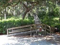
Description |
|---|
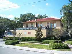
| 1 |
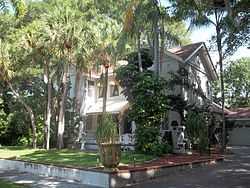
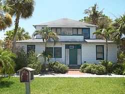
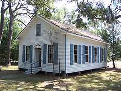
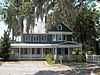
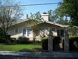
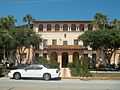
Austin House |
|
01998-02-05-0000February 5, 1998
(#98000062) |
227 Delmar Avenue
27°24′16″N 82°34′14″W / 27.404444°N 82.570556°W / 27.404444; -82.570556 (Austin House) |
Sarasota |
Part of the Whitfield Estates Subdivision MPS
|
| 2 |
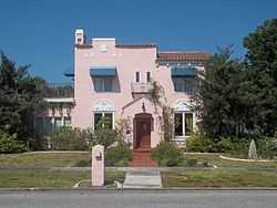
John M. Beasley House |
|
01996-03-05-0000March 5, 1996
(#96000358) |
7706 Westmoreland Drive
27°24′12″N 82°34′16″W / 27.403333°N 82.571111°W / 27.403333; -82.571111 (John M. Beasley House) |
Sarasota |
Part of the Whitfield Estates Subdivision MPS
|
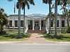
| 3 |
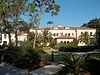
Braden Castle Park Historic District |
|
01983-05-09-0000May 9, 1983
(#83001428) |
Roughly bounded by the Manatee and Braden Rivers, Ponce DeLeon Street, and Pelot Avenue
27°29′56″N 82°31′49″W / 27.498889°N 82.530278°W / 27.498889; -82.530278 (Braden Castle Park Historic District) |
Bradenton |
|
| 4 |
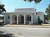
Bradenton Carnegie Library |
|
01987-04-09-0000April 9, 1987
(#87000616) |
1405 Fourth Avenue, W.
27°29′46″N 82°34′33″W / 27.496111°N 82.575833°W / 27.496111; -82.575833 (Bradenton Carnegie Library) |
Bradenton |
|
| 5 |
Cortez Historic District |
|
01995-03-16-0000March 16, 1995
(#95000250) |
Bounded by Cortez Road, 119th Street, W., Sarasota Bay, and 124th Street Court, W.
27°28′03″N 82°41′02″W / 27.4675°N 82.683889°W / 27.4675; -82.683889 (Cortez Historic District) |
Cortez |
|
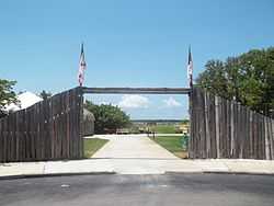
| 6 |
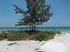
DeSoto National Memorial |
|
01966-10-15-0000October 15, 1966
(#66000078) |
5 miles (8.0 km) west of Bradenton
27°31′25″N 82°38′35″W / 27.523611°N 82.643056°W / 27.523611; -82.643056 (DeSoto National Memorial) |
Bradenton |
|
| 7 |
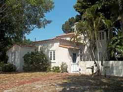
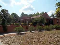
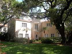
Robert Gamble House |
|
01970-08-12-0000August 12, 1970
(#70000189) |
On U.S. Route 301
27°31′21″N 82°31′36″W / 27.5225°N 82.526667°W / 27.5225; -82.526667 (Robert Gamble House) |
Ellenton |
|
| 8 |
Johnson Helm House |
|
02009-09-02-0000September 2, 2009
(#09000671) |
2104 53rd Avenue, East, SR 70
27°26′51″N 82°32′17″W / 27.4475°N 82.538056°W / 27.4475; -82.538056 (Johnson Helm House) |
Oneco |
|
| 9 |
Rufus P. Jordan House |
|
02005-08-12-0000August 12, 2005
(#05000844) |
760 Broadway Street
27°26′16″N 82°40′55″W / 27.437778°N 82.681944°W / 27.437778; -82.681944 (Rufus P. Jordan House) |
Longboat Key |
|
| 10 |
Kreissle Forge |
|
01996-12-02-0000December 2, 1996
(#96001370) |
7947 Tamiami Trail
27°24′02″N 82°33′54″W / 27.400556°N 82.565°W / 27.400556; -82.565 (Kreissle Forge) |
Sarasota |
|
| 11 |
Madira Bickel Mounds |
|
01970-08-12-0000August 12, 1970
(#70000190) |
Address Restricted
27°33′55″N 82°35′34″W / 27.565176°N 82.592825°W / 27.565176; -82.592825 (Madira Bickel Mounds) |
Terra Ceia |
Native American ceremonial mound revealing three periods of occupation beginning 2,000 years ago. Now a state archaeological site.[6]
|
| 12 |
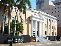
Manatee County Courthouse |
|
01998-06-11-0000June 11, 1998
(#98000676) |
1115 Manatee Avenue West
27°29′39″N 82°34′23″W / 27.494167°N 82.573056°W / 27.494167; -82.573056 (Manatee County Courthouse) |
Bradenton |
|
| 13 |
Old Manatee County Courthouse |
|
01976-06-29-0000June 29, 1976
(#76000601) |
Manatee Avenue and 15th Street, East
27°29′39″N 82°32′52″W / 27.494167°N 82.547778°W / 27.494167; -82.547778 (Old Manatee County Courthouse) |
Bradenton |
|
| 14 |
Midway Subdivision Historic District |
|
01998-05-29-0000May 29, 1998
(#98000587) |
7201 15th Street, E.
27°24′39″N 82°32′45″W / 27.410833°N 82.545833°W / 27.410833; -82.545833 (Midway Subdivision Historic District) |
Sarasota |
|
| 15 |
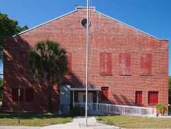
Palmetto Armory |
|
02012-10-17-0000October 17, 2012
(#12000865) |
810 6th St., W.
27°31′00″N 82°34′27″W / 27.51666°N 82.5741°W / 27.51666; -82.5741 (Palmetto Armory) |
Palmetto |
|
| 16 |
Palmetto Historic District |
|
01986-11-06-0000November 6, 1986
(#86003166) |
Roughly bounded by Twenty-first Avenue, Seventh Street, Fifth Avenue, and the Manatee River
27°30′53″N 82°34′41″W / 27.514722°N 82.578056°W / 27.514722; -82.578056 (Palmetto Historic District) |
Palmetto |
|
| 17 |
Portavant Mound Site |
|
01994-12-23-0000December 23, 1994
(#94001475) |
Address Restricted
27°31′52″N 82°37′36″W / 27.531131°N 82.626548°W / 27.531131; -82.626548 (Portavant Mound Site) |
Palmetto |
1200-year-old Native American temple mound—the largest in southwest Florida—and midden complex. Now part of a county park.[7]
|
| 18 |
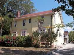
Egbert Reasoner House |
|
01995-05-04-0000May 4, 1995
(#95000555) |
3004 53rd Avenue East
27°26′48″N 82°31′34″W / 27.446667°N 82.526111°W / 27.446667; -82.526111 (Egbert Reasoner House) |
Oneco |
|
| 19 |
Regina Shipwreck Site |
|
02005-12-06-0000December 6, 2005
(#05001355) |
Offshore of Bradenton Beach
27°28′15″N 82°42′10″W / 27.470833°N 82.702778°W / 27.470833; -82.702778 (Regina Shipwreck Site) |
Bradenton Beach |
|
| 20 |
Reid-Woods House |
|
02000-08-31-0000August 31, 2000
(#00001033) |
373 Whitfield Avenue, Whitfield Estates
27°24′45″N 82°34′06″W / 27.4125°N 82.568333°W / 27.4125; -82.568333 (Reid-Woods House) |
Sarasota |
Part of the Whitfield Estates Subdivision MPS
|
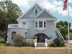
| 21 |
Richardson House |
|
02003-01-08-0000January 8, 2003
(#02001676) |
1603 1st Avenue, W.
27°29′54″N 82°34′42″W / 27.498333°N 82.578333°W / 27.498333; -82.578333 (Richardson House) |
Bradenton |
|
| 22 |
Seagate |
|
01983-01-21-0000January 21, 1983
(#83001429) |
6565 North Tamiami Trail
27°23′29″N 82°33′52″W / 27.391389°N 82.564444°W / 27.391389; -82.564444 (Seagate) |
Sarasota |
|
| 23 |
Shaw's Point Archeological District |
|
02001-04-06-0000April 6, 2001
(#01000342) |
Address Restricted
|
Bradenton |
|
| 24 |
Paul M. Souder House |
|
02000-11-02-0000November 2, 2000
(#00001282) |
242 Greenwood Avenue
27°24′18″N 82°34′11″W / 27.405°N 82.569722°W / 27.405; -82.569722 (Paul M. Souder House) |
Sarasota |
Part of the Whitfield Estates Subdivision MPS
|
| 25 |
Stevens-Gilchrist House |
|
02001-08-17-0000August 17, 2001
(#01000887) |
235 Delmar Avenue
27°24′13″N 82°34′13″W / 27.403611°N 82.570278°W / 27.403611; -82.570278 (Stevens-Gilchrist House) |
Sarasota |
Part of the Whitfield Estates Subdivision MPS
|
| 26 |
Terra Ceia Village Improvement Association Hall |
|
02003-09-16-0000September 16, 2003
(#03000942) |
1505 Center Road
27°34′22″N 82°34′54″W / 27.572778°N 82.581667°W / 27.572778; -82.581667 (Terra Ceia Village Improvement Association Hall) |
Terra Ceia |
Part of the Clubhouses of Florida's Woman's Clubs MPS
|
| 27 |
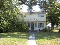
Villa Serena Apartments |
|
02000-09-29-0000September 29, 2000
(#00001172) |
7014 Willow Street
27°24′55″N 82°34′07″W / 27.415278°N 82.568611°W / 27.415278; -82.568611 (Villa Serena Apartments) |
Sarasota |
Part of the Whitfield Estates Subdivision MPS
|
| 28 |
Whitfield Estates-Lantana Avenue Historic District |
|
01997-03-08-0000March 8, 1997
(#97000209) |
332-336 Lantana Avenue
27°24′47″N 82°34′10″W / 27.413056°N 82.569444°W / 27.413056; -82.569444 (Whitfield Estates-Lantana Avenue Historic District) |
Sarasota |
Part of the Whitfield Estates Subdivision MPS
|
| 29 |
Whitfield Estates-Broughton Street Historic District |
|
01993-10-29-0000October 29, 1993
(#93001159) |
7207, 7211, 7215, 7219, and 7316 Broughton Street
27°24′18″N 82°34′12″W / 27.405°N 82.57°W / 27.405; -82.57 (Whitfield Estates-Broughton Street Historic District) |
Sarasota |
|
| 30 |
Woman's Club of Palmetto |
|
01986-03-06-0000March 6, 1986
(#86000380) |
910 Sixth Street, W.
27°30′59″N 82°34′29″W / 27.516389°N 82.574722°W / 27.516389; -82.574722 (Woman's Club of Palmetto) |
Palmetto |
|