National Register of Historic Places listings in Lynn, Massachusetts
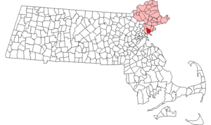
Location of Lynn in Massachusetts
This is a list of the National Register of Historic Places listings in Lynn, Massachusetts.
This is intended to be a complete list of the properties and districts on the National Register of Historic Places in Lynn, Massachusetts, United States. The locations of National Register properties and districts for which the latitude and longitude coordinates are included below, may be seen in a Google map.[1]
Essex County, of which Lynn is a part, is the location of more than 450 properties and districts listed on the National Register. Lynn itself is the location of 28 of these properties and districts.[2]
- This National Park Service list is complete through NPS recent listings posted May 1, 2015.[3]
Current listings
| [4] | Name on the Register[2] | Image | Date listed[5] | Location | Description |
|---|---|---|---|---|---|
| 1 | Capitol Diner | 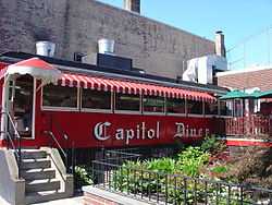 |
(#99001121) |
431 Union St. 42°27′47″N 70°56′41″W / 42.463056°N 70.944722°W |
part of the Diners of Massachusetts Multiple Property Submission (MPS) |
| 2 | Central Square Historic District | 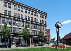 |
(#85003335) |
Central Sq., Monroe, Union, and Willow Sts. 42°27′50″N 70°56′44″W / 42.463889°N 70.945556°W |
|
| 3 | Diamond Historic District | 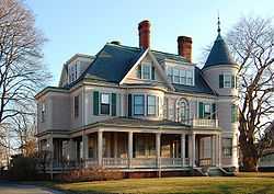 |
(#96001040) |
Roughly bounded by Broad, Lewis, Ocean Sts., Swampscott Line, Lynn Shore Dr., and Wave and Nahant Sts. 42°27′38″N 70°55′58″W / 42.460556°N 70.932778°W |
|
| 4 | English High School | 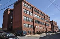 |
(#86002508) |
Essex and James Sts. 42°28′37″N 70°56′40″W / 42.476944°N 70.944444°W |
Listing is for the 1890s former building, not the current facilities. |
| 5 | Fabens Building | 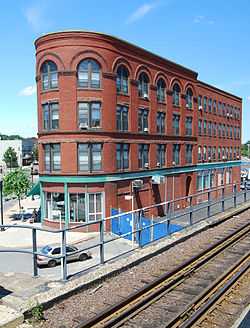 |
(#82001879) |
312-314 Union St. 42°27′53″N 70°56′38″W / 42.464722°N 70.943889°W |
|
| 6 | G.A.R. Hall and Museum | 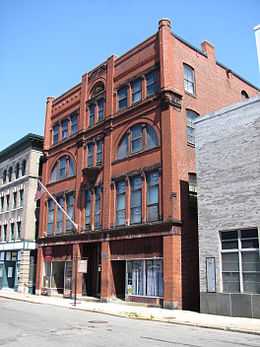 |
(#79000331) |
58 Andrew St. 42°27′46″N 70°56′53″W / 42.462778°N 70.948056°W |
|
| 7 | High Rock Tower-High Rock Cottage and Daisy Cottage | 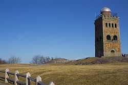 |
(#09000086) |
15, 17 Campbell Terr. and High Rock Park 42°28′06″N 70°56′49″W / 42.468441°N 70.947007°W |
|
| 8 | Charles Lovejoy House | 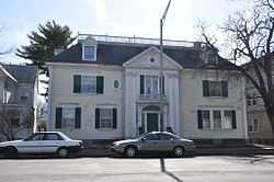 |
(#78000454) |
64 Broad St. 42°27′48″N 70°56′19″W / 42.463333°N 70.938611°W |
|
| 9 | Lynn Armory | 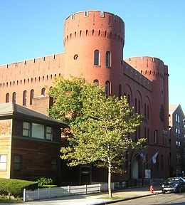 |
(#79000332) |
36 S. Common St. 42°27′47″N 70°57′16″W / 42.463056°N 70.954444°W |
|
| 10 | Lynn Bank Block | 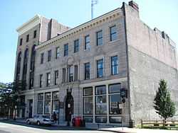 |
(#82004964) |
21-29 Exchange St. 42°27′49″N 70°56′36″W / 42.463583°N 70.943306°W |
|
| 11 | Lynn Common Historic District |  |
(#92000247) |
Roughly N. and S. Common St. from Market Sq. to City Hall 42°27′49″N 70°57′28″W / 42.463611°N 70.957778°W |
|
| 12 | Lynn Masonic Hall | 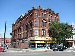 |
(#79000333) |
64-68 Market St. 42°27′48″N 70°56′59″W / 42.463333°N 70.949722°W |
|
| 13 | Lynn Memorial City Hall and Auditorium | 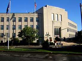 |
(#05000082) |
3 City Hall Square 42°27′53″N 70°57′06″W / 42.464722°N 70.951667°W |
|
| 14 | Lynn Public Library | 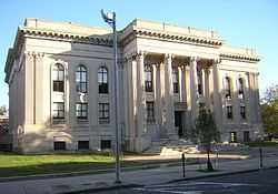 |
(#79000334) |
5 N. Common St. 42°27′52″N 70°57′15″W / 42.464444°N 70.954167°W |
|
| 15 | Lynn Realty Company Building No. 2 | 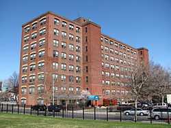 |
(#83000579) |
672-680 Washington St. 42°27′43″N 70°56′41″W / 42.461944°N 70.944722°W |
|
| 16 | Lynn Woods Historic District |  |
(#96000951) |
Roughly bounded by Lynnfield St., Bow Ridge, Great Woods Rd., Parkland Ave., Walnut St., Saugus Line 42°29′21″N 70°59′13″W / 42.489167°N 70.986944°W |
|
| 17 | Mowers' Block | 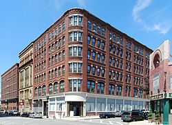 |
(#82001991) |
7 Willow St. and 67-83 Blake St. 42°27′51″N 70°56′44″W / 42.4642°N 70.9456°W |
|
| 18 | Munroe Street Historic District | 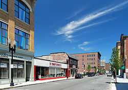 |
(#96000952) |
Bounded by Market, Oxford, and Washington Sts., and the MBTA commuter rail line 42°27′46″N 70°56′53″W / 42.4628°N 70.9481°W |
|
| 19 | Nahant Beach Boulevard-Metropolitan Park System of Greater Boston | |
(#03000747) |
Nahant Beach Boulevard 42°26′12″N 70°56′17″W / 42.4367°N 70.9381°W |
Extends for most of its length into Nahant. Part of the Metropolitan Park System of Greater Boston MPS. |
| 20 | Lucian Newhall House | 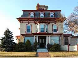 |
(#85001576) |
281 Ocean St. 42°27′39″N 70°56′12″W / 42.4608°N 70.9367°W |
|
| 21 | Old Lynn High School | 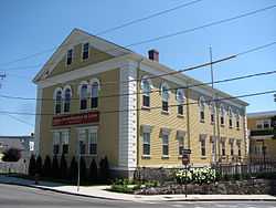 |
(#02000130) |
50 High St. 42°27′58″N 70°56′45″W / 42.4662°N 70.9459°W |
|
| 22 | Old Post Office Building | 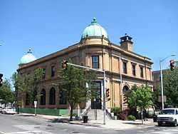 |
(#81000118) |
360 Washington St. 42°27′53″N 70°56′54″W / 42.4647°N 70.9483°W |
|
| 23 | Pine Grove Cemetery | 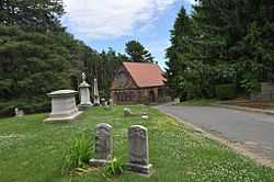 |
(#14000364) |
145 Boston St. 42°28′39″N 70°57′44″W / 42.4774°N 70.9621°W |
|
| 24 | Lydia Pinkham House | 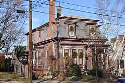 |
(#12000818) |
285 Western Ave. 42°28′33″N 70°57′03″W / 42.4757°N 70.9507°W |
Pinkham's home was the mailing address for orders of her homemade herbal remedy for menstrual cramps, one of the most popular such medications of the late 19th century, as a result of her then-innovative use of her image as a marketing tool. |
| 25 | St. Stephen's Memorial Church | 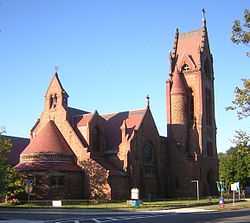 |
(#79000335) |
74 S. Common St. 42°27′46″N 70°57′24″W / 42.462778°N 70.956667°W |
|
| 26 | Tapley Building | Upload image | (#83000586) |
206 Broad St. 42°27′45″N 70°56′41″W / 42.4625°N 70.944722°W |
Destroyed by fire in 1999. |
| 27 | US Post Office-Lynn Main | 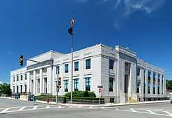 |
(#86001342) |
51 Willow St. 42°27′54″N 70°56′48″W / 42.465°N 70.946667°W |
|
| 28 | Vamp Building | 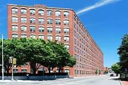 |
(#83000587) |
3-15 Liberty Square 42°27′45″N 70°56′50″W / 42.4625°N 70.947222°W |
See also
| Wikimedia Commons has media related to National Register of Historic Places in Lynn, Massachusetts. |
- List of National Historic Landmarks in Massachusetts
- National Register of Historic Places listings in Massachusetts
- National Register of Historic Places listings in Essex County, Massachusetts
References
- ↑ The latitude and longitude information provided in this table was derived originally from the National Register Information System, which has been found to be fairly accurate for about 99% of listings. For about 1% of NRIS original coordinates, experience has shown that one or both coordinates are typos or otherwise extremely far off; some corrections may have been made. A more subtle problem causes many locations to be off by up to 150 yards, depending on location in the country: most NRIS coordinates were derived from tracing out latitude and longitudes off of USGS topographical quadrant maps created under the North American Datum of 1927, which differs from the current, highly accurate WGS84 GPS system used by most on-line maps. Chicago is about right, but NRIS longitudes in Washington are higher by about 4.5 seconds, and are lower by about 2.0 seconds in Maine. Latitudes differ by about 1.0 second in Florida. Some locations in this table may have been corrected to current GPS standards.
- ↑ 2.0 2.1 "National Register Information System". National Register of Historic Places. National Park Service. 2008-04-24.
- ↑ "National Register of Historic Places: Weekly List Actions". National Park Service, United States Department of the Interior. Retrieved on May 1, 2015.
- ↑ Numbers represent an ordering by significant words. Various colorings, defined here, differentiate National Historic Landmarks and historic districts from other NRHP buildings, structures, sites or objects.
- ↑ The eight-digit number below each date is the number assigned to each location in the National Register Information System database, which can be viewed by clicking the number.
| |||||||||||||||||||||||||||||||||||||||||||||||||||||||
