| [3] |
Name on the Register[4] |
Image |
Date listed[5] |
Location |
City or town |
Description |
|---|
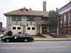
| 1 |
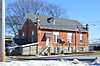
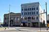
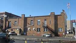
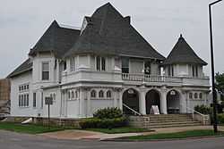
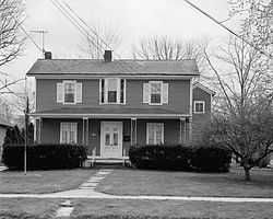
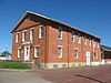
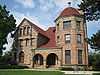
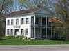
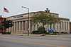
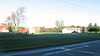
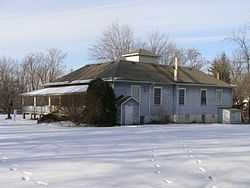
103rd Ohio Volunteer Infantry Association Barracks |
Upload image |
01978-07-14-0000July 14, 1978
(#78002115) |
5501 E. Lake Rd.
41°30′01″N 82°04′10″W / 41.500278°N 82.069444°W / 41.500278; -82.069444 (103rd Ohio Volunteer Infantry Association Barracks) |
Sheffield Lake |
|
| 2 |
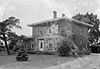
Darlon Allen House |
|
01979-06-15-0000June 15, 1979
(#79003877) |
South of Wellington on State Route 58
41°06′46″N 82°13′12″W / 41.112778°N 82.22°W / 41.112778; -82.22 (Darlon Allen House) |
Huntington Township |
|
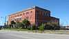
| 3 |
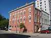
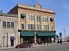
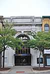
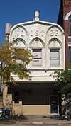
American Felsol Company Building |
|
02011-06-15-0000June 15, 2011
(#11000367) |
200 W. 9th St.
41°27′47″N 82°10′26″W / 41.463056°N 82.173889°W / 41.463056; -82.173889 (American Felsol Company Building) |
Lorain |
1909 building originally built for the Independent Order of Odd Fellows; also known as the IOOF Building and the Lorain YWCA Building[6]
|
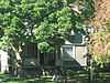
| 4 |
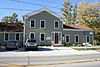
Amherst Town Hall |
|
01975-05-29-0000May 29, 1975
(#75001459) |
206 S. Main St.
41°23′54″N 82°13′38″W / 41.398333°N 82.227222°W / 41.398333; -82.227222 (Amherst Town Hall) |
Amherst |
|
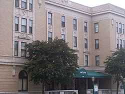
| 5 |
Antlers Hotel |
|
01982-11-30-0000November 30, 1982
(#82001470) |
Southwestern corner of the junction of Erie and Washington Aves.
41°28′03″N 82°10′51″W / 41.467500°N 82.180833°W / 41.467500; -82.180833 (Antlers Hotel) |
Lorain |
|
| 6 |
Carlos Avery House |
|
01984-05-31-0000May 31, 1984
(#84003762) |
18797 State Route 58, north of Wellington
41°12′33″N 82°13′08″W / 41.209167°N 82.218889°W / 41.209167; -82.218889 (Carlos Avery House) |
Pittsfield Township |
|
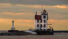
| 7 |
Avon Isle |
|
02010-07-08-0000July 8, 2010
(#10000456) |
37080 Detroit Rd.
41°27′07″N 82°02′11″W / 41.451944°N 82.036389°W / 41.451944; -82.036389 (Avon Isle) |
Avon |
|
| 8 |
O.T. Baker House |
|
01979-06-15-0000June 15, 1979
(#79003878) |
South of Wellington on State Route 58
41°06′26″N 82°13′13″W / 41.107361°N 82.220278°W / 41.107361; -82.220278 (O.T. Baker House) |
Huntington Township |
|
| 9 |
Henry Bradford Farm |
|
01982-09-30-0000September 30, 1982
(#82003608) |
North of Rochester on State Route 511
41°08′12″N 82°18′26″W / 41.136667°N 82.307222°W / 41.136667; -82.307222 (Henry Bradford Farm) |
Rochester Township |
|
| 10 |
Justin Breckenridge House |
|
01978-11-29-0000November 29, 1978
(#78002107) |
37174 S. East Main St., southeast of Grafton
41°15′51″N 82°02′44″W / 41.264167°N 82.045417°W / 41.264167; -82.045417 (Justin Breckenridge House) |
Grafton Township |
|
| 11 |
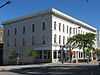
Broadway Building |
|
01985-11-14-0000November 14, 1985
(#85002833) |
Southeastern corner of W. Erie Ave. and Broadway
41°28′06″N 82°10′40″W / 41.468333°N 82.177778°W / 41.468333; -82.177778 (Broadway Building) |
Lorain |
|
| 12 |
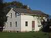
Brownhelm Historic District |
Upload image |
01979-06-28-0000June 28, 1979
(#79003748) |
Along N. Ridge Rd. in Brownhelm
41°23′21″N 82°17′15″W / 41.389167°N 82.2875°W / 41.389167; -82.2875 (Brownhelm Historic District) |
Brownhelm Township |
|
| 13 |
George Bryant House |
|
01979-08-13-0000August 13, 1979
(#79002727) |
333 3rd St.
41°21′56″N 82°06′33″W / 41.365556°N 82.109167°W / 41.365556; -82.109167 (George Bryant House) |
Elyria |
|
| 14 |
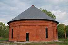
Burrell Fort |
|
01978-04-04-0000April 4, 1978
(#78002111) |
Along French Creek, ¼ mile from the Black River[7]
41°27′32″N 82°06′08″W / 41.458889°N 82.102222°W / 41.458889; -82.102222 (Burrell Fort) |
Sheffield |
|
| 15 |
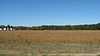
Burrell Orchard Site |
|
01977-09-15-0000September 15, 1977
(#77001073) |
On a ridge off East River Road[8]
41°27′18″N 82°06′24″W / 41.455000°N 82.106750°W / 41.455000; -82.106750 (Burrell Orchard Site) |
Sheffield |
|
| 16 |
Jabez and Robbins Burrell House and Cheese Factory |
|
01976-01-01-0000January 1, 1976
(#76001471) |
North of Lorain off State Route 301
41°27′17″N 82°06′20″W / 41.454722°N 82.105556°W / 41.454722; -82.105556 (Jabez and Robbins Burrell House and Cheese Factory) |
Sheffield |
|
| 17 |
Burrell-King House |
|
01979-03-07-0000March 7, 1979
(#79001886) |
317 E. College St.
41°17′27″N 82°12′21″W / 41.290833°N 82.205833°W / 41.290833; -82.205833 (Burrell-King House) |
Oberlin |
|
| 18 |
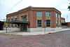
Samuel C. Cahoon House |
Upload image |
01978-09-20-0000September 20, 1978
(#78002113) |
38369 Center Ridge Rd.
41°23′00″N 82°03′10″W / 41.383333°N 82.052778°W / 41.383333; -82.052778 (Samuel C. Cahoon House) |
North Ridgeville |
|
| 19 |
Wilbur Cahoon House |
|
01978-04-06-0000April 6, 1978
(#78002104) |
2940 Stoney Ridge Rd.
41°26′50″N 82°01′58″W / 41.447222°N 82.032778°W / 41.447222; -82.032778 (Wilbur Cahoon House) |
Avon |
|
| 20 |
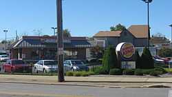
Patrick Carlin House |
Upload image |
01979-08-13-0000August 13, 1979
(#79002710) |
1182 W. River Rd., N.
41°23′19″N 82°06′18″W / 41.388611°N 82.105°W / 41.388611; -82.105 (Patrick Carlin House) |
Elyria |
|
| 21 |
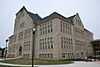
Central School |
Upload image |
01987-11-19-0000November 19, 1987
(#87001985) |
474 Church St.
41°23′12″N 82°13′32″W / 41.386667°N 82.225556°W / 41.386667; -82.225556 (Central School) |
Amherst |
|
| 22 |
Century Block |
|
01979-08-13-0000August 13, 1979
(#79002718) |
Northeastern corner of Broad St. and Washington Ave. and northern side of Broad St.
41°22′04″N 82°06′22″W / 41.367778°N 82.106111°W / 41.367778; -82.106111 (Century Block) |
Elyria |
|
| 23 |
John A. Chapman House |
|
01979-06-15-0000June 15, 1979
(#79003879) |
South of Wellington on State Route 58
41°06′57″N 82°13′10″W / 41.115833°N 82.219444°W / 41.115833; -82.219444 (John A. Chapman House) |
Huntington Township |
|
| 24 |
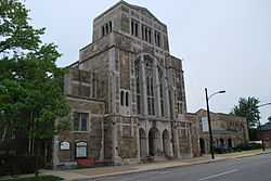
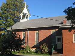
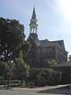
Christ Episcopal Church |
|
01978-11-30-0000November 30, 1978
(#78002114) |
156 S. Main St.
41°17′15″N 82°13′05″W / 41.2875°N 82.218056°W / 41.2875; -82.218056 (Christ Episcopal Church) |
Oberlin |
|
| 25 |
Ansel Clark House |
|
01979-06-15-0000June 15, 1979
(#79003880) |
South of Wellington on State Route 58
41°07′13″N 82°13′12″W / 41.120278°N 82.22°W / 41.120278; -82.22 (Ansel Clark House) |
Huntington Township |
|
| 26 |
Whitney Clark House |
|
01979-06-15-0000June 15, 1979
(#79003881) |
South of Wellington on State Route 58
41°06′59″N 82°13′12″W / 41.116389°N 82.22°W / 41.116389; -82.22 (Whitney Clark House) |
Huntington Township |
|
| 27 |
Columbia Baptist Church |
|
01976-07-12-0000July 12, 1976
(#76001466) |
25514 Royalton Rd.
41°18′47″N 81°55′32″W / 41.313056°N 81.925556°W / 41.313056; -81.925556 (Columbia Baptist Church) |
Columbia Township |
|
| 28 |
Columbia Town Hall |
|
01976-03-17-0000March 17, 1976
(#76001468) |
25496 Royalton Rd.
41°18′47″N 81°55′30″W / 41.313056°N 81.925000°W / 41.313056; -81.925000 (Columbia Town Hall) |
Columbia Township |
|
| 29 |
Commercial Building |
|
01979-08-13-0000August 13, 1979
(#79002724) |
Northeastern corner of 2nd St. and Middle Ave.
41°22′00″N 82°06′24″W / 41.366667°N 82.106667°W / 41.366667; -82.106667 (Commercial Building) |
Elyria |
|
| 30 |
Congregational Church of Christ |
|
01974-08-13-0000August 13, 1974
(#74001554) |
W. Lorain and N. Main Sts.
41°17′40″N 82°13′06″W / 41.294444°N 82.218333°W / 41.294444; -82.218333 (Congregational Church of Christ) |
Oberlin |
|
| 31 |
Dean Road Bridge |
Upload image |
01978-11-28-0000November 28, 1978
(#78002119) |
West of South Amherst at Dean Rd. and the Vermilion River
41°20′56″N 82°20′41″W / 41.348889°N 82.344722°W / 41.348889; -82.344722 (Dean Road Bridge) |
Henrietta Township |
Extends into Erie County
|
| 32 |
Downtown Oberlin Historic District |
|
02003-05-01-0000May 1, 2003
(#03000324) |
Roughly includes W. and E. College St., within 1 block of S. Main and S. Main from College to approximately Vine St.
41°17′25″N 82°13′05″W / 41.290278°N 82.218056°W / 41.290278; -82.218056 (Downtown Oberlin Historic District) |
Oberlin |
|
| 33 |
Duane Block |
|
01987-07-16-0000July 16, 1987
(#87001248) |
387-401 Broadway
41°28′03″N 82°10′36″W / 41.467500°N 82.176667°W / 41.467500; -82.176667 (Duane Block) |
Lorain |
|
| 34 |
Eagles Building |
|
01986-04-24-0000April 24, 1986
(#86000850) |
575 Broadway
41°27′58″N 82°10′30″W / 41.466111°N 82.175000°W / 41.466111; -82.175000 (Eagles Building) |
Lorain |
Located on the east (right) side of Broadway, it has a tall-white facade.
|
| 35 |
Eiden Prehistoric District |
|
01978-11-21-0000November 21, 1978
(#78002112) |
0.8 km north of the confluence of the Black River and French Creek[9]
41°27′52″N 82°06′45″W / 41.464306°N 82.112500°W / 41.464306; -82.112500 (Eiden Prehistoric District) |
Sheffield |
|
| 36 |
Ely Block |
|
01979-08-13-0000August 13, 1979
(#79002717) |
Northern side of Broad St. between Washington and East Ave.
41°22′04″N 82°06′26″W / 41.367778°N 82.107222°W / 41.367778; -82.107222 (Ely Block) |
Elyria |
|
| 37 |
Elyria Downtown-West Avenue Historic District |
|
02001-01-16-0000January 16, 2001
(#00001663) |
Roughly bounded by Railroad, East Ave., 5th St., and West Ave.
41°21′55″N 82°06′26″W / 41.365278°N 82.107222°W / 41.365278; -82.107222 (Elyria Downtown-West Avenue Historic District) |
Elyria |
|
| 38 |
Elyria Elks Club |
|
01979-08-13-0000August 13, 1979
(#79002726) |
246 2nd St.
41°21′59″N 82°06′22″W / 41.366389°N 82.106111°W / 41.366389; -82.106111 (Elyria Elks Club) |
Elyria |
|
| 39 |
Elyria High School - Washington Building |
|
01979-08-13-0000August 13, 1979
(#79002735) |
Southwestern corner of 6th St. and Middle Ave.
41°21′43″N 82°06′28″W / 41.361944°N 82.107778°W / 41.361944; -82.107778 (Elyria High School - Washington Building) |
Elyria |
|
| 40 |
Wilson Bruce Evans House |
|
01980-04-16-0000April 16, 1980
(#80003143) |
33 E. Vine St.
41°17′19″N 82°12′59″W / 41.288611°N 82.216389°W / 41.288611; -82.216389 (Wilson Bruce Evans House) |
Oberlin |
|
| 41 |
First Church of Christ, Scientist |
|
01975-07-18-0000July 18, 1975
(#75001460) |
309 East Ave.
41°21′53″N 82°06′16″W / 41.364861°N 82.104444°W / 41.364861; -82.104444 (First Church of Christ, Scientist) |
Elyria |
|
| 42 |
First National Bank Building |
|
01979-08-13-0000August 13, 1979
(#79002719) |
Broad St.
41°22′04″N 82°06′19″W / 41.367778°N 82.105278°W / 41.367778; -82.105278 (First National Bank Building) |
Elyria |
|
| 43 |
First United Methodist Church |
|
01979-08-13-0000August 13, 1979
(#79002730) |
312 3rd St.
41°21′55″N 82°06′29″W / 41.365278°N 82.108056°W / 41.365278; -82.108056 (First United Methodist Church) |
Elyria |
|
| 44 |
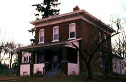
Halsey Garfield House |
Upload image |
01978-05-22-0000May 22, 1978
(#78002116) |
4789 Detroit Rd.
41°25′19″N 82°05′35″W / 41.421944°N 82.093056°W / 41.421944; -82.093056 (Halsey Garfield House) |
Sheffield |
|
| 45 |
Milton Garfield House |
Upload image |
01978-09-21-0000September 21, 1978
(#78002117) |
4921 Detroit Rd.
41°25′23″N 82°05′17″W / 41.423056°N 82.088056°W / 41.423056; -82.088056 (Milton Garfield House) |
Sheffield |
|
| 46 |
Arthur L. Garford House |
|
01974-12-30-0000December 30, 1974
(#74001551) |
509 Washington Ave.
41°22′28″N 82°06′21″W / 41.374444°N 82.105833°W / 41.374444; -82.105833 (Arthur L. Garford House) |
Elyria |
|
| 47 |
Gould Block |
|
02005-02-09-0000February 9, 2005
(#05000031) |
608-630 Broadway Ave.
41°15′56″N 82°10′31″W / 41.265556°N 82.175278°W / 41.265556; -82.175278 (Gould Block) |
Lorain |
|
| 48 |
Grafton School |
|
02008-02-21-0000February 21, 2008
(#08000117) |
1111 Elm St.
41°16′33″N 82°03′03″W / 41.275833°N 82.050833°W / 41.275833; -82.050833 (Grafton School) |
Grafton |
|
| 49 |
Gregg House |
|
01979-06-15-0000June 15, 1979
(#79003882) |
South of Wellington on State Route 58
41°06′11″N 82°13′14″W / 41.102917°N 82.220556°W / 41.102917; -82.220556 (Gregg House) |
Huntington Township |
|
| 50 |
Gunn House |
|
01979-06-15-0000June 15, 1979
(#79003883) |
South of Wellington on State Route 58
41°08′27″N 82°13′08″W / 41.140833°N 82.218889°W / 41.140833; -82.218889 (Gunn House) |
Wellington Township |
|
| 51 |
Huntington Grange |
|
01979-06-15-0000June 15, 1979
(#79003884) |
South of Wellington at the junction of State Routes 58 and 162
41°06′03″N 82°13′11″W / 41.100833°N 82.219722°W / 41.100833; -82.219722 (Huntington Grange) |
Huntington Township |
|
| 52 |
Huntington Public School |
|
01979-06-15-0000June 15, 1979
(#79003885) |
South of Wellington at junction of State Routes 58 and 162
41°06′01″N 82°13′11″W / 41.100278°N 82.219722°W / 41.100278; -82.219722 (Huntington Public School) |
Huntington Township |
|
| 53 |
Huntington Township Hall |
|
01979-06-15-0000June 15, 1979
(#79003886) |
South of Wellington on State Route 58
41°05′59″N 82°13′12″W / 41.099722°N 82.22°W / 41.099722; -82.22 (Huntington Township Hall) |
Huntington Township |
|
| 54 |
William E. Hurst House |
|
01974-09-11-0000September 11, 1974
(#74001550) |
33065 Detroit Ave.
41°27′12″N 81°59′07″W / 41.453333°N 81.985278°W / 41.453333; -81.985278 (William E. Hurst House) |
Avon |
|
| 55 |
Immaculate Conception Church |
|
01976-03-16-0000March 16, 1976
(#76001469) |
708 Erie St.
41°16′37″N 82°03′36″W / 41.276944°N 82.06°W / 41.276944; -82.06 (Immaculate Conception Church) |
Grafton |
|
| 56 |
Frank Jewett House |
|
01979-07-24-0000July 24, 1979
(#79001887) |
73 S. Professor St.
41°17′23″N 82°13′11″W / 41.289722°N 82.219722°W / 41.289722; -82.219722 (Frank Jewett House) |
Oberlin |
|
| 57 |
Johnson Steel Street Railway Company General Offices Building |
|
01992-07-16-0000July 16, 1992
(#92000887) |
1807 E. 28th St.
41°26′45″N 82°08′11″W / 41.445833°N 82.136389°W / 41.445833; -82.136389 (Johnson Steel Street Railway Company General Offices Building) |
Lorain |
|
| 58 |
E.J. Johnson House |
|
01979-08-13-0000August 13, 1979
(#79002737) |
Middle Ave. and 8th St.
41°21′35″N 82°06′25″W / 41.359722°N 82.106944°W / 41.359722; -82.106944 (E.J. Johnson House) |
Elyria |
|
| 59 |
John Mercer Langston House |
|
01975-05-15-0000May 15, 1975
(#75001464) |
207 E. College St.
41°17′28″N 82°12′36″W / 41.291111°N 82.21°W / 41.291111; -82.21 (John Mercer Langston House) |
Oberlin |
|
| 60 |
Thomas W. Laundon House |
|
01975-10-21-0000October 21, 1975
(#75001462) |
307 West Ave.
41°21′54″N 82°06′39″W / 41.365000°N 82.110833°W / 41.365000; -82.110833 (Thomas W. Laundon House) |
Elyria |
|
| 61 |
John Lersch House |
|
01979-08-13-0000August 13, 1979
(#79002711) |
121 Harrison St.
41°22′21″N 82°06′20″W / 41.372500°N 82.105556°W / 41.372500; -82.105556 (John Lersch House) |
Elyria |
|
| 62 |
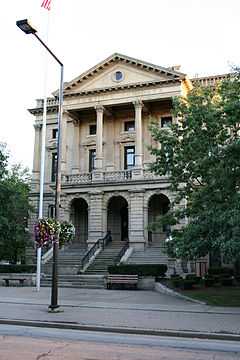
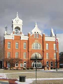
Lorain County Courthouse |
|
01975-06-18-0000June 18, 1975
(#75001463) |
308 2nd St.
41°21′57″N 82°06′27″W / 41.365833°N 82.1075°W / 41.365833; -82.1075 (Lorain County Courthouse) |
Elyria |
|
| 63 |
Lorain Fire Station No. 1 |
|
01987-08-20-0000August 20, 1987
(#87001374) |
605 W. 4th St.
41°28′00″N 82°10′47″W / 41.466528°N 82.179722°W / 41.466528; -82.179722 (Lorain Fire Station No. 1) |
Lorain |
|
| 64 |
Lorain Lighthouse |
|
01978-12-29-0000December 29, 1978
(#78002108) |
Lorain Harbor
41°28′38″N 82°11′25″W / 41.477222°N 82.190278°W / 41.477222; -82.190278 (Lorain Lighthouse) |
Lorain |
|
| 65 |
Lorain YMCA Building |
|
01992-07-16-0000July 16, 1992
(#92000886) |
Junction of E. 28th St. and Pearl Ave.
41°26′45″N 82°08′17″W / 41.445833°N 82.138056°W / 41.445833; -82.138056 (Lorain YMCA Building) |
Lorain |
|
| 66 |
Addison Lord House |
|
01999-12-09-0000December 9, 1999
(#99001497) |
315 West Ave.
41°21′53″N 82°06′39″W / 41.364722°N 82.110833°W / 41.364722; -82.110833 (Addison Lord House) |
Elyria |
|
| 67 |
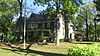
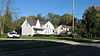
The Mill Hollow House |
Upload image |
01976-06-29-0000June 29, 1976
(#76001472) |
Southeast of Vermilion on N. Ridge Rd.
41°22′55″N 82°18′54″W / 41.381944°N 82.315°W / 41.381944; -82.315 (The Mill Hollow House) |
Brownhelm Township |
|
| 68 |
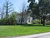
Peter Miller House |
Upload image |
01978-08-25-0000August 25, 1978
(#78002106) |
33740 Lake Rd.
41°30′08″N 82°03′37″W / 41.502222°N 82.060278°W / 41.502222; -82.060278 (Peter Miller House) |
Avon Lake |
|
| 69 |
Monteith Hall |
|
01974-10-09-0000October 9, 1974
(#74001552) |
218 East Ave.
41°21′56″N 82°06′14″W / 41.365556°N 82.103889°W / 41.365556; -82.103889 (Monteith Hall) |
Elyria |
|
| 70 |
Leonard M. Moore House |
|
01993-12-30-0000December 30, 1993
(#93001439) |
309 5th St.
41°27′57″N 82°10′41″W / 41.465833°N 82.178056°W / 41.465833; -82.178056 (Leonard M. Moore House) |
Lorain |
|
| 71 |
Morris-Franks Site |
|
01975-09-05-0000September 5, 1975
(#75001465) |
Between Vermilion Rd. and the Black River, southeast of central Vermilion[10]
41°24′33″N 82°20′04″W / 41.409167°N 82.334444°W / 41.409167; -82.334444 (Morris-Franks Site) |
Vermilion |
|
| 72 |
Mosher House |
|
01979-06-15-0000June 15, 1979
(#79003887) |
South of Wellington on State Route 58
41°09′13″N 82°13′03″W / 41.153611°N 82.2175°W / 41.153611; -82.2175 (Mosher House) |
Wellington Township |
|
| 73 |
New York Central Freight House |
|
01982-06-01-0000June 1, 1982
(#82003605) |
412 E. River St.
41°22′11″N 82°05′46″W / 41.369722°N 82.096111°W / 41.369722; -82.096111 (New York Central Freight House) |
Elyria |
|
| 74 |
Walter Nichols House |
|
01979-08-13-0000August 13, 1979
(#79002733) |
Southeastern corner of 4th St. and West Ave.
41°21′50″N 82°06′36″W / 41.363889°N 82.110000°W / 41.363889; -82.110000 (Walter Nichols House) |
Elyria |
|
| 75 |
Nimocks House |
|
01979-06-15-0000June 15, 1979
(#79003888) |
South of Wellington on State Route 58
41°05′35″N 82°13′13″W / 41.092917°N 82.220278°W / 41.092917; -82.220278 (Nimocks House) |
Huntington Township |
|
| 76 |
William Nooney House |
|
01979-06-15-0000June 15, 1979
(#79003889) |
South of Wellington on State Route 58
41°06′29″N 82°13′13″W / 41.107917°N 82.220278°W / 41.107917; -82.220278 (William Nooney House) |
Huntington Township |
|
| 77 |
North Ridgeville City Hall |
Upload image |
01974-12-30-0000December 30, 1974
(#74001553) |
U.S. Route 20
41°23′20″N 82°01′14″W / 41.388889°N 82.020556°W / 41.388889; -82.020556 (North Ridgeville City Hall) |
North Ridgeville |
|
| 78 |
Oberlin College |
|
01966-10-15-0000October 15, 1966
(#66000615) |
Tappan Sq.
41°17′34″N 82°13′08″W / 41.292778°N 82.218889°W / 41.292778; -82.218889 (Oberlin College) |
Oberlin |
|
| 79 |
Oberlin Gas Lighting Company Gasholder House |
|
01998-11-19-0000November 19, 1998
(#98001397) |
291 S. Main St.
41°17′03″N 82°12′58″W / 41.284167°N 82.216111°W / 41.284167; -82.216111 (Oberlin Gas Lighting Company Gasholder House) |
Oberlin |
|
| 80 |
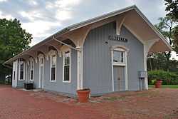
Oberlin Lake Shore And Michigan Southern Station |
|
01979-03-02-0000March 2, 1979
(#79001888) |
Depot Park
41°17′04″N 82°13′08″W / 41.284444°N 82.218889°W / 41.284444; -82.218889 (Oberlin Lake Shore And Michigan Southern Station) |
Oberlin |
|
| 81 |
Old Amherst Freight Depot |
|
01978-11-21-0000November 21, 1978
(#78002103) |
Franklin St.
41°23′42″N 82°13′08″W / 41.395°N 82.218889°W / 41.395; -82.218889 (Old Amherst Freight Depot) |
Amherst |
|
| 82 |
Old Baptist Parsonage |
|
01979-06-15-0000June 15, 1979
(#79003890) |
South of Wellington on State Route 58
41°06′12″N 82°13′14″W / 41.103333°N 82.220556°W / 41.103333; -82.220556 (Old Baptist Parsonage) |
Huntington Township |
|
| 83 |
Old City Hall |
|
01979-08-13-0000August 13, 1979
(#79002725) |
Court St. facing Elyria Square
41°22′01″N 82°06′29″W / 41.366944°N 82.108056°W / 41.366944; -82.108056 (Old City Hall) |
Elyria |
|
| 84 |
Old District Nine Schoolhouse |
|
01979-08-13-0000August 13, 1979
(#79002715) |
Chestnut St.
41°22′06″N 82°06′44″W / 41.368472°N 82.112361°W / 41.368472; -82.112361 (Old District Nine Schoolhouse) |
Elyria |
|
| 85 |
Old Elyria Water Tower |
|
01979-08-13-0000August 13, 1979
(#79002739) |
Southern side of W. 15th St., 100 ft (30 m) west of Black River Bridge
41°21′09″N 82°06′54″W / 41.352500°N 82.115000°W / 41.352500; -82.115000 (Old Elyria Water Tower) |
Elyria |
|
| 86 |
Old Huntington Inn |
|
01979-06-15-0000June 15, 1979
(#79003891) |
South of Wellington at the junction of State Routes 58 and 162
41°06′04″N 82°13′14″W / 41.101111°N 82.220556°W / 41.101111; -82.220556 (Old Huntington Inn) |
Huntington Township |
|
| 87 |
Old Methodist Parsonage |
|
01979-06-15-0000June 15, 1979
(#79003892) |
South of Wellington on State Route 58
41°06′21″N 82°13′13″W / 41.105833°N 82.220278°W / 41.105833; -82.220278 (Old Methodist Parsonage) |
Huntington Township |
|
| 88 |
Old Railroad Station |
|
01979-08-13-0000August 13, 1979
(#79002714) |
49 East Ave.
41°22′06″N 82°06′13″W / 41.368333°N 82.103611°W / 41.368333; -82.103611 (Old Railroad Station) |
Elyria |
|
| 89 |
Old St. John's Church |
|
01979-08-13-0000August 13, 1979
(#79002721) |
600 W. Broad St.
41°22′03″N 82°06′38″W / 41.367500°N 82.110556°W / 41.367500; -82.110556 (Old St. John's Church) |
Elyria |
|
| 90 |
Old St. Patrick's Church |
|
01979-03-21-0000March 21, 1979
(#79001890) |
512 N. Main St.
41°10′27″N 82°13′00″W / 41.174167°N 82.216667°W / 41.174167; -82.216667 (Old St. Patrick's Church) |
Wellington |
|
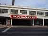
| 91 |
Palace Theatre Building |
|
01978-03-30-0000March 30, 1978
(#78002109) |
Broadway and 6th St.
41°27′57″N 82°10′30″W / 41.465833°N 82.175000°W / 41.465833; -82.175000 (Palace Theatre Building) |
Lorain |
|
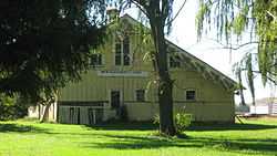
| 92 |
Reamer Barn |
|
01979-03-21-0000March 21, 1979
(#79001889) |
Southern side of State Route 511, east of Quarry Rd. and west of Oberlin[11]
41°17′38″N 82°14′42″W / 41.293889°N 82.245000°W / 41.293889; -82.245000 (Reamer Barn) |
New Russia Township |
|
| 93 |
Redington Block |
|
01979-08-13-0000August 13, 1979
(#79002723) |
Eastern side of Middle Ave. between Broad and 2nd Sts., second building from Ind. St.
41°22′01″N 82°06′24″W / 41.366806°N 82.106667°W / 41.366806; -82.106667 (Redington Block) |
Elyria |
|
| 94 |
Frederick Reefy House |
|
01979-08-13-0000August 13, 1979
(#79002729) |
3rd St. between West Ave. and Court St.
41°21′55″N 82°06′35″W / 41.365278°N 82.109861°W / 41.365278; -82.109861 (Frederick Reefy House) |
Elyria |
|
| 95 |
William H. Root House |
|
01978-09-20-0000September 20, 1978
(#78002110) |
3535 E. Erie Ave.
41°29′04″N 82°07′52″W / 41.484444°N 82.131111°W / 41.484444; -82.131111 (William H. Root House) |
Lorain |
|
| 96 |
Sage House |
|
01979-06-15-0000June 15, 1979
(#79003893) |
South of Wellington on State Route 58
41°06′23″N 82°13′12″W / 41.106389°N 82.22°W / 41.106389; -82.22 (Sage House) |
Huntington Township |
|
| 97 |
St. Andrew's Episcopal Church |
|
01979-08-13-0000August 13, 1979
(#79002731) |
300 3rd St.
41°21′54″N 82°06′26″W / 41.365°N 82.107222°W / 41.365; -82.107222 (St. Andrew's Episcopal Church) |
Elyria |
|
| 98 |
St. Ladislaus Roman Catholic Church |
|
01982-04-01-0000April 1, 1982
(#82003607) |
2908 Wood Ave.
41°26′39″N 82°09′00″W / 41.444028°N 82.150000°W / 41.444028; -82.150000 (St. Ladislaus Roman Catholic Church) |
Lorain |
|
| 99 |
St. Mary's Catholic School |
|
01979-08-13-0000August 13, 1979
(#79002734) |
320 Middle Ave.
41°21′52″N 82°06′22″W / 41.364444°N 82.106111°W / 41.364444; -82.106111 (St. Mary's Catholic School) |
Elyria |
|
| 100 |
St. Mary's Roman Catholic Church |
|
01979-08-13-0000August 13, 1979
(#79002732) |
320 Middle Ave.
41°21′52″N 82°06′24″W / 41.364444°N 82.106667°W / 41.364444; -82.106667 (St. Mary's Roman Catholic Church) |
Elyria |
|
| 101 |
William Seher House |
|
01976-06-17-0000June 17, 1976
(#76001470) |
329 W. 9th St.
41°27′42″N 82°10′33″W / 41.461528°N 82.175833°W / 41.461528; -82.175833 (William Seher House) |
Lorain |
|
| 102 |
Sheffield Village Hall |
Upload image |
01978-10-05-0000October 5, 1978
(#78002118) |
Detroit Rd.
41°25′17″N 82°05′34″W / 41.421389°N 82.092778°W / 41.421389; -82.092778 (Sheffield Village Hall) |
Sheffield |
|
| 103 |
John J. Shipherd House |
|
01979-08-13-0000August 13, 1979
(#79002736) |
Northwestern corner of East Ave. and 8th St.
41°21′36″N 82°06′16″W / 41.360000°N 82.104444°W / 41.360000; -82.104444 (John J. Shipherd House) |
Elyria |
|
| 104 |
Charles William and Anna Smith House |
|
01997-01-25-0000January 25, 1997
(#96001623) |
651 W. Broad St.
41°22′05″N 82°06′43″W / 41.368056°N 82.111944°W / 41.368056; -82.111944 (Charles William and Anna Smith House) |
Elyria |
|
| 105 |
Soldiers and Sailors Monument |
|
01979-08-13-0000August 13, 1979
(#79002722) |
Elyria Square (Downtown)
41°22′03″N 82°06′27″W / 41.3675°N 82.1075°W / 41.3675; -82.1075 (Soldiers and Sailors Monument) |
Elyria |
|
| 106 |
South Ridge Schoolhouse |
Upload image |
01985-08-08-0000August 8, 1985
(#85001692) |
State Route 113 and Bechtel Rd.
41°22′11″N 82°10′31″W / 41.369722°N 82.175278°W / 41.369722; -82.175278 (South Ridge Schoolhouse) |
Amherst Township |
|
| 107 |
Sprague House |
|
01979-06-15-0000June 15, 1979
(#79003894) |
South of Wellington at the junction of State Route 58 and Jones Rd.
41°08′48″N 82°13′06″W / 41.146667°N 82.218333°W / 41.146667; -82.218333 (Sprague House) |
Wellington Township |
|
| 108 |
Horace C. Starr House and Carriage Barns |
|
01979-04-03-0000April 3, 1979
(#79001885) |
276 Washington Ave.
41°22′16″N 82°06′25″W / 41.371111°N 82.106944°W / 41.371111; -82.106944 (Horace C. Starr House and Carriage Barns) |
Elyria |
|
| 109 |
U.S. Post Office |
|
01979-08-13-0000August 13, 1979
(#79002720) |
Northeastern corner of Broad and East Sts.
41°22′04″N 82°06′13″W / 41.367778°N 82.103611°W / 41.367778; -82.103611 (U.S. Post Office) |
Elyria |
|
| 110 |
U.S. Post Office |
|
01982-12-09-0000December 9, 1982
(#82001471) |
9th St. and Broadway Ave.
41°27′48″N 82°10′22″W / 41.463333°N 82.172778°W / 41.463333; -82.172778 (U.S. Post Office) |
Lorain |
|
| 111 |
Union Church |
|
01982-03-15-0000March 15, 1982
(#82003606) |
511 Church St.
41°15′56″N 82°18′15″W / 41.265556°N 82.304167°W / 41.265556; -82.304167 (Union Church) |
Kipton |
|
| 112 |
United Church of Huntington |
|
01979-06-15-0000June 15, 1979
(#79003895) |
South of Wellington on State Route 58
41°06′19″N 82°13′11″W / 41.105278°N 82.219722°W / 41.105278; -82.219722 (United Church of Huntington) |
Huntington Township |
|
| 113 |
Benjamin Wadsworth House |
|
01979-06-15-0000June 15, 1979
(#79003896) |
South of Wellington on State Route 58
41°08′09″N 82°13′11″W / 41.135833°N 82.219722°W / 41.135833; -82.219722 (Benjamin Wadsworth House) |
Huntington Township |
|
| 114 |
Washington Avenue Historic District |
|
01987-08-20-0000August 20, 1987
(#87001376) |
Roughly Ohio, Columbus, Harrison, and Saint Clair Sts. between Washington Ave. and Glenwood St.
41°22′27″N 82°06′13″W / 41.374167°N 82.103611°W / 41.374167; -82.103611 (Washington Avenue Historic District) |
Elyria |
|
| 115 |
Washington Terrace Apartments |
|
01979-08-13-0000August 13, 1979
(#79002713) |
Washington Ave.
41°22′10″N 82°06′25″W / 41.369444°N 82.106944°W / 41.369444; -82.106944 (Washington Terrace Apartments) |
Elyria |
|
| 116 |
A.R. Webber House |
|
01979-08-13-0000August 13, 1979
(#79002712) |
251 Washington Ave.
41°22′13″N 82°06′21″W / 41.370139°N 82.105833°W / 41.370139; -82.105833 (A.R. Webber House) |
Elyria |
|
| 117 |
Wellington Center Historic District |
|
01974-11-21-0000November 21, 1974
(#74001556) |
Main St. and Herrick Ave.
41°10′07″N 82°13′03″W / 41.168611°N 82.217500°W / 41.168611; -82.217500 (Wellington Center Historic District) |
Wellington |
|
| 118 |
Wellington Historic District |
|
01979-05-30-0000May 30, 1979
(#79001891) |
Irregular pattern along Main St. from Kelley St. to the former Wheeling & Lake Erie railroad line
41°09′52″N 82°13′03″W / 41.164444°N 82.2175°W / 41.164444; -82.2175 (Wellington Historic District) |
Wellington and Wellington Township |
|
| 119 |
West House |
|
01979-06-15-0000June 15, 1979
(#79003897) |
South of Wellington on State Route 58
41°05′14″N 82°13′13″W / 41.087222°N 82.220278°W / 41.087222; -82.220278 (West House) |
Huntington Township |
|
| 120 |
Westervelt Hall |
|
01974-05-03-0000May 3, 1974
(#74001555) |
39 S. Main St.
41°17′26″N 82°13′01″W / 41.290556°N 82.216944°W / 41.290556; -82.216944 (Westervelt Hall) |
Oberlin |
|
| 121 |
J.B. Wilber House |
|
01979-06-15-0000June 15, 1979
(#79003898) |
South of Wellington on State Route 58
41°07′48″N 82°13′11″W / 41.13°N 82.219722°W / 41.13; -82.219722 (J.B. Wilber House) |
Huntington Township |
|
| 122 |
Henry Harrison Williams House |
|
01978-07-12-0000July 12, 1978
(#78002105) |
37392 Detroit Rd.
41°26′58″N 82°02′18″W / 41.449444°N 82.038333°W / 41.449444; -82.038333 (Henry Harrison Williams House) |
Avon |
|
| 123 |
Wilson-Falkner-Baldauf House |
|
02010-05-21-0000May 21, 2010
(#10000278) |
3260 Center Rd.
41°26′26″N 82°01′11″W / 41.440436°N 82.019667°W / 41.440436; -82.019667 (Wilson-Falkner-Baldauf House) |
Avon |
|
| 124 |
Wooster Block |
|
01979-08-13-0000August 13, 1979
(#79002716) |
Northern side of Broad St. between Lodi St. and Washington Ave.
41°22′05″N 82°06′30″W / 41.368056°N 82.108472°W / 41.368056; -82.108472 (Wooster Block) |
Elyria |
|

.jpg)
_P2160036.JPG)