National Register of Historic Places listings in Lawrence County, Ohio

Location of Lawrence County in Ohio
This is a list of the National Register of Historic Places listings in Lawrence County, Ohio.
This is intended to be a complete list of the properties and districts on the National Register of Historic Places in Lawrence County, Ohio, United States. The locations of National Register properties and districts for which the latitude and longitude coordinates are included below, may be seen in a Google map.[1]
There are 19 properties and districts listed on the National Register in the county.
- This National Park Service list is complete through NPS recent listings posted May 1, 2015.[2]
Current listings
| [3] | Name on the Register[4] | Image | Date listed[5] | Location | City or town | Description |
|---|---|---|---|---|---|---|
| 1 | Brumberg Building | 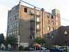 |
(#08000148) |
222 S. 3rd St. 38°32′02″N 82°41′05″W / 38.533889°N 82.684722°W |
Ironton | |
| 2 | Burlington 37 Cemetery | 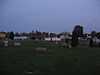 |
(#01001064) |
Center St. in Burlington 38°24′41″N 82°31′12″W / 38.411389°N 82.52°W |
Fayette Township | part of the Underground Railroad in Ohio MPS |
| 3 | Downtown Ironton Historic District | 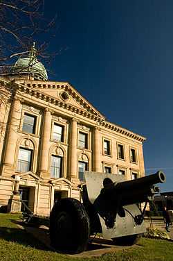 |
(#08001296) |
Portions of 2nd, 3rd, 4th, 5th, Center Sts., Park Ave., Vernon St., and Bobby Bare Boulevard 38°32′06″N 82°41′05″W / 38.53492°N 82.68459°W |
Ironton | |
| 4 | F.W. Erlich House | 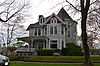 |
(#80003134) |
1908 S. 6th St. 38°31′18″N 82°40′13″W / 38.521667°N 82.670278°W |
Ironton | |
| 5 | Fifth and Lawrence Streets Residential District | 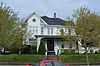 |
(#78002098) |
5th and Lawrence Sts. 38°32′18″N 82°41′06″W / 38.538281°N 82.685122°W |
Ironton | |
| 6 | Grand Army of the Republic Memorial Hall | 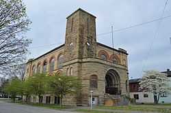 |
(#12000801) |
401 Railroad St. 38°32′15″N 82°41′08″W / 38.537500°N 82.685556°W |
Ironton | |
| 7 | William C. Johnston House and General Store | 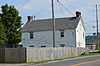 |
(#76001463) |
Washington and Davidson Sts. in Burlington 38°24′22″N 82°31′51″W / 38.406111°N 82.530833°W |
Fayette Township | |
| 8 | Macedonia Church | 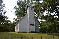 |
(#78002096) |
North of Burlington 38°26′22″N 82°31′46″W / 38.439583°N 82.529444°W |
Fayette Township | |
| 9 | Maplewood | 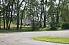 |
(#77001070) |
West of Chesapeake on Maplewood Lane 38°25′22″N 82°28′23″W / 38.422778°N 82.473056°W |
Fayette Township | |
| 10 | Marlow Theatre | 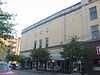 |
(#08000149) |
S. 3rd St. and Park Ave. 38°32′03″N 82°41′06″W / 38.534167°N 82.685000°W |
Ironton | |
| 11 | Marting Hotel | 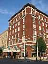 |
(#99000331) |
202 Park Ave. 38°32′03″N 82°41′07″W / 38.534167°N 82.685278°W |
Ironton | |
| 12 | Miller-Knight House |  |
(#03000720) |
2 Township Road 1046 38°32′27″N 82°17′53″W / 38.540833°N 82.298056°W |
Rome Township | |
| 13 | Norfolk And Western Railroad Depot | 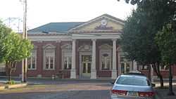 |
(#78002099) |
1st St. and Park Ave. 38°32′03″N 82°41′11″W / 38.534167°N 82.686389°W |
Ironton | |
| 14 | Old Lawrence County Jail | 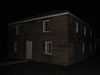 |
(#78002097) |
Court St. in Burlington 38°24′26″N 82°31′43″W / 38.407222°N 82.528611°W |
Fayette Township | |
| 15 | Olive Furnace | Upload image | (#07000299) |
State Route 93 at Township Road 239 (Olive Branch Rd.), north of Pedro 38°45′44″N 82°37′50″W / 38.762222°N 82.630556°W |
Washington Township | |
| 16 | Rankin Historic District | 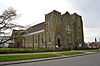 |
(#79001876) |
Roughly bounded by Vernon, 7th, Monroe and 4th Sts. 38°32′04″N 82°40′48″W / 38.534444°N 82.680000°W |
Ironton | |
| 17 | Scottown Covered Bridge | 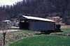 |
(#75001456) |
East of Scottown on State Route 67 38°32′52″N 82°22′49″W / 38.547778°N 82.380278°W |
Windsor Township | |
| 18 | Selby Shoe Company Building |  |
(#09000444) |
1603 S. 3rd St. 38°31′22″N 82°40′30″W / 38.522778°N 82.675000°W |
Ironton | |
| 19 | Vesuvius Furnace |  |
(#89001714) |
Vesuvius Recreation Area off State Route 93, near Ironton 38°36′19″N 82°37′49″W / 38.605278°N 82.630278°W |
Elizabeth Township | Originally located on County Highway 29 at Storms Creek in the Vesuvius Recreation Area of the Wayne National Forest; current boundaries reflect a boundary decrease of 2011-09-15[6] |
See also
| Wikimedia Commons has media related to National Register of Historic Places in Lawrence County, Ohio. |
References
- ↑ The latitude and longitude information provided in this table was derived originally from the National Register Information System, which has been found to be fairly accurate for about 99% of listings. For about 1% of NRIS original coordinates, experience has shown that one or both coordinates are typos or otherwise extremely far off; some corrections may have been made. A more subtle problem causes many locations to be off by up to 150 yards, depending on location in the country: most NRIS coordinates were derived from tracing out latitude and longitudes off of USGS topographical quadrant maps created under the North American Datum of 1927, which differs from the current, highly accurate WGS84 GPS system used by most on-line maps. Chicago is about right, but NRIS longitudes in Washington are higher by about 4.5 seconds, and are lower by about 2.0 seconds in Maine. Latitudes differ by about 1.0 second in Florida. Some locations in this table may have been corrected to current GPS standards.
- ↑ "National Register of Historic Places: Weekly List Actions". National Park Service, United States Department of the Interior. Retrieved on May 1, 2015.
- ↑ Numbers represent an ordering by significant words. Various colorings, defined here, differentiate National Historic Landmarks and historic districts from other NRHP buildings, structures, sites or objects.
- ↑ "National Register Information System". National Register of Historic Places. National Park Service. 2008-04-24.
- ↑ The eight-digit number below each date is the number assigned to each location in the National Register Information System database, which can be viewed by clicking the number.
- ↑ 76 FR 54250


| |||||||||||||||||||||||||||||