| [3] |
Name on the Register[4] |
Image |
Date listed[5] |
Location |
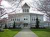
City or town |
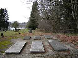
Description |
|---|
| 1 |
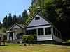
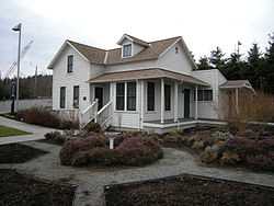
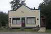
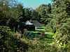
William and Estella Adair Farm |
|
02002-03-22-0000March 22, 2002
(#02000249) |
27929 NE 100th St.
47°41′01″N 121°57′56″W / 47.683611°N 121.965556°W / 47.683611; -121.965556 (William and Estella Adair Farm) |
Carnation |
|
| 2 |
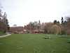
Horatio and Laura Allen Farm |
|
02002-03-22-0000March 22, 2002
(#02000250) |
28704 NE Cherry Valley Rd.
47°45′06″N 121°57′04″W / 47.751667°N 121.951111°W / 47.751667; -121.951111 (Horatio and Laura Allen Farm) |
Duvall |
|
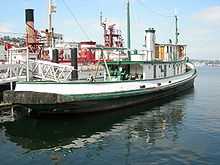
| 3 |
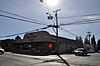
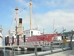
ARTHUR FOSS (tugboat) |
|
01989-04-11-0000April 11, 1989
(#89001078) |
Moss Bay waterfront
47°40′30″N 122°12′26″W / 47.675°N 122.207222°W / 47.675; -122.207222 (ARTHUR FOSS (tugboat)) |
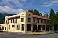
Kirkland |
The Arthur Foss, although registered in Kirkland, is now based at Northwest Seaport in Seattle.
|
| 4 |
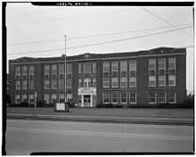
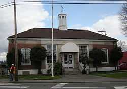
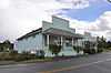
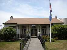
Auburn Post Office |
|
02000-04-21-0000April 21, 2000
(#00000407) |
20 Auburn Ave. NE
47°18′29″N 122°13′35″W / 47.308056°N 122.226389°W / 47.308056; -122.226389 (Auburn Post Office) |
Auburn |
|
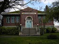
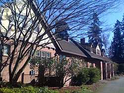
| 5 |
Auburn Public Library |
|
01982-08-03-0000August 3, 1982
(#82004221) |
306 Auburn Ave.
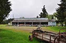
47°18′34″N 122°13′38″W / 47.309444°N 122.227222°W / 47.309444; -122.227222 (Auburn Public Library) |
Auburn |
Carnegie Libraries of Washington TR
|
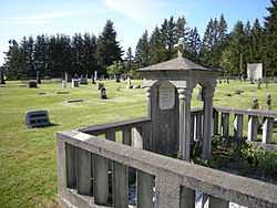
| 6 |
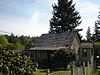
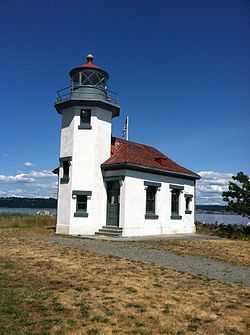
Black Diamond Cemetery |
|
02000-04-21-0000April 21, 2000
(#00000406) |
Cemetery Hill Rd.
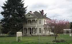
47°18′39″N 122°00′55″W / 47.310833°N 122.015278°W / 47.310833; -122.015278 (Black Diamond Cemetery) |
Black Diamond |
|
| 7 |
Oscar Blomeen House |
|
01991-06-21-0000June 21, 1991
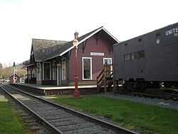
(#91000781) |
324 B St. NE.
47°18′40″N 122°13′35″W / 47.311111°N 122.226389°W / 47.311111; -122.226389 (Oscar Blomeen House) |
Auburn |
|
| 8 |
William E. Boeing House |
Upload image |
01988-12-16-0000December 16, 1988
(#88002743) |
Huckleberry Ln.
47°44′50″N 122°22′18″W / 47.747222°N 122.371667°W / 47.747222; -122.371667 (William E. Boeing House) |
Highlands |
Gated, guarded community; photo here http://www.nps.gov/nr/travel/aviation/boe.htm
|
| 9 |
Bothell Pioneer Cemetery |
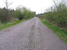
|
01996-02-16-0000February 16, 1996
(#96000050) |
Jct. of 108th Ave. NE. and NE. 180th St., NE and SE corners
47°45′32″N 122°11′39″W / 47.758889°N 122.194167°W / 47.758889; -122.194167 (Bothell Pioneer Cemetery) |
Bothell |
Bothell MPS
|
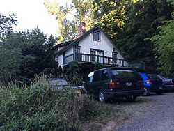
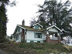
| 10 |
Brandes House |
Upload image |
01994-12-14-0000December 14, 1994
(#94001436) |
2202 212th Ave. SE.
47°34′39″N 122°03′14″W / 47.5775°N 122.053889°W / 47.5775; -122.053889 (Brandes House) |
Issaquah |
|
| 11 |
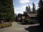
Camp North Bend |
|
01993-04-29-0000April 29, 1993
(#93000372) |
45509 SE. 150th St.
47°28′10″N 121°43′58″W / 47.469444°N 121.732778°W / 47.469444; -121.732778 (Camp North Bend) |
North Bend |
|
| 12 |
Dr. Reuben Chase House |
|
01990-08-27-0000August 27, 1990
(#90001246) |
17819 113th Ave. NE
47°45′27″N 122°11′20″W / 47.7575°N 122.188889°W / 47.7575; -122.188889 (Dr. Reuben Chase House) |
Bothell |
Bothell MPS
|
| 13 |
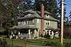
James W. Clise House |
|
01973-06-19-0000June 19, 1973
(#73001874) |
6046 Lake Sammamish Pkwy., NE
47°39′42″N 122°07′13″W / 47.661667°N 122.120278°W / 47.661667; -122.120278 (James W. Clise House) |
Redmond |
|
| 14 |
Colvos Store |
|
02000-08-10-0000August 10, 2000
(#00000970) |
123rd Ave. SW and Cove Rd.
47°27′55″N 122°29′29″W / 47.465278°N 122.491389°W / 47.465278; -122.491389 (Colvos Store) |
Vashon |
|
| 15 |
Covenant Beach Bible Camp |
|
02006-01-11-0000January 11, 2006
(#05000313) |
Cliff Ave. and 220th St.
47°24′26″N 122°19′43″W / 47.407222°N 122.328611°W / 47.407222; -122.328611 (Covenant Beach Bible Camp) |
Des Moines |
|
| 16 |
Dockton Hotel |
|
01983-07-28-0000July 28, 1983
(#83003337) |
260th St., SE and 99th Ave., SW
47°22′15″N 122°27′38″W / 47.370833°N 122.460556°W / 47.370833; -122.460556 (Dockton Hotel) |
Dockton |
Better known as "Dockton Store" or "Dockton Store and Post Office".
|
| 17 |
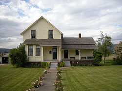
John and Kate Dougherty Farmstead |
|
02005-12-01-0000December 1, 2005
(#05001353) |
26524 NE Cherry Valley Rd.
47°45′05″N 121°59′03″W / 47.751389°N 121.984167°W / 47.751389; -121.984167 (John and Kate Dougherty Farmstead) |
Duvall |
|
| 18 |
Dr. Trueblood House |
|
01982-08-03-0000August 3, 1982
(#82004222) |
127 7th Ave.
47°40′49″N 122°12′19″W / 47.680278°N 122.205278°W / 47.680278; -122.205278 (Dr. Trueblood House) |
Kirkland |
|
| 19 |
James G. Eddy House and Grounds |
|
01982-02-19-0000February 19, 1982
(#82004226) |
1005 Evergreen Point Rd.
47°37′11″N 122°14′23″W / 47.619722°N 122.239722°W / 47.619722; -122.239722 (James G. Eddy House and Grounds) |
Medina |
|
| 20 |
David and Martha Entwistles House |
|
01999-07-28-0000July 28, 1999
(#99000918) |
32021 E. Entwistle St.
47°38′52″N 121°54′31″W / 47.647778°N 121.908611°W / 47.647778; -121.908611 (David and Martha Entwistles House) |
Carnation |
|
| 21 |
Falls City Masonic Hall |
|
02004-08-25-0000August 25, 2004
(#04000922) |
4304 337th Place SE
47°34′01″N 121°53′21″W / 47.566944°N 121.889167°W / 47.566944; -121.889167 (Falls City Masonic Hall) |
Fall City |
|
| 22 |
Faust-Ryan House |
|
01994-05-19-0000May 19, 1994
(#94000405) |
18604 104th Ave.
47°45′49″N 122°11′56″W / 47.763611°N 122.198889°W / 47.763611; -122.198889 (Faust-Ryan House) |
Bothell |
Bothell MPS
|
| 23 |
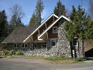
Gaffney's Lake Wilderness Lodge |
|
02003-03-28-0000March 28, 2003
(#03000163) |
22500 SE 248th St.
47°22′45″N 122°02′14″W / 47.379167°N 122.037222°W / 47.379167; -122.037222 (Gaffney's Lake Wilderness Lodge) |
Maple Valley |
|
| 24 |
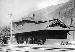
Great Northern Depot |
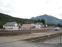
|
01997-04-14-0000April 14, 1997
(#97000322) |
Jct. of Railroad Ave. and 4th St., SE corner
47°42′34″N 121°21′34″W / 47.709444°N 121.359444°W / 47.709444; -121.359444 (Great Northern Depot) |
Skykomish |
|
| 25 |
Andrew and Bergette Hjertoos Farm |
|
02002-03-22-0000March 22, 2002
(#02000248) |
31523 NE 40th
47°38′34″N 121°54′59″W / 47.642778°N 121.916389°W / 47.642778; -121.916389 (Andrew and Bergette Hjertoos Farm) |
Carnation |
|
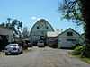
| 26 |
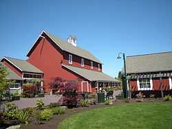
Hollywood Farm |
|
01978-12-15-0000December 15, 1978
(#78002757) |
SE of Woodinville at 14111 NE 145th St.
47°43′48″N 122°08′59″W / 47.73°N 122.149722°W / 47.73; -122.149722 (Hollywood Farm) |
Woodinville |
|
| 27 |
Independent Order of Odd Fellows (IOOF) Hall No. 148 |
|
01999-07-28-0000July 28, 1999
(#99000917) |
3940 Tolt Ave.
47°38′39″N 121°54′51″W / 47.644167°N 121.914167°W / 47.644167; -121.914167 (Independent Order of Odd Fellows (IOOF) Hall No. 148) |
Carnation |
|
| 28 |
Issaquah Depot |
|
01990-09-13-0000September 13, 1990
(#90001461) |
Rainier Ave. N
47°31′53″N 122°02′02″W / 47.531389°N 122.033889°W / 47.531389; -122.033889 (Issaquah Depot) |
Issaquah |
|
| 29 |
Issaquah Sportsmen's Club |
|
01998-11-19-0000November 19, 1998
(#98001419) |
23600 SE Evans St.
47°31′36″N 122°01′31″W / 47.526667°N 122.025278°W / 47.526667; -122.025278 (Issaquah Sportsmen's Club) |
Issaquah |
|
| 30 |
Jovita Land Company Model Home-Corbett House |
|
02004-03-10-0000March 10, 2004
(#04000158) |
4600 S. 364th St.
47°16′33″N 122°16′32″W / 47.275833°N 122.275556°W / 47.275833; -122.275556 (Jovita Land Company Model Home-Corbett House) |
Federal Way |
|
| 31 |
Keewaydin Clubhouse |
|
02005-08-24-0000August 24, 2005
(#05000923) |
1836 72nd Ave. SE
47°35′44″N 122°14′34″W / 47.595556°N 122.242778°W / 47.595556; -122.242778 (Keewaydin Clubhouse) |
Mercer Island |
|
| 32 |
Lilly Kirk House |
|
01995-03-09-0000March 9, 1995
(#95000188) |
19619 100th Ave. NE
47°46′15″N 122°12′28″W / 47.770833°N 122.207778°W / 47.770833; -122.207778 (Lilly Kirk House) |
Bothell |
Bothell MPS
|
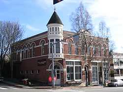
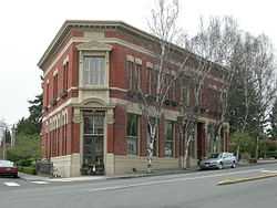
| 33 |
Peter Kirk Building |
|
01973-08-14-0000August 14, 1973
(#73001873) |
620 Market St.
47°40′55″N 122°12′28″W / 47.681944°N 122.207778°W / 47.681944; -122.207778 (Peter Kirk Building) |
Kirkland |
|
| 34 |
Kirkland Women's Club |
|
01990-01-26-0000January 26, 1990
(#89002321) |
407 First St.
47°40′43″N 122°12′26″W / 47.678611°N 122.207222°W / 47.678611; -122.207222 (Kirkland Women's Club) |
Kirkland |
|
| 35 |
Lakeview School |
|
01988-06-16-0000June 16, 1988
(#88000742) |
Island Crest Way and S.E. Sixty-eighth St.
47°32′31″N 122°13′14″W / 47.541944°N 122.220556°W / 47.541944; -122.220556 (Lakeview School) |
Mercer Island |
Rural Public Schools of Washington State MPS
|
| 36 |
Lester Depot |
|
01987-09-10-0000September 10, 1987
(#87001534) |
US Forest Service Rd. 212, Green River Watershed
47°12′32″N 121°29′38″W / 47.208889°N 121.493889°W / 47.208889; -121.493889 (Lester Depot) |
Lester |
Has been demolished.
|
| 37 |
Loomis House |
|
01982-08-03-0000August 3, 1982
(#82004223) |
304 8th Ave., W.
47°40′59″N 122°12′36″W / 47.683056°N 122.21°W / 47.683056; -122.21 (Loomis House) |
Kirkland |
|
| 38 |
Maloney's General Store |
|
01997-08-29-0000August 29, 1997
(#97001078) |
104 Railroad Ave. W
47°42′34″N 121°21′40″W / 47.709444°N 121.361111°W / 47.709444; -121.361111 (Maloney's General Store) |
Skykomish |
|
| 39 |
Louis S. Marsh House |
|
01989-06-30-0000June 30, 1989
(#89000500) |
6604 Lake Washington Blvd.
47°39′57″N 122°12′16″W / 47.665833°N 122.204444°W / 47.665833; -122.204444 (Louis S. Marsh House) |
Kirkland |
|
| 40 |
Marymoor Prehistoric Indian Site |
|
01970-11-20-0000November 20, 1970
(#70000642) |
Address Restricted
|
Redmond |
|
| 41 |
Masonic Lodge Building |
|
01982-08-03-0000August 3, 1982
(#82004224) |
700 Market St.
47°40′51″N 122°12′29″W / 47.680833°N 122.208056°W / 47.680833; -122.208056 (Masonic Lodge Building) |
Kirkland |
|
| 42 |
McGrath Cafe and Hotel-The McGrath |
|
02002-02-21-0000February 21, 2002
(#02000089) |
101 W. North Bend Way
47°29′42″N 121°47′05″W / 47.495°N 121.784722°W / 47.495; -121.784722 (McGrath Cafe and Hotel-The McGrath) |
North Bend |
|
| 43 |
Messenger of Peace Chapel Car |
Upload image |
02009-01-21-0000January 21, 2009
(#08000998) |
38625 SE King St.
47°31′42″N 121°49′38″W / 47.528267°N 121.827136°W / 47.528267; -121.827136 (Messenger of Peace Chapel Car) |
Snoqualmie |
|
| 44 |
Mukai Cold Process Fruit Barrelling Plant |
|
01994-09-26-0000September 26, 1994
(#94001165) |
18005, 18017 107th Ave. SW
47°26′36″N 122°28′16″W / 47.443333°N 122.471111°W / 47.443333; -122.471111 (Mukai Cold Process Fruit Barrelling Plant) |
Vashon |
|
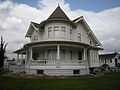
| 45 |
Aaron Neely Sr., Mansion |
|
01974-10-15-0000October 15, 1974
(#74001955) |
E of Auburn off WA 18
47°18′03″N 122°10′36″W / 47.300833°N 122.176667°W / 47.300833; -122.176667 (Aaron Neely Sr., Mansion) |
Auburn |
|
| 46 |
Neighbor-Bennett House |
|
02004-08-25-0000August 25, 2004
(#04000921) |
4317-337th Place SE
47°31′27″N 121°53′27″W / 47.524167°N 121.890833°W / 47.524167; -121.890833 (Neighbor-Bennett House) |
Fall City |
|
| 47 |
Nelson–Parker House |
|
02014-04-21-0000April 21, 2014
(#14000166) |
17605 182nd Ave, NE
47°45′21″N 122°05′51″W / 47.755893°N 122.097437°W / 47.755893; -122.097437 (Nelson–Parker House) |
Woodinville |
|
| 48 |
Norman Bridge |
|
01994-07-19-0000July 19, 1994
(#94000676) |
Old 428th Ave. SE, across the N. Fork, Snoqualmie R.
47°30′58″N 121°46′05″W / 47.516111°N 121.768056°W / 47.516111; -121.768056 (Norman Bridge) |
North Bend |
Has been demolished.
|
| 49 |
North Bend Ranger Station |
|
01991-03-06-0000March 6, 1991
(#91000157) |
42404 SE. North Bend Way
47°29′23″N 121°46′20″W / 47.489722°N 121.772222°W / 47.489722; -121.772222 (North Bend Ranger Station) |
North Bend |
|
| 50 |
Louis and Ellen Olson House |
|
01984-08-30-0000August 30, 1984
(#84003492) |
1513 Griffin Ave.
47°12′20″N 121°59′30″W / 47.205556°N 121.991667°W / 47.205556; -121.991667 (Louis and Ellen Olson House) |
Enumclaw |
|
| 51 |
Mary Olson Farm |
|
02001-10-05-0000October 5, 2001
(#01001080) |
28728 Green River Rd. S.
47°20′40″N 122°12′13″W / 47.344444°N 122.203611°W / 47.344444; -122.203611 (Mary Olson Farm) |
Kent |
|
| 52 |
Pacific Coast Company House No. 75 |
|
01979-12-21-0000December 21, 1979
(#79002534) |
N of Renton at 7210 138th St., SE
47°32′17″N 122°09′21″W / 47.538056°N 122.155833°W / 47.538056; -122.155833 (Pacific Coast Company House No. 75) |
Renton |
|
| 53 |
Luigi and Aurora Pagani House |
|
02002-08-09-0000August 9, 2002
(#02000861) |
32907 Merino St.
47°18′24″N 122°00′23″W / 47.306667°N 122.006389°W / 47.306667; -122.006389 (Luigi and Aurora Pagani House) |
Black Diamond |
|
| 54 |
Patton Bridge |
|
01995-05-24-0000May 24, 1995
(#95000626) |
Green Valley Rd. over the Green R.
47°17′18″N 122°09′34″W / 47.288333°N 122.159444°W / 47.288333; -122.159444 (Patton Bridge) |
Auburn |
Bridges of Washington State MPS
|
| 55 |
Pickering Farm |
|
01983-07-07-0000July 7, 1983
(#83003343) |
21809 SE 56th St.
47°32′58″N 122°02′55″W / 47.549444°N 122.048611°W / 47.549444; -122.048611 (Pickering Farm) |
Issaquah |
|
| 56 |
Point Robinson Light Station |
|
02004-04-21-0000April 21, 2004
(#04000359) |
NE end of Maury Island in Puget Sound
47°23′16″N 122°22′29″W / 47.387778°N 122.374722°W / 47.387778; -122.374722 (Point Robinson Light Station) |
Vashon Island |
|
| 57 |
Preston Community Clubhouse |
|
02008-12-04-0000December 4, 2008
(#08001186) |
8625 310th Ave. SE
47°31′34″N 121°56′11″W / 47.526011°N 121.936414°W / 47.526011; -121.936414 (Preston Community Clubhouse) |
Preston |
|
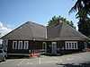
| 58 |
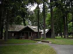
Redmond City Park |
|
02009-01-06-0000January 6, 2009
(#08001302) |
7802 168th Ave NE
47°40′23″N 122°06′56″W / 47.672989°N 122.115572°W / 47.672989; -122.115572 (Redmond City Park) |
Redmond |
|
| 59 |
RELIEF (lightship) |
|
01975-04-23-0000April 23, 1975
(#75001852) |
Central Waterfront at Moss Bay
47°40′30″N 122°12′26″W / 47.675°N 122.207222°W / 47.675; -122.207222 (RELIEF (lightship)) |
Kirkland |
|
| 60 |
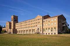
St. Edward Seminary |
|
02007-03-08-0000March 8, 2007
(#07000137) |
14445 Juanita Dr. NE
47°43′58″N 122°14′45″W / 47.732722°N 122.245911°W / 47.732722; -122.245911 (St. Edward Seminary) |
Kenmore |
|
| 61 |
Erick Gustave Sanders Mansion |
|
01986-11-06-0000November 6, 1986
(#86003163) |
5516 S. Two Hundred and Seventy-seventh St.
47°21′17″N 122°15′50″W / 47.354722°N 122.263889°W / 47.354722; -122.263889 (Erick Gustave Sanders Mansion) |
Kent |
|
| 62 |
Joshua Sears Building |
|
01982-08-03-0000August 3, 1982
(#82004225) |
701 Market St.
47°40′51″N 122°12′31″W / 47.680833°N 122.208611°W / 47.680833; -122.208611 (Joshua Sears Building) |
Kirkland |
|
| 63 |
Seattle Municipal Light and Power Plant |
Upload image |
01997-09-11-0000September 11, 1997
(#97001077) |
20030 Cedar Falls Rd. SE
47°25′04″N 121°46′05″W / 47.417778°N 121.768056°W / 47.417778; -121.768056 (Seattle Municipal Light and Power Plant) |
North Bend |
|
| 64 |
Selleck Historic District |
|
01989-03-16-0000March 16, 1989
(#89000214) |
SE 252nd
47°22′33″N 121°52′00″W / 47.375833°N 121.866667°W / 47.375833; -121.866667 (Selleck Historic District) |
Selleck |
|
| 65 |
Shawnee House |
|
02000-11-22-0000November 22, 2000
(#00001449) |
11608 SW Shawnee Rd.
47°22′56″N 122°28′57″W / 47.382222°N 122.4825°W / 47.382222; -122.4825 (Shawnee House) |
Vashon |
|
| 66 |
Si View Park |
|
02015-01-07-0000January 7, 2015
(#14001143) |
400 SE. Orchard Dr.
47°29′27″N 121°46′58″W / 47.4907°N 121.7828°W / 47.4907; -121.7828 (Si View Park) |
North Bend |
|
| 67 |
Skykomish Historic Commercial District |
|
02000-08-10-0000August 10, 2000
(#00000974) |
Railroad Ave., from 3rd St. to W of N 6th St., and part of Old Cascade Hwy.
47°42′35″N 121°21′34″W / 47.709722°N 121.359444°W / 47.709722; -121.359444 (Skykomish Historic Commercial District) |
Skykomish |
|
| 68 |
Snoqualmie Depot |
|
01974-07-24-0000July 24, 1974
(#74001963) |
109 King St.
47°31′43″N 121°49′28″W / 47.528611°N 121.824444°W / 47.528611; -121.824444 (Snoqualmie Depot) |
Snoqualmie |
|
| 69 |
Snoqualmie Falls |
|
02009-09-02-0000September 2, 2009
(#92000784) |
Snoqualmie R. below crossing of WA 522
47°32′32″N 121°50′13″W / 47.542122°N 121.836833°W / 47.542122; -121.836833 (Snoqualmie Falls) |
Snoqualmie |
|
| 70 |
Snoqualmie Falls Cavity Generating Station |
|
01976-04-23-0000April 23, 1976
(#76001895) |
N of Snoqualmie on Snoqualmie River
47°32′27″N 121°50′07″W / 47.540833°N 121.835278°W / 47.540833; -121.835278 (Snoqualmie Falls Cavity Generating Station) |
Snoqualmie |
|
| 71 |
Snoqualmie Falls Hydroelectric Power Plant Historic District |
|
01992-10-24-0000October 24, 1992
(#92001324) |
WA 202, .5 mi. N of Snoqualmie
47°32′32″N 121°50′11″W / 47.542222°N 121.836389°W / 47.542222; -121.836389 (Snoqualmie Falls Hydroelectric Power Plant Historic District) |
Snoqualmie |
|
| 72 |
Snoqualmie School Campus |
|
01989-03-16-0000March 16, 1989
(#89000209) |
Silva and King Sts.
47°31′44″N 121°49′38″W / 47.528889°N 121.827222°W / 47.528889; -121.827222 (Snoqualmie School Campus) |
Snoqualmie |
|
| 73 |
Sorenson House |
|
01995-03-09-0000March 9, 1995
(#95000187) |
10011 W. Riverside Dr.
47°45′23″N 122°12′19″W / 47.756389°N 122.205278°W / 47.756389; -122.205278 (Sorenson House) |
Bothell |
Bothell MPS
|
| 74 |
Helmer and Selma Steen House |
|
02000-08-10-0000August 10, 2000
(#00000976) |
10924 SW Cove Rd.
47°27′22″N 122°28′24″W / 47.456111°N 122.473333°W / 47.456111; -122.473333 (Helmer and Selma Steen House) |
Vashon |
|
| 75 |
Stevens Pass Historic District |
|
01976-10-22-0000October 22, 1976
(#76001884) |
West of Berne on U.S. 2
47°44′40″N 121°06′03″W / 47.744444°N 121.100833°W / 47.744444; -121.100833 (Stevens Pass Historic District) |
Berne |
|
| 76 |
William Harper Thorton House |
|
01997-11-07-0000November 7, 1997
(#97001408) |
17424 95th Ave, NE
47°45′19″N 122°12′44″W / 47.755278°N 122.212222°W / 47.755278; -122.212222 (William Harper Thorton House) |
Bothell |
Bothell MPS
|
| 77 |
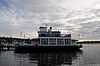
TOURIST II (auto ferry) |
|
01997-04-15-0000April 15, 1997
(#97000321) |
25 Lake Shore Plaze, Marina Park
47°40′29″N 122°12′27″W / 47.674722°N 122.2075°W / 47.674722; -122.2075 (TOURIST II (auto ferry)) |
Kirkland |
|
| 78 |
Tracy House |
|
01995-07-13-0000July 13, 1995
(#95000830) |
18971 Edgecliff Dr. SW.
47°25′57″N 122°20′58″W / 47.4325°N 122.349444°W / 47.4325; -122.349444 (Tracy House) |
Normandy Park |
The NRHP lists this in Seattle, but it is actually in Normandy Park.[6]
|
| 79 |
Trommald Building |
|
02000-08-24-0000August 24, 2000
(#00000972) |
1523-1525 Cole St.
47°12′12″N 121°59′19″W / 47.203333°N 121.988611°W / 47.203333; -121.988611 (Trommald Building) |
Enumclaw |
|
| 80 |
Tukwila School |
|
01979-11-29-0000November 29, 1979
(#79002544) |
14475 59th Ave., S.
47°28′20″N 122°15′25″W / 47.472222°N 122.256944°W / 47.472222; -122.256944 (Tukwila School) |
Tukwila |
Now Tukwila Library.
|
| 81 |
Vashon Hardware Store |
|
02000-08-10-0000August 10, 2000
(#00000971) |
17601 99th Ave. SW
47°26′50″N 122°27′34″W / 47.447222°N 122.459444°W / 47.447222; -122.459444 (Vashon Hardware Store) |
Vashon |
|
| 82 |
Vincent School |
|
02004-08-25-0000August 25, 2004
(#04000920) |
8010 W. Snoqualmie Valley Rd.
47°40′26″N 121°58′42″W / 47.673889°N 121.978333°W / 47.673889; -121.978333 (Vincent School) |
Carnation |
Rural Public Schools of Washington State MPS
|
| 83 |
Frederick W. Winters House |
|
01992-04-21-0000April 21, 1992
(#92000367) |
2102 Bellevue Way, SE.
47°35′30″N 122°11′31″W / 47.591667°N 122.191944°W / 47.591667; -122.191944 (Frederick W. Winters House) |
Bellevue |
|
| 84 |
Harry Vanderbilt Wurdemann House |
|
01990-12-27-0000December 27, 1990
(#90002154) |
17602 Bothell Way NE.
47°45′19″N 122°16′29″W / 47.755278°N 122.274722°W / 47.755278; -122.274722 (Harry Vanderbilt Wurdemann House) |
Lake Forest Park |
|
| 85 |
The Yellowstone Road |
|
01974-12-02-0000December 2, 1974
(#74001956) |
196th St. between the Fall City Hwy. and 80th, NE
47°39′59″N 122°06′03″W / 47.666389°N 122.100833°W / 47.666389; -122.100833 (The Yellowstone Road) |
Redmond |
|

.jpg)

.jpg)
.jpg)
.jpg)

.jpg)