| [3] |
Name on the Register[4] |
Image |
Date listed[5] |
Location |
City or town |
Description |
|---|
| 1 |
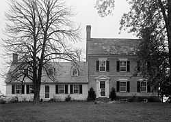
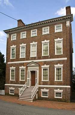
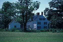
Airy Hill |
|
01996-12-30-0000December 30, 1996
(#96001478) |
7909 Airy Hill Rd.
39°11′34″N 76°05′36″W / 39.192778°N 76.093333°W / 39.192778; -76.093333 (Airy Hill) |
Chestertown |
|
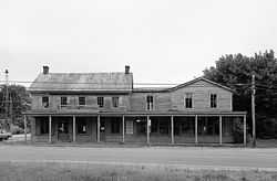
| 2 |
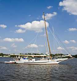
BERNICE J. (skipjack) |
Upload image |
01985-09-05-0000September 5, 1985
(#85001946) |
Town Dock
39°12′24″N 76°03′48″W / 39.206667°N 76.063333°W / 39.206667; -76.063333 (BERNICE J. (skipjack)) |
Chestertown |
|
| 3 |
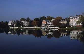
Betterton Historic District |
Upload image |
01984-06-07-0000June 7, 1984
(#84001805) |
Roughly bounded by the Sassafras River, Gut Marsh, 6th, and Ericsson Aves.
39°22′02″N 76°03′47″W / 39.367222°N 76.063056°W / 39.367222; -76.063056 (Betterton Historic District) |
Betterton |
|
| 4 |
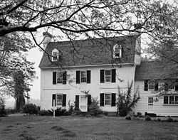
Brampton |
Upload image |
01983-08-04-0000August 4, 1983
(#83002954) |
Maryland Route 20
39°12′43″N 76°05′44″W / 39.211944°N 76.095556°W / 39.211944; -76.095556 (Brampton) |
Chestertown |
|
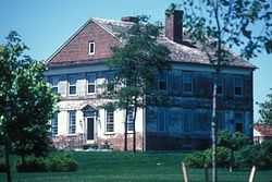
| 5 |
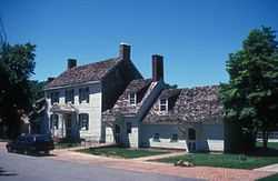
Carvill Hall |
|
01973-03-14-0000March 14, 1973
(#73000930) |
Great Oak Estates, 10 miles west of Chestertown
39°15′34″N 76°12′06″W / 39.259444°N 76.201667°W / 39.259444; -76.201667 (Carvill Hall) |
Chestertown |
|
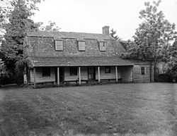
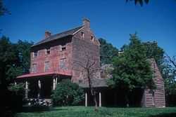
| 6 |
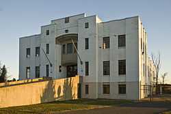
Chestertown Armory |
|
01985-09-25-0000September 25, 1985
(#85002668) |
Quaker Neck Rd.
39°12′10″N 76°04′06″W / 39.20291°N 76.06835°W / 39.20291; -76.06835 (Chestertown Armory) |
Chestertown |
|
| 7 |
Chestertown Historic District |
|
01970-04-15-0000April 15, 1970
((original)
84001808 (increase)&natregadvancedsearch=Search #70000263 (original)
84001808 (increase)) |
Roughly bounded by Maple Avenue, the Chester River, and Cannon and Cross Streets
39°12′29″N 76°03′52″W / 39.208056°N 76.064444°W / 39.208056; -76.064444 (Chestertown Historic District) |
Chestertown |
|
| 8 |
Chestertown Railroad Station |
Upload image |
01982-12-08-0000December 8, 1982
(#82001597) |
Cross St.
39°12′28″N 76°04′08″W / 39.207778°N 76.068889°W / 39.207778; -76.068889 (Chestertown Railroad Station) |
Chestertown |
|
| 9 |
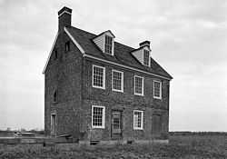
Chesterville Brick House |
|
01979-07-17-0000July 17, 1979
(#79001139) |
Junction of Maryland Routes 290 and 444
39°16′36″N 75°54′57″W / 39.276667°N 75.915833°W / 39.276667; -75.915833 (Chesterville Brick House) |
Chesterville |
|
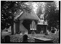
| 10 |
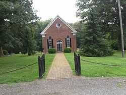
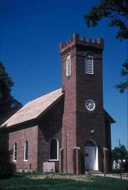
Christ Church, Graveyard and Sexton's House |
|
01980-04-02-0000April 2, 1980
(#80001822) |
North of Worton on Maryland Route 298
39°17′26″N 76°05′32″W / 39.290556°N 76.092222°W / 39.290556; -76.092222 (Christ Church, Graveyard and Sexton's House) |
Worton |
|
| 11 |
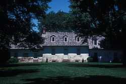
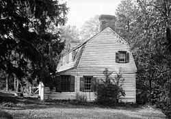
Clark's Conveniency |
|
01975-09-09-0000September 9, 1975
(#75000906) |
2 miles south of Pomona on Quaker Neck Rd.
39°08′27″N 76°07′18″W / 39.140833°N 76.121667°W / 39.140833; -76.121667 (Clark's Conveniency) |
Pomona |
|
| 12 |
Denton House |
|
01971-03-11-0000March 11, 1971
(#71000377) |
107 Water St.
39°12′29″N 76°03′47″W / 39.208056°N 76.063056°W / 39.208056; -76.063056 (Denton House) |
Chestertown |
|
| 13 |
ELSWORTH |
|
01985-05-16-0000May 16, 1985
(#85001088) |
Gibsontown Rd.
38°42′46″N 76°19′53″W / 38.712778°N 76.331389°W / 38.712778; -76.331389 (ELSWORTH) |
Tilghman |
|
| 14 |
Fairlee Manor Camp House |
|
01973-04-11-0000April 11, 1973
(#73000931) |
1.5 miles west of Fairlee off Maryland Route 445
39°14′33″N 76°12′12″W / 39.2425°N 76.203333°W / 39.2425; -76.203333 (Fairlee Manor Camp House) |
Fairlee |
|
| 15 |
Gobbler Hill |
Upload image |
02009-12-23-0000December 23, 2009
(#09001149) |
10121 Fairlee Rd.
39°14′33″N 76°12′12″W / 39.2425°N 76.203333°W / 39.2425; -76.203333 (Gobbler Hill) |
Chestertown |
|
| 16 |
Godlington Manor |
|
01972-02-11-0000February 11, 1972
(#72000583) |
Wilkins Lane
39°10′42″N 76°03′27″W / 39.178333°N 76.0575°W / 39.178333; -76.0575 (Godlington Manor) |
Chestertown |
|
| 17 |
George Harper Store |
|
01982-07-09-0000July 9, 1982
(#82002816) |
Maryland Route 292 and Main St.
39°19′38″N 76°02′41″W / 39.327222°N 76.044722°W / 39.327222; -76.044722 (George Harper Store) |
Still Pond |
|
| 18 |
Hebron |
Upload image |
01978-09-18-0000September 18, 1978
(#78001471) |
Southeast of Still Pond off Maryland Route 292
39°19′23″N 76°02′24″W / 39.323056°N 76.04°W / 39.323056; -76.04 (Hebron) |
Still Pond |
|
| 19 |
Hinchingham |
Upload image |
01975-09-05-0000September 5, 1975
(#75000907) |
North of Rock Hall off Maryland Route 445
39°11′40″N 76°14′56″W / 39.194444°N 76.248889°W / 39.194444; -76.248889 (Hinchingham) |
Rock Hall |
|
| 20 |
ISLAND IMAGE (log canoe) |
Upload image |
01985-09-18-0000September 18, 1985
(#85002248) |
Walnut Point Rd.
39°10′11″N 76°03′46″W / 39.169722°N 76.062778°W / 39.169722; -76.062778 (ISLAND IMAGE (log canoe)) |
Chestertown |
|
| 21 |
Knocks Folly |
|
01976-06-17-0000June 17, 1976
(#76001006) |
North of Kennedyville on Maryland Route 298
39°21′06″N 75°59′04″W / 39.351667°N 75.984444°W / 39.351667; -75.984444 (Knocks Folly) |
Kennedyville |
|
| 22 |
Lauretum |
Upload image |
01997-09-04-0000September 4, 1997
(#97000926) |
954 High St.
39°13′10″N 76°05′08″W / 39.219444°N 76.085556°W / 39.219444; -76.085556 (Lauretum) |
Chestertown |
|
| 23 |
NELLIE CROCKETT |
Upload image |
01994-04-19-0000April 19, 1994
(#94001185) |
Sassafras River
39°21′47″N 75°52′55″W / 39.363056°N 75.881944°W / 39.363056; -75.881944 (NELLIE CROCKETT) |
Georgetown |
|
| 24 |
Radcliffe Mill |
Upload image |
02006-12-27-0000December 27, 2006
(#06001165) |
860 High St.
39°13′09″N 76°04′49″W / 39.219167°N 76.080278°W / 39.219167; -76.080278 (Radcliffe Mill) |
Chestertown |
|
| 25 |
Reward-Tilden's Farm |
Upload image |
01976-05-06-0000May 6, 1976
(#76001004) |
South of Chestertown, off Maryland Route 289 on Walnut Point Rd.
39°09′08″N 76°08′39″W / 39.152222°N 76.144167°W / 39.152222; -76.144167 (Reward-Tilden's Farm) |
Chestertown |
|
| 26 |
Rich Hill |
Upload image |
01972-12-15-0000December 15, 1972
(#72000585) |
Maryland Route 299
39°22′07″N 75°48′27″W / 39.368611°N 75.8075°W / 39.368611; -75.8075 (Rich Hill) |
Sassafras |
|
| 27 |
Rose Hill |
|
01976-12-12-0000December 12, 1976
(#76001005) |
2 miles north of Chestertown on Maryland Route 213
39°14′54″N 76°03′48″W / 39.248333°N 76.063333°W / 39.248333; -76.063333 (Rose Hill) |
Chestertown |
|
| 28 |
St. Paul's Church |
|
01980-06-06-0000June 6, 1980
(#80001820) |
Sandy Bottom Rd. and Ricaud's Branch-Lankford Rd.
39°11′11″N 76°10′47″W / 39.186389°N 76.179722°W / 39.186389; -76.179722 (St. Paul's Church) |
Fairlee |
|
| 29 |
Shepherd's Delight |
|
01976-06-17-0000June 17, 1976
(#76001007) |
South of Still Pond on Maryland Route 292
39°17′58″N 76°02′22″W / 39.299444°N 76.039444°W / 39.299444; -76.039444 (Shepherd's Delight) |
Still Pond |
|
| 30 |
Shrewsbury Church |
|
01986-06-04-0000June 4, 1986
(#86001245) |
Shrewsbury Ln.
39°19′44″N 75°58′03″W / 39.328889°N 75.9675°W / 39.328889; -75.9675 (Shrewsbury Church) |
Kennedyville |
|
| 31 |
SILVER HEEL (log canoe) |
Upload image |
01985-09-18-0000September 18, 1985
(#85002249) |
Quaker Neck Landing
39°07′45″N 76°05′50″W / 39.129167°N 76.097222°W / 39.129167; -76.097222 (SILVER HEEL (log canoe)) |
Chestertown |
|
| 32 |
Still Pond Historic District |
Upload image |
02009-08-26-0000August 26, 2009
(#09000645) |
Still Pond Road, Old Still Pond Road, Main Street, Medders Road, Maple Avenue, Trustee Street
39°19′42″N 76°03′55″W / 39.328333°N 76.06521°W / 39.328333; -76.06521 (Still Pond Historic District) |
Still Pond |
|
| 33 |
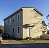
Charles Sumner Post No. 25, Grand Army of the Republic |
|
02005-07-06-0000July 6, 2005
(#05000655) |
206 S. Queen St.
39°12′25″N 76°04′00″W / 39.20682°N 76.066667°W / 39.20682; -76.066667 (Charles Sumner Post No. 25, Grand Army of the Republic) |
Chestertown |
|
| 34 |
Thornton |
Upload image |
02005-12-23-0000December 23, 2005
(#05001428) |
10618 Perkins Hill Rd.
39°16′20″N 76°01′11″W / 39.272222°N 76.019722°W / 39.272222; -76.019722 (Thornton) |
Chestertown |
|
| 35 |
Trumpington |
Upload image |
01980-11-10-0000November 10, 1980
(#80001821) |
South of Rock Hall on Maryland Route 445
39°03′47″N 76°13′39″W / 39.063056°N 76.2275°W / 39.063056; -76.2275 (Trumpington) |
Rock Hall |
|
| 36 |
Valley Cottage |
|
01983-01-11-0000January 11, 1983
(#83002955) |
Princess Stop St.
39°21′37″N 75°52′51″W / 39.360278°N 75.880833°W / 39.360278; -75.880833 (Valley Cottage) |
Georgetown |
|
| 37 |
Washington College: Middle, East and West Halls |
Upload image |
01979-09-06-0000September 6, 1979
(#79001138) |
Washington Ave., Washington College campus
39°13′02″N 76°04′05″W / 39.217222°N 76.068056°W / 39.217222; -76.068056 (Washington College: Middle, East and West Halls) |
Chestertown |
|
| 38 |
White House Farm |
Upload image |
01992-03-12-0000March 12, 1992
(#92000080) |
Maryland Route 213 southwest of its junction with Maryland Route 292
39°17′00″N 76°01′11″W / 39.283333°N 76.019722°W / 39.283333; -76.019722 (White House Farm) |
Chestertown |
|
| 39 |
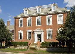
Widehall |
|
01972-10-31-0000October 31, 1972
(#72000584) |
101 Water St.
39°12′27″N 76°03′50″W / 39.2075°N 76.063889°W / 39.2075; -76.063889 (Widehall) |
Chestertown |
|
| 40 |
Woodland Hall |
Upload image |
02008-12-10-0000December 10, 2008
(#07001287) |
13111 Shallcross Wharf Road
39°20′02″N 75°56′19″W / 39.333889°N 75.938611°W / 39.333889; -75.938611 (Woodland Hall) |
Kennedyville |
|