| [4] |
Name on the Register[2] |
Image |
Date listed[5] |
Location |
Description |
|---|
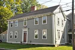
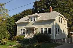
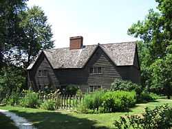
| 1 |
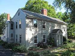
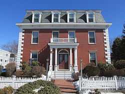
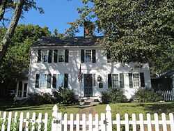
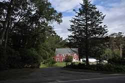
Bailey House |
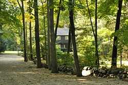
|
01980-09-17-0000September 17, 1980
(#80000457) |
40 Market St.
42°40′43″N 70°50′24″W / 42.6786°N 70.84°W / 42.6786; -70.84 (Bailey House) |
|
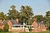
| 2 |
Brown Stocking Mill Historic District |
|
01996-08-22-0000August 22, 1996
(#96000924) |
24-32 Broadway Ave., 3-41 Brownville Ave., 10 Burleigh Ave., 3-5 Burleigh Pl., and 35-47 Topsfield Rd.
42°40′38″N 70°50′49″W / 42.6772°N 70.8469°W / 42.6772; -70.8469 (Brown Stocking Mill Historic District) |
|
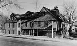
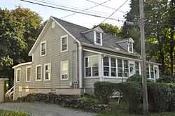
| 3 |
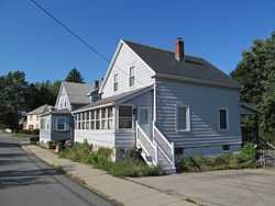
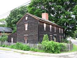
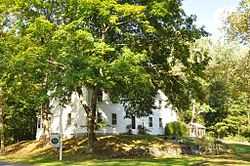
Brown's Manor |
|
01980-09-17-0000September 17, 1980
(#80000459) |
115 High St.
42°41′20″N 70°50′58″W / 42.6889°N 70.8494°W / 42.6889; -70.8494 (Brown's Manor) |
|
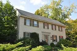
| 4 |
James Burnham House |
|
01990-03-09-0000March 9, 1990
(#90000236) |
37 Heartbreak Rd.
42°39′53″N 70°49′49″W / 42.6647°N 70.8303°W / 42.6647; -70.8303 (James Burnham House) |
|
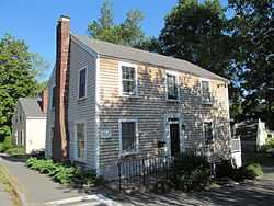
| 5 |
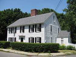
Burnham-Patch House |
|
01980-09-17-0000September 17, 1980
(#80000452) |
1 Turkey Shore Rd.
42°40′35″N 70°50′01″W / 42.6764°N 70.8336°W / 42.6764; -70.8336 (Burnham-Patch House) |
|
| 6 |
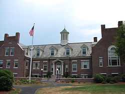
Benjamin Stickney Cable Memorial Hospital |
|
01990-05-10-0000May 10, 1990
(#90000683) |
Junction of MA 1A and MA 133
42°39′59″N 70°50′15″W / 42.6664°N 70.8375°W / 42.6664; -70.8375 (Benjamin Stickney Cable Memorial Hospital) |
|
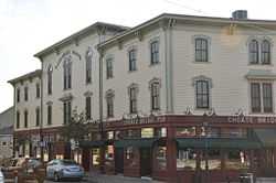
| 7 |
Caldwell Block |
|
01983-07-07-0000July 7, 1983
(#83003434) |
S. Main St.
42°40′46″N 70°50′17″W / 42.6794°N 70.8381°W / 42.6794; -70.8381 (Caldwell Block) |
|
| 8 |
Dr. John Calef House |
|
01980-09-17-0000September 17, 1980
(#80000447) |
7 Poplar St.
42°40′33″N 70°50′05″W / 42.6758°N 70.8347°W / 42.6758; -70.8347 (Dr. John Calef House) |
|
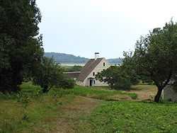
| 9 |
Castle Hill |
|
01977-12-02-0000December 2, 1977
(#77000183) |
East of Ipswich on Argilla Rd.
42°41′09″N 70°45′53″W / 42.6858°N 70.7647°W / 42.6858; -70.7647 (Castle Hill) |
|
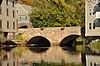
| 10 |
Choate Bridge |
|
01972-08-21-0000August 21, 1972
(#72000137) |
MA 133/1A (S. Main St.) over the Ipswich River
42°40′46″N 70°50′16″W / 42.6794°N 70.8378°W / 42.6794; -70.8378 (Choate Bridge) |
|
| 11 |
East End Historic District |
|
01980-09-17-0000September 17, 1980
(#80000461) |
East St.
42°40′57″N 70°49′54″W / 42.6825°N 70.8317°W / 42.6825; -70.8317 (East End Historic District) |
|
| 12 |
Giddings-Burnham House |
|
01990-03-09-0000March 9, 1990
(#90000233) |
37 Argilla Rd.
42°40′25″N 70°49′54″W / 42.6736°N 70.8317°W / 42.6736; -70.8317 (Giddings-Burnham House) |
|
| 13 |
Isaac Goodale House |
Upload image |
01990-03-09-0000March 9, 1990
(#90000232) |
153 Argilla Rd.
42°39′38″N 70°47′58″W / 42.6606°N 70.7994°W / 42.6606; -70.7994 (Isaac Goodale House) |
|
| 14 |
Benjamin Grant House |
|
01980-09-17-0000September 17, 1980
(#80000449) |
47 County St.
42°40′41″N 70°50′09″W / 42.6781°N 70.8358°W / 42.6781; -70.8358 (Benjamin Grant House) |
|
| 15 |
Heard-Lakeman House |
|
01980-09-17-0000September 17, 1980
(#80000441) |
2 Turkey Shore Rd.
42°40′35″N 70°50′03″W / 42.6764°N 70.8342°W / 42.6764; -70.8342 (Heard-Lakeman House) |
|
| 16 |
High Street Historic District |
|
01980-09-17-0000September 17, 1980
(#80000454) |
High St.
42°41′07″N 70°50′28″W / 42.6853°N 70.8411°W / 42.6853; -70.8411 (High Street Historic District) |
|
| 17 |
House on Labor-in-Vain Road |
Upload image |
01990-03-09-0000March 9, 1990
(#90000234) |
Labor in Vain Rd.
42°40′40″N 70°48′22″W / 42.6778°N 70.8061°W / 42.6778; -70.8061 (House on Labor-in-Vain Road) |
|
| 18 |
Howe Barn |
|
01990-03-09-0000March 9, 1990
(#90000230) |
421 Linebrook Rd.[6]
42°40′38″N 70°56′07″W / 42.6772°N 70.9353°W / 42.6772; -70.9353 (Howe Barn) |
Listed at 403 Linebrook Rd; this is a 17th century barn that was converted to house in 1948.
|
| 19 |
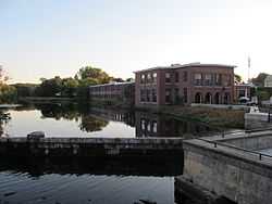
Ipswich Mills Historic District |
|
01996-08-22-0000August 22, 1996
(#96000923) |
Roughly bounded by Union St., Boston and Maine railroad tracks, and the Ipswich River
42°40′33″N 70°50′24″W / 42.6758°N 70.84°W / 42.6758; -70.84 (Ipswich Mills Historic District) |
|
| 20 |
Thomas Low House |
|
01990-03-09-0000March 9, 1990
(#90000237) |
36 Heartbreak Rd.
42°39′49″N 70°49′43″W / 42.6636°N 70.8286°W / 42.6636; -70.8286 (Thomas Low House) |
|
| 21 |
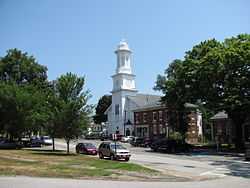
Meetinghouse Green Historic District |
|
01980-09-17-0000September 17, 1980
(#80000464) |
N. Main St.
42°40′53″N 70°50′11″W / 42.6814°N 70.8364°W / 42.6814; -70.8364 (Meetinghouse Green Historic District) |
|
| 22 |
Merrifield House |
|
01980-09-17-0000September 17, 1980
(#80000469) |
7 Woods Lane
42°40′38″N 70°49′52″W / 42.6772°N 70.8311°W / 42.6772; -70.8311 (Merrifield House) |
|
| 23 |
Paine-Dodge House |
|
01990-03-09-0000March 9, 1990
(#90000231) |
49 Jeffrey's Neck Rd.
42°41′36″N 70°49′00″W / 42.6933°N 70.8167°W / 42.6933; -70.8167 (Paine-Dodge House) |
On The Trustees of Reservations Greenwood Farm property.
|
| 24 |
Ross Tavern |
|
01990-03-09-0000March 9, 1990
(#90000235) |
52 Jeffrey's Neck Rd.
42°41′53″N 70°49′45″W / 42.6981°N 70.8292°W / 42.6981; -70.8292 (Ross Tavern) |
|
| 25 |
Nathaniel Rust Mansion |
|
01980-09-17-0000September 17, 1980
(#80000440) |
83 County St.
42°40′21″N 70°50′15″W / 42.6725°N 70.8375°W / 42.6725; -70.8375 (Nathaniel Rust Mansion) |
|
| 26 |
Smith House |
Upload image |
01990-03-09-0000March 9, 1990
(#90000238) |
142 Argilla Rd.
42°40′16″N 70°47′43″W / 42.6711°N 70.7953°W / 42.6711; -70.7953 (Smith House) |
|
| 27 |
South Green Historic District |
|
01980-09-17-0000September 17, 1980
(#80000471) |
MA 1A
42°40′32″N 70°50′13″W / 42.6756°N 70.8369°W / 42.6756; -70.8369 (South Green Historic District) |
|
| 28 |
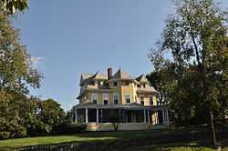
Turner Hill |
|
01982-11-26-0000November 26, 1982
(#82000483) |
315 Topsfield Rd.
42°39′48″N 70°52′59″W / 42.6633°N 70.8831°W / 42.6633; -70.8831 (Turner Hill) |
|
| 29 |
Wade House |
|
01980-09-17-0000September 17, 1980
(#80000467) |
5 Woods Lane
42°40′35″N 70°49′53″W / 42.6764°N 70.8314°W / 42.6764; -70.8314 (Wade House) |
|
| 30 |
John Whipple House |
|
01966-10-15-0000October 15, 1966
(#66000791) |
53 S. Main St.
42°40′34″N 70°50′11″W / 42.6761°N 70.8364°W / 42.6761; -70.8364 (John Whipple House) |
|
| 31 |
Shoreborne Wilson House |
|
01980-09-17-0000September 17, 1980
(#80000456) |
4 S. Main St.
42°40′44″N 70°50′14″W / 42.6789°N 70.8372°W / 42.6789; -70.8372 (Shoreborne Wilson House) |
|
.jpg)
.jpg)