National Register of Historic Places listings in Hays County, Texas
List of Registered Historic Places in Hays County, Texas
This is intended to be a complete list of properties and districts listed on the National Register of Historic Places in Hays County, Texas. The locations of National Register properties and districts (at least for all showing latitude and longitude coordinates below) may be seen in a Google map by clicking on "Map of all coordinates".[1]
- This National Park Service list is complete through NPS recent listings posted May 1, 2015.[2]
| [3] | Name on the Register[4] | Image | Date listed[5] | Location | City or town | Description |
|---|---|---|---|---|---|---|
| 1 | Barber House | 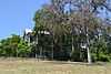 |
(#83004489) |
1000 Burleson St. 29°52′45″N 97°57′13″W / 29.87904°N 97.95365°W |
San Marcos | |
| 2 | Belger-Cahill Lime Kiln | 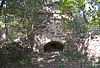 |
(#83004490) |
Lime Kiln Rd. 29°53′59″N 97°55′35″W / 29.899722°N 97.926389°W |
San Marcos | |
| 3 | Belvin Street Historic District | 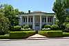 |
(#83003792) |
700, 800, 900 blocks of Belvin St., and 227 Mitchell St. 29°52′44″N 97°57′03″W / 29.878889°N 97.950833°W |
San Marcos | |
| 4 | Bunton Branch Bridge | 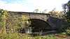 |
(#02000086) |
Cty. Rd. 210, approx. 0.2 mi (0.32 km). NW of jct. with IH-35 at Bunton Overpass 30°01′05″N 97°51′31″W / 30.018056°N 97.858611°W |
Kyle | |
| 5 | Burleson-Knispel House | Upload image | (#79002975) |
1.5 mi (2.4 km). N of San Marcos on Lime Kiln Rd 29°54′43″N 97°55′43″W / 29.911944°N 97.928611°W |
San Marcos | |
| 6 | Caldwell House |  |
(#83004491) |
619 Maury St. 29°53′00″N 97°57′05″W / 29.883333°N 97.951389°W |
San Marcos | |
| 7 | Camp Ben McCulloch |  |
(#04001151) |
18301 Ranch Rd. 1826 30°07′45″N 98°00′52″W / 30.129167°N 98.014444°W |
Driftwood | |
| 8 | Cape House |  |
(#83004492) |
316 W. Hopkins St. 29°52′59″N 97°56′40″W / 29.8830°N 97.9445°W |
San Marcos | |
| 9 | Cemetery Chapel, San Marcos Cemetery |  |
(#83003793) |
TX 12 29°53′12″N 97°57′27″W / 29.88676°N 97.9576°W |
San Marcos | |
| 10 | Cen-Tex Wool Mill Historic District | Upload image | (#05000520) |
101 Uhland Rd. 29°54′02″N 97°54′59″W / 29.900556°N 97.916389°W |
San Marcos | |
| 11 | Cock House | 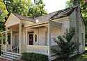 |
(#73001966) |
400 E. Hopkins St. 29°53′00″N 97°56′14″W / 29.88335°N 97.93725°W |
San Marcos | |
| 12 | John R. Dobie House |  |
(#92001024) |
282 Old Kyle Rd. 29°59′48″N 98°05′34″W / 29.996667°N 98.092778°W |
Wimberley | |
| 13 | Cora Jackman Donalson House | 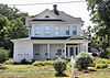 |
(#10000864) |
200 S. Sledge St. 29°59′18″N 97°52′47″W / 29.9883°N 97.8798°W |
Kyle | Rural Properties of Hays County, Texas MPS |
| 14 | Downtown Buda Historic District | 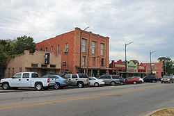 |
(#03001126) |
Roughly bounded by Elm St., Main St., China St., and Austin St. 30°04′50″N 97°50′35″W / 30.080556°N 97.843056°W |
Buda | |
| 15 | Dripping Springs Downtown Historic District | 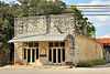 |
(#13000504) |
100-500 blk. Mercer, 100 blk. Wallace, 100 blk. San Marcos & 101 College Sts., 101-103 Old Fitzhugh Rd. 30°11′34″N 98°05′21″W / 30.19281°N 98.0892°W |
Dripping Springs | |
| 16 | Episcopalian Rectory | 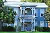 |
(#83004493) |
225 W. Hopkins St. 29°52′57″N 97°56′37″W / 29.8826°N 97.9436°W |
San Marcos | |
| 17 | Farmers Union Gin Company | 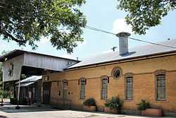 |
(#83004494) |
120 Grove St. 29°52′33″N 97°56′25″W / 29.875833°N 97.940278°W |
San Marcos | |
| 18 | Fire Station and City Hall |  |
(#83004495) |
224 N. Guadalupe St. 29°53′02″N 97°56′28″W / 29.883889°N 97.941111°W |
San Marcos | |
| 19 | First United Methodist Church | 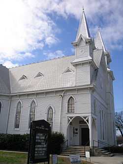 |
(#74002269) |
129 W. Hutchison 29°53′02″N 97°56′34″W / 29.883889°N 97.942778°W |
San Marcos | |
| 20 | Fisher Hall | Upload image | (#83004496) |
1132 Belvin St. 29°52′35″N 97°57′16″W / 29.876389°N 97.954444°W |
San Marcos | Destroyed by fire in 2007[6] |
| 21 | Fort Street Presbyterian Church | 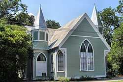 |
(#84001860) |
516 W. Hopkins St. 29°52′55″N 97°56′48″W / 29.8819°N 97.9467°W |
San Marcos | |
| 22 | Harry Freeman Site | Upload image | (#78002953) |
Address Restricted |
San Marcos | |
| 23 | Goforth-Harris House |  |
(#83004497) |
401 Comanche St. 29°53′06″N 97°56′40″W / 29.885°N 97.944444°W |
San Marcos | |
| 24 | Isham Jones Good Homestead | Upload image | (#04000896) |
13401 Evergreen Way 30°10′09″N 97°57′43″W / 30.169167°N 97.961944°W |
Austin | |
| 25 | Green and Faris Buildings |  |
(#83004498) |
136-144 E. San Antonio St. 29°52′56″N 97°56′25″W / 29.8821°N 97.9402°W |
San Marcos | |
| 26 | Hardy-Williams Building |  |
(#83004499) |
127 E. Hopkins St. 29°53′00″N 97°56′27″W / 29.8833°N 97.9407°W |
San Marcos | |
| 27 | Hays County Courthouse | 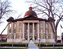 |
(#80004134) |
Public Sq. 29°52′56″N 97°56′25″W / 29.882222°N 97.940278°W |
San Marcos | |
| 28 | Hays County Courthouse Historic District |  |
(#92001233) |
Roughly bounded by the alleys behind N. Guadalupe, E. Hopkins, N. LBJ and E. San Antonio Sts. 29°52′57″N 97°56′25″W / 29.8825°N 97.940278°W |
San Marcos | |
| 29 | Hays County Jail | 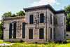 |
(#83004500) |
170 S Fredericksburg St. 29°52′50″N 97°56′33″W / 29.88042°N 97.9424°W |
San Marcos | |
| 30 | Heard House | 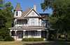 |
(#83004501) |
620 W. San Antonio St. 29°52′46″N 97°56′48″W / 29.879444°N 97.946667°W |
San Marcos | |
| 31 | Augusta Hofheinz House | 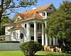 |
(#83004502) |
1104 W. Hopkins St. 29°52′35″N 97°57′10″W / 29.8764°N 97.95275°W |
San Marcos | |
| 32 | Walter Hofheinz House | 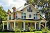 |
(#83003794) |
819 W. Hopkins St. 29°52′42″N 97°57′00″W / 29.87835°N 97.94993°W |
San Marcos | |
| 33 | Hutchison House |  |
(#83004503) |
LBJ Dr. and University St. 29°53′08″N 97°56′25″W / 29.88565°N 97.9403°W |
San Marcos | |
| 34 | Johnson House |  |
(#83004504) |
1030 Belvin St. 29°52′37″N 97°57′12″W / 29.876944°N 97.953333°W |
San Marcos | |
| 35 | Kone-Cliett House |  |
(#83003795) |
724 Burleson St. 29°52′52″N 97°57′05″W / 29.88116°N 97.9513°W |
San Marcos | |
| 36 | Kyle City Hall |  |
(#02000528) |
109 Burleson Rd. 29°59′18″N 97°52′37″W / 29.988333°N 97.876944°W |
Kyle | |
| 37 | Claiborne Kyle Log House | 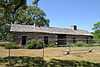 |
(#81000630) |
SW of Kyle 29°57′55″N 97°54′08″W / 29.965278°N 97.902222°W |
Kyle vicinity | |
| 38 | James C. Lane House | 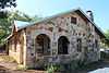 |
(#10000961) |
306 Wimberley Square 29°59′43″N 98°05′51″W / 29.995278°N 98.0975°W |
Wimberley | |
| 39 | Main Building, Southwest Texas Normal School | 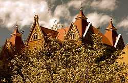 |
(#83004505) |
Old Main St., Texas State University 29°53′21″N 97°56′19″W / 29.889167°N 97.938611°W |
San Marcos | 1903 Victorian Gothic building designed by Edward Northcraft; first building of the Southwest Texas State Normal School (now known as Texas State University)[7] |
| 40 | McKie-Bass Building |  |
(#83003797) |
111 N. Guadalupe St. 29°52′57″N 97°56′29″W / 29.8825°N 97.9415°W |
San Marcos | |
| 41 | Michaelis Ranch | |
(#02001212) |
3600 FM 150 West 30°01′42″N 97°55′24″W / 30.0284°N 97.923217°W |
Kyle | |
| 42 | Moore Grocery Company | 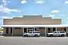 |
(#83004506) |
101 S. Edward Gary St. 29°52′56″N 97°56′18″W / 29.8821°N 97.9384°W |
San Marcos | |
| 43 | Ruskin C. Norman Site (41 HY 86) | Upload image | (#78002954) |
Address Restricted |
San Marcos | |
| 44 | Onion Creek Post Office and Stagecoach House |  |
(#02001211) |
109 N. Loop 4 30°05′23″N 97°50′13″W / 30.089722°N 97.836944°W |
Buda | |
| 45 | Pettey House |  |
(#08000541) |
714 Burleson St. 29°52′53″N 97°57′03″W / 29.8813°N 97.9509°W |
San Marcos | |
| 46 | Katherine Anne Porter House |  |
(#04000893) |
508 W. Center St. 29°59′22″N 97°52′49″W / 29.989444°N 97.880278°W |
Kyle | |
| 47 | Dr. Joseph M. and Sarah Pound Farmstead |  |
(#95000929) |
Ranch Rd. 12 N. 30°12′02″N 98°04′50″W / 30.200556°N 98.080556°W |
Dripping Springs | |
| 48 | Ragsdale-Jackman-Yarbough House |  |
(#83004507) |
621 W. San Antonio St. 29°52′45″N 97°56′47″W / 29.8791°N 97.9464°W |
San Marcos | |
| 49 | Rylander-Kyle House |  |
(#83004508) |
711 W. San Antonio St. 29°52′43″N 97°56′49″W / 29.8787°N 97.9470°W |
San Marcos | |
| 50 | San Marcos Milling Company |  |
(#83003799) |
Nicola Alley 29°52′33″N 97°56′18″W / 29.875833°N 97.938333°W |
San Marcos | |
| 51 | San Marcos Telephone Company |  |
(#83004509) |
138 W. San Antonio St. 29°52′56″N 97°56′32″W / 29.882222°N 97.942361°W |
San Marcos | |
| 52 | Simon Building |  |
(#83004510) |
124-126 W. Hopkins St. 29°52′59″N 97°56′32″W / 29.8831°N 97.9422°W |
San Marcos | |
| 53 | Smith House |  |
(#83004511) |
322 Scott St. 29°52′53″N 97°56′59″W / 29.88143°N 97.94984°W |
San Marcos | |
| 54 | Williams-Tarbutton House |  |
(#83004512) |
626 Lindsey St. 29°52′57″N 97°57′04″W / 29.8826°N 97.9511°W |
San Marcos | |
| 55 | Winters-Wimberley House |  |
(#02000527) |
14070 Ranch Road 12 29°59′53″N 98°05′54″W / 29.998056°N 98.098333°W |
Wimberley |
Former listings
| [3] | Name on the Register | Image | Date listed | Date removed | Location | City or town | Summary |
|---|---|---|---|---|---|---|---|
| 1 | Negro School | Upload image | (#84001868) | Comal and Endicott Sts. |
San Marcos |
See also
| Wikimedia Commons has media related to National Register of Historic Places in Hays County, Texas. |
References
- ↑ The latitude and longitude information provided in this table was derived originally from the National Register Information System, which has been found to be fairly accurate for about 99% of listings. For about 1% of NRIS original coordinates, experience has shown that one or both coordinates are typos or otherwise extremely far off; some corrections may have been made. A more subtle problem causes many locations to be off by up to 150 yards, depending on location in the country: most NRIS coordinates were derived from tracing out latitude and longitudes off of USGS topographical quadrant maps created under the North American Datum of 1927, which differs from the current, highly accurate WGS84 GPS system used by most on-line maps. Chicago is about right, but NRIS longitudes in Washington are higher by about 4.5 seconds, and are lower by about 2.0 seconds in Maine. Latitudes differ by about 1.0 second in Florida. Some locations in this table may have been corrected to current GPS standards.
- ↑ "National Register of Historic Places: Weekly List Actions". National Park Service, United States Department of the Interior. Retrieved on May 1, 2015.
- ↑ 3.0 3.1 Numbers represent an ordering by significant words. Various colorings, defined here, differentiate National Historic Landmarks and historic districts from other NRHP buildings, structures, sites or objects.
- ↑ "National Register Information System". National Register of Historic Places. National Park Service. 2008-04-24.
- ↑ The eight-digit number below each date is the number assigned to each location in the National Register Information System database, which can be viewed by clicking the number.
- ↑
- ↑ "Old Main". San Marcos, Texas: Texas State University. Retrieved September 3, 2013.
 |
Blanco County | Travis County | | |
| |
||||
| ||||
| | ||||
| Comal County | Guadalupe County | Caldwell County |
| ||||||||||||||||||||||||||