| [3] |
Name on the Register[4] |
Image |
Date listed[5] |
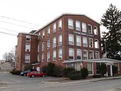
Location |
City or town |
Description |
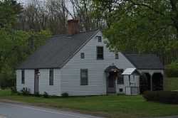
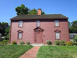
|---|
| 1 |
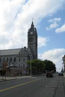
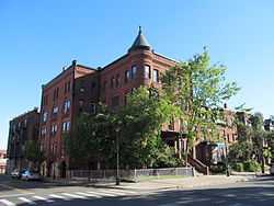
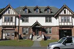
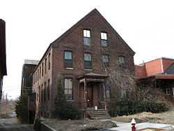
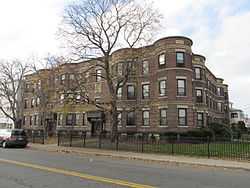
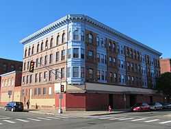
Academy Historic District |
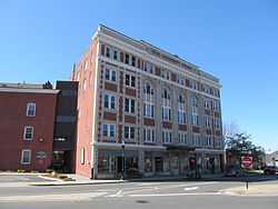
|
01979-04-20-0000April 20, 1979
(#79000351) |
Mountain Rd., Main and Faculty Sts.
42°07′29″N 72°25′56″W / 42.124722°N 72.432222°W / 42.124722; -72.432222 (Academy Historic District) |
Wilbraham |
|
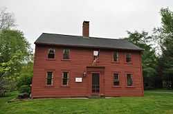
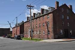
| 2 |
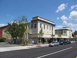
Agawam Center Historic District |
|
02001-06-21-0000June 21, 2001
(#01000670) |
24-196 Elm St.; 551-1008 Main St.
42°04′00″N 72°37′05″W / 42.066667°N 72.618056°W / 42.066667; -72.618056 (Agawam Center Historic District) |
Agawam |
|
| 3 |
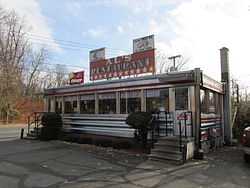
Al's Diner |
|
02000-12-14-0000December 14, 2000
(#00001482) |
14 Yelle St.
42°11′30″N 72°35′58″W / 42.191667°N 72.599444°W / 42.191667; -72.599444 (Al's Diner) |
Chicopee |
part of the Diners of Massachusetts Multiple Property Submission (MPS)
|
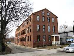
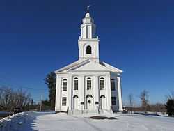
| 4 |
Ames Manufacturing Company |
|
01983-06-23-0000June 23, 1983
(#83000734) |
5-7 Springfield St.
42°08′57″N 72°36′24″W / 42.149167°N 72.606667°W / 42.149167; -72.606667 (Ames Manufacturing Company) |
Chicopee |
|
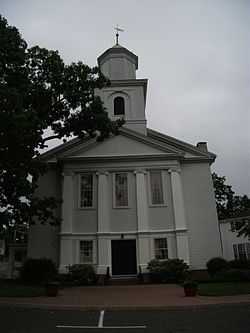
| 5 |
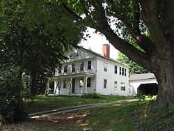
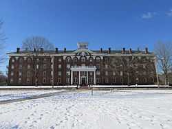
Edward Bellamy House |
|
01971-11-11-0000November 11, 1971
(#71000091) |
91-93 Church St.
42°09′21″N 72°35′04″W / 42.155833°N 72.584444°W / 42.155833; -72.584444 (Edward Bellamy House) |
Chicopee |
|
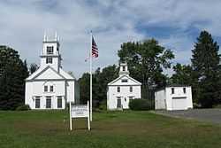
| 6 |
Brimfield Center Historic District |
|
02006-06-22-0000June 22, 2006
(#06000524) |
Main St., Brookfled, Wales, Sturbridge and Warren Rds.
42°07′29″N 72°18′32″W / 42.124722°N 72.308889°W / 42.124722; -72.308889 (Brimfield Center Historic District) |
Brimfield |
|
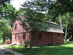
| 7 |
Thornton W. Burgess House |
|
01983-04-21-0000April 21, 1983
(#83000740) |
789 Main St.
42°03′48″N 72°24′24″W / 42.063333°N 72.406667°W / 42.063333; -72.406667 (Thornton W. Burgess House) |
Hampden |
|
| 8 |
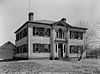
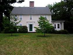
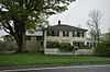
Elijah Burt House |
|
01976-04-26-0000April 26, 1976
(#76000240) |
201 Chestnut St.
42°03′15″N 72°30′54″W / 42.054167°N 72.515°W / 42.054167; -72.515 (Elijah Burt House) |
East Longmeadow |
|
| 9 |
Cabotville Common Historic District |
|
01999-05-28-0000May 28, 1999
(#99000558) |
School, Chestnut, Park and West Sts.
42°08′42″N 72°36′42″W / 42.145°N 72.611667°W / 42.145; -72.611667 (Cabotville Common Historic District) |
Chicopee |
|
| 10 |
Caledonia Building |
|
01979-07-03-0000July 3, 1979
(#79000346) |
185-193 High St.
42°12′27″N 72°36′27″W / 42.2075°N 72.6075°W / 42.2075; -72.6075 (Caledonia Building) |
Holyoke |
|
| 11 |
Carreau Block |
|
01998-08-06-0000August 6, 1998
(#98000993) |
640-642 Chicopee St.
42°11′05″N 72°36′41″W / 42.184722°N 72.611389°W / 42.184722; -72.611389 (Carreau Block) |
Chicopee |
|
| 12 |
Chester Center Historic District |
|
01988-02-25-0000February 25, 1988
(#88000161) |
Skyline Trail at intersection of Bromley and Lyman Rds.
42°17′26″N 72°55′27″W / 42.290556°N 72.924167°W / 42.290556; -72.924167 (Chester Center Historic District) |
Chester |
|
| 13 |
Chester Factory Village Historic District |
|
01989-03-16-0000March 16, 1989
(#89000145) |
Roughly bounded by Middlefield Rd., River, Main, and Maple Sts., US 20, and Williams St.
42°16′52″N 72°58′54″W / 42.281111°N 72.981667°W / 42.281111; -72.981667 (Chester Factory Village Historic District) |
Chester |
|
| 14 |
City Hall |
|
01974-07-30-0000July 30, 1974
(#74002052) |
Market Sq.
42°08′55″N 72°36′52″W / 42.148611°N 72.614444°W / 42.148611; -72.614444 (City Hall) |
Chicopee |
|
| 15 |
Josiah Day House |
|
01975-04-16-0000April 16, 1975
(#75000265) |
70 Park St.
42°06′25″N 72°37′08″W / 42.106944°N 72.618889°W / 42.106944; -72.618889 (Josiah Day House) |
West Springfield |
|
| 16 |
Joseph Dewey House |
|
02001-07-27-0000July 27, 2001
(#01000746) |
87 S. Maple St.
42°06′42″N 72°45′49″W / 42.111667°N 72.763611°W / 42.111667; -72.763611 (Joseph Dewey House) |
Westfield |
|
| 17 |
Dwight Manufacturing Company Housing District |
|
01977-06-03-0000June 3, 1977
(#77000173) |
Front, Depot, Dwight, Exchange, Chestnut Sts.
42°08′48″N 72°36′44″W / 42.146667°N 72.612222°W / 42.146667; -72.612222 (Dwight Manufacturing Company Housing District) |
Chicopee |
|
| 18 |
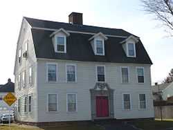
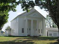
First Congregational Church of Blandford |
|
01985-10-24-0000October 24, 1985
(#85003371) |
North St.
42°10′55″N 72°55′45″W / 42.181944°N 72.929167°W / 42.181944; -72.929167 (First Congregational Church of Blandford) |
Blandford |
|
| 19 |
First Congregational Church of East Longmeadow |
|
01978-01-03-0000January 3, 1978
(#78000444) |
7 Somers Rd.
42°03′51″N 72°30′46″W / 42.064167°N 72.512778°W / 42.064167; -72.512778 (First Congregational Church of East Longmeadow) |
East Longmeadow |
|
| 20 |
Friedrich Block |
|
02002-12-05-0000December 5, 2002
(#02001473) |
449-461 Main St.
42°11′52″N 72°36′36″W / 42.197778°N 72.61°W / 42.197778; -72.61 (Friedrich Block) |
Holyoke |
|
| 21 |
Granville Center Historic District |
|
01991-11-05-0000November 5, 1991
(#91001587) |
Main Rd.
42°04′02″N 72°52′33″W / 42.067222°N 72.875833°W / 42.067222; -72.875833 (Granville Center Historic District) |
Granville |
|
| 22 |
Granville Village Historic District |
|
01991-11-05-0000November 5, 1991
(#91001588) |
Roughly, area around the junction of Maple St. and Main and Granby Rds., including part of Water St.
42°03′54″N 72°51′49″W / 42.065°N 72.863611°W / 42.065; -72.863611 (Granville Village Historic District) |
Granville |
|
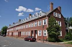
| 23 |
Hadley Falls Company Housing District |
|
01972-11-09-0000November 9, 1972
(#72000133) |
Center, N. Canal, Grover, and Lyman Sts.
42°12′30″N 72°35′00″W / 42.208333°N 72.583333°W / 42.208333; -72.583333 (Hadley Falls Company Housing District) |
Holyoke |
|
| 24 |
Hampden Park Historic District |
|
02012-09-10-0000September 10, 2012
(#12000781) |
Roughly bounded by Hampden, Chestnut, Maple, & Dwight Sts.
42°12′30″N 72°36′30″W / 42.208383°N 72.608333°W / 42.208383; -72.608333 (Hampden Park Historic District) |
Holyoke |
|
| 25 |
Holyoke Canal System |
|
01980-12-03-0000December 3, 1980
(#80000473) |
Front and South Sts. and the Connecticut River
42°12′06″N 72°36′21″W / 42.201667°N 72.605833°W / 42.201667; -72.605833 (Holyoke Canal System) |
Holyoke |
|
| 26 |
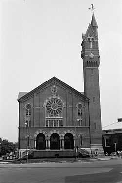
Holyoke City Hall |
|
01975-12-06-0000December 6, 1975
(#75000259) |
536 Dwight St.
42°12′23″N 72°36′28″W / 42.206389°N 72.607778°W / 42.206389; -72.607778 (Holyoke City Hall) |
Holyoke |
|
| 27 |
Laflin-Phelps Homestead |
|
02005-12-06-0000December 6, 2005
(#05001371) |
20 Depot St.
42°03′14″N 72°46′02″W / 42.053911°N 72.767186°W / 42.053911; -72.767186 (Laflin-Phelps Homestead) |
Southwick |
|
| 28 |
Landlord Fowler Tavern |
|
01982-08-11-0000August 11, 1982
(#82001914) |
171 Main St.
42°07′03″N 72°44′10″W / 42.1175°N 72.736111°W / 42.1175; -72.736111 (Landlord Fowler Tavern) |
Westfield |
|
| 29 |
Capt. Charles Leonard House |
|
01975-03-10-0000March 10, 1975
(#75000273) |
663 Main St.
42°04′14″N 72°36′53″W / 42.070556°N 72.614722°W / 42.070556; -72.614722 (Capt. Charles Leonard House) |
Agawam |
|
| 30 |
Longmeadow Historic District |
|
01982-11-12-0000November 12, 1982
(#82000490) |
Roughly Longmeadow St. from Birdie Rd. to Wheelmeadow Brook
42°02′57″N 72°34′59″W / 42.049167°N 72.583056°W / 42.049167; -72.583056 (Longmeadow Historic District) |
Longmeadow |
|
| 31 |
Longmeadow Street-North Historic District |
|
01994-10-28-0000October 28, 1994
(#94001262) |
Bounded by Longmeadow St., Springfield Town Line, Westmoreland Ave. and Colley Dr.
42°04′01″N 72°34′41″W / 42.066944°N 72.578056°W / 42.066944; -72.578056 (Longmeadow Street-North Historic District) |
Longmeadow |
|
| 32 |
Ludlow Center Historic District |
|
01988-10-21-0000October 21, 1988
(#88001999) |
Along Center, Church and Booth Sts.
42°11′31″N 72°27′35″W / 42.191944°N 72.459722°W / 42.191944; -72.459722 (Ludlow Center Historic District) |
Ludlow |
|
| 33 |
Ludlow Village Historic District |
|
01993-02-22-0000February 22, 1993
(#93000009) |
Roughly bounded by Winsor, Sewall and State Sts. and the Chicopee River, and crossing the Chicopee, above Red Bridge Rd.
42°09′55″N 72°26′32″W / 42.165278°N 72.442222°W / 42.165278; -72.442222 (Ludlow Village Historic District) |
Ludlow |
|
| 34 |
Maplewood Hotel |
|
01983-11-10-0000November 10, 1983
(#83003980) |
328-330 Maple St.
42°12′13″N 72°36′44″W / 42.203611°N 72.612222°W / 42.203611; -72.612222 (Maplewood Hotel) |
Holyoke |
|
| 35 |
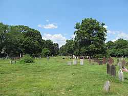
Mechanic Street Cemetery |
|
02002-06-26-0000June 26, 2002
(#02000632) |
Mechanic St.
42°07′23″N 72°44′41″W / 42.123056°N 72.744722°W / 42.123056; -72.744722 (Mechanic Street Cemetery) |
Westfield |
|
| 36 |
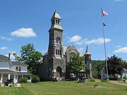
Memorial Town Hall |
|
01984-05-17-0000May 17, 1984
(#84002449) |
Main St.
42°05′51″N 72°18′48″W / 42.0975°N 72.313333°W / 42.0975; -72.313333 (Memorial Town Hall) |
Monson |
|
| 37 |
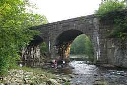
Middlefield-Becket Stone Arch Railroad Bridge District |
|
01980-04-11-0000April 11, 1980
(#80000502) |
Middlefield vicinity
42°18′44″N 73°01′10″W / 42.312222°N 73.019444°W / 42.312222; -73.019444 (Middlefield-Becket Stone Arch Railroad Bridge District) |
Chester |
Extends into Middlefield and Becket.
|
| 38 |
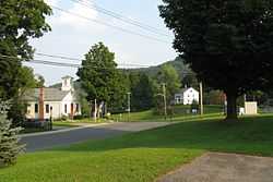
Monson Center Historic District |
|
01991-05-06-0000May 6, 1991
(#90000788) |
Main and Cushman Streets
42°05′53″N 72°18′50″W / 42.098015°N 72.313989°W / 42.098015; -72.313989 (Monson Center Historic District) |
Monson |
|
| 39 |
Monson Developmental Center |
|
01994-01-21-0000January 21, 1994
(#93001483) |
200 State Ave.
42°08′43″N 72°20′04″W / 42.145278°N 72.334444°W / 42.145278; -72.334444 (Monson Developmental Center) |
Monson |
|
| 40 |
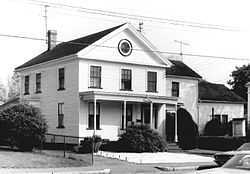
William Norcross House |
|
01984-03-29-0000March 29, 1984
(#84002450) |
14 Cushman St.
42°05′56″N 72°18′47″W / 42.098889°N 72.313056°W / 42.098889; -72.313056 (William Norcross House) |
Monson |
|
| 41 |
North Chester Historic District |
|
01996-12-06-0000December 6, 1996
(#96001465) |
Roughly bounded by E. River, Smith, and N. Chester Rds.
42°19′35″N 72°55′53″W / 42.326389°N 72.931389°W / 42.326389; -72.931389 (North Chester Historic District) |
Chester |
|
| 42 |
North High Street Historic District |
|
01986-06-26-0000June 26, 1986
(#86001376) |
High St. between Dwight and Lyman Sts.
• Boundary increase (listed 01992-12-24-0000December 24, 1992, refnum 92001725): 233--411 High St.
• Boundary increase II (listed 02008-09-12-0000September 12, 2008, refnum 08000897): 580 Dwight St., 230, 234 and 236 Maple St.
42°12′29″N 72°36′26″W / 42.208056°N 72.607222°W / 42.208056; -72.607222 (North High Street Historic District) |
Holyoke |
|
| 43 |
Octagon House |
|
01982-04-01-0000April 1, 1982
(#82004967) |
28 King St.
42°07′17″N 72°45′19″W / 42.121389°N 72.755278°W / 42.121389; -72.755278 (Octagon House) |
Westfield |
|
| 44 |
Our Mother of Sorrows Monastery and Retreat Center |
|
02002-08-30-0000August 30, 2002
(#02000904) |
110 Monastery Ave.
42°07′07″N 72°37′57″W / 42.118611°N 72.6325°W / 42.118611; -72.6325 (Our Mother of Sorrows Monastery and Retreat Center) |
West Springfield |
Now a senior housing facility.
|
| 45 |
Thomas D. Page House |
|
01988-10-25-0000October 25, 1988
(#87001782) |
105 East St.
42°09′22″N 72°34′39″W / 42.156111°N 72.5775°W / 42.156111; -72.5775 (Thomas D. Page House) |
Chicopee |
|
| 46 |
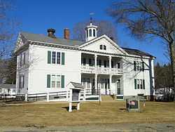
Palmer Memorial Hall |
|
01999-09-03-0000September 3, 1999
(#99001082) |
1029 Central St.
42°09′23″N 72°19′39″W / 42.156389°N 72.3275°W / 42.156389; -72.3275 (Palmer Memorial Hall) |
Palmer |
|
| 47 |
Polish National Home |
|
01980-11-14-0000November 14, 1980
(#80000475) |
136-144 Cabot St.
42°08′41″N 72°36′35″W / 42.144722°N 72.609722°W / 42.144722; -72.609722 (Polish National Home) |
Chicopee |
|
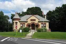
| 48 |
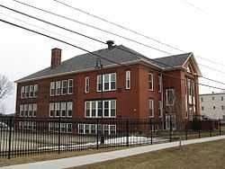
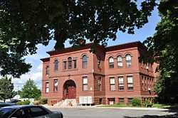
Prospect Hill School |
|
02008-11-19-0000November 19, 2008
(#08001069) |
33 Montgomery St.
42°08′03″N 72°44′46″W / 42.134167°N 72.746111°W / 42.134167; -72.746111 (Prospect Hill School) |
Westfield |
|
| 49 |
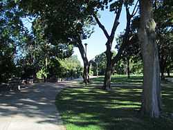
Prospect Park |
|
02004-09-10-0000September 10, 2004
(#04000931) |
Maple St., Arbor Way, and the Connecticut River
42°12′43″N 72°36′21″W / 42.211944°N 72.605833°W / 42.211944; -72.605833 (Prospect Park) |
Holyoke |
Now called Pulaski Park
|
| 50 |
Purchase-Ferre House |
|
01990-11-29-0000November 29, 1990
(#90001805) |
1289 Main St.
42°02′58″N 72°36′58″W / 42.049444°N 72.616111°W / 42.049444; -72.616111 (Purchase-Ferre House) |
Agawam |
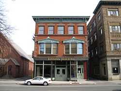
|
| 51 |
Clovis Robert Block |
|
02002-12-05-0000December 5, 2002
(#02001472) |
338-348 Main St.
42°11′59″N 72°36′28″W / 42.199722°N 72.607778°W / 42.199722; -72.607778 (Clovis Robert Block) |
Holyoke |
|
| 52 |
Russell Center Historic District |
|
01996-12-27-0000December 27, 1996
(#96001524) |
Junction of Main and Lincoln Ave.
42°11′22″N 72°51′24″W / 42.189444°N 72.856667°W / 42.189444; -72.856667 (Russell Center Historic District) |
Russell |
|
| 53 |
Sanford Whip Factory |
|
02008-12-10-0000December 10, 2008
(#08001176) |
330 Elm St.
42°07′39″N 72°44′50″W / 42.1276°N 72.7473°W / 42.1276; -72.7473 (Sanford Whip Factory) |
Westfield |
|
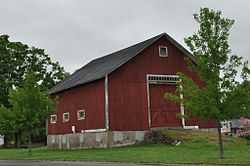
| 54 |
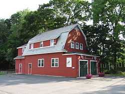
School Street Barn |
|
02012-09-10-0000September 10, 2012
(#12000782) |
551 School St.
42°04′27″N 72°35′34″W / 42.074065°N 72.592734°W / 42.074065; -72.592734 (School Street Barn) |
Agawam |
|
| 55 |
Thomas and Esther Smith House |
|
02005-06-02-0000June 2, 2005
(#05000217) |
251 North West St.
42°04′31″N 72°41′44″W / 42.075278°N 72.695556°W / 42.075278; -72.695556 (Thomas and Esther Smith House) |
Agawam |
|
| 56 |
Springfield Street Historic District |
|
01991-01-25-0000January 25, 1991
(#90002217) |
Roughly bounded by Springfield St., Gaylord St. and Fairview Ave.
42°08′38″N 72°36′14″W / 42.143889°N 72.603889°W / 42.143889; -72.603889 (Springfield Street Historic District) |
Chicopee |
|
| 57 |
State Normal Training School |
|
01983-07-07-0000July 7, 1983
(#83000769) |
Washington St.
42°07′19″N 72°45′08″W / 42.121944°N 72.752222°W / 42.121944; -72.752222 (State Normal Training School) |
Westfield |
|
| 58 |
Swetland-Pease House |
|
01980-04-09-0000April 9, 1980
(#80000505) |
Southeast of East Longmeadow at 191 Pease Rd.
42°02′38″N 72°29′41″W / 42.043889°N 72.494722°W / 42.043889; -72.494722 (Swetland-Pease House) |
East Longmeadow |
|
| 59 |
Union Station |
|
01988-06-09-0000June 9, 1988
(#88000715) |
Depot St.
42°09′20″N 72°19′47″W / 42.155556°N 72.329722°W / 42.155556; -72.329722 (Union Station) |
Palmer |
|
| 60 |
United States Whip Company Complex |
|
01983-11-29-0000November 29, 1983
(#83003983) |
24 Main St.
42°07′12″N 72°44′53″W / 42.12°N 72.748056°W / 42.12; -72.748056 (United States Whip Company Complex) |
Westfield |
|
| 61 |
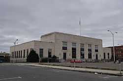
US Post Office-Holyoke Main |
|
01986-01-21-0000January 21, 1986
(#86000122) |
650 Dwight St.
42°12′29″N 72°36′38″W / 42.208056°N 72.610556°W / 42.208056; -72.610556 (US Post Office-Holyoke Main) |
Holyoke |
|
| 62 |
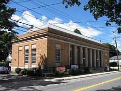
US Post Office-Palmer Main |
|
01985-12-12-0000December 12, 1985
(#85003336) |
Park and Central Sts.
42°09′28″N 72°19′39″W / 42.157778°N 72.3275°W / 42.157778; -72.3275 (US Post Office-Palmer Main) |
Palmer |
|
| 63 |
Valentine School |
|
01983-09-16-0000September 16, 1983
(#83000774) |
Grape and Elm Sts.
42°08′46″N 72°36′12″W / 42.146111°N 72.603333°W / 42.146111; -72.603333 (Valentine School) |
Chicopee |
|
| 64 |
H. M. Van Deusen Whip Company |
|
01987-02-18-0000February 18, 1987
(#87000037) |
42 Arnold St.
42°07′22″N 72°45′03″W / 42.122778°N 72.750833°W / 42.122778; -72.750833 (H. M. Van Deusen Whip Company) |
Westfield |
|
| 65 |
West Granville Historic District |
|
01991-11-05-0000November 5, 1991
(#91001589) |
Roughly, Main Rd. from west of Beach Hill Rd. to South Ln. No. 2
42°04′39″N 72°56′18″W / 42.0775°N 72.938333°W / 42.0775; -72.938333 (West Granville Historic District) |
Granville |
|
| 66 |
Westfield Center Historic District |
|
02013-06-25-0000June 25, 2013
(#13000441) |
0-362 Elm Street, 2-86 Broad Street, 0-83 Court Street, 2-24 Main Street, 0-71 North Elm Street, Chestnut Street on the west, West Silver Street on the South , Union Street on the north
42°07′22″N 72°44′55″W / 42.122711°N 72.748481°W / 42.122711; -72.748481 (Westfield Center Historic District) |
Westfield |
Expansion and rename of Westfield Center Commercial Historic District (#08000506)
|
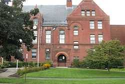
| 67 |
Westfield Municipal Building |
|
01978-03-08-0000March 8, 1978
(#78000449) |
59 Court St.
42°07′12″N 72°45′01″W / 42.12005°N 72.7504°W / 42.12005; -72.7504 (Westfield Municipal Building) |
Westfield |
430 buildings, 39 sites, 14 structures, and 19 objects.
|
| 68 |
Westfield Whip Manufacturing Company |
|
01985-10-17-0000October 17, 1985
(#85003233) |
360 Elm St.
42°07′41″N 72°44′50″W / 42.128056°N 72.747222°W / 42.128056; -72.747222 (Westfield Whip Manufacturing Company) |
Westfield |
|
| 69 |
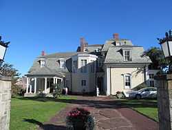
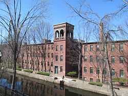
Wistariahurst |
|
01973-04-23-0000April 23, 1973
(#73000295) |
238 Cabot St.
42°12′17″N 72°37′04″W / 42.204722°N 72.617778°W / 42.204722; -72.617778 (Wistariahurst) |
Holyoke |
|


.jpg)