| [3] |
Name on the Register[4] |
Image |
Date listed[5] |
Location |
City or town |
Description |
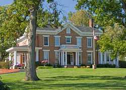
|---|
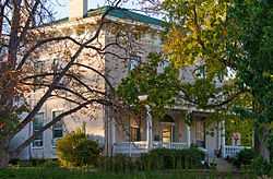
| 1 |
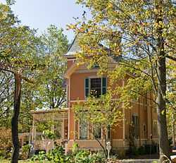
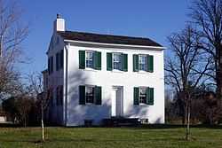
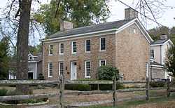
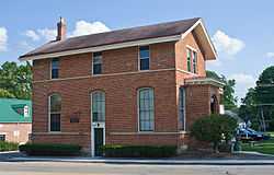
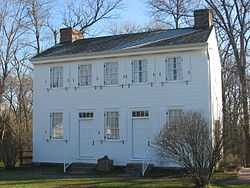
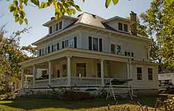
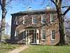
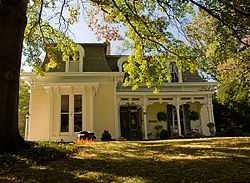
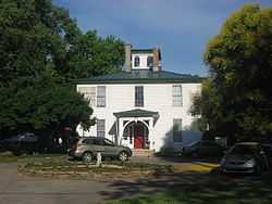
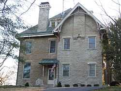
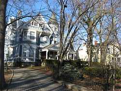
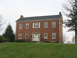
Joseph W. Baldwin House |
|
01986-08-25-0000August 25, 1986
(#86001628) |
217 Springfield Pike
39°13′18″N 84°28′25″W / 39.221667°N 84.473611°W / 39.221667; -84.473611 (Joseph W. Baldwin House) |
Wyoming |
|
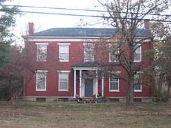
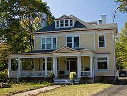
| 2 |
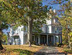
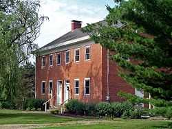
James Baxter House |
|
01994-07-22-0000July 22, 1994
(#94000774) |
2930 Fair Acres Dr.
39°11′33″N 84°25′57″W / 39.192500°N 84.432500°W / 39.192500; -84.432500 (James Baxter House) |
Amberley |
|
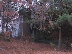
| 3 |
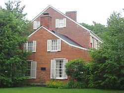
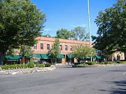
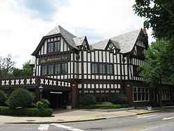
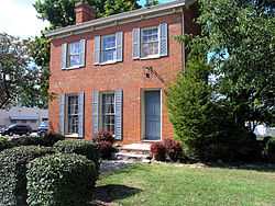
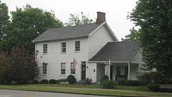
Becker House |
|
01974-07-18-0000July 18, 1974
(#74001522) |
179 W. Crescentville Rd.
39°18′06″N 84°28′28″W / 39.301667°N 84.474444°W / 39.301667; -84.474444 (Becker House) |
Springdale |
|
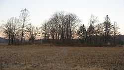
| 4 |
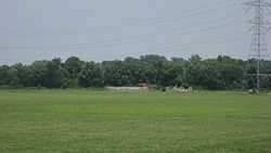
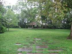
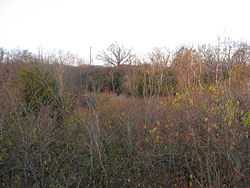
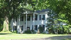
Benham Mound |
|
01974-07-30-0000July 30, 1974
(#74001508) |
Section 30 of the original Columbia Township, off Montgomery Rd.[6]
39°11′38″N 84°25′31″W / 39.193889°N 84.425278°W / 39.193889; -84.425278 (Benham Mound) |
Amberley |
|
| 5 |
George Bennett House |
|
01975-05-29-0000May 29, 1975
(#75001426) |
10281 Harrison Pike
39°14′45″N 84°46′58″W / 39.245833°N 84.782778°W / 39.245833; -84.782778 (George Bennett House) |
Harrison |
|
| 6 |
Blair House |
|
01982-11-30-0000November 30, 1982
(#82001466) |
7844 Remington Rd (at West St.)
39°13′42″N 84°21′34″W / 39.228333°N 84.359444°W / 39.228333; -84.359444 (Blair House) |
Montgomery |
|
| 7 |
Cyrus Broadwell House |
|
01975-05-29-0000May 29, 1975
(#75001433) |
Northeast of Newtown at 3882 Mount Carmel Rd.
39°07′58″N 84°18′35″W / 39.132778°N 84.309722°W / 39.132778; -84.309722 (Cyrus Broadwell House) |
Anderson Township |
|
| 8 |
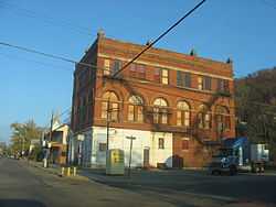
Jacob Bromwell House |
|
01986-08-25-0000August 25, 1986
(#86001629) |
69 Mt. Pleasant Ave.
39°13′24″N 84°28′47″W / 39.223333°N 84.479722°W / 39.223333; -84.479722 (Jacob Bromwell House) |
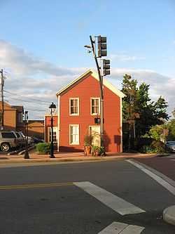
Wyoming |
|
| 9 |
Brown-Gorman Farm |
|
02012-08-01-0000August 1, 2012
(#12000463) |
10052 Reading Rd.
39°14′42″N 84°25′28″W / 39.245000°N 84.424444°W / 39.245000; -84.424444 (Brown-Gorman Farm) |
Evendale |
|
| 10 |
Burchenal Mound |
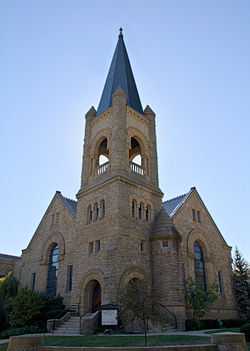
|
01975-05-29-0000May 29, 1975
(#75001437) |
West of benchmark 659 above Mill Creek[7]:84
39°15′38″N 84°28′23″W / 39.260694°N 84.473056°W / 39.260694; -84.473056 (Burchenal Mound) |
Woodlawn |
|
| 11 |
Wesley Butler Archeological District |
|
01976-07-24-0000July 24, 1976
(#76001446) |
Off U.S. Route 50 southwest of Elizabethtown[7]:121
39°09′16″N 84°48′48″W / 39.154444°N 84.813333°W / 39.154444; -84.813333 (Wesley Butler Archeological District) |
Whitewater Township |
|
| 12 |
Hugh Campbell House |
|
01976-11-07-0000November 7, 1976
(#76001448) |
332 Weathervane Rd.
39°15′03″N 84°48′43″W / 39.250833°N 84.811944°W / 39.250833; -84.811944 (Hugh Campbell House) |
Harrison |
|
| 13 |
Cheviot Fieldhouse |
|
02009-04-01-0000April 1, 2009
(#09000170) |
3729 Robb Ave.
39°09′22″N 84°37′12″W / 39.156111°N 84.620000°W / 39.156111; -84.620000 (Cheviot Fieldhouse) |
Cheviot |
|
| 14 |
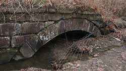
Cincinnati and Whitewater Canal Tunnel |
|
02001-05-25-0000May 25, 2001
(#01000562) |
Parallel to Miami Ave., junction of Wamsley and Miami Ave.
39°09′18″N 84°44′58″W / 39.155000°N 84.749444°W / 39.155000; -84.749444 (Cincinnati and Whitewater Canal Tunnel) |
Cleves and North Bend |
|
| 15 |
Clough Creek and Sand Ridge Archeological District |
|
01974-10-01-0000October 1, 1974
(#74001509) |
Along the ridge to the west of the Union Bridge[8]
39°06′46″N 84°23′48″W / 39.112778°N 84.396667°W / 39.112778; -84.396667 (Clough Creek and Sand Ridge Archeological District) |
Anderson Township |
|
| 16 |
Clovernook |
|
01973-06-18-0000June 18, 1973
(#73001454) |
7000 Hamilton Ave.
39°13′12″N 84°32′56″W / 39.22°N 84.548889°W / 39.22; -84.548889 (Clovernook) |
North College Hill |
|
| 17 |
Colerain Works Archeological District |
|
01976-06-18-0000June 18, 1976
(#76001445) |
Eastern bank of the Great Miami River, north of the site of Fort Dunlap[9]
39°17′53″N 84°39′36″W / 39.298°N 84.66°W / 39.298; -84.66 (Colerain Works Archeological District) |
Colerain Township |
|
| 18 |
Conrad Mound Archeological Site |
|
01975-06-20-0000June 20, 1975
(#75001420) |
Off Rittenhouse Rd., southwest of Cleves[10]
39°08′49″N 84°46′20″W / 39.146944°N 84.772222°W / 39.146944; -84.772222 (Conrad Mound Archeological Site) |
Miami Township |
|
| 19 |
Dravo Gravel Site |
|
01978-12-22-0000December 22, 1978
(#78002083) |
On a bluff above the Great Miami River, north of Cleves[11]
39°11′28″N 84°45′00″W / 39.191111°N 84.75°W / 39.191111; -84.75 (Dravo Gravel Site) |
Miami Township |
|
| 20 |
Dunlap Archeological District |
|
01975-10-21-0000October 21, 1975
(#75001421) |
Eastern bank of the Great Miami River, near the junction of Dunlap and Great Miami River Rds.[12]
39°17′36″N 84°39′12″W / 39.293333°N 84.653333°W / 39.293333; -84.653333 (Dunlap Archeological District) |
Colerain Township |
Also known as Fort Dunlap[4]
|
| 21 |
William Edwards Farmhouse |
|
01989-10-04-0000October 4, 1989
(#89001455) |
3851 Edwards Rd.
39°07′41″N 84°20′30″W / 39.128056°N 84.341667°W / 39.128056; -84.341667 (William Edwards Farmhouse) |
Newtown |
|
| 22 |
Eighteen Mile House |
|
01975-10-10-0000October 10, 1975
(#75001427) |
2 mi (3.2 km) southeast of Harrison at Harrison Pike and Patriot Dr.
39°14′18″N 84°46′06″W / 39.238333°N 84.768333°W / 39.238333; -84.768333 (Eighteen Mile House) |
Harrison Township |
|
| 23 |
Elliott House |
|
01976-10-29-0000October 29, 1976
(#76001451) |
9352 Given Rd., south of Remington
39°13′23″N 84°19′16″W / 39.223056°N 84.321111°W / 39.223056; -84.321111 (Elliott House) |
Indian Hill |
|
| 24 |
Charles Fay House |
|
01986-08-25-0000August 25, 1986
(#86001630) |
325 Reily Rd.
39°13′41″N 84°28′46″W / 39.228056°N 84.479444°W / 39.228056; -84.479444 (Charles Fay House) |
Wyoming |
|
| 25 |
Eliphalet Ferris House |
|
01975-05-29-0000May 29, 1975
(#75001431) |
3915 Plainville Rd.
39°08′50″N 84°22′42″W / 39.147222°N 84.378333°W / 39.147222; -84.378333 (Eliphalet Ferris House) |
Mariemont |
|
| 26 |
Joseph Ferris House |
|
01975-06-30-0000June 30, 1975
(#75001417) |
5729 Dragon Way
39°08′28″N 84°23′31″W / 39.141111°N 84.391944°W / 39.141111; -84.391944 (Joseph Ferris House) |
Fairfax |
|
| 27 |
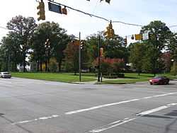
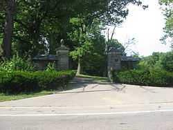
Glendale Historic District |
|
01976-07-20-0000July 20, 1976
(#76001447) |
State Route 747
39°16′17″N 84°27′49″W / 39.271389°N 84.463611°W / 39.271389; -84.463611 (Glendale Historic District) |
Glendale |
|
| 28 |
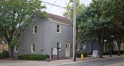
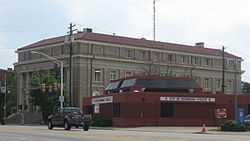
Glendale Police Station |
|
01975-03-27-0000March 27, 1975
(#75001425) |
305 E. Sharon Ave.
39°16′18″N 84°27′30″W / 39.271667°N 84.458333°W / 39.271667; -84.458333 (Glendale Police Station) |
Glendale |
|
| 29 |
Greenhills Historic District |
|
01989-01-12-0000January 12, 1989
(#88003066) |
Roughly Damon Rd., Enfield St., Farragut Rd., Flanders Ln., Winton Rd., Andover Rd., Burley Cir., and Cromwell Rd.
39°15′50″N 84°31′28″W / 39.263889°N 84.524444°W / 39.263889; -84.524444 (Greenhills Historic District) |
Greenhills |
|
| 30 |
Hahn Field Archeological District |
|
01974-10-29-0000October 29, 1974
(#74001519) |
Above the Little Miami River in Clear Creek Park, 0.4 miles (0.64 km) north of State Route 32[13]
39°07′38″N 84°22′47″W / 39.127222°N 84.379722°W / 39.127222; -84.379722 (Hahn Field Archeological District) |
Anderson Township |
|
| 31 |
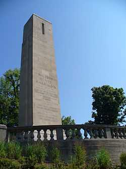
William Henry Harrison Tomb State Memorial |
|
01970-11-10-0000November 10, 1970
(#70000499) |
Mount Nebo on State Route 128
39°09′06″N 84°45′08″W / 39.151667°N 84.752222°W / 39.151667; -84.752222 (William Henry Harrison Tomb State Memorial) |
North Bend |
|
| 32 |
Harrison-Landers House |
|
01975-05-29-0000May 29, 1975
(#75001434) |
3881 Newtown Rd., north of Newtown
39°08′03″N 84°21′18″W / 39.134167°N 84.355°W / 39.134167; -84.355 (Harrison-Landers House) |
Anderson Township |
|
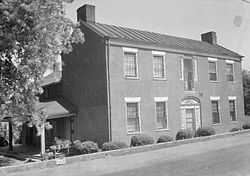
| 33 |
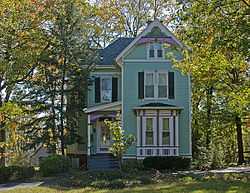
Elmer Hess House |
|
01986-08-25-0000August 25, 1986
(#86001633) |
333 Springfield Pike
39°13′27″N 84°28′24″W / 39.224167°N 84.473333°W / 39.224167; -84.473333 (Elmer Hess House) |
Wyoming |
|
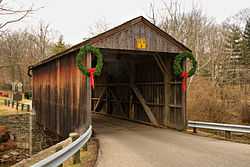
| 34 |
Jediah Hill Covered Bridge |
|
01973-03-28-0000March 28, 1973
(#73001460) |
7 mi (11 km) north of Cincinnati off U.S. Route 127 on Covered Bridge Rd.
39°15′08″N 84°32′44″W / 39.25233°N 84.54546°W / 39.25233; -84.54546 (Jediah Hill Covered Bridge) |
Springfield Township |
|
| 35 |
Jefferson Schoolhouse |
|
01976-03-17-0000March 17, 1976
(#76001450) |
Indian Hill and Drake Rds.
39°09′40″N 84°20′49″W / 39.161111°N 84.346944°W / 39.161111; -84.346944 (Jefferson Schoolhouse) |
Indian Hill |
|
| 36 |
Jehu John House |
|
01975-10-31-0000October 31, 1975
(#75001428) |
East of Harrison on Stone Dr.
39°15′28″N 84°47′48″W / 39.257778°N 84.796667°W / 39.257778; -84.796667 (Jehu John House) |
Harrison |
|
| 37 |
Josiah Kirby House |
|
01986-08-25-0000August 25, 1986
(#86001634) |
65 Oliver Rd.
39°13′54″N 84°28′27″W / 39.231667°N 84.474167°W / 39.231667; -84.474167 (Josiah Kirby House) |
Wyoming |
|
| 38 |
Gretchen Kroger Barnes Graf House |
|
02011-02-04-0000February 4, 2011
(#10001213) |
9575 Cunningham Rd.
39°11′56″N 84°18′18″W / 39.198889°N 84.305°W / 39.198889; -84.305 (Gretchen Kroger Barnes Graf House) |
Indian Hill |
|
| 39 |
Othniel Looker House |
|
01975-06-05-0000June 5, 1975
(#75001429) |
10580 Marvin Rd., north of Harrison
39°16′26″N 84°48′11″W / 39.273750°N 84.803056°W / 39.273750; -84.803056 (Othniel Looker House) |
Harrison Township |
|
| 40 |
Luethstrom-Hurin House |
|
01986-08-25-0000August 25, 1986
(#86001635) |
30 Reily Rd.
39°13′42″N 84°28′25″W / 39.228333°N 84.473611°W / 39.228333; -84.473611 (Luethstrom-Hurin House) |
Wyoming |
|
| 41 |
Mariemont Embankment and Village Site |
|
01974-10-16-0000October 16, 1974
(#74001517) |
Southern side of Mariemont, above the Little Miami River[14]
39°08′27″N 84°22′45″W / 39.140833°N 84.379167°W / 39.140833; -84.379167 (Mariemont Embankment and Village Site) |
Mariemont |
|
| 42 |
Mariemont Historic District |
|
01979-07-24-0000July 24, 1979
(#79001862) |
U.S. Route 50; also bordering both sides of U.S. Route 50, bounded by Westover industrial section, Beech St., Murray and Grove Aves., and the Little Miami River
39°08′35″N 84°22′51″W / 39.143056°N 84.380833°W / 39.143056; -84.380833 (Mariemont Historic District) |
Mariemont |
Declared a National Historic Landmark District on 02007-03-29-0000March 29, 2007 under the name of "Village of Mariemont". Second set of boundaries represents the increased boundaries of the National Historic Landmark District.
|
| 43 |
Mathew Mound |
|
01975-05-29-0000May 29, 1975
(#75001424) |
Atop the hill on the northern side of Oak Rd.[7]:83
39°15′44″N 84°26′34″W / 39.262361°N 84.442639°W / 39.262361; -84.442639 (Mathew Mound) |
Glendale |
|
| 44 |
Thomas Miller House |
|
02000-11-02-0000November 2, 2000
(#00001294) |
11294 U.S. Route 50
39°09′36″N 84°48′55″W / 39.16°N 84.815278°W / 39.16; -84.815278 (Thomas Miller House) |
Whitewater Township |
|
| 45 |
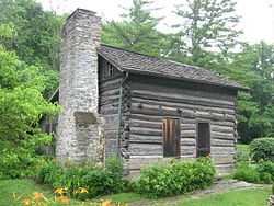
Miller-Leuser Log House |
|
01974-08-30-0000August 30, 1974
(#74001511) |
Clough Pike and Newton Rd. in Turpin Hills
39°06′06″N 84°22′07″W / 39.101667°N 84.368611°W / 39.101667; -84.368611 (Miller-Leuser Log House) |
Anderson Township |
|
| 46 |
Montgomery Saltbox Houses |
|
01987-07-28-0000July 28, 1987
(#87001254) |
7789 and 7795 Cooper Rd.
39°13′35″N 84°21′24″W / 39.226444°N 84.356667°W / 39.226444; -84.356667 (Montgomery Saltbox Houses) |
Montgomery |
|
| 47 |
Charles H. Moore House |
|
01986-08-25-0000August 25, 1986
(#86001636) |
749 Stout Ave.
39°13′55″N 84°28′11″W / 39.231944°N 84.469722°W / 39.231944; -84.469722 (Charles H. Moore House) |
Wyoming |
|
| 48 |
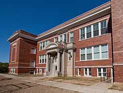
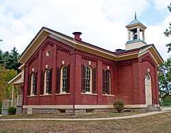
Mt. Healthy Public School |
|
01985-05-02-0000May 2, 1985
(#85000946) |
Compton and Harrison Aves.
39°13′58″N 84°33′00″W / 39.232778°N 84.55°W / 39.232778; -84.55 (Mt. Healthy Public School) |
Mt. Healthy |
|
| 49 |
Mt. Nebo Archeological District |
|
01975-03-03-0000March 3, 1975
(#75001435) |
Along the Great Miami River, west of North Bend[14]
39°08′42″N 84°47′31″W / 39.145°N 84.791944°W / 39.145; -84.791944 (Mt. Nebo Archeological District) |
Miami Township |
|
| 50 |
Norwood Mound |
|
01974-05-02-0000May 2, 1974
(#74001520) |
Off Indian Mound Ave.[14]
39°10′04″N 84°26′45″W / 39.167861°N 84.445833°W / 39.167861; -84.445833 (Norwood Mound) |
Norwood |
|
| 51 |
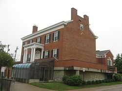
Norwood Municipal Building |
|
01980-03-11-0000March 11, 1980
(#80003093) |
4645 Montgomery Rd.
39°09′42″N 84°27′22″W / 39.161667°N 84.456111°W / 39.161667; -84.456111 (Norwood Municipal Building) |
Norwood |
|
| 52 |
Nurre-Royston House |
|
02009-01-08-0000January 8, 2009
(#08001295) |
4330 Errun Ln.
39°09′49″N 84°29′39″W / 39.163611°N 84.494167°W / 39.163611; -84.494167 (Nurre-Royston House) |
St. Bernard |
|
| 53 |
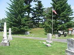
Odd Fellows' Cemetery Mound |
|
01973-06-18-0000June 18, 1973
(#73001474) |
Along Round Bottom Rd.[15]
39°07′49″N 84°21′36″W / 39.130333°N 84.36°W / 39.130333; -84.36 (Odd Fellows' Cemetery Mound) |
Newtown |
|
| 54 |
Old Gothic Barns |
|
01976-07-20-0000July 20, 1976
(#76001438) |
6058 Colerain Ave. in White Oak East
39°12′13″N 84°34′49″W / 39.203611°N 84.580278°W / 39.203611; -84.580278 (Old Gothic Barns) |
Green Township |
|
| 55 |
Professor William Pabodie House |
|
01986-08-25-0000August 25, 1986
(#86001638) |
731 Brooks Ave.
39°13′52″N 84°28′35″W / 39.231111°N 84.476389°W / 39.231111; -84.476389 (Professor William Pabodie House) |
Wyoming |
|
| 56 |
Perin Village Site |
|
01977-03-25-0000March 25, 1977
(#77001067) |
0.3 miles (0.48 km) northwest of the Odd Fellows' Cemetery Mound[16]
39°07′49″N 84°21′36″W / 39.130333°N 84.36°W / 39.130333; -84.36 (Perin Village Site) |
Newtown |
|
| 57 |
Pine Meer |
|
01982-11-30-0000November 30, 1982
(#82001468) |
5336 Cleves-Warsaw Pike, west of Cincinnati
39°07′13″N 84°37′04″W / 39.120278°N 84.617778°W / 39.120278; -84.617778 (Pine Meer) |
Green Township |
|
| 58 |
John C. Pollock House |
|
01986-08-25-0000August 25, 1986
(#86001639) |
88 Reily Rd.
39°13′43″N 84°28′35″W / 39.228611°N 84.476389°W / 39.228611; -84.476389 (John C. Pollock House) |
Wyoming |
|
| 59 |
Rennert Mound Archeological District |
|
01975-03-04-0000March 4, 1975
(#75001422) |
Western side of Elizabethtown[14]
39°09′34″N 84°48′30″W / 39.1595°N 84.808444°W / 39.1595; -84.808444 (Rennert Mound Archeological District) |
Whitewater Township |
|
| 60 |
W.C. Retszch House |
|
01986-08-25-0000August 25, 1986
(#86001642) |
129 Springfield Pike
39°13′14″N 84°28′26″W / 39.220556°N 84.473889°W / 39.220556; -84.473889 (W.C. Retszch House) |
Wyoming |
|
| 61 |
Riddle-Friend House |
|
01986-08-25-0000August 25, 1986
(#86001643) |
507 Springfield Pike
39°13′37″N 84°28′23″W / 39.226944°N 84.473056°W / 39.226944; -84.473056 (Riddle-Friend House) |
Wyoming |
|
| 62 |
Roudebush Farm |
|
01976-06-17-0000June 17, 1976
(#76001449) |
8643 Kilby Rd., southeast of Harrison
39°14′10″N 84°47′01″W / 39.236111°N 84.783611°W / 39.236111; -84.783611 (Roudebush Farm) |
Harrison Township |
|
| 63 |
St. Francis Seminary |
|
01999-03-05-0000March 5, 1999
(#99000275) |
10290 Mill Rd.
39°15′28″N 84°32′32″W / 39.257778°N 84.542222°W / 39.257778; -84.542222 (St. Francis Seminary) |
Springfield Township |
|
| 64 |
Salem Methodist Church Complex |
|
01982-04-29-0000April 29, 1982
(#82003586) |
6137 Salem Rd.
39°04′31″N 84°23′29″W / 39.075278°N 84.391389°W / 39.075278; -84.391389 (Salem Methodist Church Complex) |
Anderson Township |
|
| 65 |
Louis Sawyer House |
|
01986-08-25-0000August 25, 1986
(#86001645) |
315 Reily Rd.
39°13′41″N 84°28′40″W / 39.228056°N 84.477778°W / 39.228056; -84.477778 (Louis Sawyer House) |
Wyoming |
|
| 66 |
Shawnee Lookout Archeological District |
|
01974-12-02-0000December 2, 1974
(#74001516) |
In Shawnee Lookout, southwest of Cleves[14]
39°07′30″N 84°47′56″W / 39.125°N 84.798889°W / 39.125; -84.798889 (Shawnee Lookout Archeological District) |
Miami Township |
|
| 67 |
Edwin M. Shield's House |
|
01982-04-01-0000April 1, 1982
(#82003592) |
220 Riverside Ave.
39°16′01″N 84°15′44″W / 39.266944°N 84.262222°W / 39.266944; -84.262222 (Edwin M. Shield's House) |
Loveland |
|
| 68 |
Smith-Jessup House |
|
01984-08-23-0000August 23, 1984
(#84003717) |
1038 W. North Bend Rd. in Finneytown
39°12′07″N 84°31′47″W / 39.201944°N 84.529722°W / 39.201944; -84.529722 (Smith-Jessup House) |
Springfield Township |
|
| 69 |
State Line Archeological District |
|
01975-07-24-0000July 24, 1975
(#75001423) |
Straddling the Ohio/Indiana border, 2 miles (3.2 km) north of the Ohio River[17]
39°08′15″N 84°49′12″W / 39.1375°N 84.82°W / 39.1375; -84.82 (State Line Archeological District) |
Whitewater Township |
Extends into Dearborn County, Indiana
|
| 70 |
Edward R. Stearns House |
|
01986-08-25-0000August 25, 1986
(#86001648) |
333 Oliver Rd.
39°13′54″N 84°28′45″W / 39.231667°N 84.479167°W / 39.231667; -84.479167 (Edward R. Stearns House) |
Wyoming |
|
| 71 |
William Stearns House |
|
01986-08-25-0000August 25, 1986
(#86001649) |
320 Reily Rd.
39°13′46″N 84°28′44″W / 39.229444°N 84.478889°W / 39.229444; -84.478889 (William Stearns House) |
Wyoming |
|
| 72 |
Sunny Knolls-Gordon E. Pape House |
|
02006-06-09-0000June 9, 2006
(#06000484) |
8725 Blome Rd.
39°12′55″N 84°20′42″W / 39.215278°N 84.345000°W / 39.215278; -84.345000 (Sunny Knolls-Gordon E. Pape House) |
Indian Hill |
|
| 73 |
John Tangeman House |
|
01986-08-25-0000August 25, 1986
(#86001650) |
550 Larchmont
39°13′39″N 84°28′31″W / 39.2275°N 84.475278°W / 39.2275; -84.475278 (John Tangeman House) |
Wyoming |
|
| 74 |
Gerald B. and Beverley Tonkens House |
|
01991-10-03-0000October 3, 1991
(#91001414) |
6980 Knoll Rd.
39°11′43″N 84°24′54″W / 39.195278°N 84.415°W / 39.195278; -84.415 (Gerald B. and Beverley Tonkens House) |
Amberley |
|
| 75 |
Turpin Site |
|
01974-12-27-0000December 27, 1974
(#74001514) |
On the old Turpin farmstead at 3295 Turpin Ln.[6][18]
39°07′23″N 84°22′19″W / 39.123°N 84.372°W / 39.123; -84.372 (Turpin Site) |
Anderson Township |
|
| 76 |
Twelve Mile House |
|
01976-09-01-0000September 1, 1976
(#76001452) |
11006 Reading Rd.
39°16′07″N 84°24′46″W / 39.268611°N 84.412778°W / 39.268611; -84.412778 (Twelve Mile House) |
Sharonville |
|
| 77 |
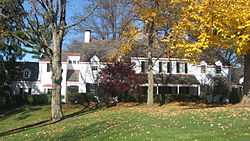
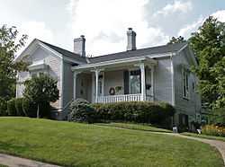
Twin Oaks |
|
01975-05-29-0000May 29, 1975
(#86001640) |
629 Liddle Lane
39°13′46″N 84°28′53″W / 39.229444°N 84.481389°W / 39.229444; -84.481389 (Twin Oaks) |
Wyoming |
Also known as the Robert Reily House[4]
|
| 78 |
United Brethren in Christ |
|
01978-06-13-0000June 13, 1978
(#78002082) |
South of Cincinnati off Interstate 275
39°03′12″N 84°22′29″W / 39.053333°N 84.374722°W / 39.053333; -84.374722 (United Brethren in Christ) |
Anderson Township |
|
| 79 |
United Methodist Church |
|
01975-12-04-0000December 4, 1975
(#75001432) |
5125 Drake Rd., northeast of Mariemont
39°09′37″N 84°20′49″W / 39.160278°N 84.346944°W / 39.160278; -84.346944 (United Methodist Church) |
Indian Hill |
|
| 80 |
Universalist Church Historic District |
|
01970-12-02-0000December 2, 1970
(#70000498) |
Montgomery Rd. from 9433 north to Remington Ave.
39°13′41″N 84°21′15″W / 39.228056°N 84.354167°W / 39.228056; -84.354167 (Universalist Church Historic District) |
Montgomery |
|
| 81 |
Village Historic District |
|
01986-08-25-0000August 25, 1986
(#86001626) |
Roughly bounded by Wentworth Ave., the former B&O railroad tracks, E. Mills Ave., and Springfield Pike
39°13′27″N 84°28′11″W / 39.224167°N 84.469722°W / 39.224167; -84.469722 (Village Historic District) |
Wyoming |
|
| 82 |
Village of Addyston Historic District |
|
01991-09-13-0000September 13, 1991
(#91001388) |
Roughly along Main, Sekitan, Church, 1st, and 2nd Sts., and the Three Rivers Parkway
39°08′14″N 84°42′47″W / 39.137222°N 84.713056°W / 39.137222; -84.713056 (Village of Addyston Historic District) |
Addyston |
|
| 83 |
Waldschmidt-Camp Dennison District |
|
01973-03-07-0000March 7, 1973
(#73001471) |
7509 and 7567 Glendale-Milford Rd. in Camp Dennison
39°11′28″N 84°17′26″W / 39.191111°N 84.290556°W / 39.191111; -84.290556 (Waldschmidt-Camp Dennison District) |
Symmes Township |
|
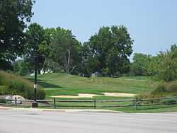
| 84 |
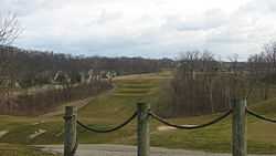
John Aston Warder House |
|
01978-05-19-0000May 19, 1978
(#78002084) |
Between holes 10 and 11 of the Aston Oaks Golf Course, off Shady Lane east of central North Bend[19]
39°09′12″N 84°43′32″W / 39.153333°N 84.725556°W / 39.153333; -84.725556 (John Aston Warder House) |
North Bend |
Warder's gardens, now a golf course, contribute to the historic designation.[4]
|
| 85 |
Washington Heights School |
|
01975-07-30-0000July 30, 1975
(#75001430) |
8100 Given Rd.
39°12′11″N 84°19′26″W / 39.203056°N 84.323889°W / 39.203056; -84.323889 (Washington Heights School) |
Indian Hill |
|
| 86 |
James Whallon House |
|
01973-05-17-0000May 17, 1973
(#73001473) |
11000 Winton Rd.
39°16′17″N 84°31′20″W / 39.271389°N 84.522222°W / 39.271389; -84.522222 (James Whallon House) |
Greenhills |
|
| 87 |
Whitewater Shaker Settlement |
|
01974-01-21-0000January 21, 1974
(#74001518) |
11813, 11347, and 11081 Oxford Rd., north of New Haven
39°17′40″N 84°44′34″W / 39.294444°N 84.742778°W / 39.294444; -84.742778 (Whitewater Shaker Settlement) |
Crosby Township |
|
| 88 |
Wilder-Swaim House |
|
01981-05-20-0000May 20, 1981
(#81000438) |
7650 Cooper Rd.
39°13′41″N 84°21′36″W / 39.228056°N 84.36°W / 39.228056; -84.36 (Wilder-Swaim House) |
Montgomery |
|
| 89 |
W. L. Williams House |
|
01977-03-25-0000March 25, 1977
(#77001066) |
280 Anderson Ferry Rd.
39°05′18″N 84°37′06″W / 39.088333°N 84.618333°W / 39.088333; -84.618333 (W. L. Williams House) |
Delhi Township |
|
| 90 |
Charles Woodruff House |
|
01986-08-25-0000August 25, 1986
(#86001651) |
411 Springfield Pike
39°13′32″N 84°28′27″W / 39.2255°N 84.47425°W / 39.2255; -84.47425 (Charles Woodruff House) |
Wyoming |
|
| 91 |
Wyoming Presbyterian Church |
|
01980-03-03-0000March 3, 1980
(#80003094) |
Wyoming and Burns Aves.
39°13′36″N 84°28′06″W / 39.226667°N 84.468333°W / 39.226667; -84.468333 (Wyoming Presbyterian Church) |
Wyoming |
|
| 92 |
Yost Tavern |
|
01993-05-06-0000May 6, 1993
(#93000406) |
7872 Cooper Rd.
39°13′36″N 84°21′15″W / 39.226556°N 84.354181°W / 39.226556; -84.354181 (Yost Tavern) |
Montgomery |
|